
Satellite Snapshots
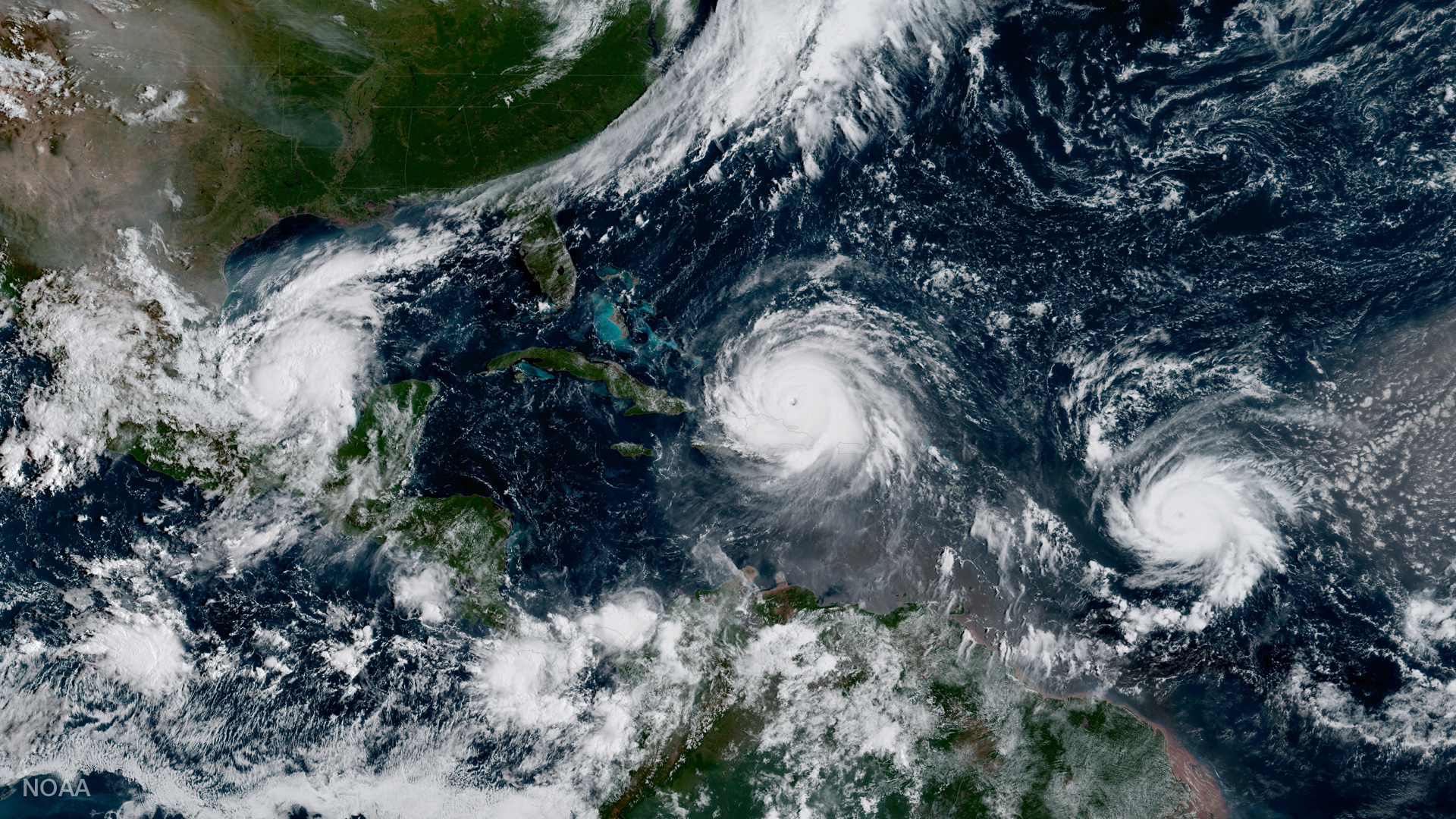
Geocolor image from GOES-16 shows Hurricanes Katia (l), Irma (m) and Jose (r) in the Atlantic Ocean.
Satellite Snapshots
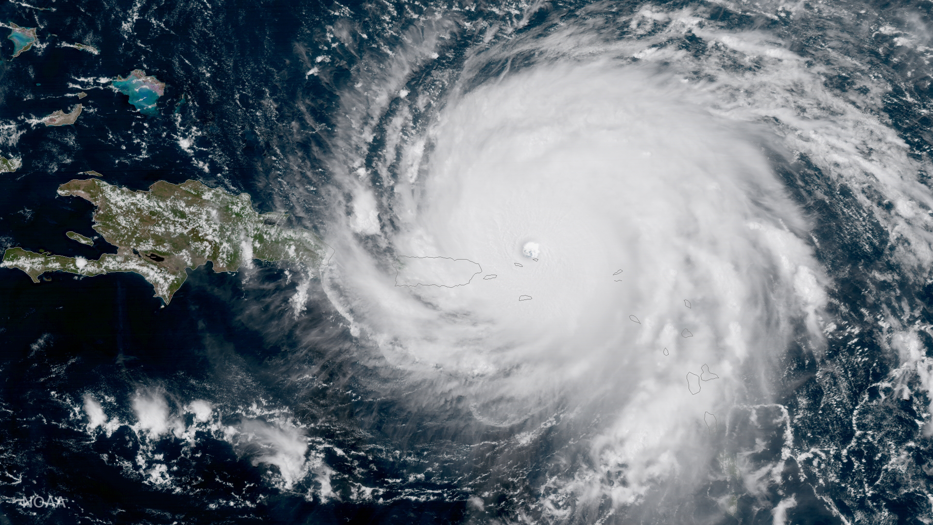
GOES-16 captured this geocolor image of Hurricane Irma -- a category 5 storm with winds as high as 185 miles per hour.
Satellite Snapshots
This data visualization shows the maximum wind gusts from Hurricane Irma from September 7 to September 10, 2017.
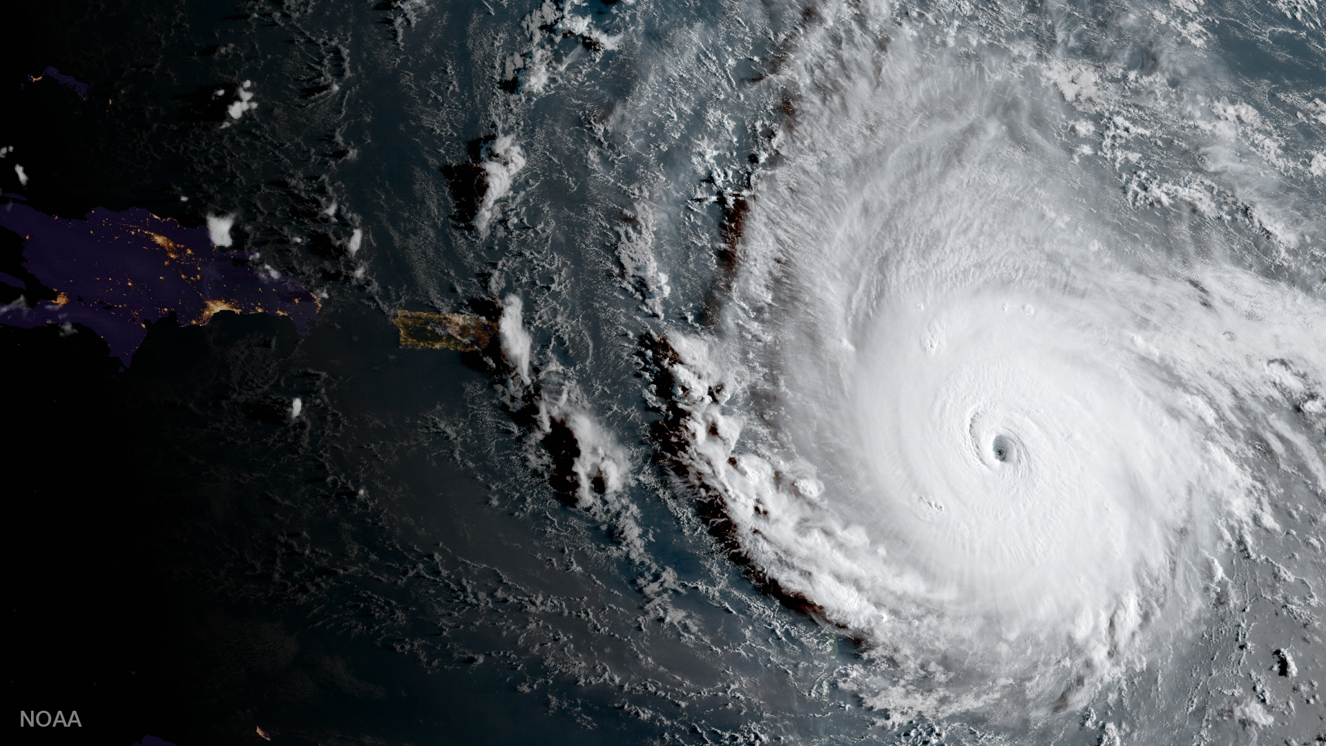
Satellite Snapshots
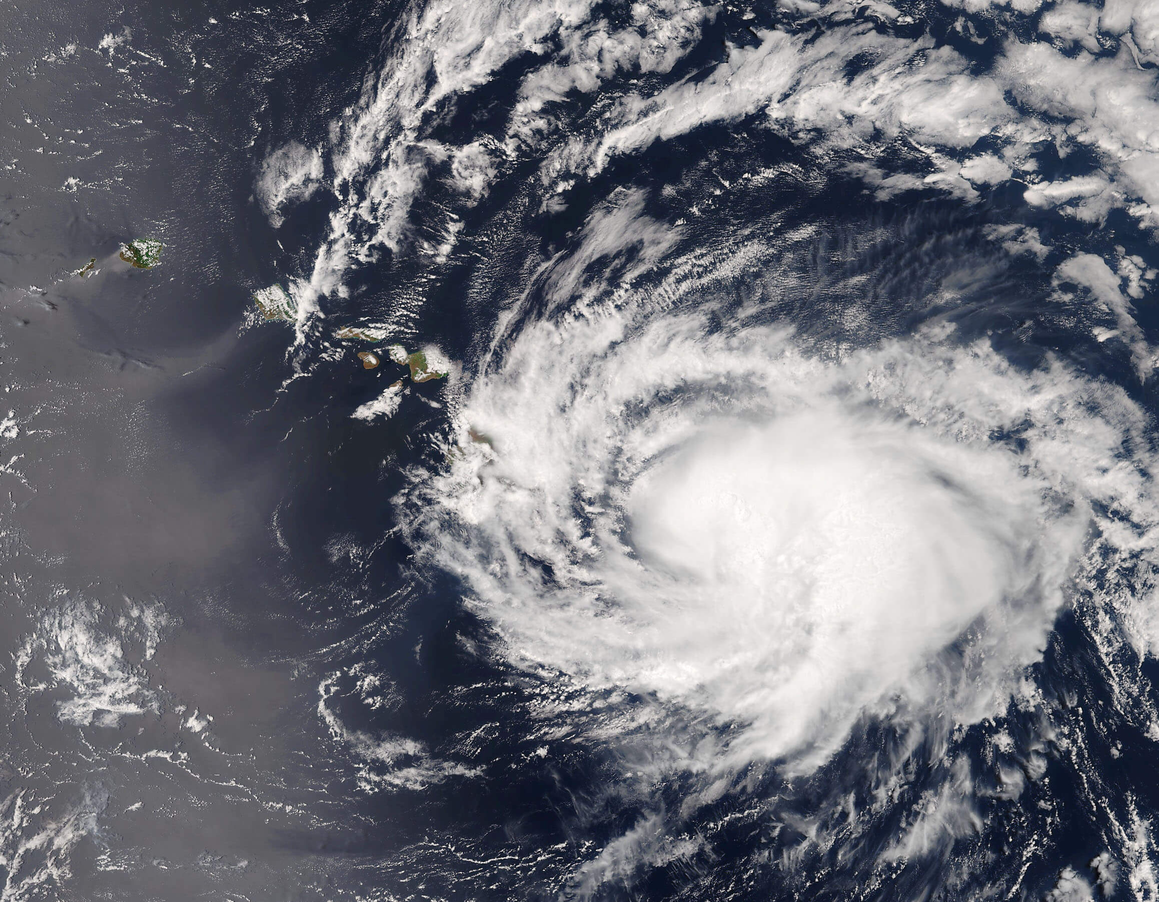
The Visible Infrared Imaging Radiometer Suite (VIIRS) instrument aboard the Suomi NPP satellite captured Hurricane Irma.
Feature Story
This is a collection of weather imagery from JPSS-1. NOAA’s Joint Polar Satellite System (JPSS) provides global observations that serve as the backbone of both short- and long-term forecasts, including those that help us predict and prepare for…
Feature Story
This is a collection of weather imagery from JPSS-1. NOAA’s Joint Polar Satellite System (JPSS) provides global observations that serve as the backbone of both short- and long-term forecasts, including those that help us predict and prepare for…
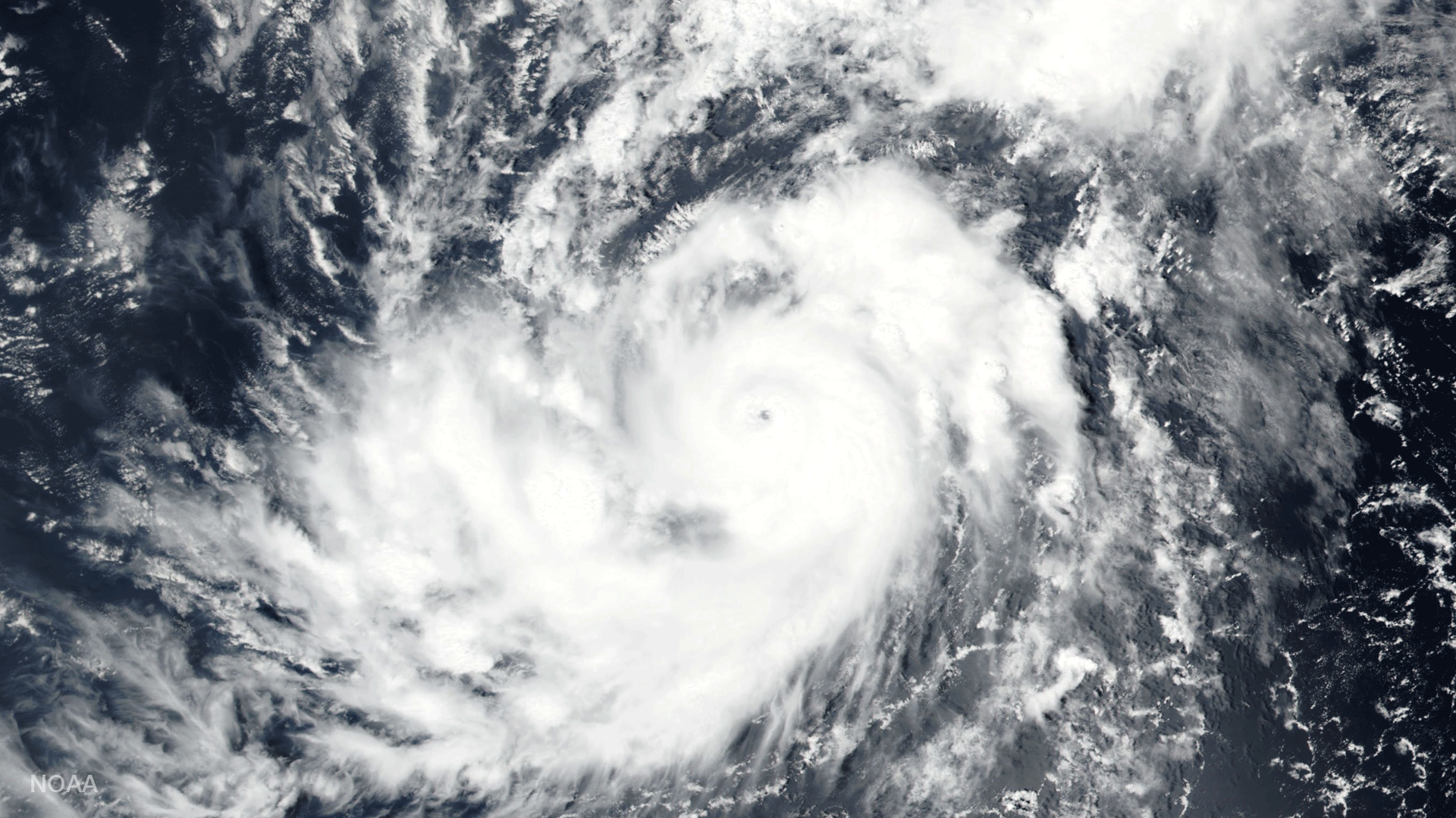
Satellite Snapshots
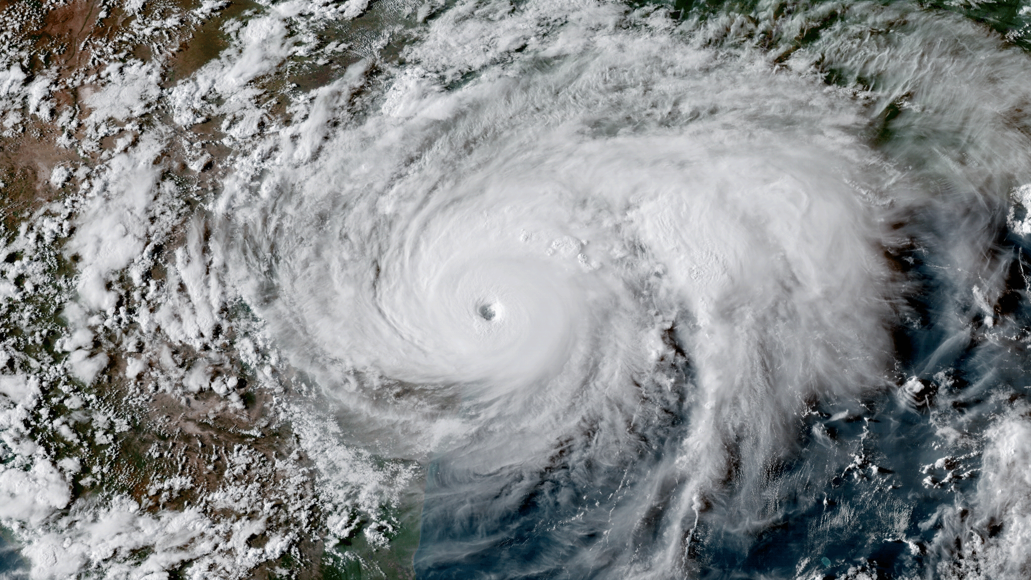
GOES-16 satellite GeoColor image of Hurricane Harvey at peak intensity on August 25, 2017 at 23:00 UTC.
Satellite Snapshots
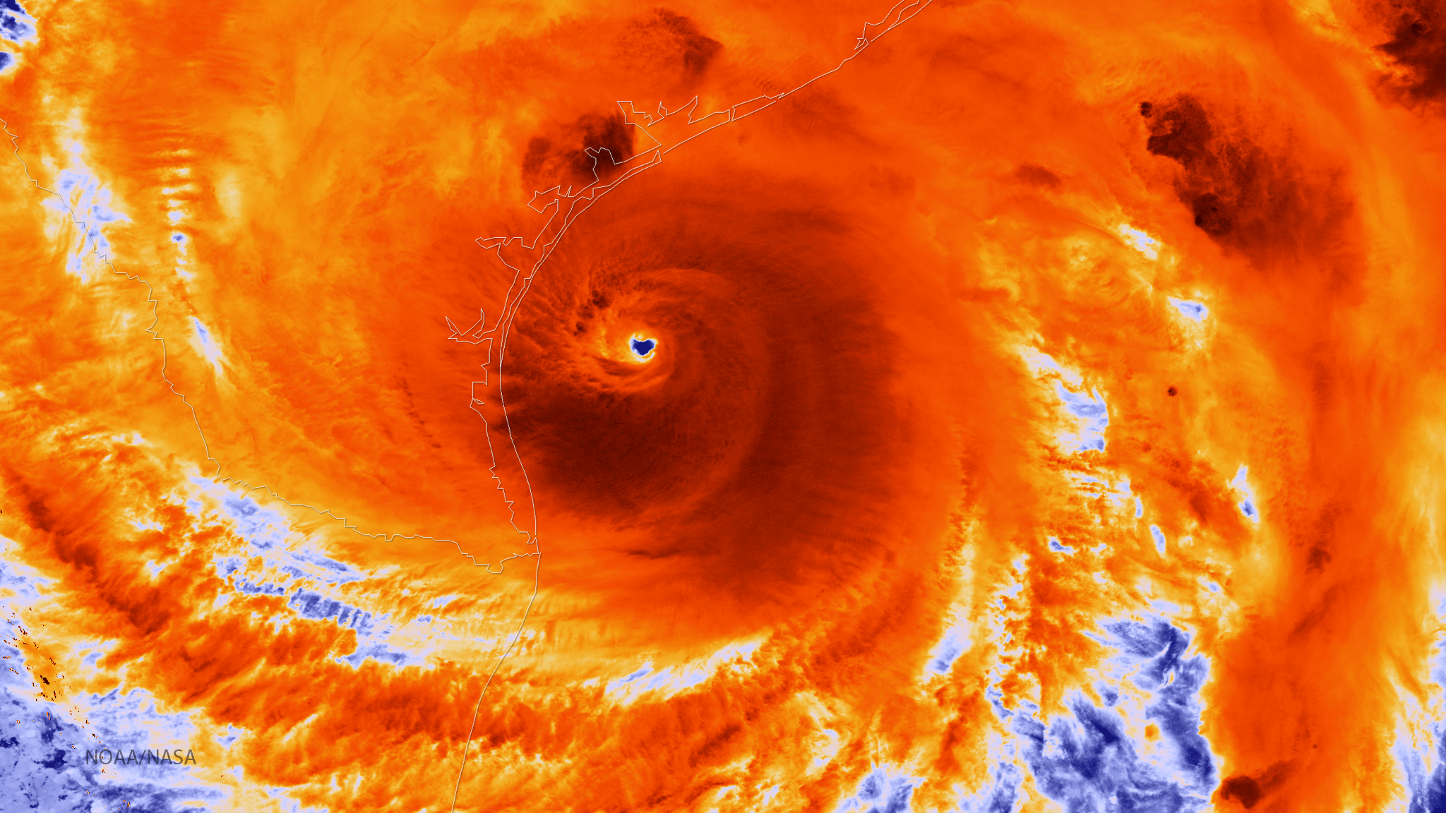
The NOAA/NASA Suomi NPP satellite captured this infrared image of Hurricane Harvey on August 25, 2017 at 18:55 UTC.