
Satellite Snapshots

The NOAA-20 satellite snapped this beautiful photo of marine stratocumulus clouds (MSCs) off the western coast of South America on…
Feature Story
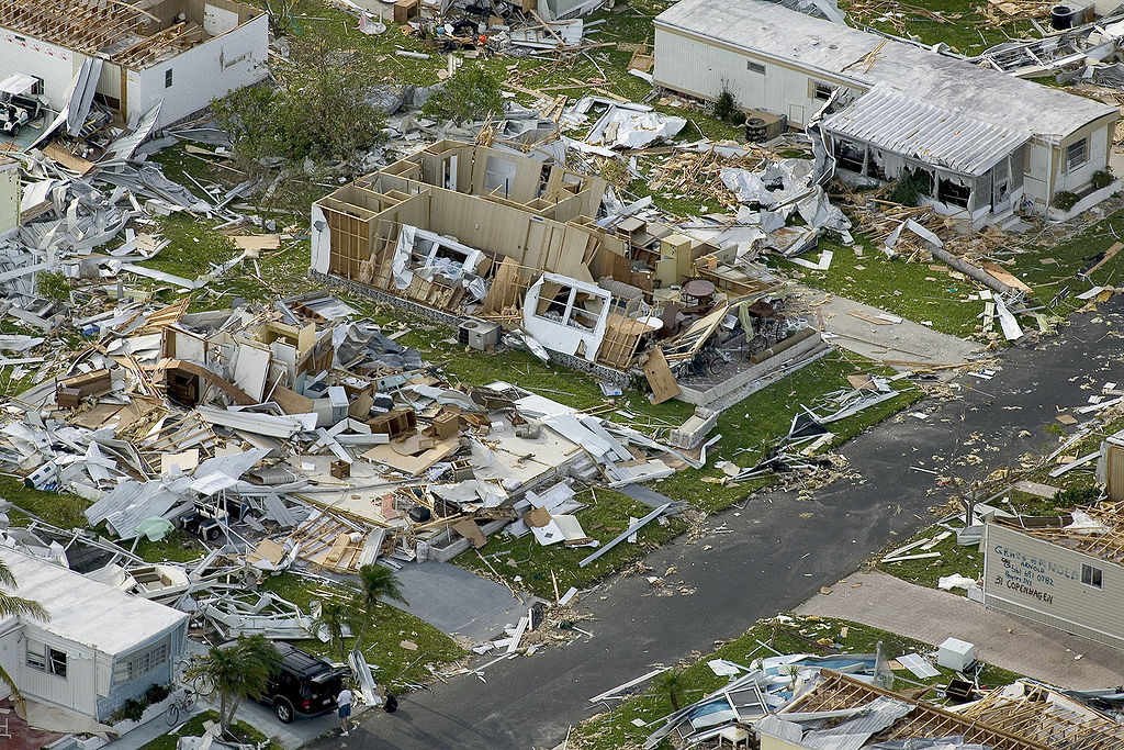
In 2004, the Atlantic had one of its most active and destructive hurricane seasons on record. These storms produced more than $61 billion in damages
Satellite Snapshots

Clear skies over Australia on July 16, 2019, gave the NOAA-20 polar-orbiting satellite an unobstructed view of smoke plumes from…
Satellite Snapshots
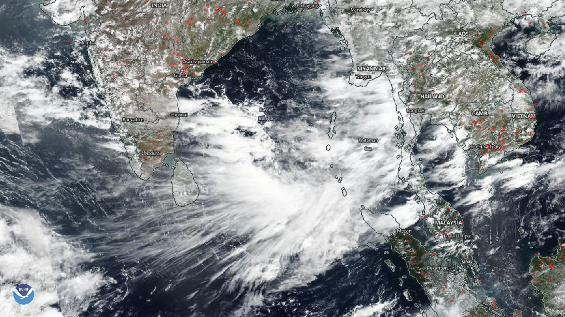
Upper level winds from thunderstorms over the Bay of Bengal blew anvil clouds to the southwest, forming an eye-catching cirrus cloud…
Satellite Snapshots
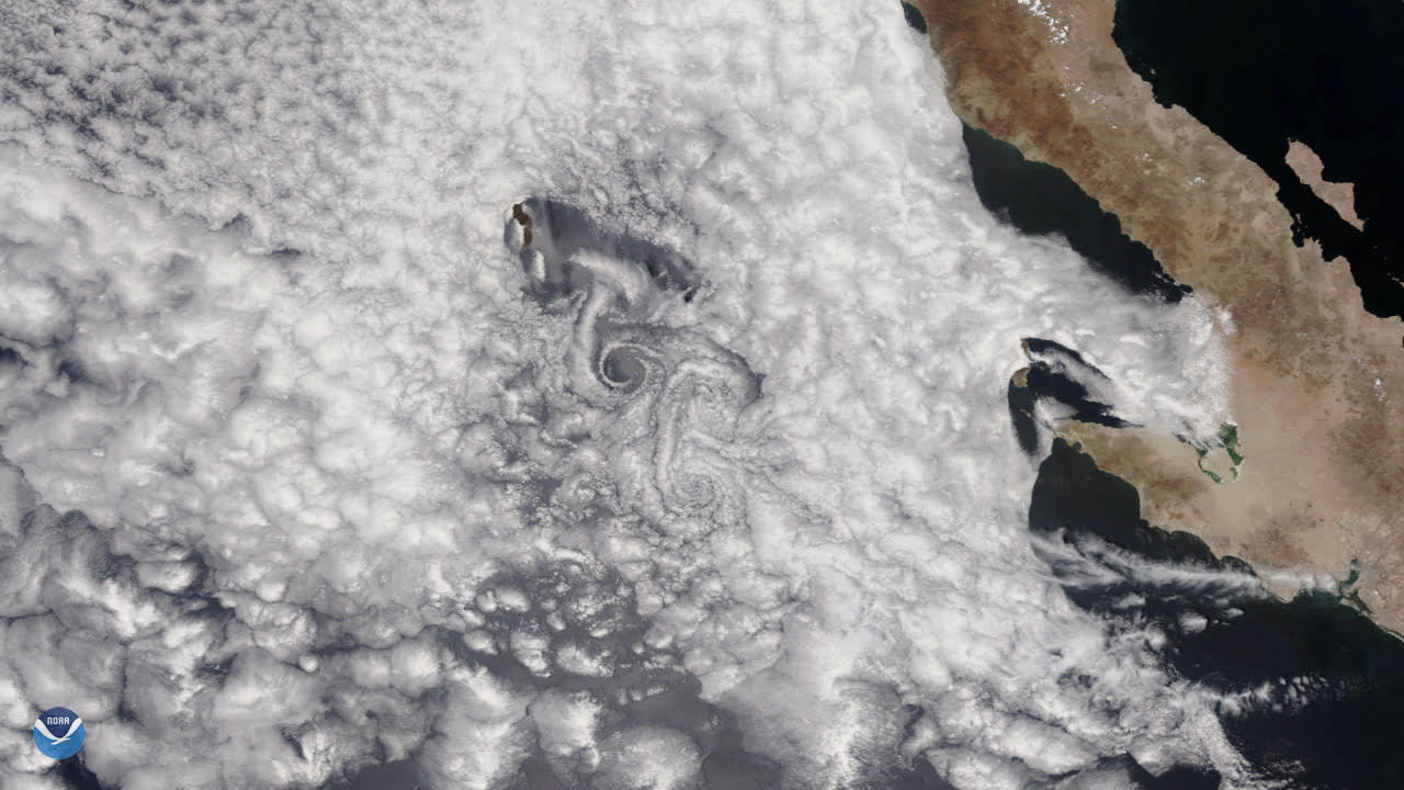
A spiraling cloud pattern, known as a von Kármán vortex, formed off the west coast of Mexico’s Baja California Peninsula on May 13, 2019.
Feature Story
In the late 1950s, a scientist named Lewis Kaplan divined a groundbreaking way to calculate temperature in the atmosphere for weather forecasting.
Feature Story

Rain forests may contain more than half the Earth’s plant and animal species, but in terms of diversity, coral reefs are…
Satellite Snapshots
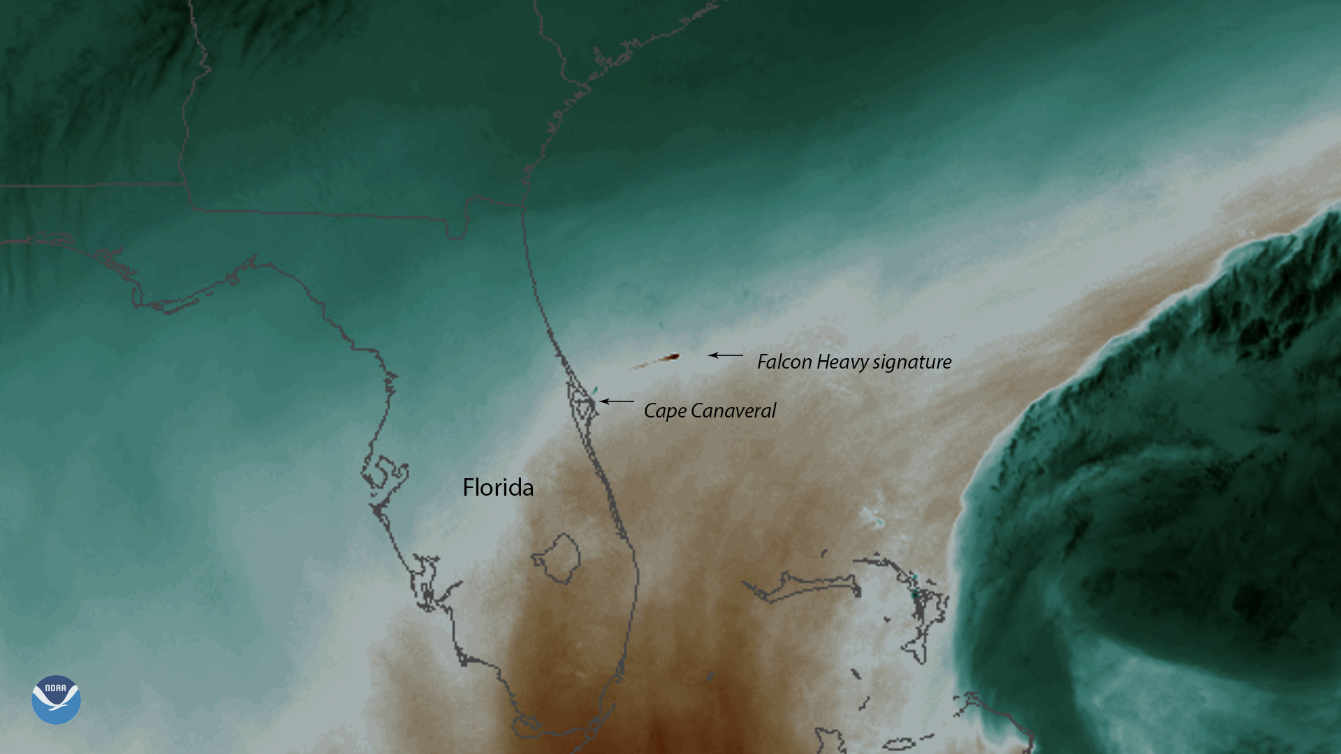
SpaceX’s Falcon Heavy, the world’s most powerful operational rocket, launched the communications satellite Arabsat-6A into orbit.