
Satellite Snapshots
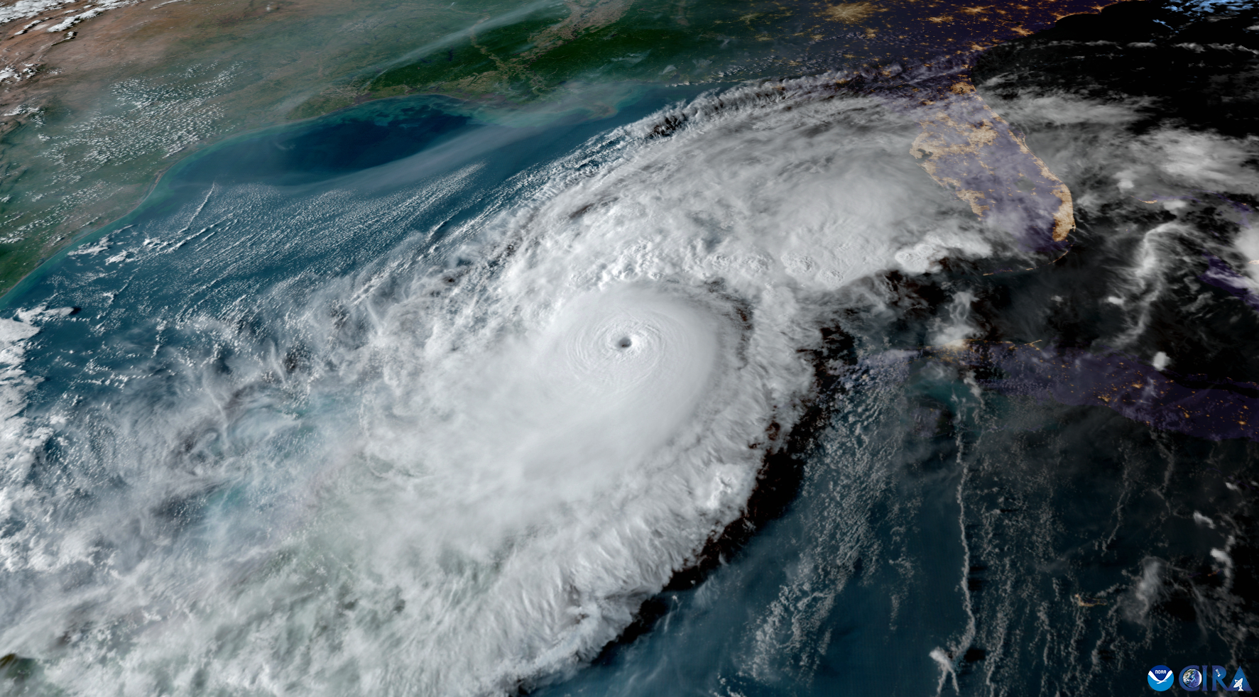
On Oct. 8, 2024, at 6:30 p.m. EDT, NOAA’s GOES East satellite captured this imagery of Hurricane Milton approaching the Gulf Coast of Florida.
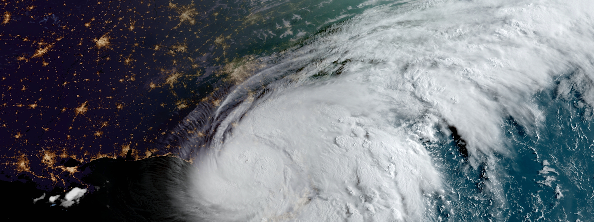
Satellite Snapshots
Hurricane Helene made landfall in Florida's Big Bend region at 11:10 p.m. EDT on Sept. 26, 2024.
Feature Story

As wildfires become more frequent and severe, accurate forecasting is essential for saving lives, protecting property, and managing resources effectively.
Earth from Orbit
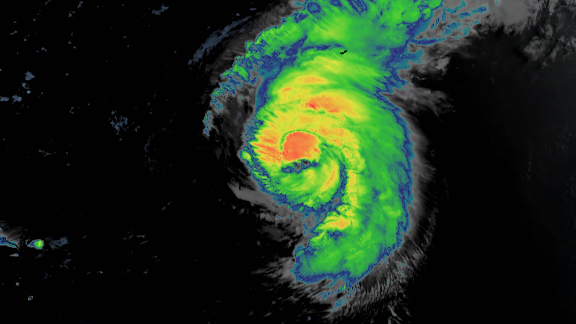
Even with the storm hundreds of miles offshore, Hurricane Ernesto was still being felt Saturday along much of the U.S. Eastern Seaboard, with dangerous rip currents forcing public beaches to close during one of the final busy weekends of the summer…
Earth from Orbit
Last week, NOAA satellites tracked Debby, a storm that impacted Florida’s Big Bend region near Steinhatchee before moving up the East Coast, causing widespread flooding and damaging winds as far north as New York state with numerous destructive…
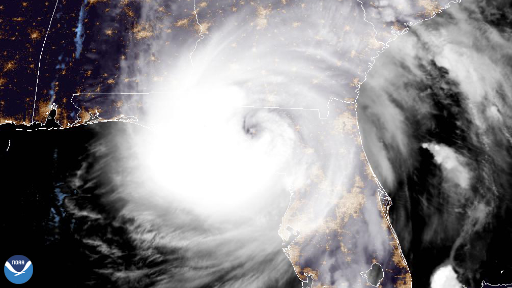
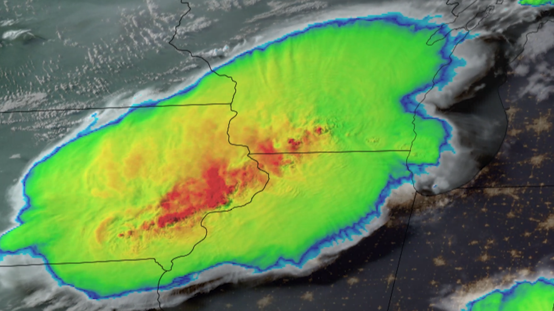
Satellite Snapshots
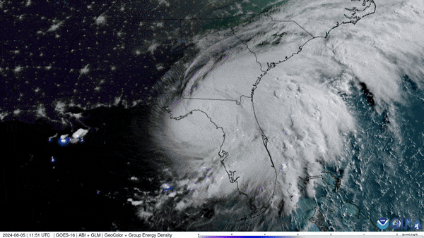
NOAA’s GOES East (GOES-16) satellite has been carefully monitoring Hurricane Debby as it travels across the U.S. state of Florida.
Earth from Orbit
Parts of the Midwest are cleaning up after thunderstorms barreled through the region on the night of Monday, July 15, 2024, bringing hurricane-force winds and multiple tornadoes around Chicago.
Satellite Snapshots
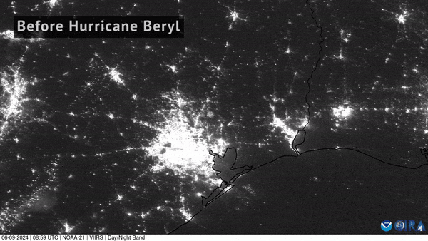
NOAA-21 captured imagery of the devastating power loss across East Texas following Hurricane Beryl’s landfall.