
Feature Story
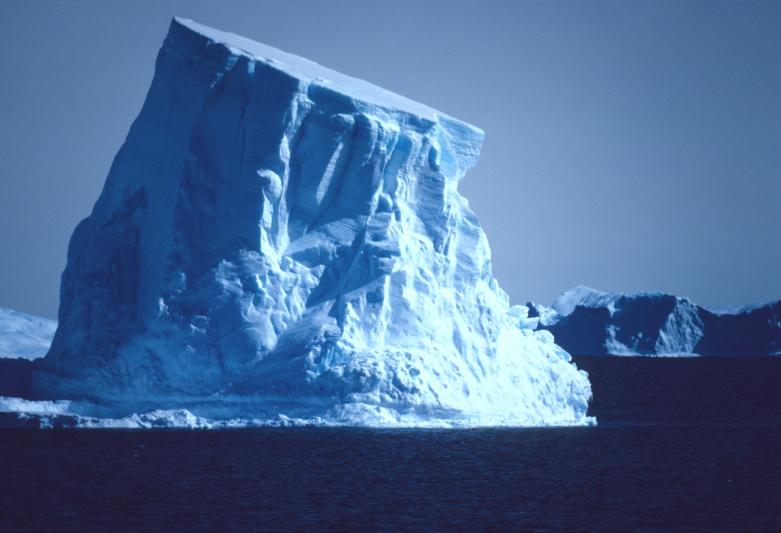
On February 4, 1979, an iceberg slightly larger in area than the city of Indianapolis was first spotted in the Wilkesland Sea…
Feature Story
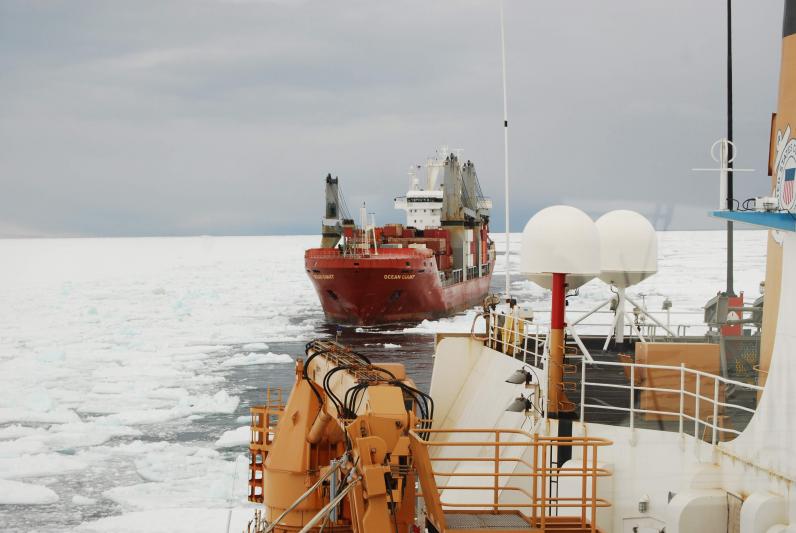
Navigating the icy waters of Antarctica is no easy feat, but each year the U.S. military conducts a mission called Operation Deep Freeze.
Satellite Snapshots
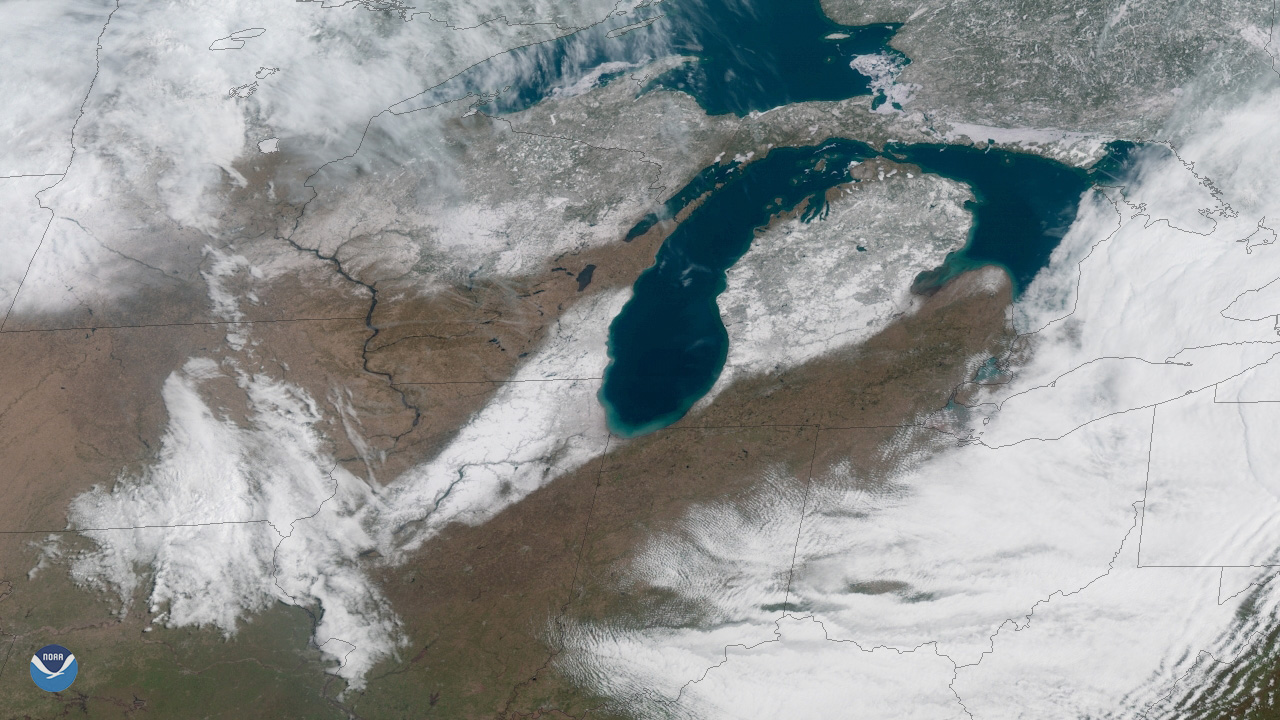
Nothing says spring quite like a little bit of mid-April snow, right? A swath of snow stretches from central Illinois to northeast Michigan.
Satellite Snapshots
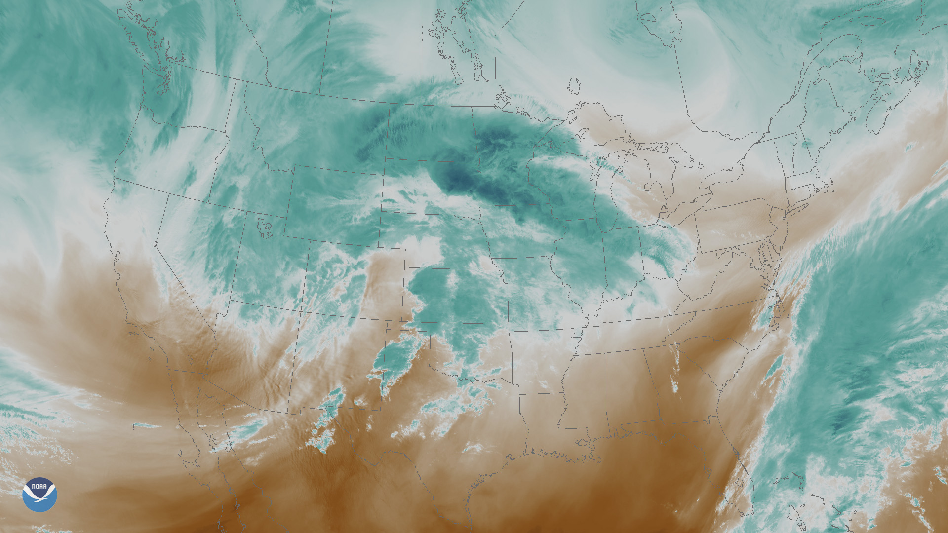
A powerful late-season winter storm is set to unleash heavy snow and high winds across parts of the north-central Plains and the upper Midwest.
Satellite Snapshots
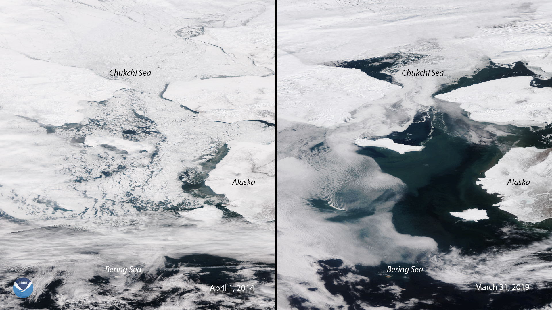
Side-by-side images of the Bering Sea taken by Suomi NPP in 2014 and NOAA-20 in 2019 show a drastic change in sea ice extent.
Feature Story
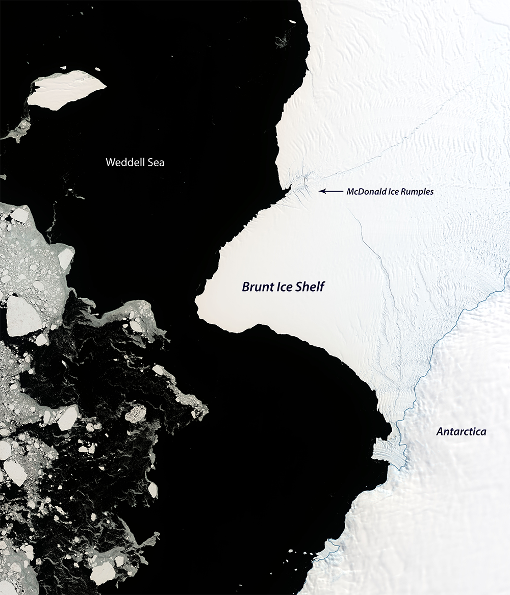
It’s difficult to predict when the two growing cracks on Antarctica’s Brunt Ice Shelf will intersect and cause an iceberg, although it's imminent.
Satellite Snapshots
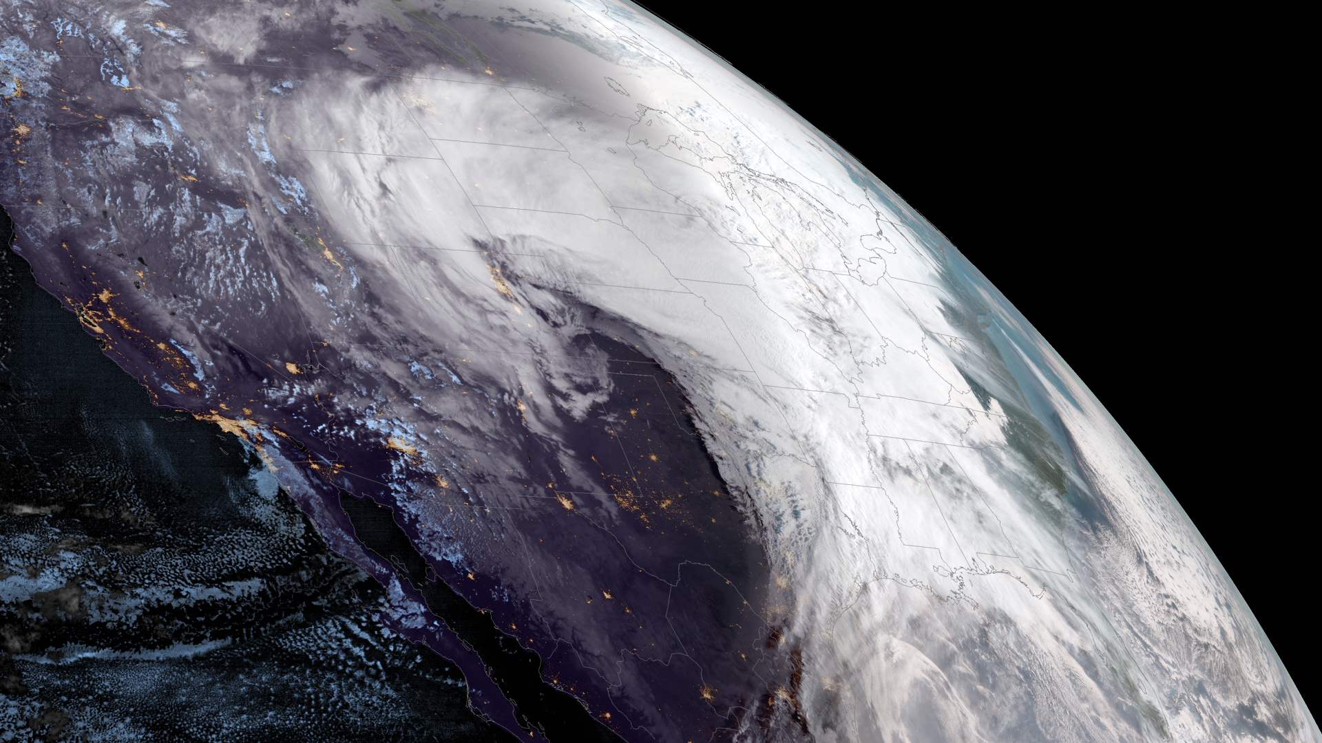
GOES West captured this view of a powerful winter storm system on March 13, 2019 that is projected to sweep across much of the Central United States.
Satellite Snapshots
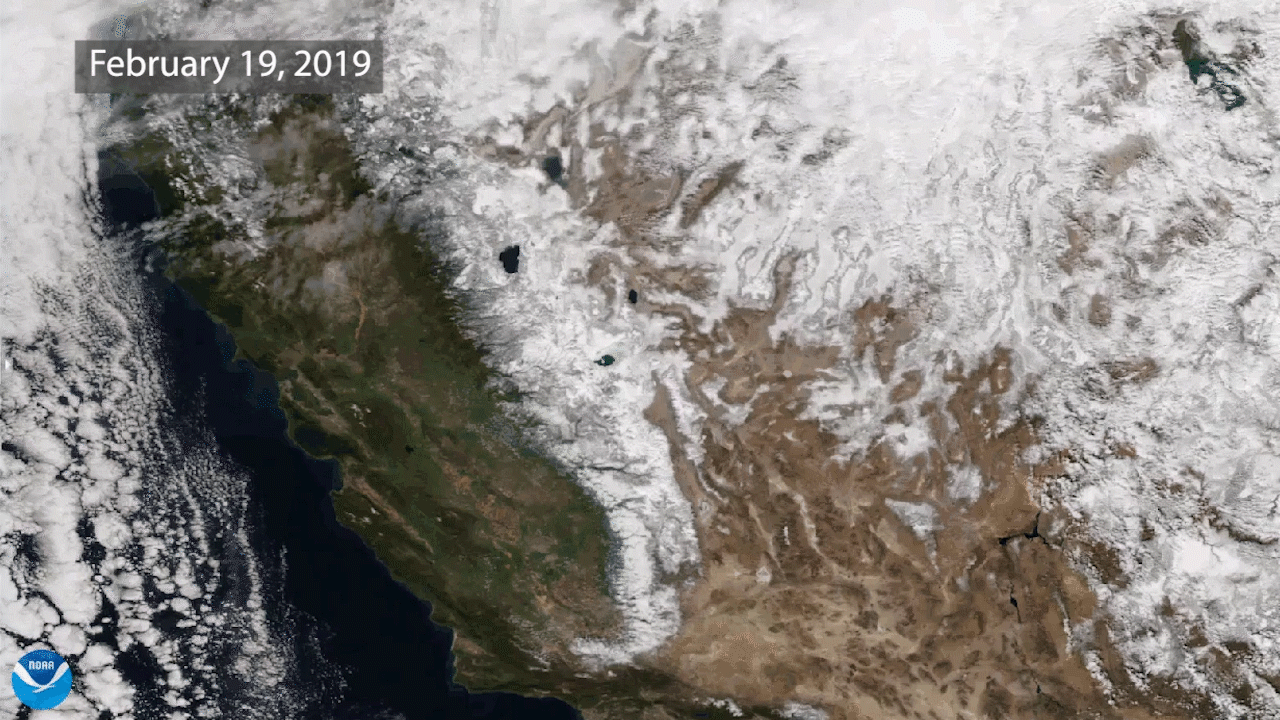
Two views of the Sierra Nevada mountains, taken approximately one year apart in 2018 and 2019 by NOAA-20, shows much more snow in 2019.