
Satellite Snapshots
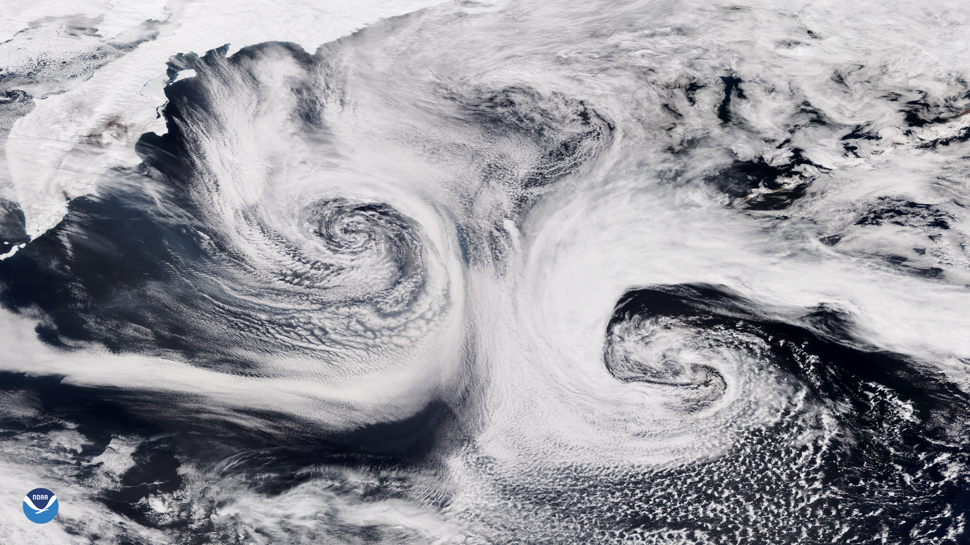
NOAA-20 satellite captured this stunning imagery of two mid-latitude cyclones swirling over the Pacific Ocean.
Feature Story

Earth Day celebrates its golden anniversary in 2020, NOAA too is celebrating 50 years of monitoring the Earth’s weather,…
Satellite Snapshots
April 20, 2020 Today, the GOES-East satellite viewed the Gulf Coast (inset) which suffered a devastating oil spill from the Deepwater Horizon oil rig…
Satellite Snapshots
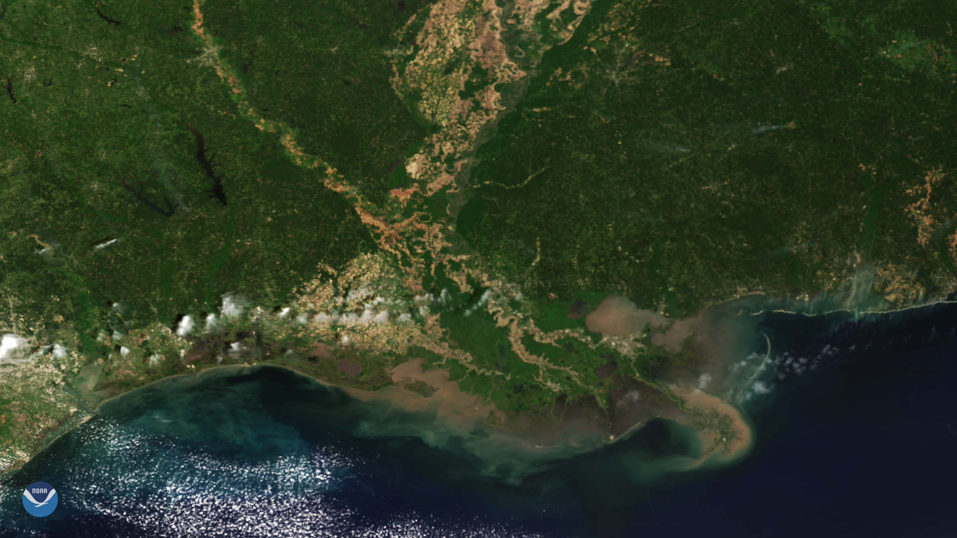
From its vantage point 512 miles up, the NOAA-20 satellite had a clear view of the Mississippi River Delta.
Satellite Snapshots
From its vantage point 512 miles up, the NOAA-20 satellite had a clear view of the Mississippi River Delta.
Satellite Snapshots

April 16, 2020 On April 16, 2020, GOES-East viewed the aftermath of an EF- 4 tornado in Mississippi, which caused a 68-mile-long scar across…
Satellite Snapshots
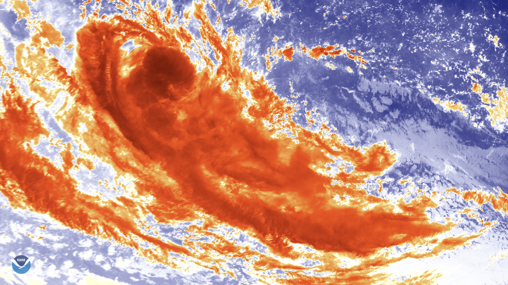
Himawari-8 satellite newly-formed Tropical Cyclone Jeruto swirling over the Indian Ocean via its clean…
Satellite Snapshots
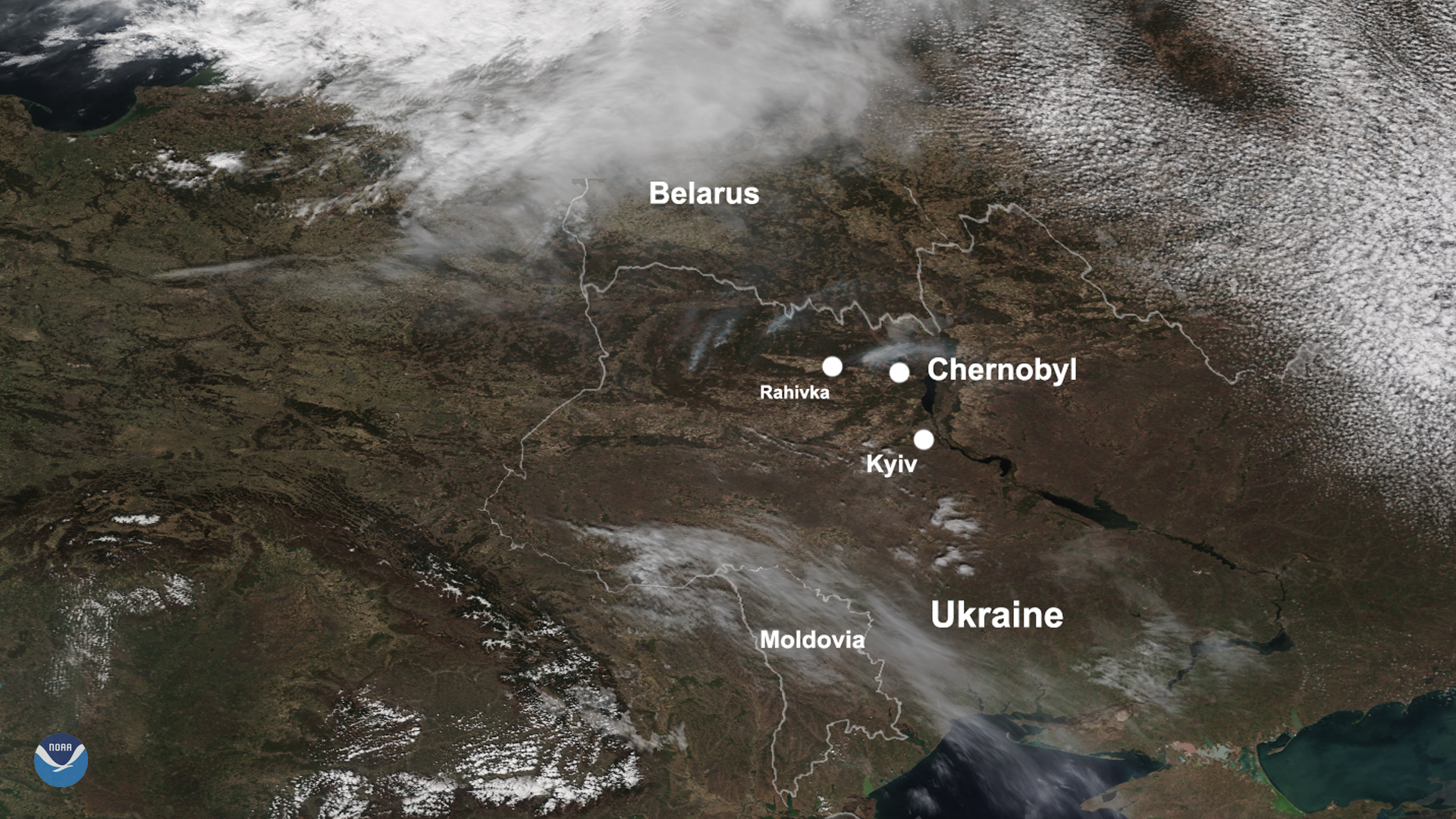
April 14, 2020 On April 12, 2020, NOAA-20 passed over Ukraine as severe blazes around the Chernobyl Exclusion Zone, and the capital city of Kyiv,…