
Satellite Snapshots
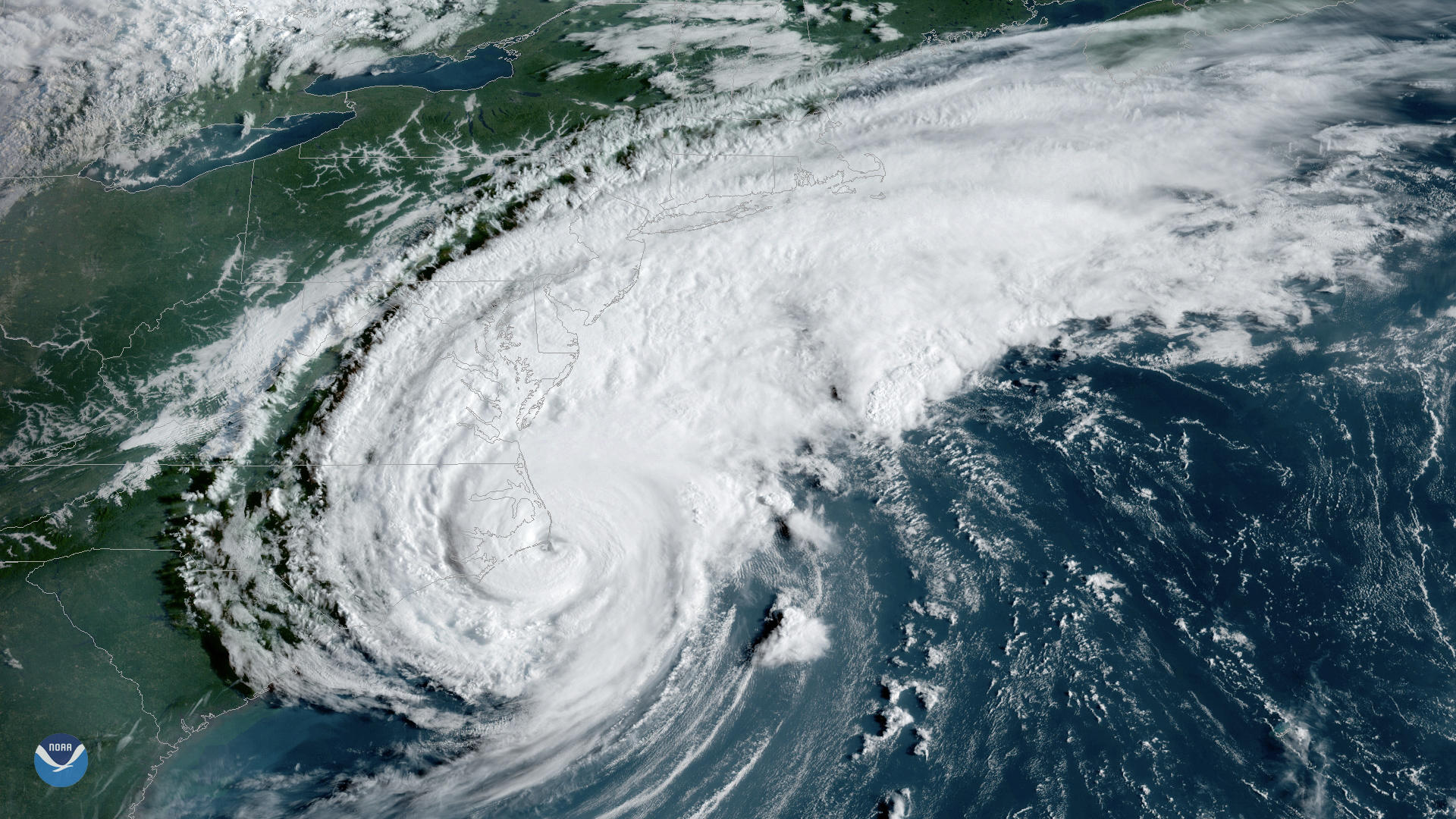
GOES-East satellite has been monitoring severe thunderstorms that brought torrential rain, destructive winds.
Satellite Snapshots
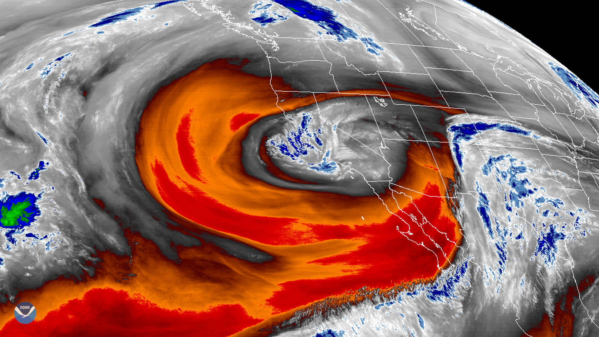
GOES West's water vapor band shows a low-pressure area off California that has become isolated or “cut off” from the main westerly air current.
Satellite Snapshots
GOES West's water vapor band shows a low-pressure area off California that has become isolated or “cut off” from the main westerly air current.
Satellite Snapshots
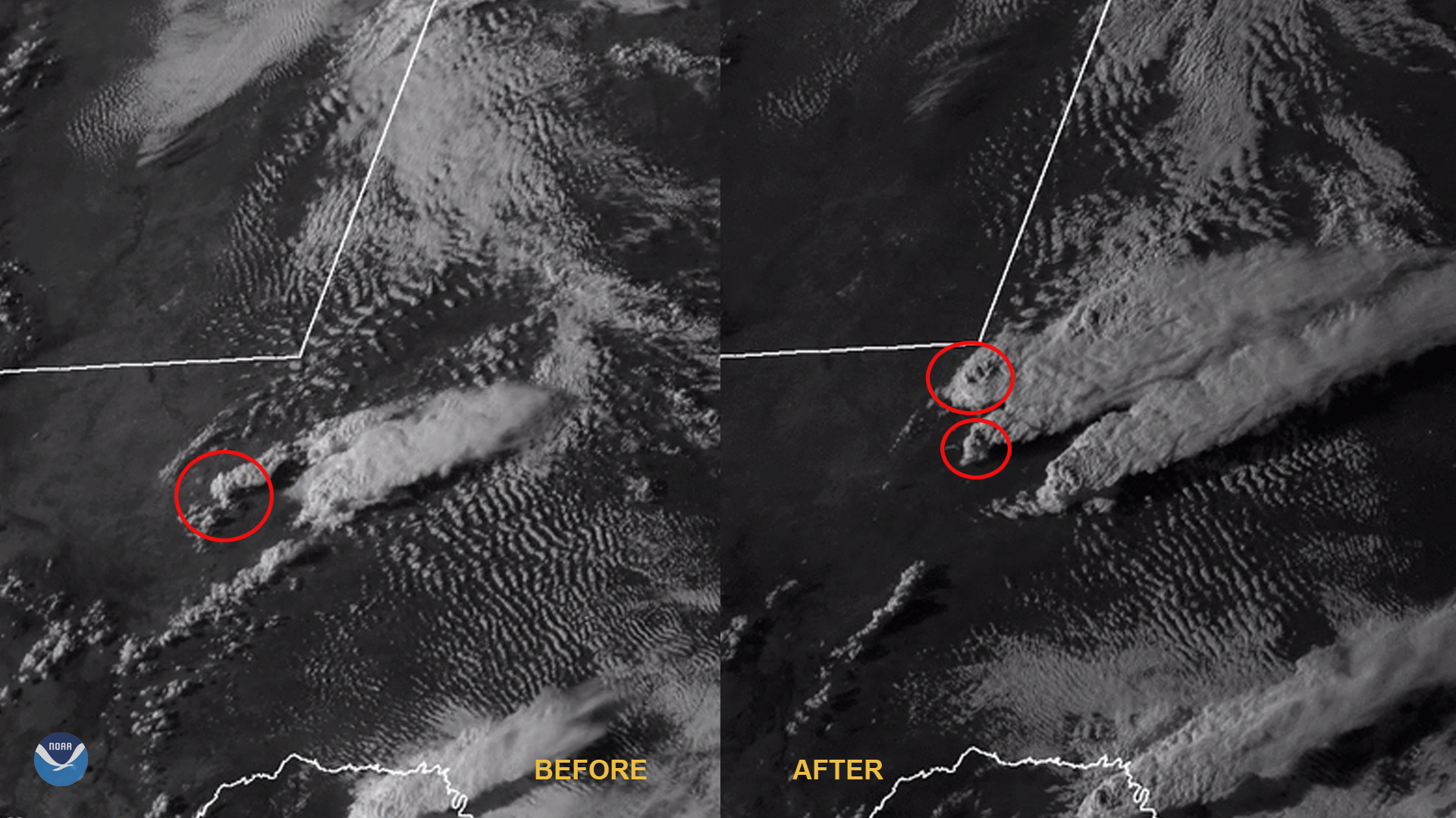
April 08, 2020 On April 5, 2020, NOAA-20 passed over Ukraine as fires broke out within and around the Chernobyl Exclusion Zone. It is believed that…
Satellite Snapshots
NCEI's global inventory of tropical cyclones, IBTrACS, lets forecasters analyze current storms in the context of historical data.
Feature Story
April 06, 2020 Happy SARSAT Beacon Awareness Day! The Search and Rescue Satellite Aided Tracking (SARSAT) system is recognized by emergency…
Feature Story
April 06, 2020 Happy SARSAT Beacon Awareness Day! The Search and Rescue Satellite Aided Tracking (SARSAT) system is recognized by emergency…
Satellite Snapshots
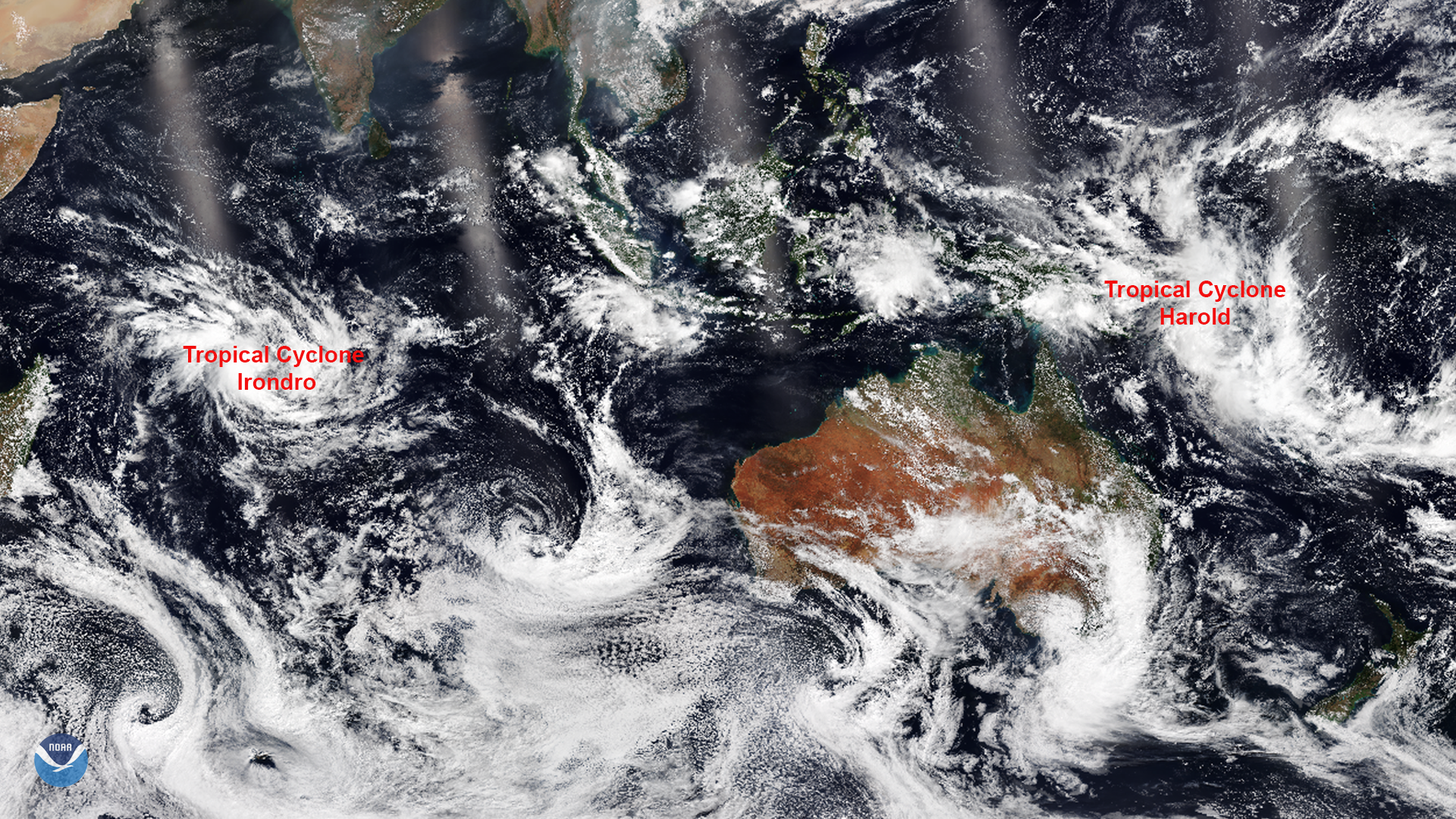
NOAA-20 captured this imagery of two tropical cyclones that developed in the Southern Hemisphere. The…