
Satellite Snapshots
March 18, 2020 On this day 95 years ago, the U.S.suffered its worst single-tornado in history—-the Tri-State Tornado. Producing more than 2.2 billion…
Satellite Snapshots
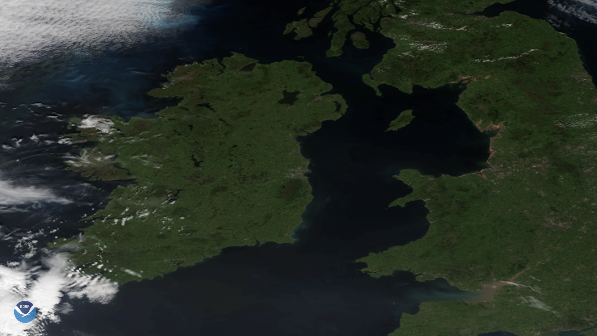
This St. Patrick’s Day, we thought it would be appropriate to share this beautiful image of Ireland, Northern Ireland, as well as…
Satellite Snapshots

Hurricane Dorian—shown here in an image created by the Visible Infrared Imaging Radiometer Suite (VIIRS) on September 1, 2019…
Satellite Snapshots
March 16, 2020 The NOAA-20 satellite, on March 15, 2020, saw Tropical Cyclone Herold over the northeastern shores of Madagascar, as it headed…
Satellite Snapshots
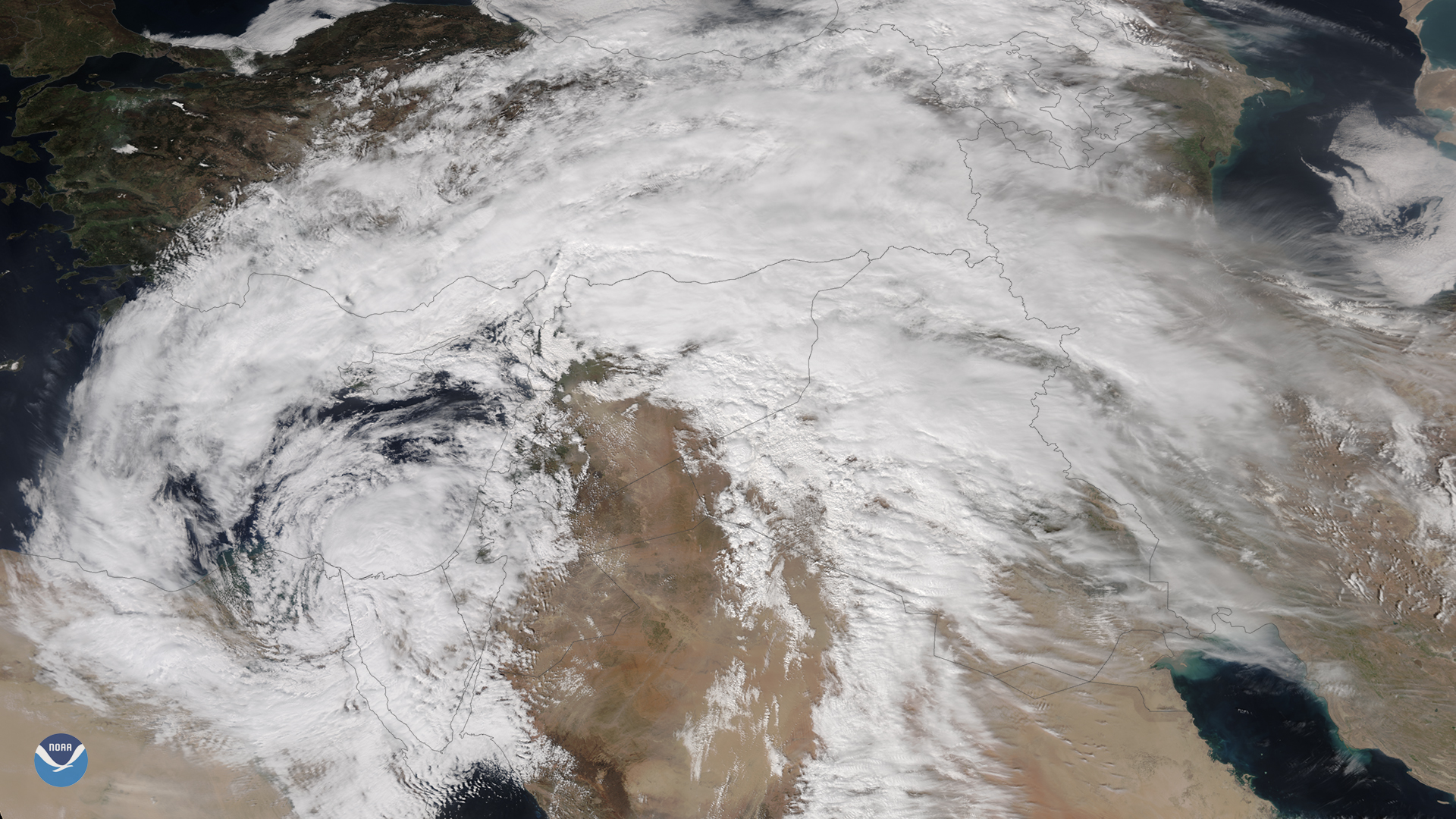
March 13, 2020 An unusually powerful mid-latitude cyclone that formed rapidly over Egypt on Thursday, March 12, 2020, is wreaking havoc in the Middle…
Satellite Snapshots
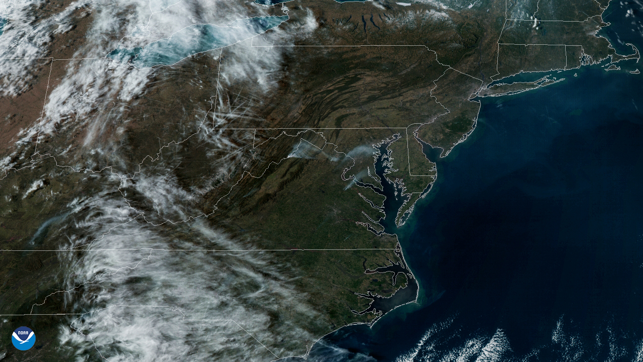
On March 8, 2020, the GOES-East satellite viewed the Washington, D.C. metro area as haziness covered the region from a prescribed burn…
Satellite Snapshots
On March 8, 2020, the GOES-East satellite viewed the Washington, D.C. metro area as haziness covered the region from a prescribed burn…
Satellite Snapshots
March 10, 2020 On March 10, 2020, the GOES-East satellite viewed an atmospheric river (or AR) flowing up from the South Pacific, across the Gulf of…