
Feature Story
GOES satellites provide beautiful images of Earth. But what you see are digital representations of the data they capture. How are the images created?
Feature Story
GOES satellites provide beautiful images of Earth. But what you see are digital representations of the data they capture. How are the images created?
Satellite Snapshots
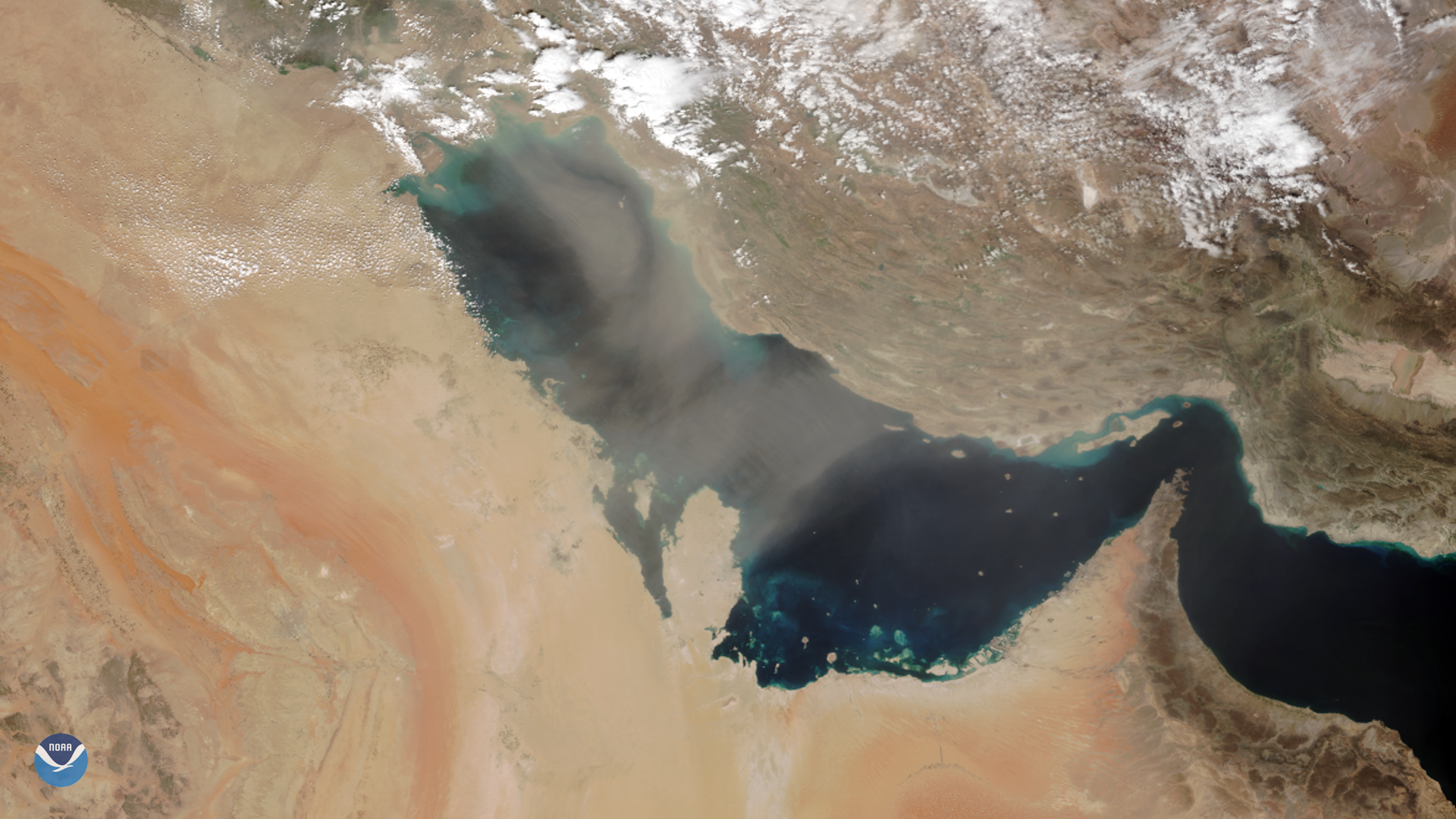
As NOAA-20 passed over the Middle East on March 8, 2020, it captured this image of dust blowing over the Persian Gulf. Dust storms are…
Satellite Snapshots
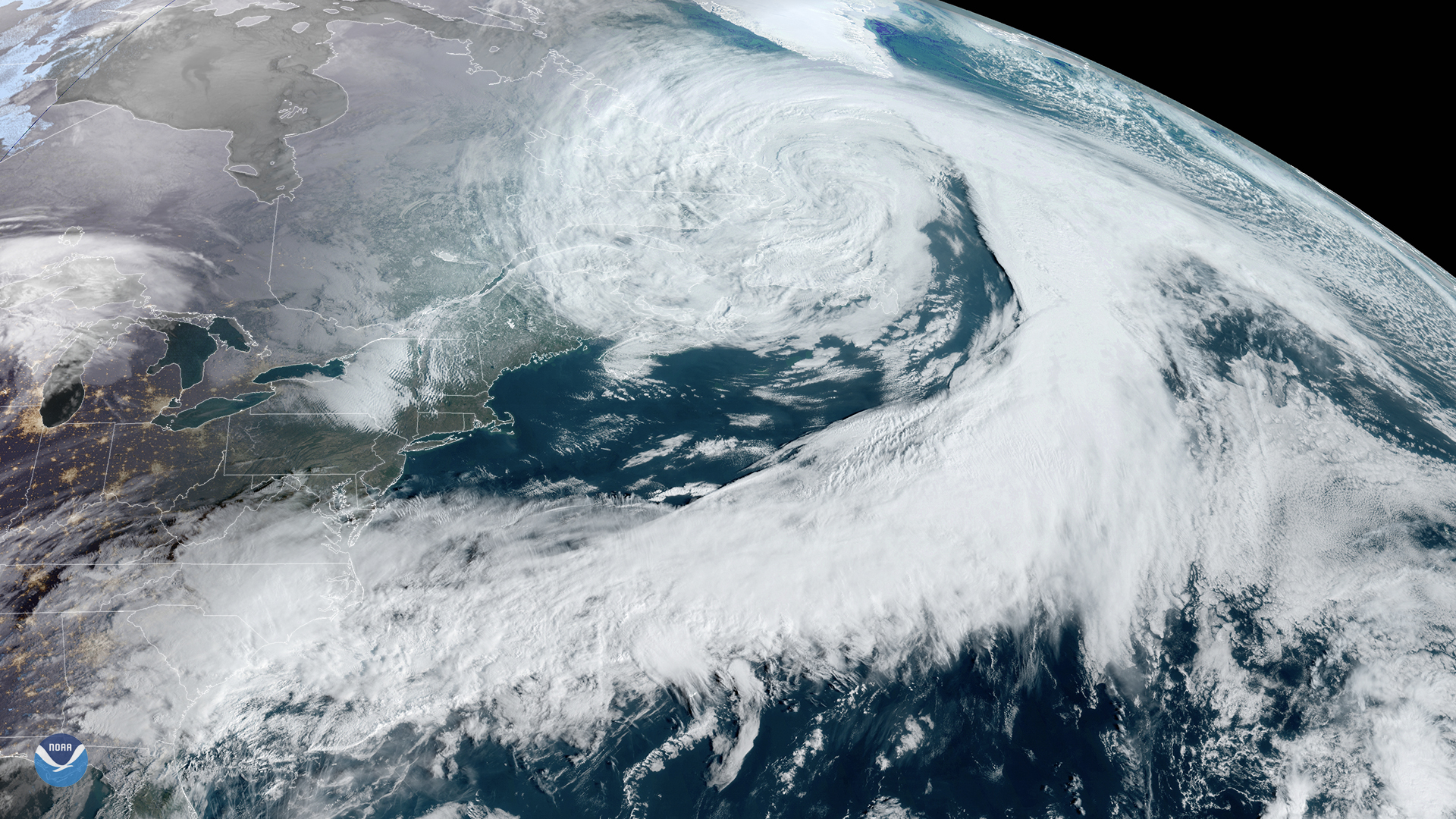
GOES-East satellite zoomed in on a large low-pressure system centered over eastern Canada, trailing a cold front.
Satellite Snapshots
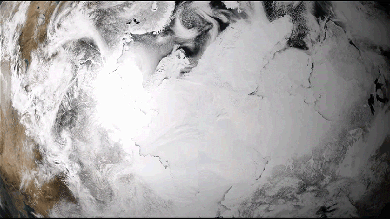
This animation shows the maximum-to-minimum melt cycle of Arctic sea ice for a single warm season spanning from April to September 2019.
Satellite Snapshots
March 04, 2020 On March 4, 2020, GOES-East saw an ongoing storm system over the coast and interior of Brazil. According to Brazil’s National…
Satellite Snapshots
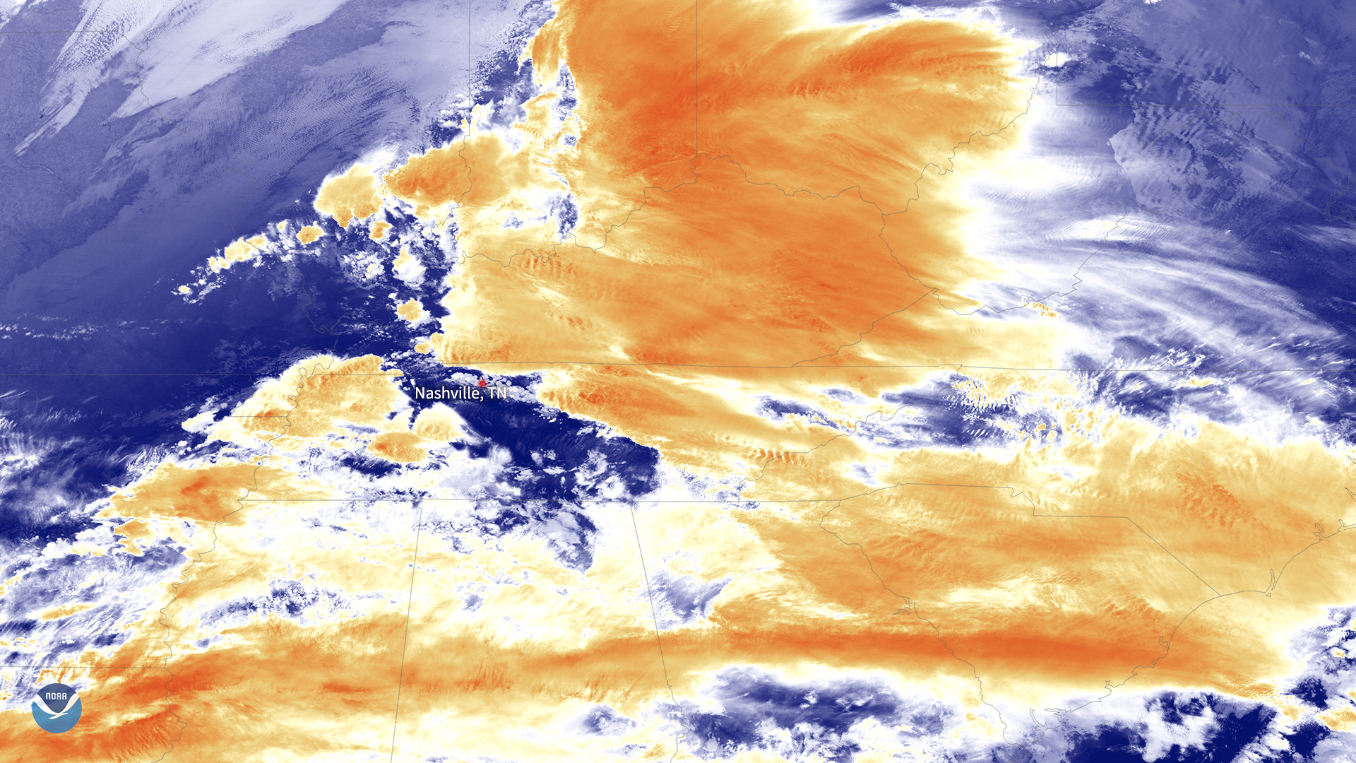
NOAA-20 satellite passed over a line of severe storms that spawned several tornadoes in central united states.
Satellite Snapshots
NOAA-20 satellite passed over a line of severe storms that spawned several tornadoes in central united states.