
Satellite Snapshots
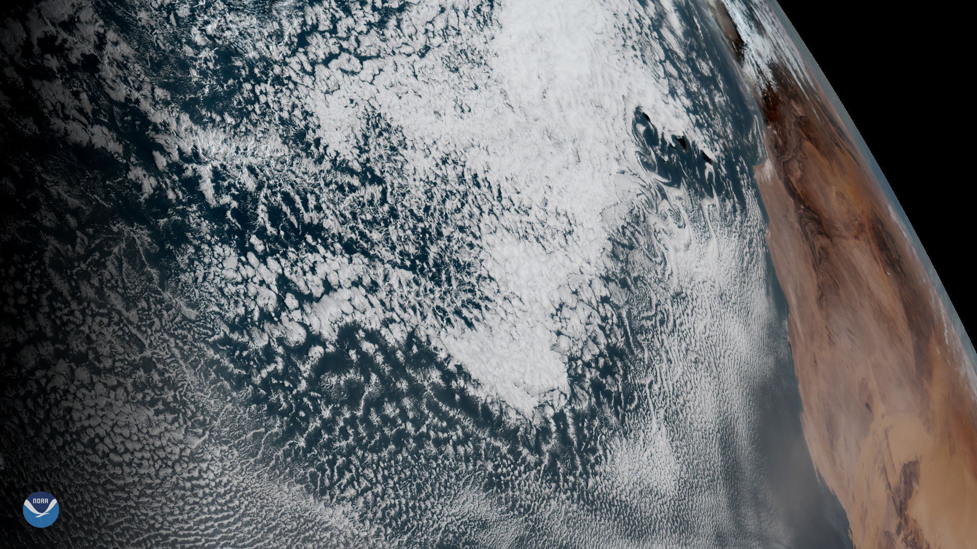
GOES East spied spiral cloud eddies called von Kármán vortices off the Canary Islands on Feb. 20, 2020.
Satellite Snapshots
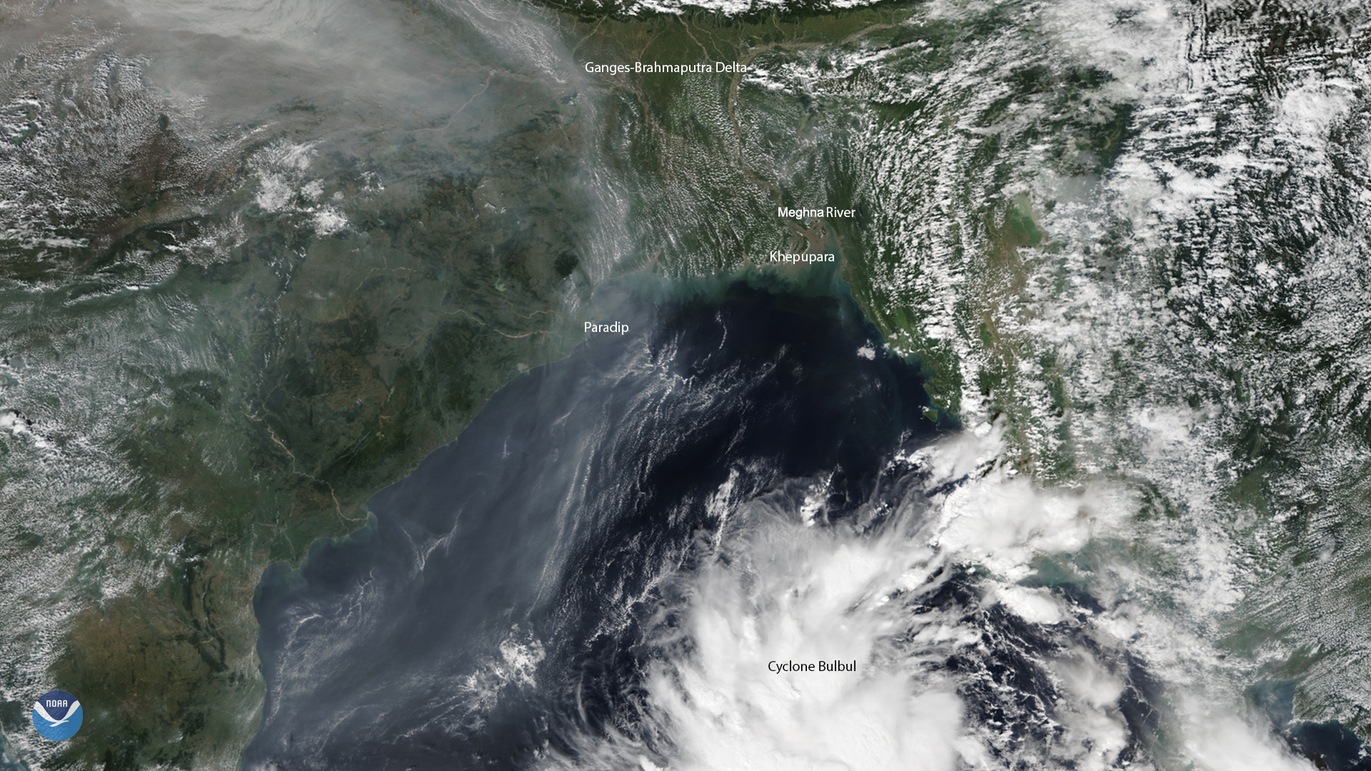
NOAA-20 captured this image of Bangladesh and the Bay of Bengal at the onset of Cyclone Bulbul, which has made its way across the Indian subcontinent.
Satellite Snapshots
February 19, 2020 On Feb. 19, 2020, the GOES-East satellite viewed an ongoing storm system in the South, where an atmospheric river (AR) weather…
Satellite Snapshots
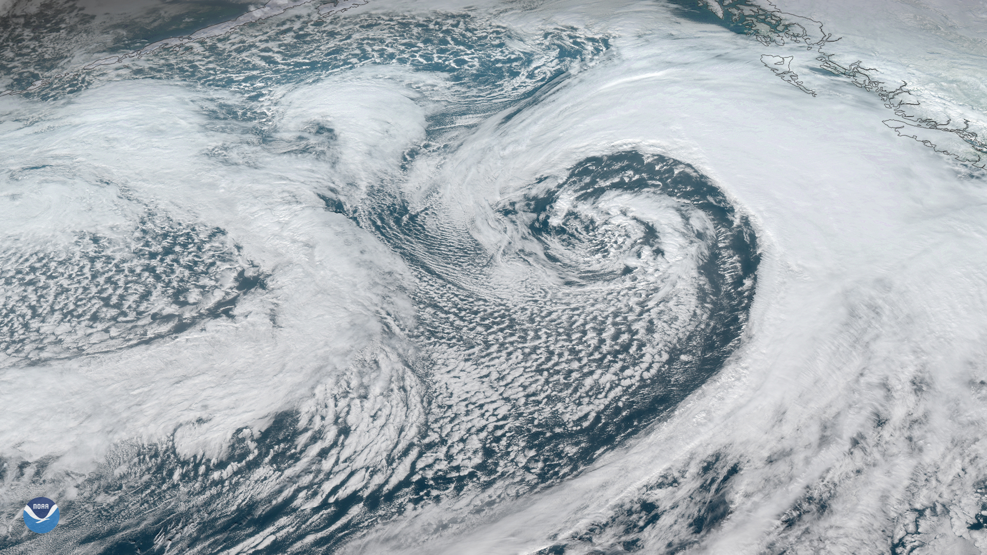
A strong area of low pressure is moving northward across Alaska’s eastern Aleutian Islands and western Peninsula. The system is…
Satellite Snapshots
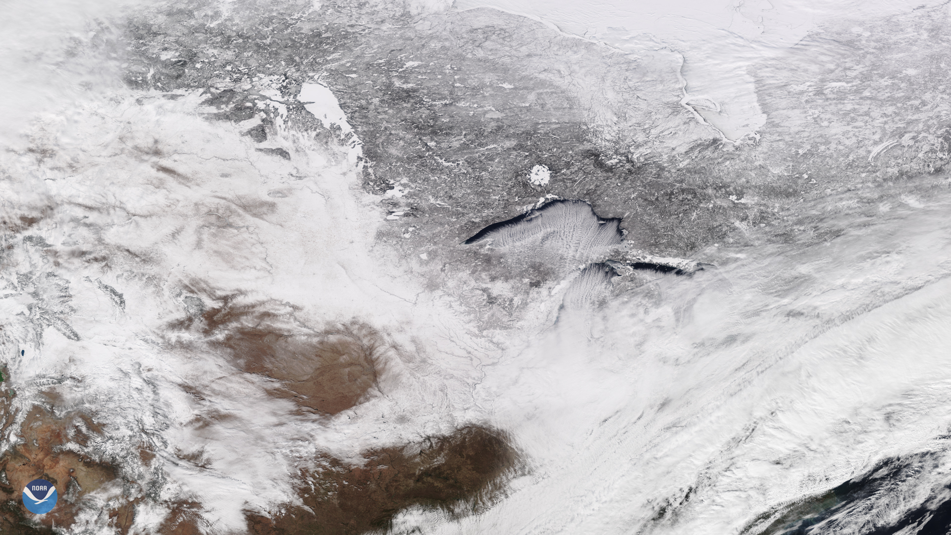
February 14, 2020 On Feb. 13, 2020, the NOAA-20 satellite viewed cloud streets over Lake Superior, signifying a cold air mass on the move. In fact,…
Satellite Snapshots
February 14, 2020 On Feb. 13, 2020, the NOAA-20 satellite viewed cloud streets over Lake Superior, signifying a cold air mass on the move. In fact,…
Feature Story

To support global weather forecasting NOAA is looking for new ways to augment observations in low-Earth orbit made by the Joint Polar Satellite System
Feature Story
To support global weather forecasting NOAA is looking for new ways to augment observations in low-Earth orbit made by the Joint Polar Satellite System