
Satellite Snapshots
On the eastern coast of North America on Dec. 18, 2019, the GOES-16 satellite showed a long cold front that stretched from…
Satellite Snapshots
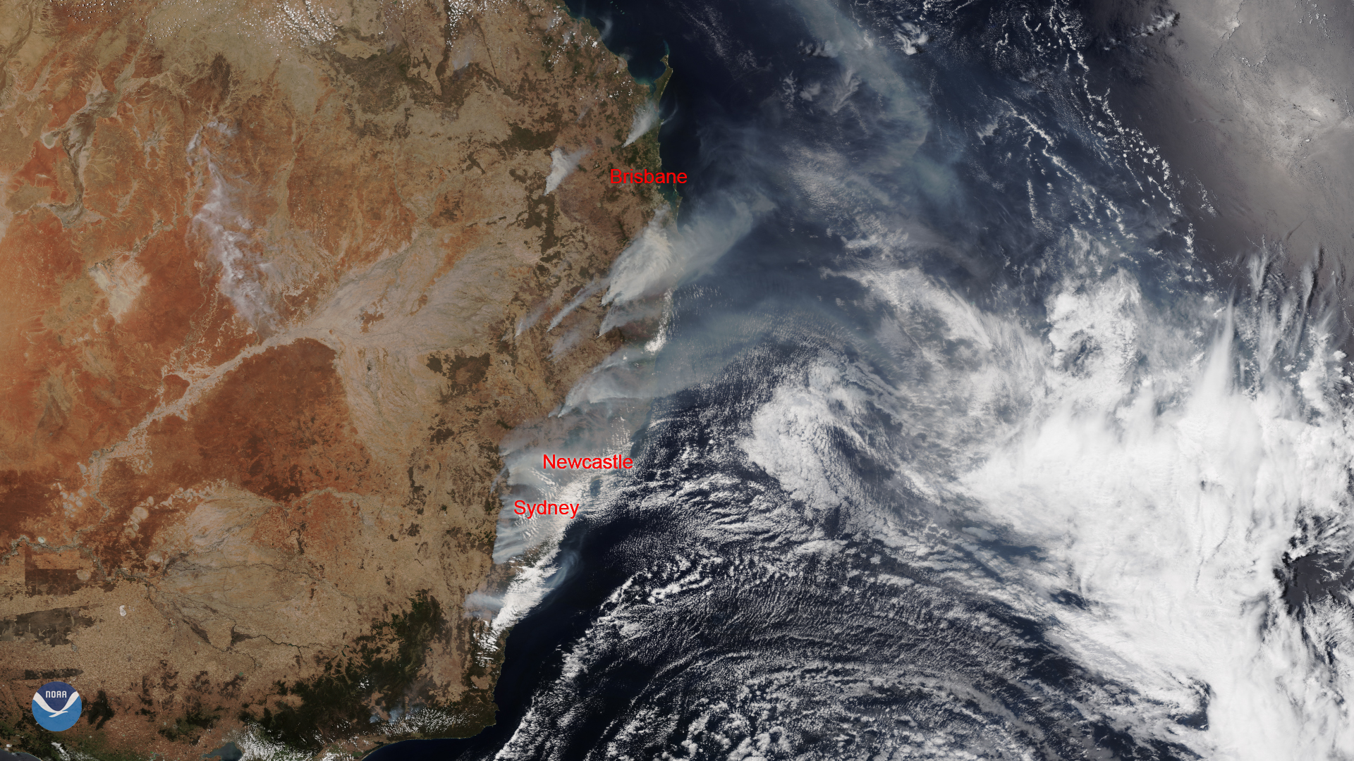
As massive wildfires continue to rage in the southeastern states of Australia, a dangerous heat wave is also moving across the…
Satellite Snapshots
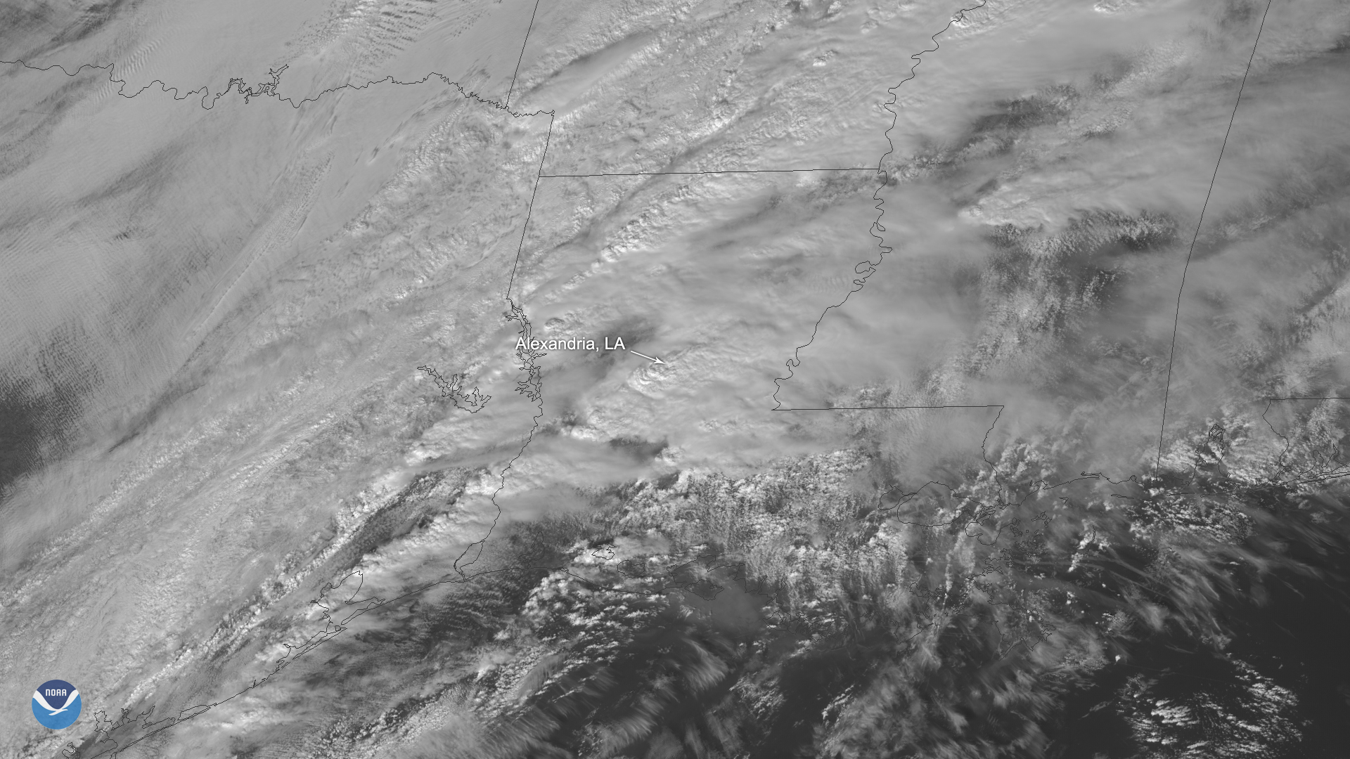
On Dec. 16, 2019, GOES East spotted severe thunderstorms that reportedly produced a tornado near the city of Alexandria, Louisiana…
Satellite Snapshots
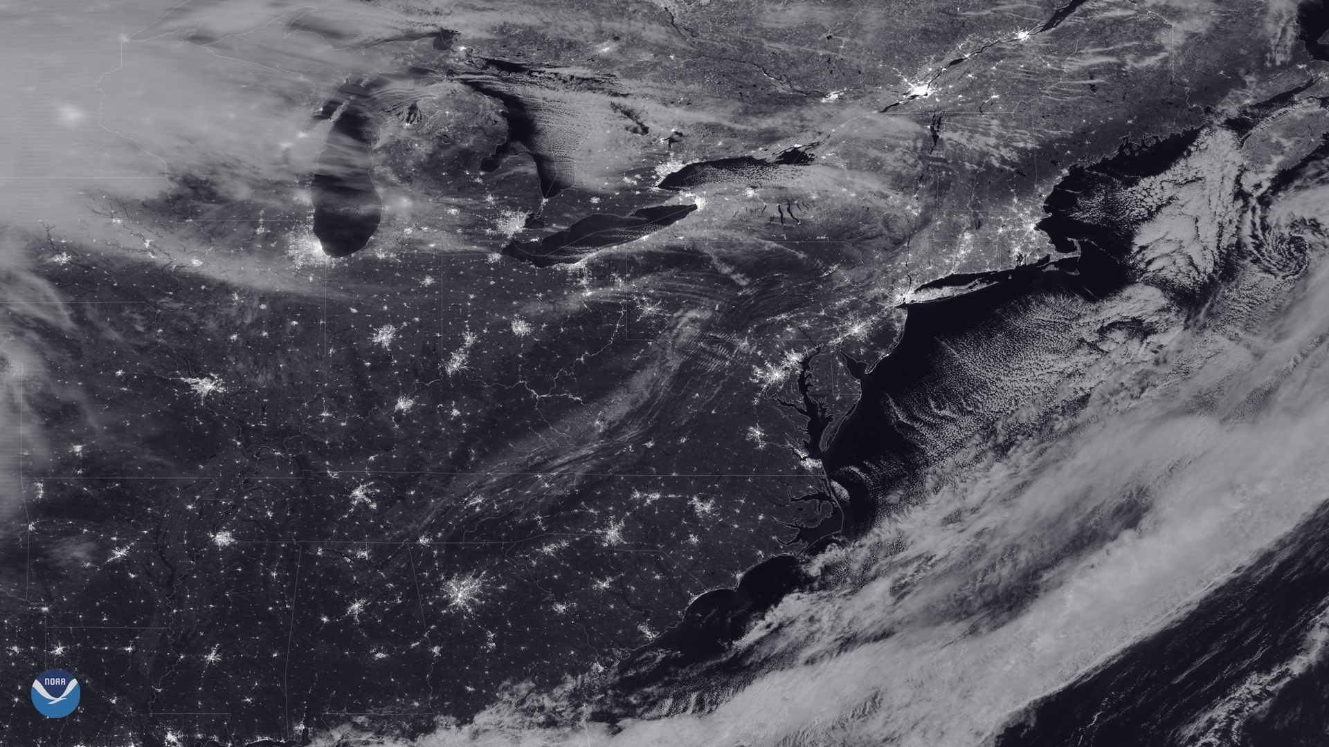
As the NOAA-20 satellite passed over the eastern United States on the night of the last full moon of the year, the sky was mostly…
Satellite Snapshots
As the NOAA-20 satellite passed over the eastern United States on the night of the last full moon of the year, the sky was mostly…
Satellite Snapshots
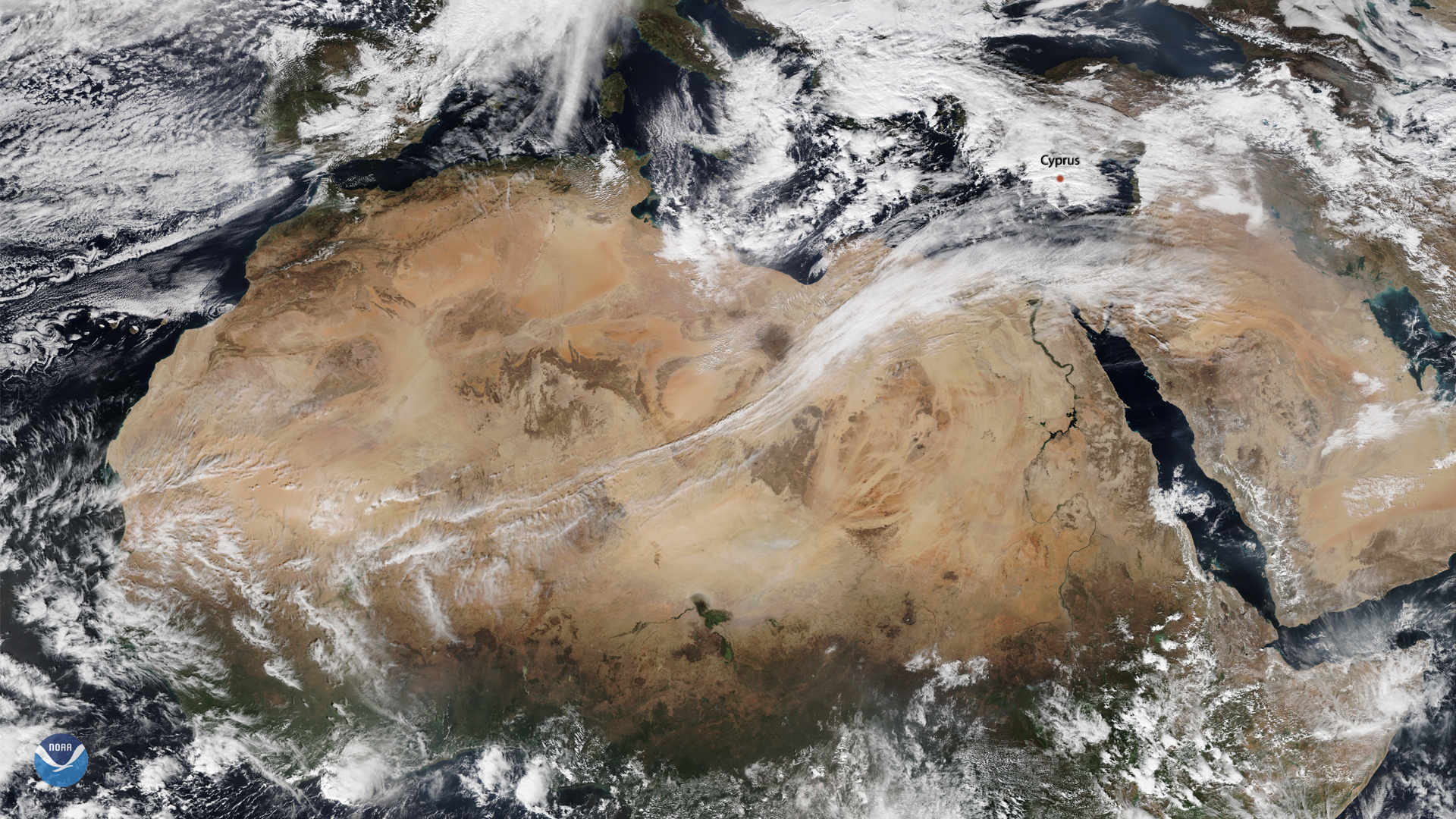
On Dec. 11, 2019, NOAA-20 captured this image of an unusual westerly trade wind flow in Northern Africa — this pattern was caused…
Satellite Snapshots
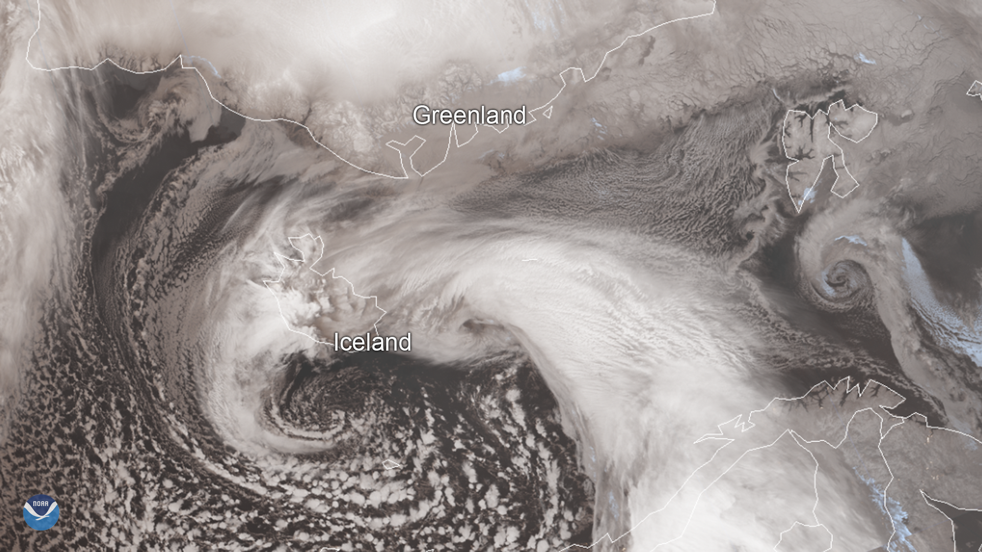
Iceland’s worst winter storm of the year hit the country yesterday, Dec. 10, 2019, and is continuing to bring extremely windy…
Satellite Snapshots
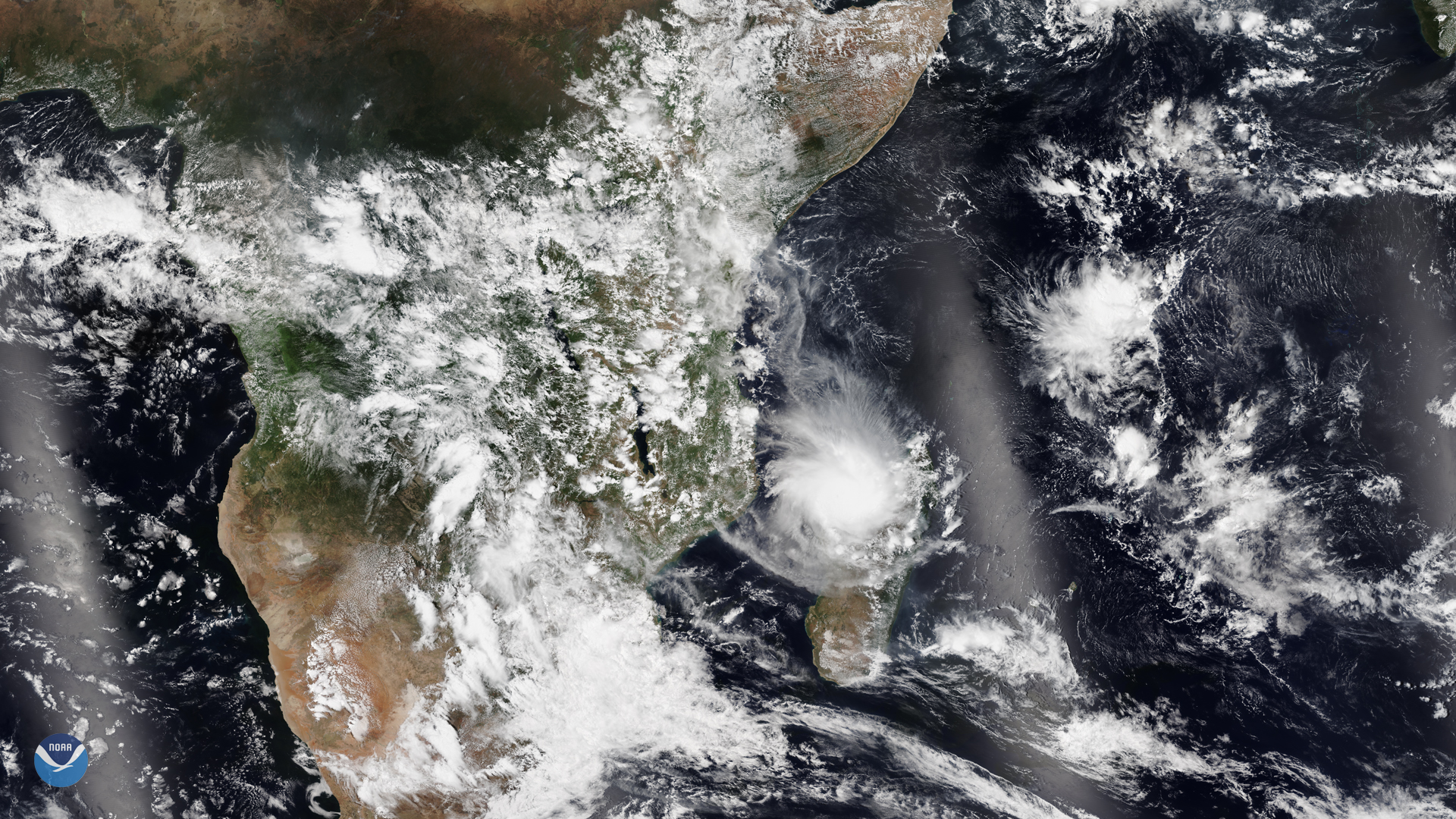
NOAA-20 captured Tropical Cyclone Belna as it made landfall at Boeny, a northwestern province on the island nation of Madagascar on…