
Feature Story
The stunning, colorful imagery you see from GOES-16 and GOES-17 isn’t just beautiful to look at, it also provides critical information to forecasters
Satellite Snapshots
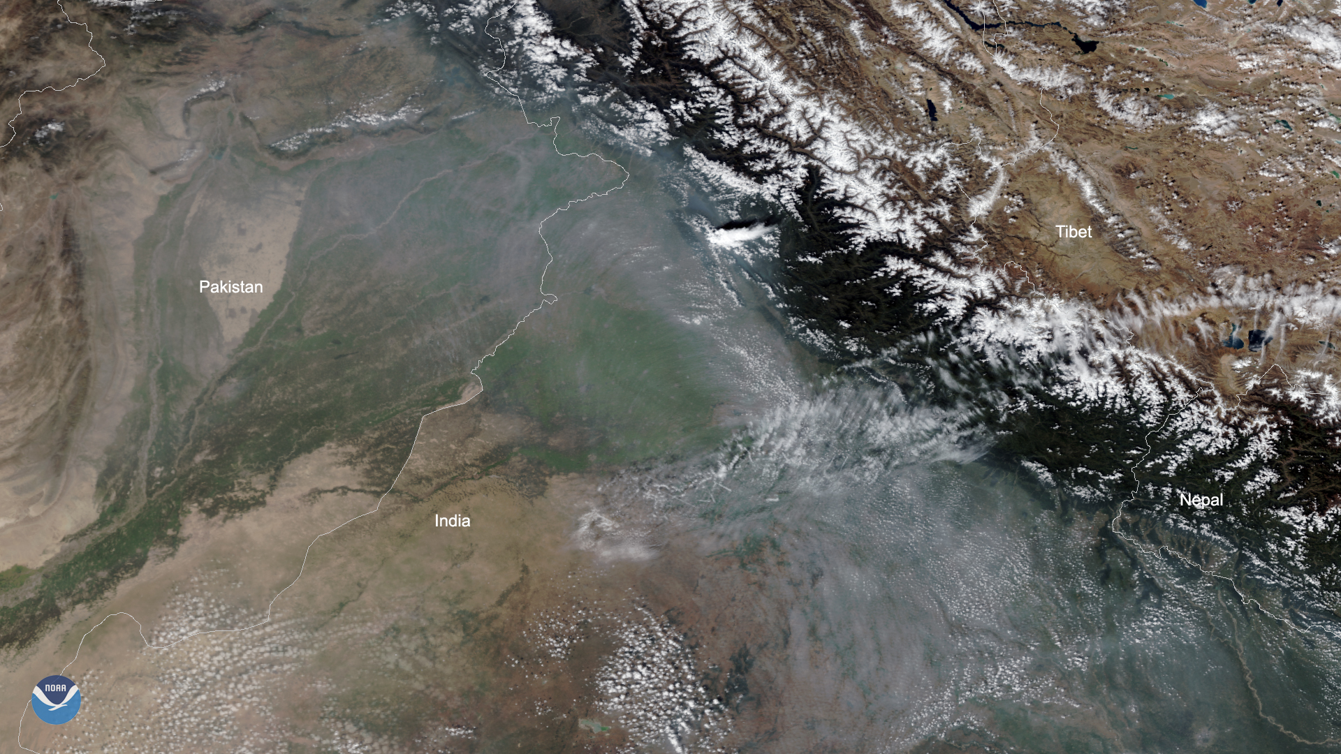
Smoke from fires in northeastern Pakistan and northwestern India can be clearly seen in this imagery captured by the NOAA-20…
Satellite Snapshots
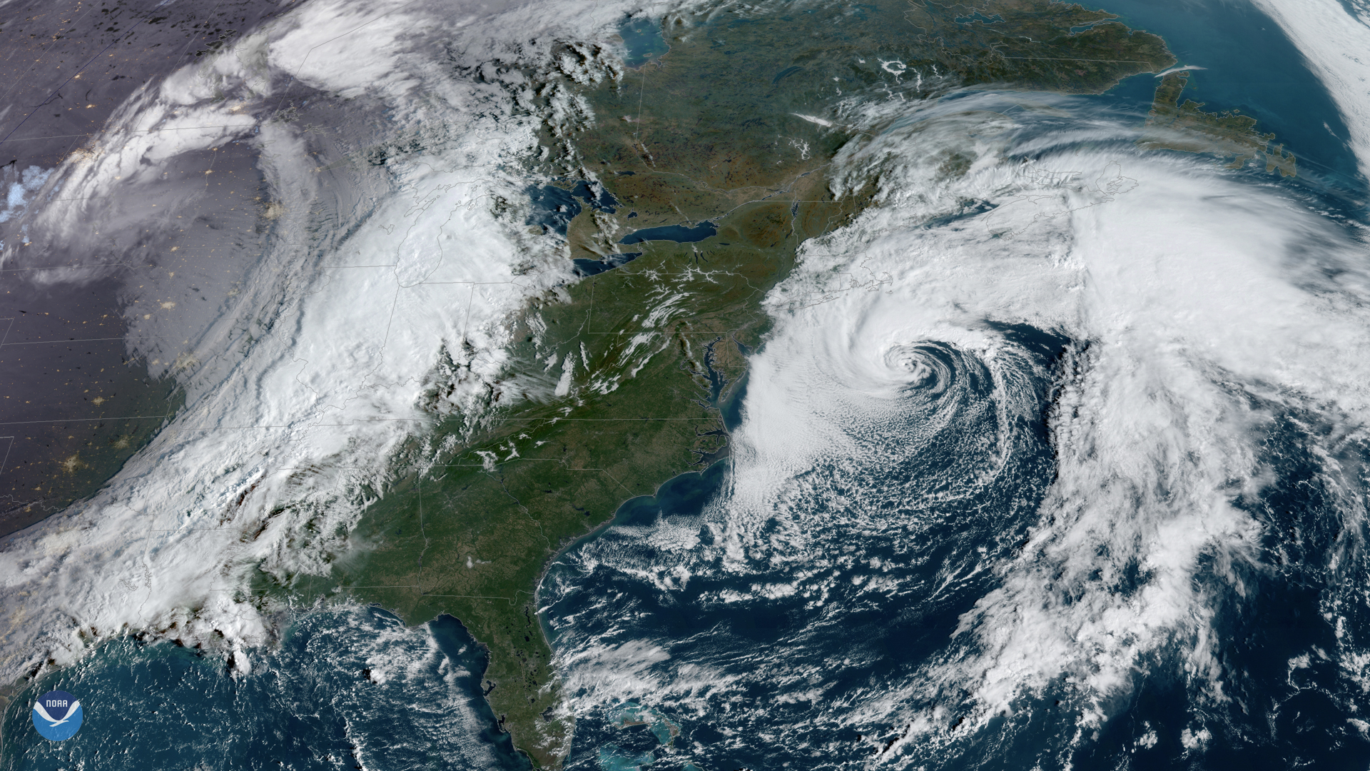
GOES East captured this awe-inspiring view of two large storm systems over North America on Friday, Oct. 11, 2019. To the west, a…
Feature Story
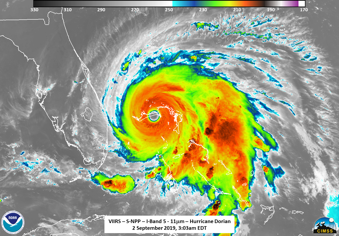
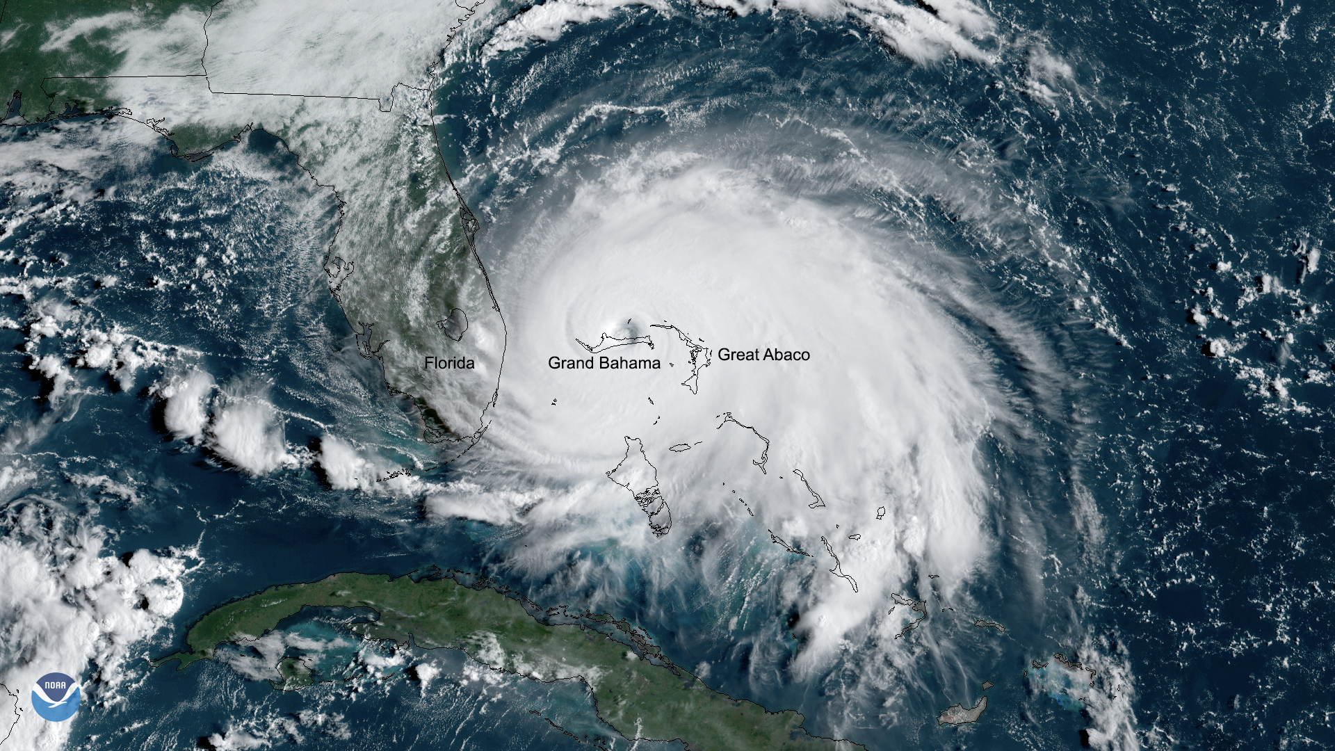
As Hurricane Dorian made landfall over two islands in the Bahamas, NOAA's Joint Polar Satellite System satellites captured these infrared images.
Satellite Snapshots
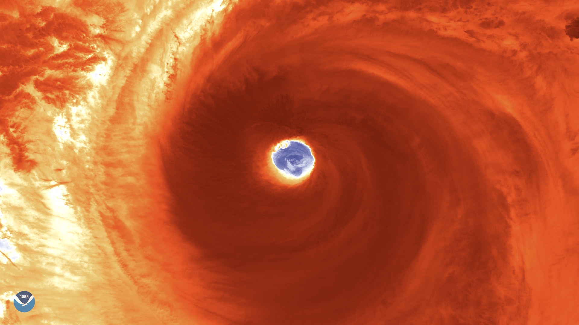
Japan is bracing for a possible hit from Super Typhoon Hagibis, as the monstrous storm located some 600 miles south of Yokosuka,…
Feature Story

The new marine heat wave off the Pacific Coast is reminiscent of the early stages of the 2014–2016 “blob” that devastated…
Feature Story
The new marine heat wave off the Pacific Coast is reminiscent of the early stages of the 2014–2016 “blob” that devastated…
Feature Story
The new marine heat wave off the Pacific Coast is reminiscent of the early stages of the 2014–2016 “blob” that devastated…