
Announcement

NOAA issued two Broad Agency Announcements, seeking fresh ideas for new instrument technologies and concepts for future use on its advancedgeostationa
Satellite Snapshots

GOES East watched a large low pressure system swirl over the Eastern United States and Canada on Sunday, Oct. 6, 2019, which brought…
Satellite Snapshots
GOES East watched a large low pressure system swirl over the Eastern United States and Canada on Sunday, Oct. 6, 2019, which brought…
Satellite Snapshots
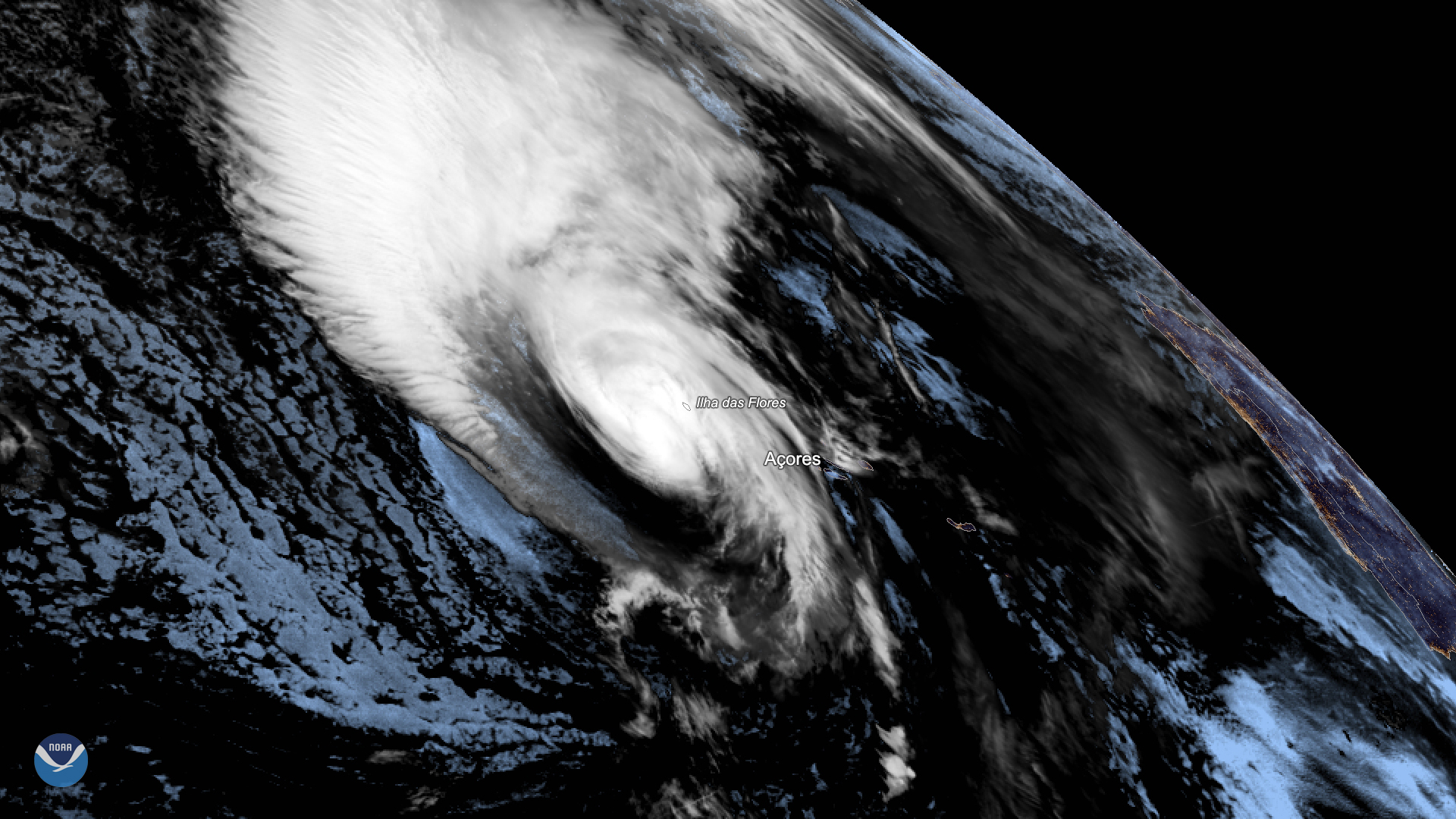
Hurricane Lorenzo lashed Portugal’s Azores Islands early Wednesday morning, toppling trees and downing power lines as the then…
Satellite Snapshots
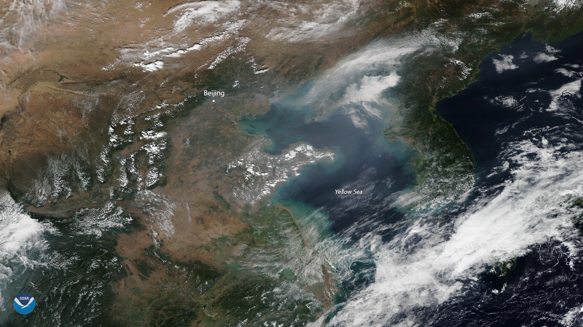
The NOAA-20 satellite spied heavy smog over China's capital city of Beijing on Sept. 29, 2019.
Satellite Snapshots
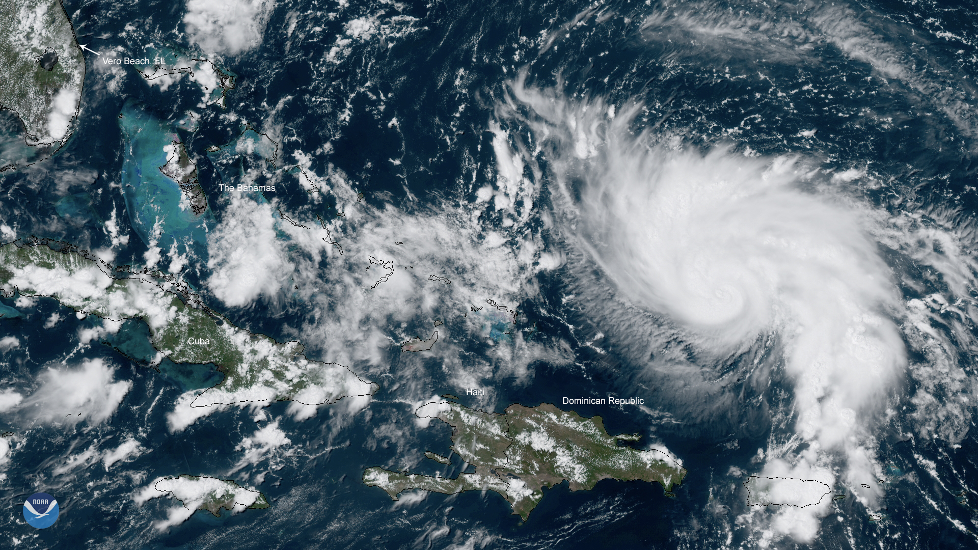
NOAA’s GOES East satellite zoomed in on Category 1 Hurricane Dorian on Thursday, Aug. 29, 2019 over the open waters of the Atlantic Ocean
Satellite Snapshots
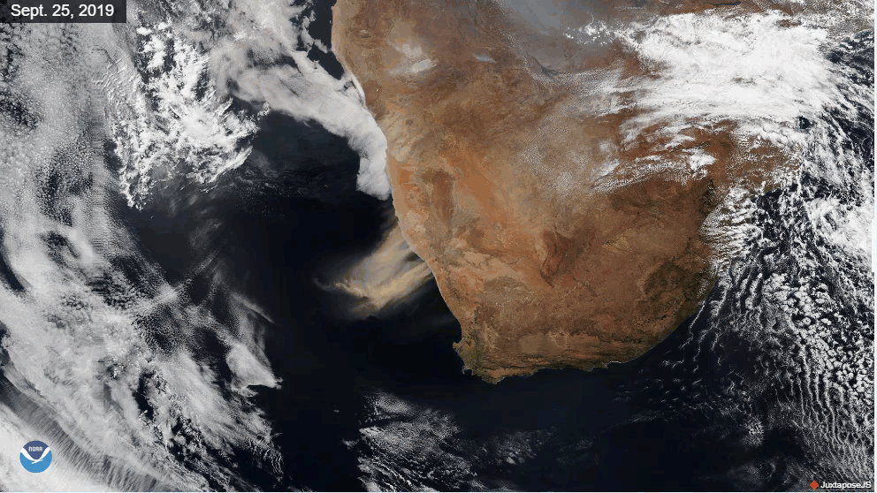
Very strong winds over southern Africa kicked up huge plumes of dust and sand, turning the skies an earthy red on Sept. 25, 2019.
Satellite Snapshots
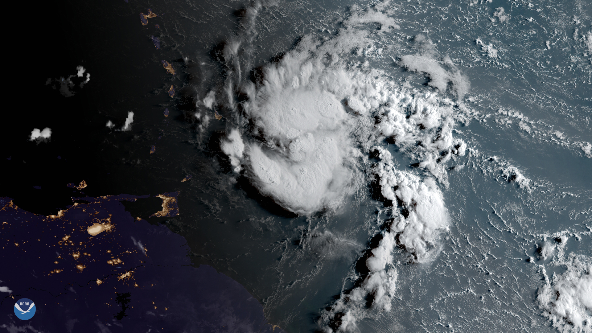
GOES East has been watching a tropical system just east of the Lesser Antilles, which became Tropical Storm Dorian