
Feature Story
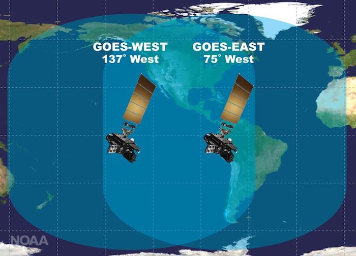
Excitement is building for the launch of GOES-S. On March 1, 2018, NOAA’s newest geostationary satellite will launch into…
Satellite Snapshots
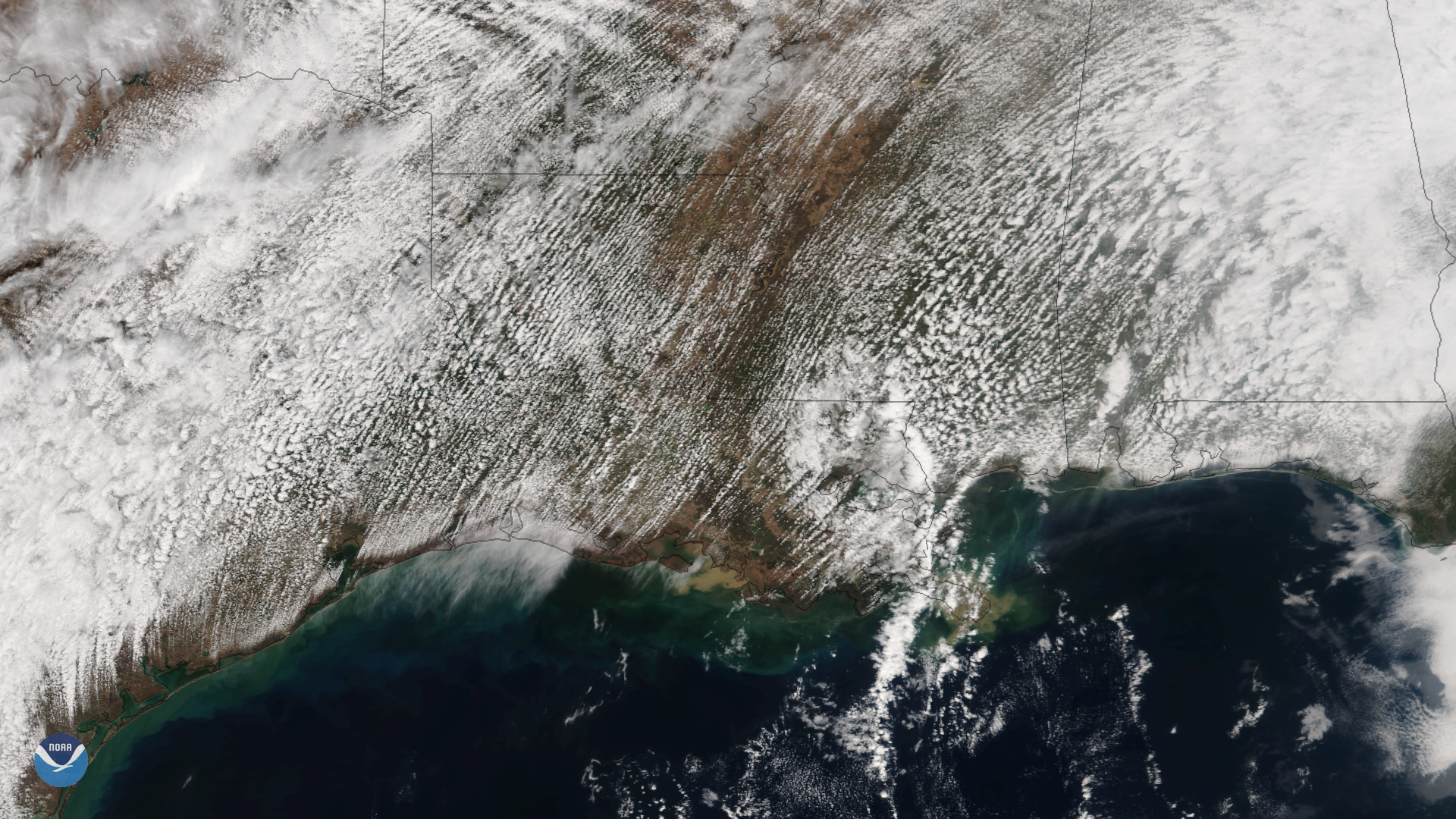
Multiple rows of cumulus clouds appear over Texas, Louisiana and the Gulf Coast in this image captured by the Suomi NPP satellite's…
Satellite Snapshots
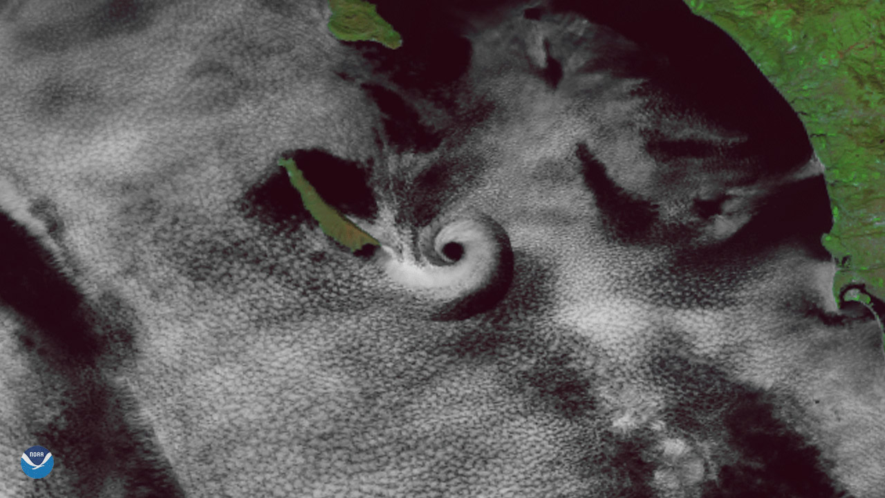
A spiral cloud appears just off the southern California coast in this image seen by the Suomi NPP satellite's VIIRS instrument on February 1, 2018.
Satellite Snapshots
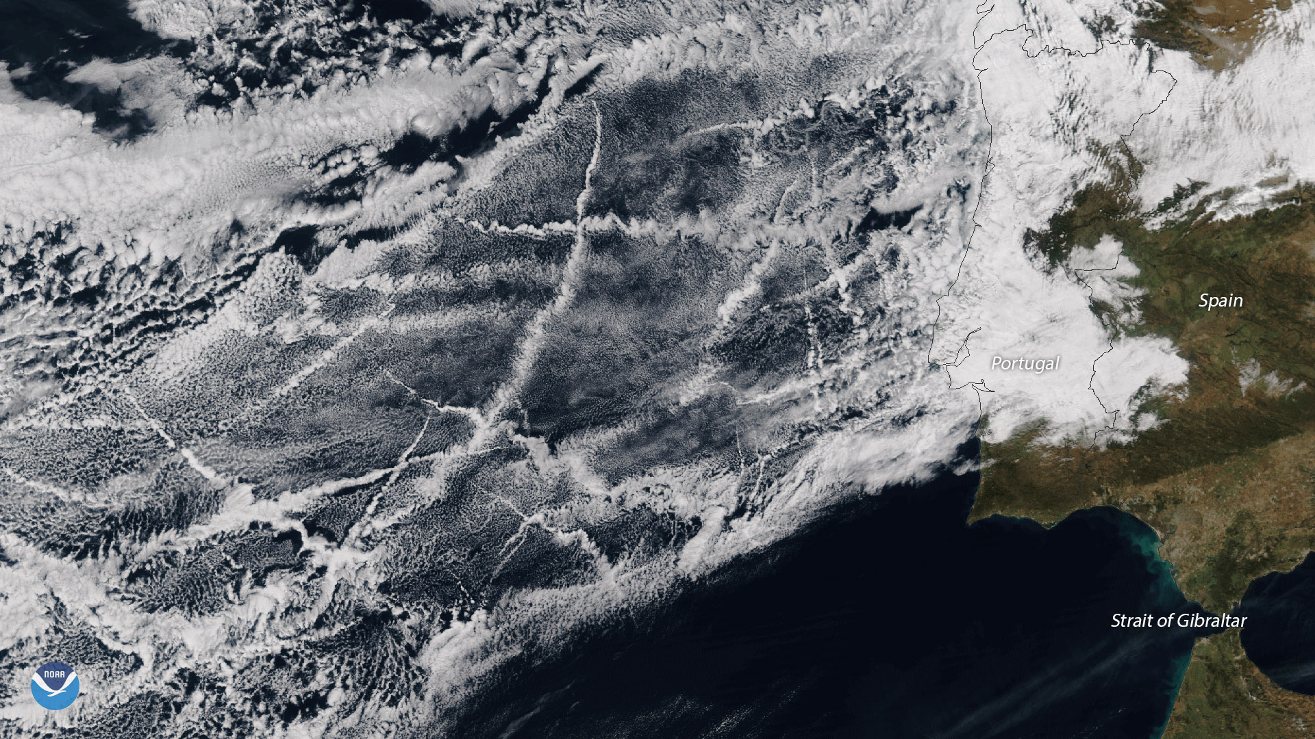
The ship tracks in this image stretch several hundred miles off the coast of Portugal, and occur in one of the most heavily trafficked areas for cargo
Satellite Snapshots
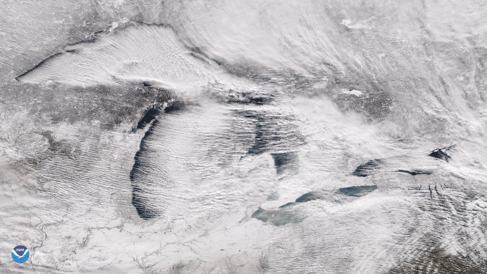
The Suomi NPP satellite's VIIRS instrument captured these parallel rows of clouds, known as "cloud streets" streaming over the Great Lakes.
Satellite Snapshots
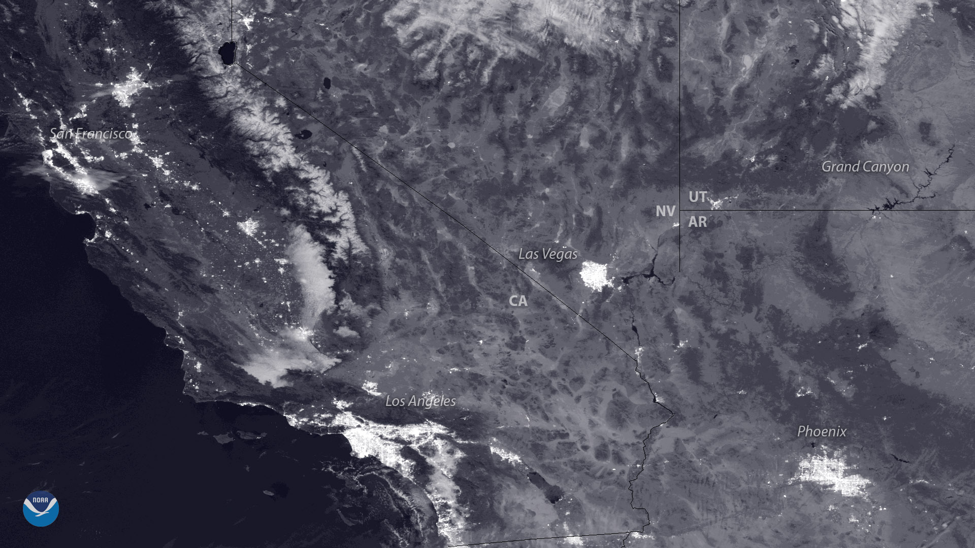
The polar-orbiting NOAA/NASA Suomi NPP satellite captured this view of Northern California last night (December 3, 2017)…
Feature Story
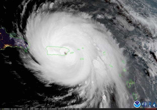
Although not yet operational, data from NOAA’s GOES-16 satellite proved vital in forecasting operations for Hurricane Maria as it neared Puerto Rico.
Feature Story
GOES-16's 5-minute imagery is a big improvement over the 15- or 30-minute refresh rate offered by the current GOES imager.