
Earth from Orbit
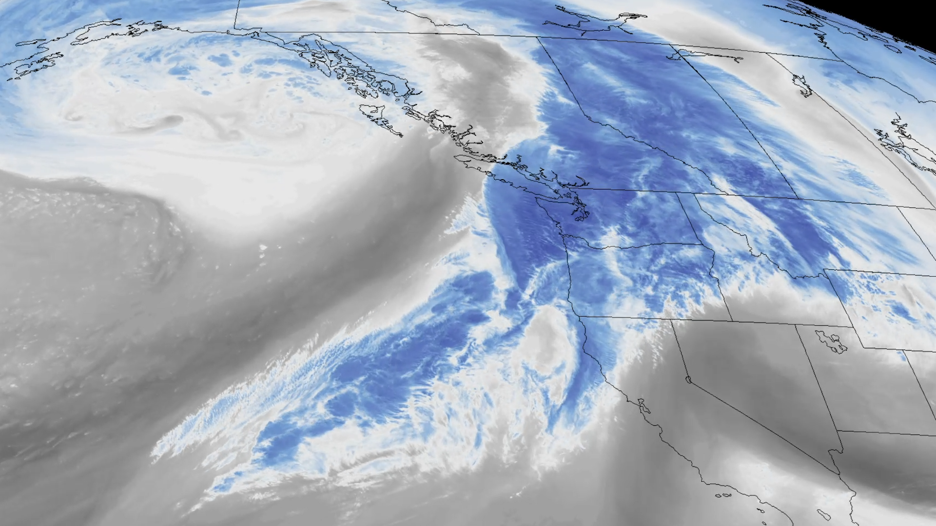
NOAA satellites are closely monitoring a strong atmospheric river that has been bringing excessive rainfall, flooding, and high elevation snow.
Earth from Orbit

NOAA satellites constantly monitor the oceans for tropical activity. As the 2023 Atlantic hurricane season comes to a close, we’re looking back at this above-normal season.
Earth from Orbit
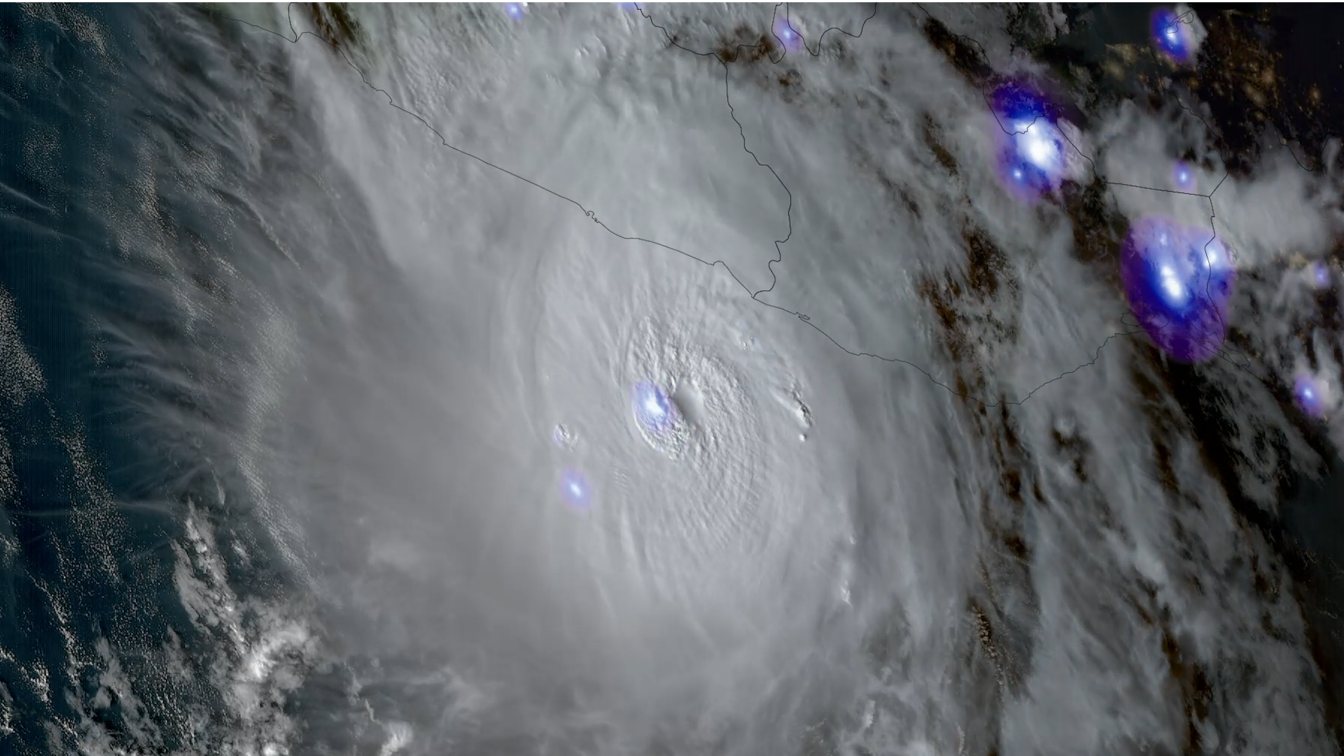
Hurricane Otis made landfall on Mexico’s southern Pacific coast, at 1:25 a.m. CDT as a Category 5 hurricane with sustained winds of 165 mph.
Feature Story
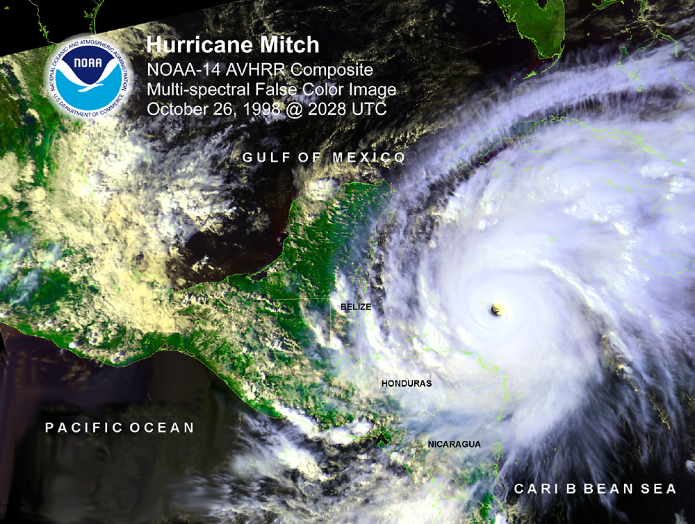
Twenty-five years ago, Hurricane Mitch formed, and was one of the strongest and most intense Atlantic hurricanes on record.
Satellite Snapshots
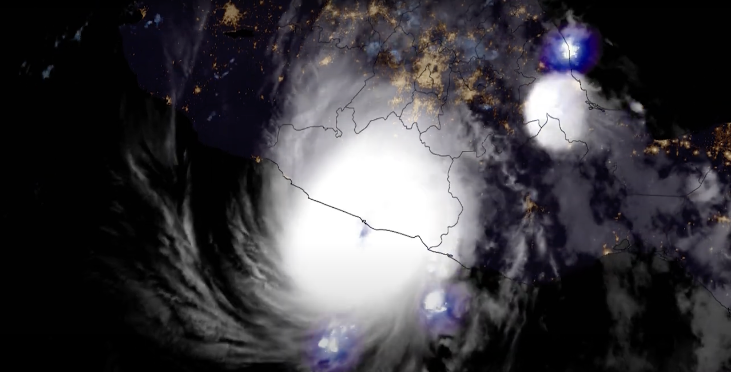
On Wednesday, Oct. 25, Hurricane Otis made landfall near Acapulco, on Mexico’s southern Pacific coast, at 1:25 a.m. CDT as a Category 5 hurricane with
Earth from Orbit
The remnants of Tropical Storm Ophelia over the Atlantic Ocean combined with a mid-latitude system arriving from the west at a time of year when ocean
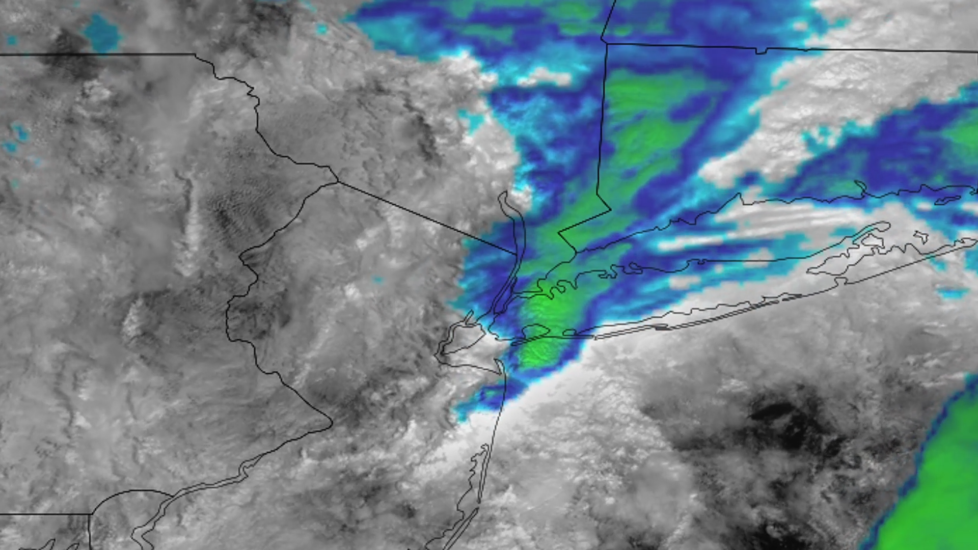
Earth from Orbit
The remnants of Tropical Storm Ophelia over the Atlantic Ocean combined with a mid-latitude system arriving from the west at a time of year when ocean
Satellite Snapshots

On September 27, 2023, the VIIRS instrument onboard NOAA’s JPSS satellites captured this GeoColor imagery of Canadian wildfire smoke being pulled acro