
Earth from Orbit
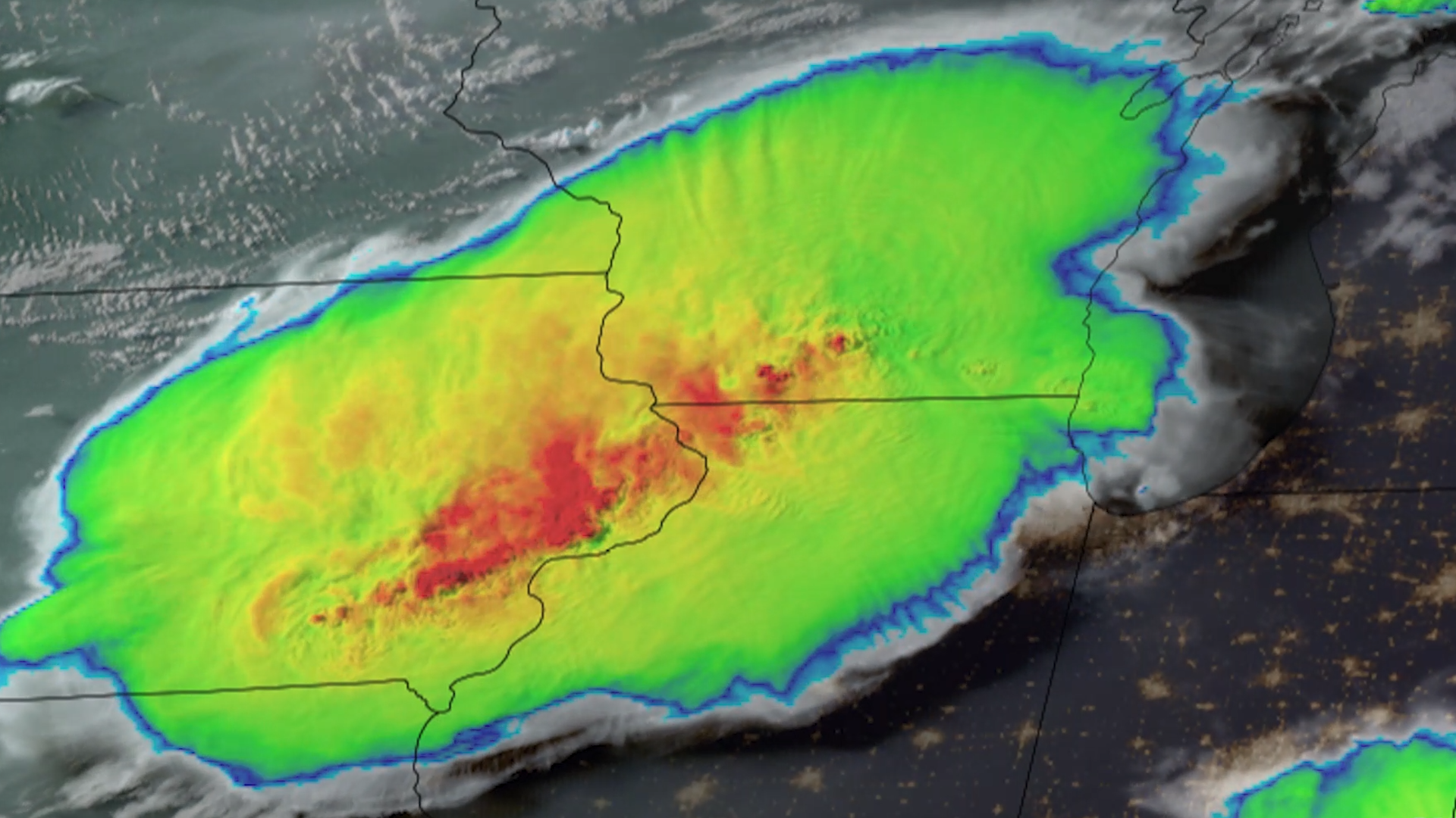
Parts of the Midwest are cleaning up after thunderstorms barreled through the region on the night of Monday, July 15, 2024, bringing hurricane-force winds and multiple tornadoes around Chicago.
Satellite Snapshots
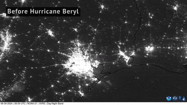
NOAA-21 captured imagery of the devastating power loss across East Texas following Hurricane Beryl’s landfall.
Satellite Snapshots
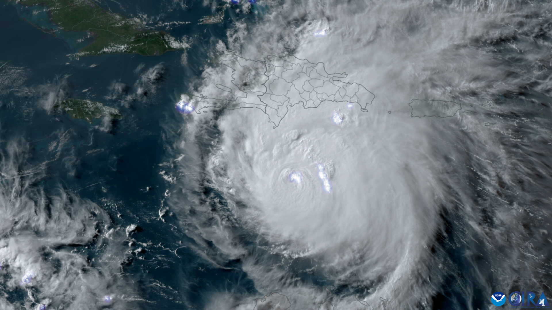
NOAA’s GOES East (GOES-16) satellite has been carefully monitoring Hurricane Beryl as it travels across the Caribbean.
Feature Story

Cool imagery from the GOES satellite series, a retrospectiveNOAA’s Geostationary Operational Environmental Satellites (GOES) have been monitoring the Earth since 1975...
Feature Story

GOES-U, the latest of NOAA’s four advanced geostationary satellites, soared into orbit on a SpaceX Falcon Heavy rocket at 5:26 p.m.
Announcement
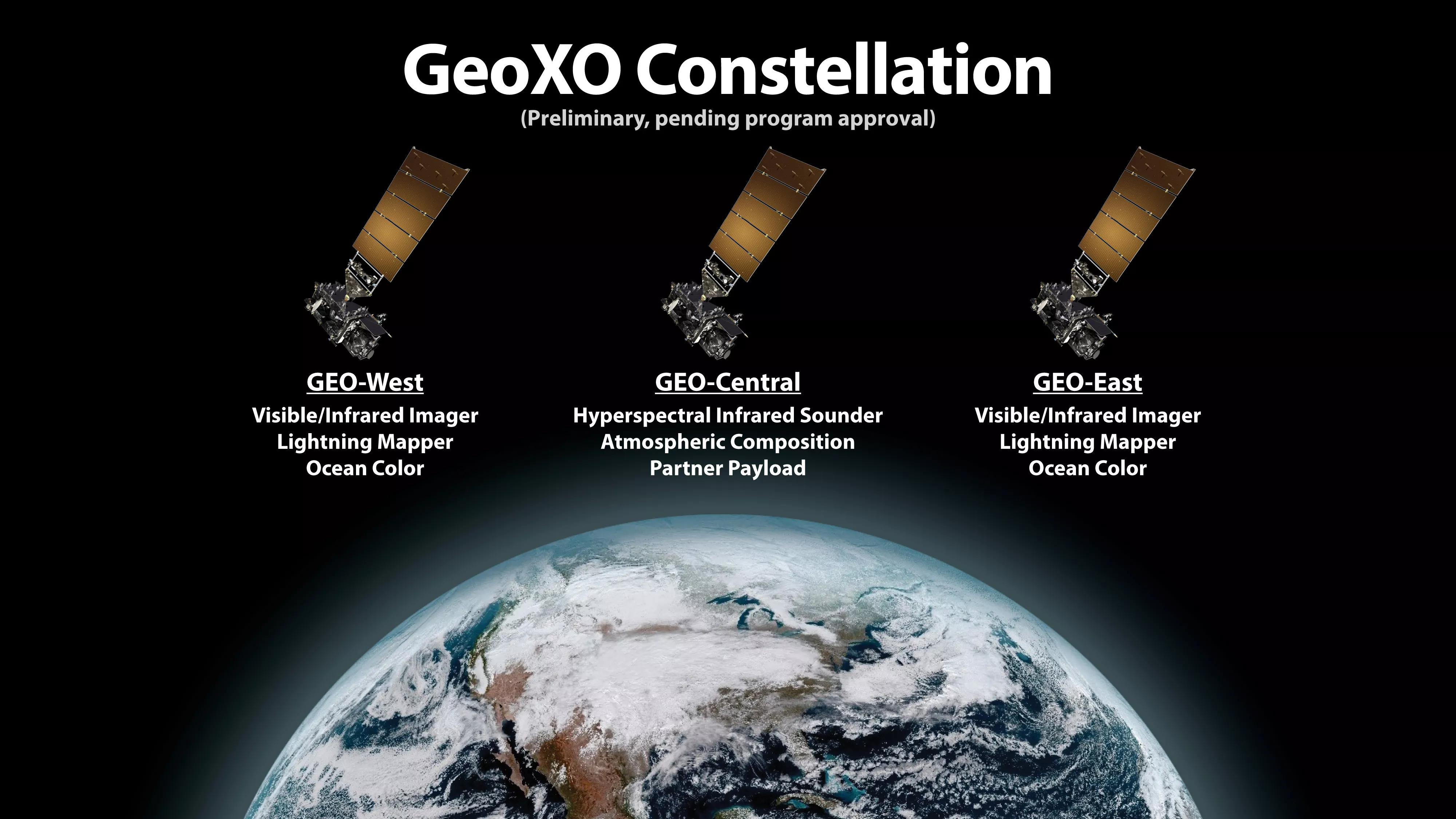
NASA, on behalf of NOAA, has selected Lockheed Martin Corp. of Littleton, Colorado, to build the spacecraft for NOAA’s Geostationary Extended Observations (GeoXO) satellite program.
Announcement

In May 2024, NOAA SciJinks and NASA Space Place released its monthly art challenge! They called on young explorers to draw how they imagined lightning looks, either within the clouds or striking the ground, from above the sky or from their window.
Satellite Snapshots
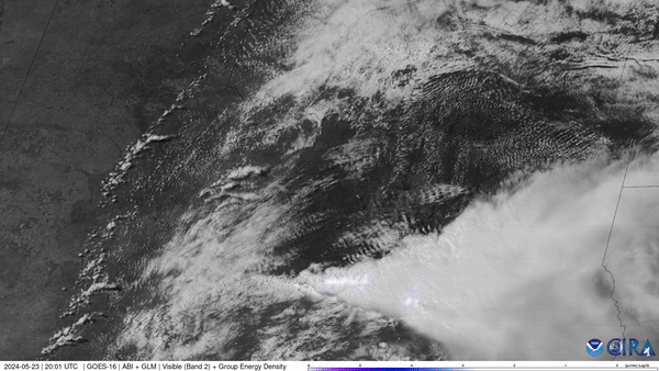
NOAA’s GOES East (GOES-16) satellite watched severe thunderstorms fire up along a dry line situated in west Texas and western Oklahoma on May 23, 2024.