
Satellite Snapshots
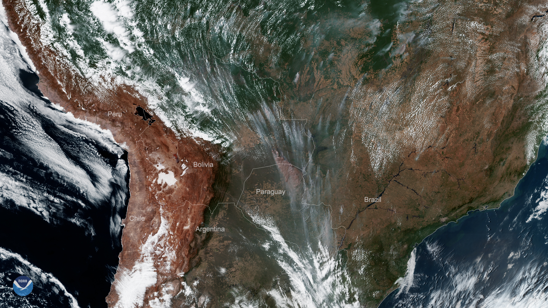
On Sept. 9, 2019, GOES East viewed severe fires in South America across Brazil, Bolivia, and Paraguay.
Feature Story
This season’s Humberto isn’t the first tropical cyclone in the Atlantic Basin to be given the name. In fact, it’s the…
Satellite Snapshots
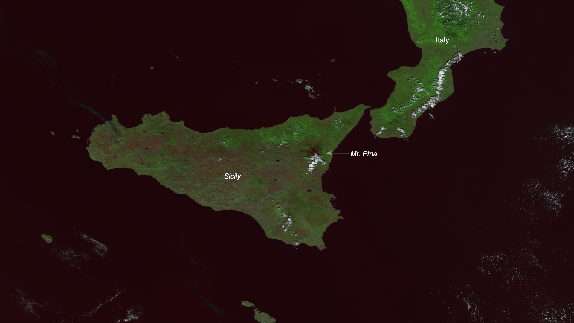
Mount Etna, the famous volcano on the Italian island of Sicily, has been spewing ash and red-hot chunks of lava known as “lava…
Satellite Snapshots
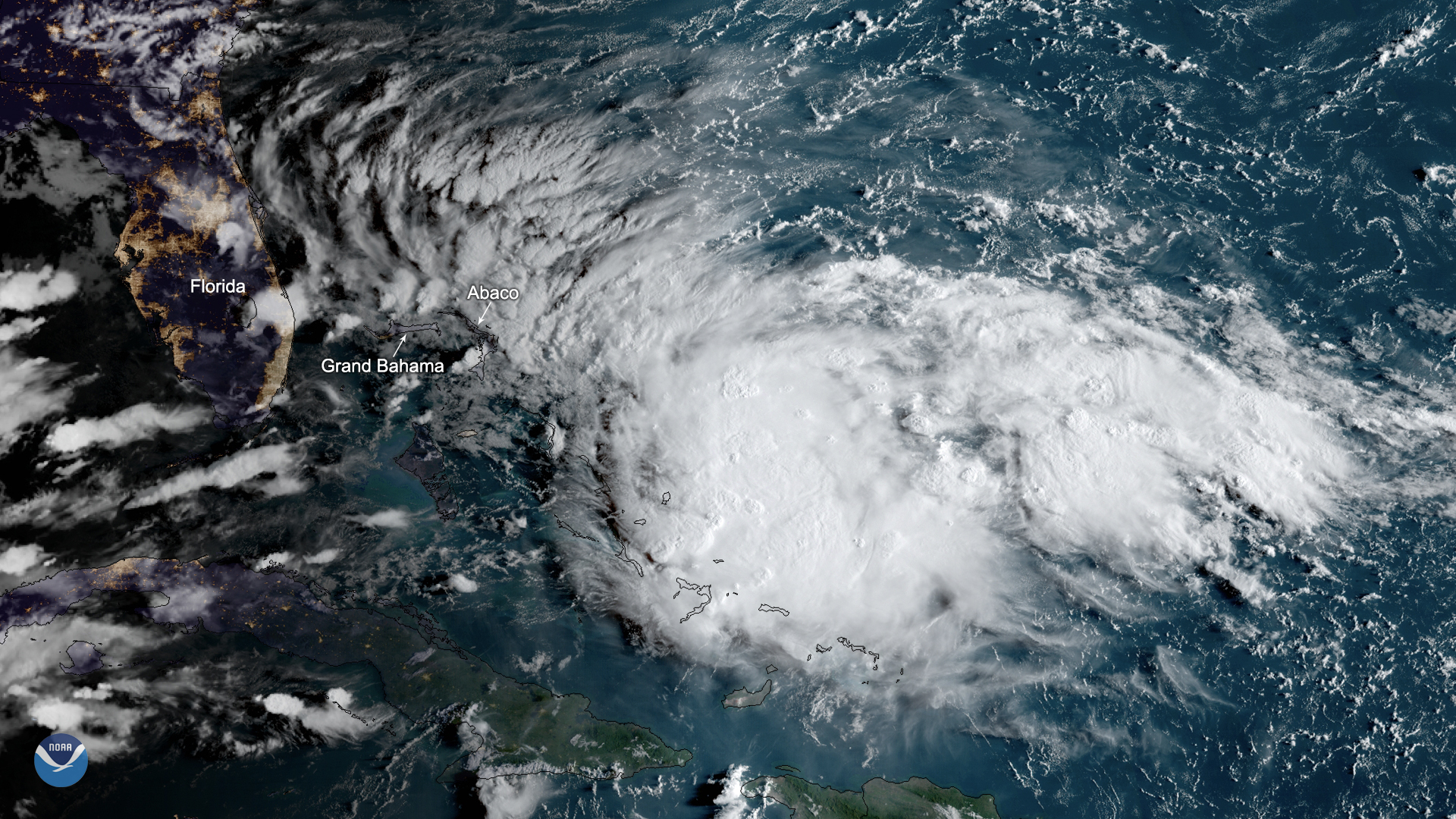
Potential Tropical Cyclone Nine is expected to become a tropical depression or a tropical storm as it moves northwestward over the…
Satellite Snapshots
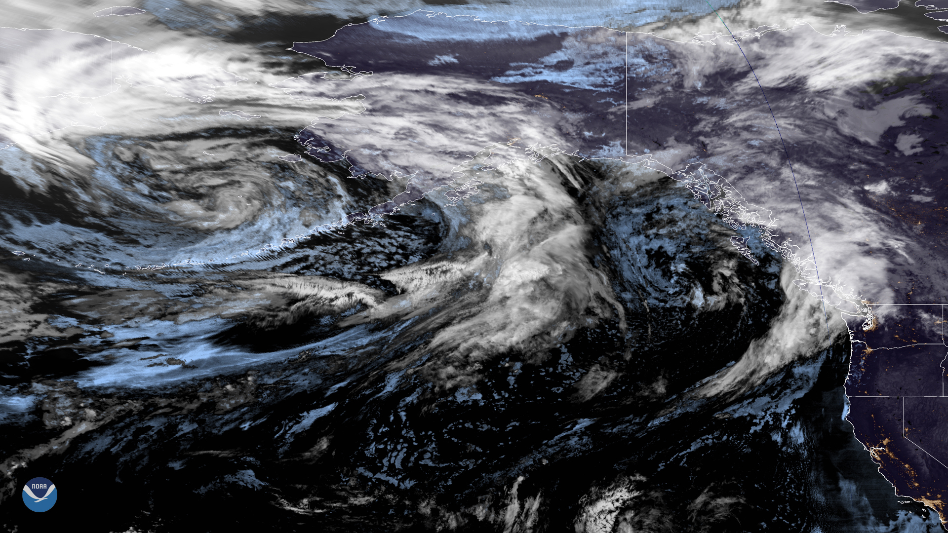
A large low-pressure system over the northern Pacific is making its way to the West Coast in this merged imagery captured by NOAA…
Satellite Snapshots
A large low-pressure system over the northern Pacific is making its way to the West Coast in this merged imagery captured by NOAA…
Satellite Snapshots
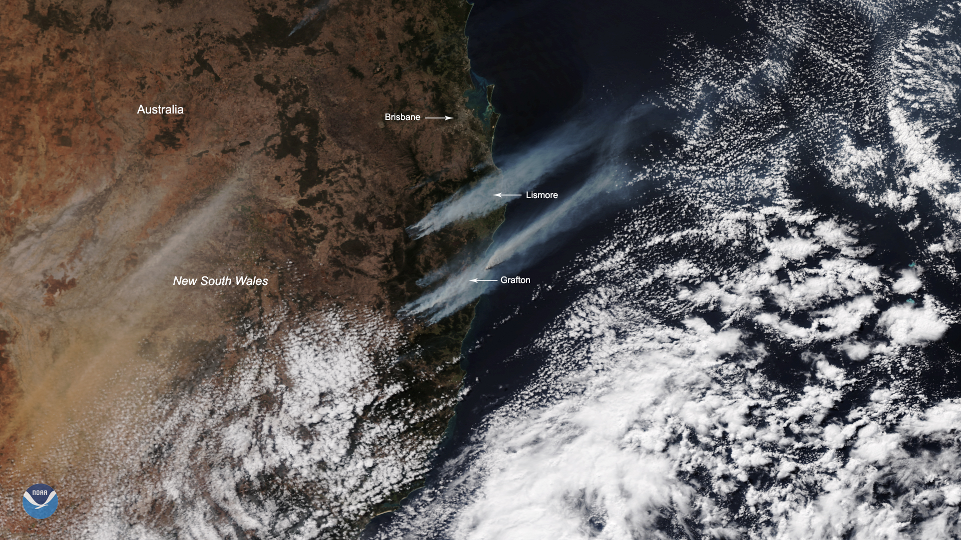
Hundreds of firefighters across New South Wales and Queensland, Australia are battling more than 140 bushfires that have broken…
Feature Story
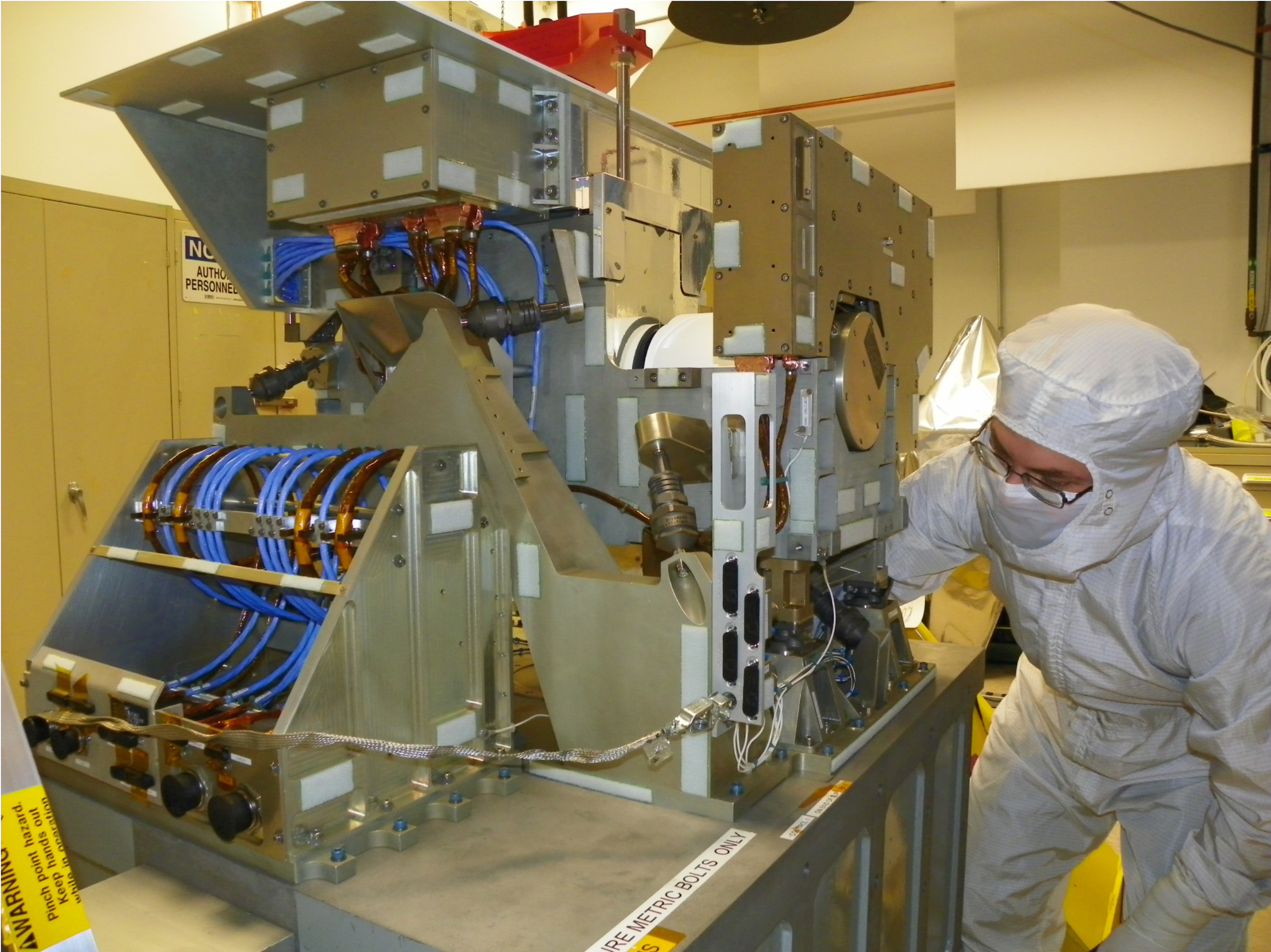
A team of engineers, scientists, and satellite operators recently restored a damaged satellite instrument that is used to measure temperature and wate