
Feature Story
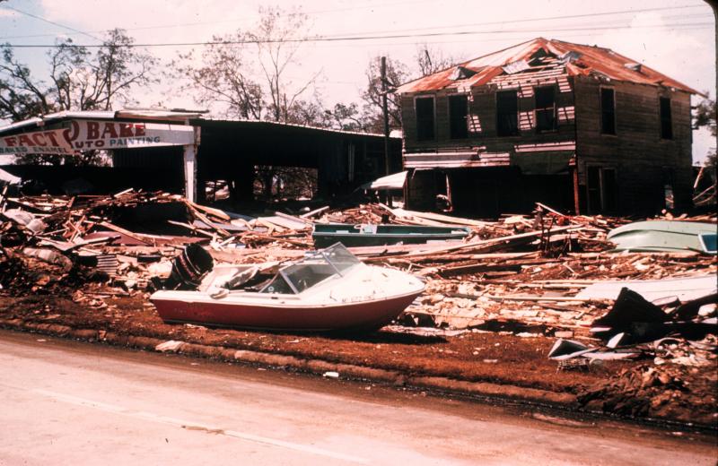
In the late evening hours of August 17, 1969, a catastrophic storm named Hurricane Camille slammed into the Gulf Coast. A…
Feature Story
In the late evening hours of August 17, 1969, a catastrophic storm named Hurricane Camille slammed into the Gulf Coast. A…
Feature Story
In the late evening hours of August 17, 1969, a catastrophic storm named Hurricane Camille slammed into the Gulf Coast. A…
Satellite Snapshots
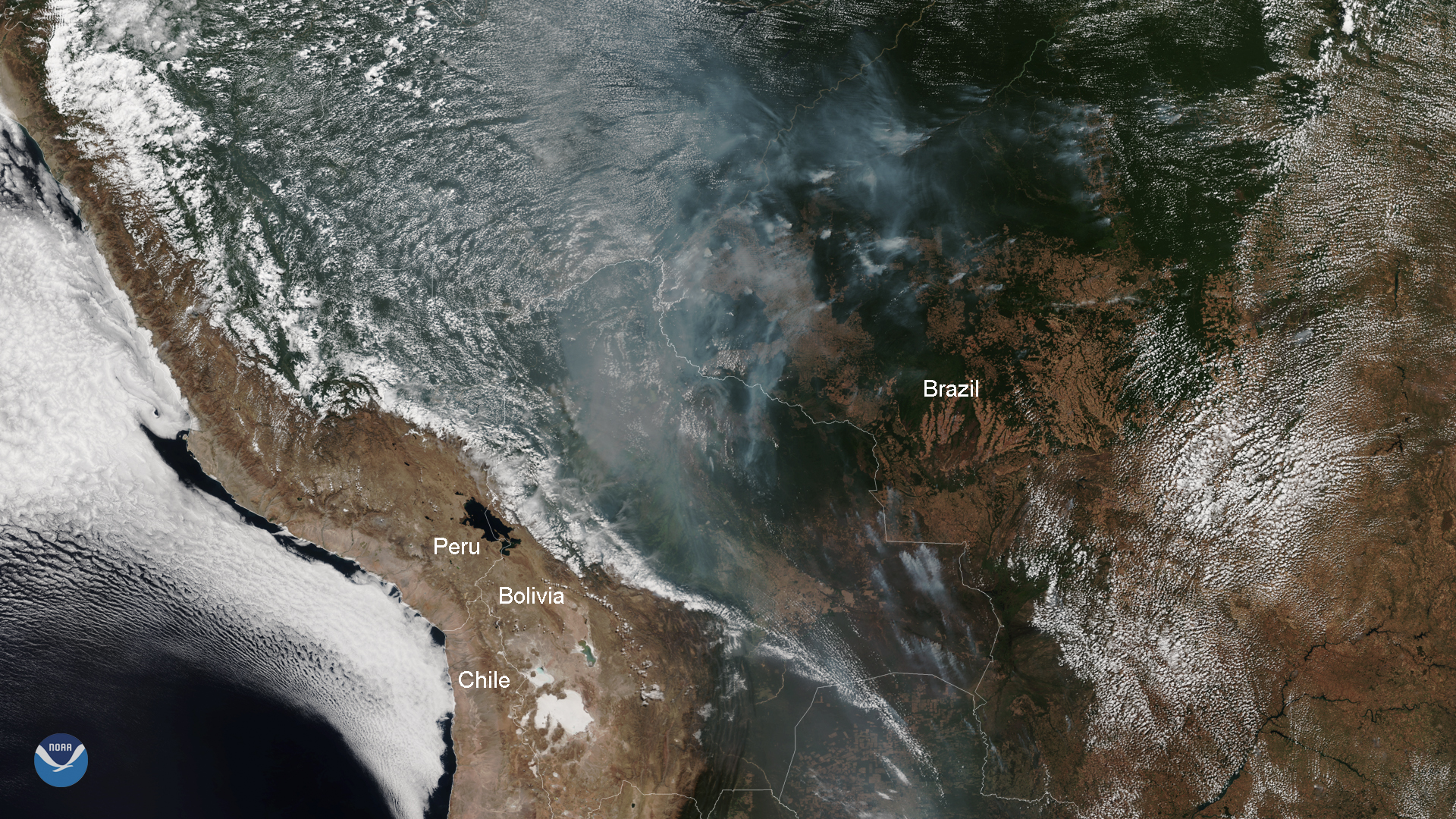
August 13, 2019 Throughout most of its history, the Amazon rainforest was relatively fire-resistant thanks to its natural moisture and humidity…
Satellite Snapshots
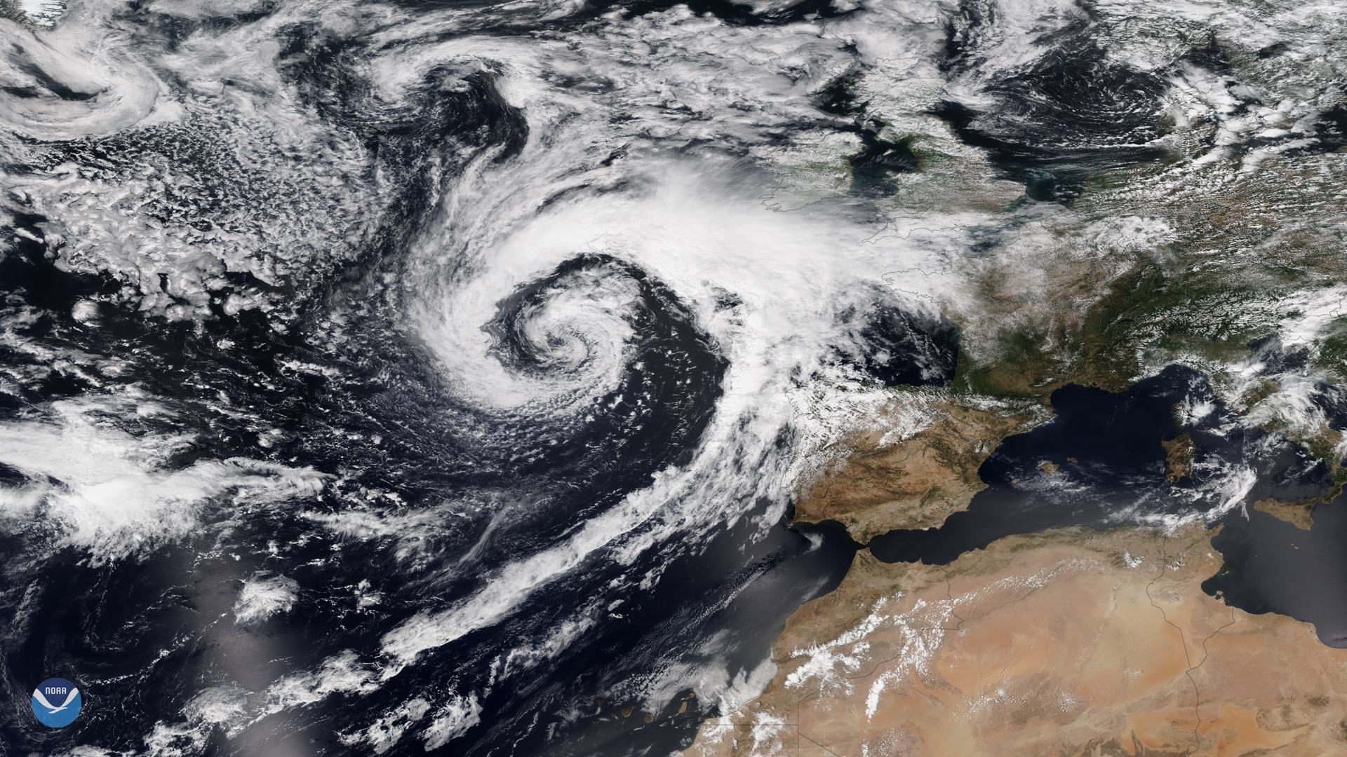
This past week the United Kingdom (UK) has experienced nasty weather and torrential rains, which brought flooding, power outages, and…
Satellite Snapshots

Hazy smoke from agricultural fires in central to southern Africa can be clearly seen in this VIIRS true-color image taken by NOAA-20…
Announcement

A blockage in the loop heat pipe of the Advanced Baseline Imager (ABI), the primary instrument on NOAA’s GOES-17 satellite ,…
Satellite Snapshots
GOES East is ideally located to detect Saharan dust blowing across the Atlantic Ocean, as shown in this GeoColor image on August 1,…