
Satellite Snapshots
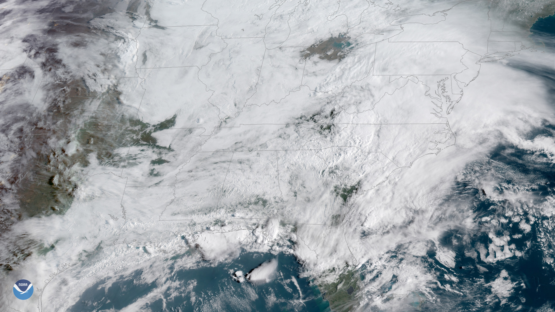
Gulf Coast thunderstorms bubble up above a blanket of clouds in this GOES East view from April 5, 2019.
Satellite Snapshots

This image from NOAA-20’s VIIRS day-night band shows Nevada’s Massacre Rim Wilderness Study Area on Sept. 24, 2018.
Satellite Snapshots
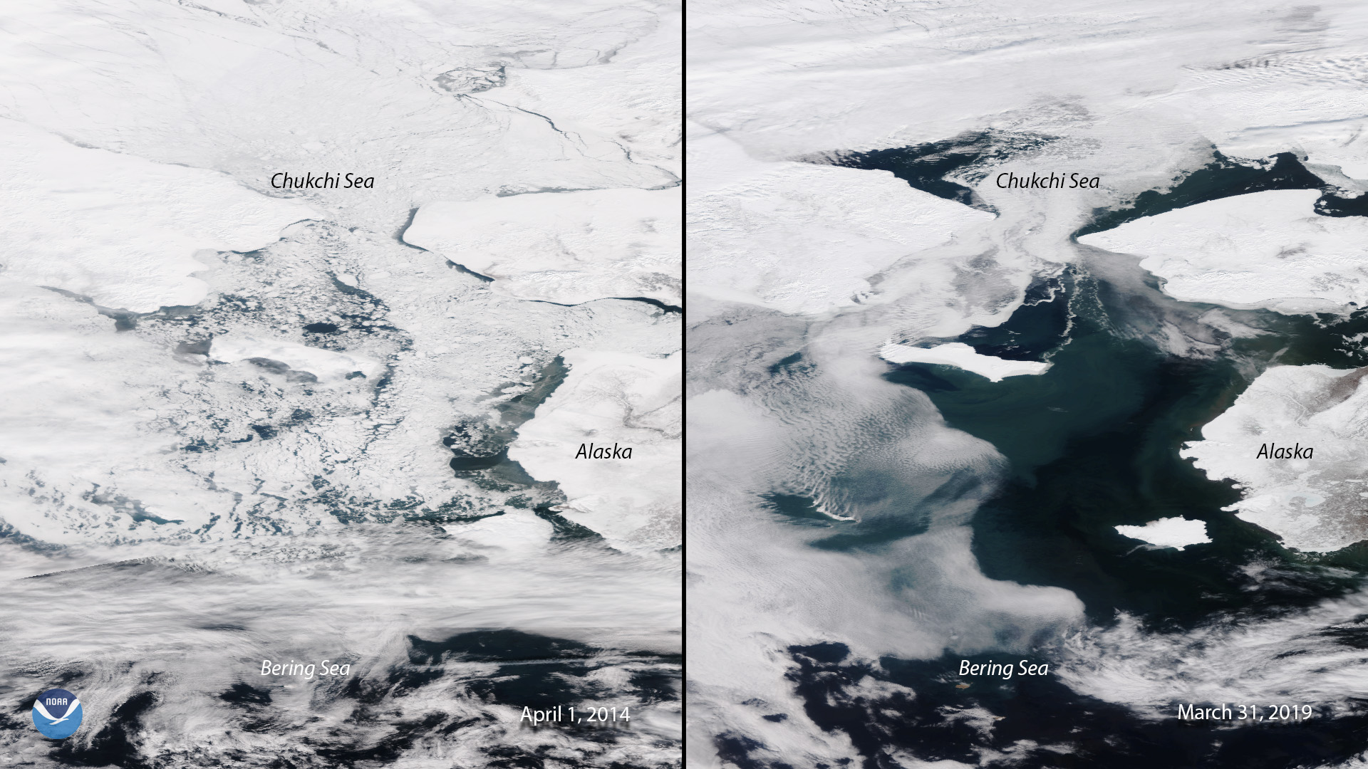
Side-by-side images of the Bering Sea taken by Suomi NPP in 2014 and NOAA-20 in 2019 show a drastic change in sea ice extent.
Satellite Snapshots
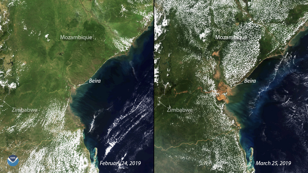
Exactly two weeks after Tropical Cyclone Idai barrelled through Mozambique’s coastal city of Beira, the devastation on the ground remains visible.
Satellite Snapshots
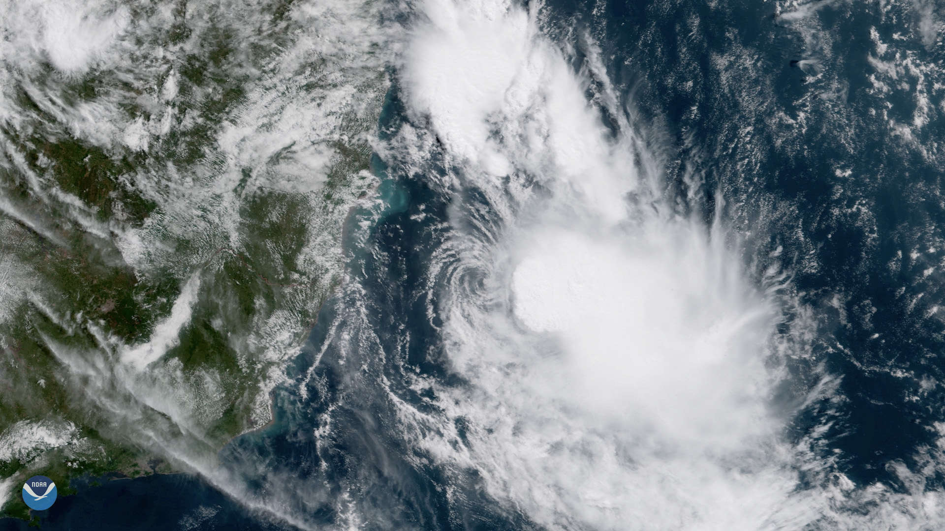
GOES East is watching Tropical Storm Iba, a rare storm that formed in the South Atlantic off the coast of Brazil on March 24, 2019.
Satellite Snapshots
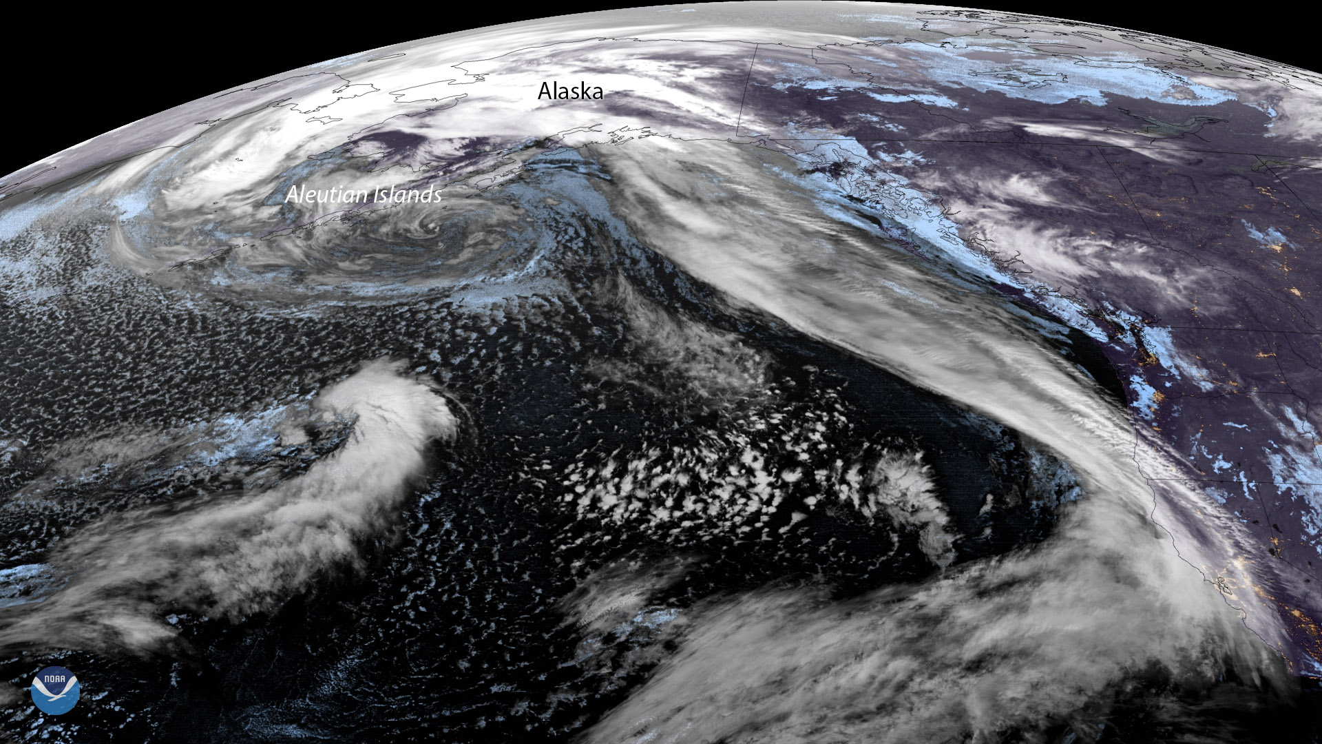
GOES West is watching an impressive low-pressure system of the coast of the Aleutian Islands that stretches to Hawaii.
Satellite Snapshots
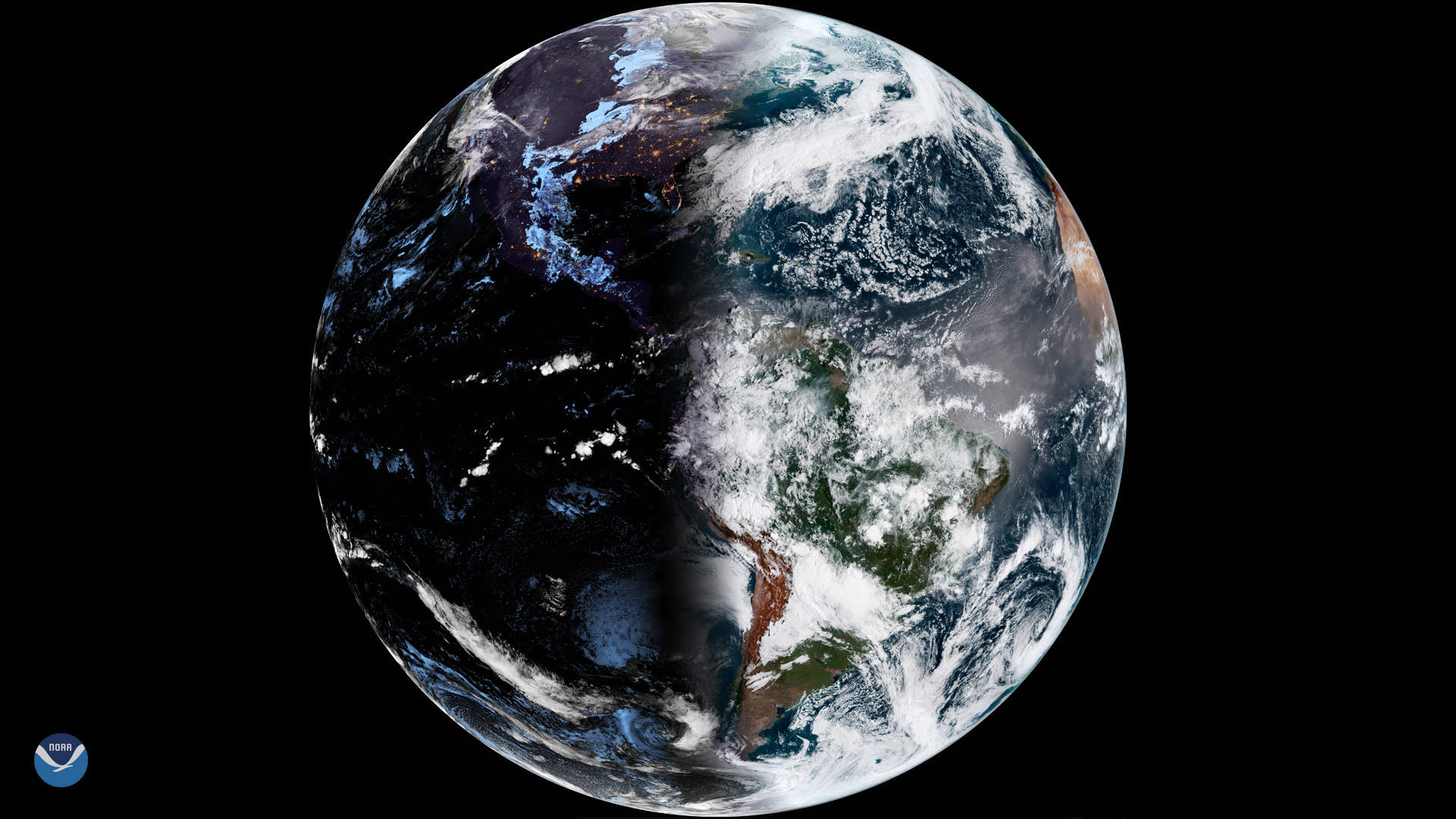
There are two times each year, in March and September, when the amount of daylight and darkness is “nearly” equal at all latitudes.
Feature Story

Farmers and ranchers rely on the land to make a living, and while there are many ways to prepare for natural disasters, a newly…