
Satellite Snapshots
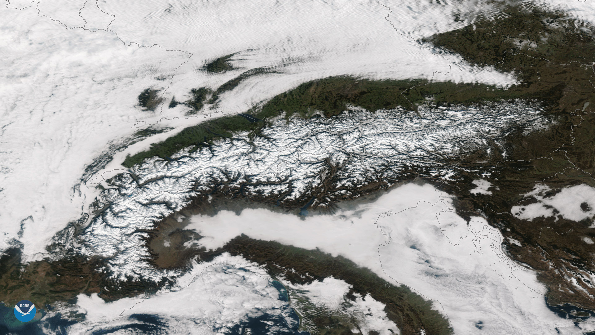
Clear skies over the snow-covered European Alps can be seen in this image captured by the Suomi NPP satellite's VIIRS instrument on…
Satellite Snapshots
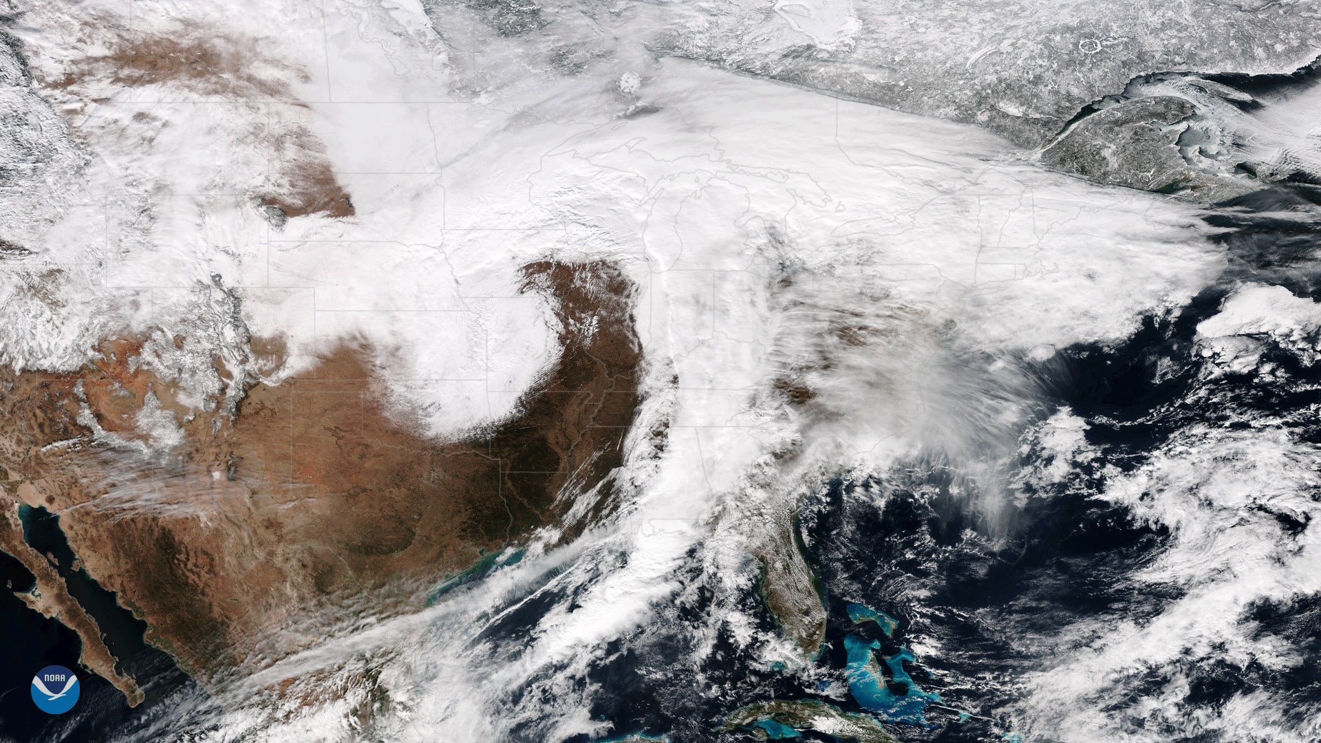
January 23, 2018 The Suomi NPP satellite's VIIRS instrument captured this image of a large winter storm moving across the central United States on…
Satellite Snapshots
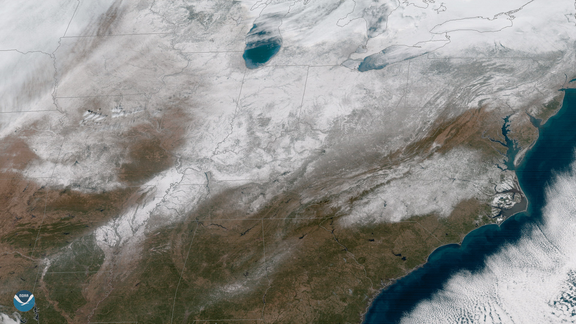
Clear skies enabled the GOES East satellite to capture this view of current snow cover over the eastern United States on January 18,…
Satellite Snapshots
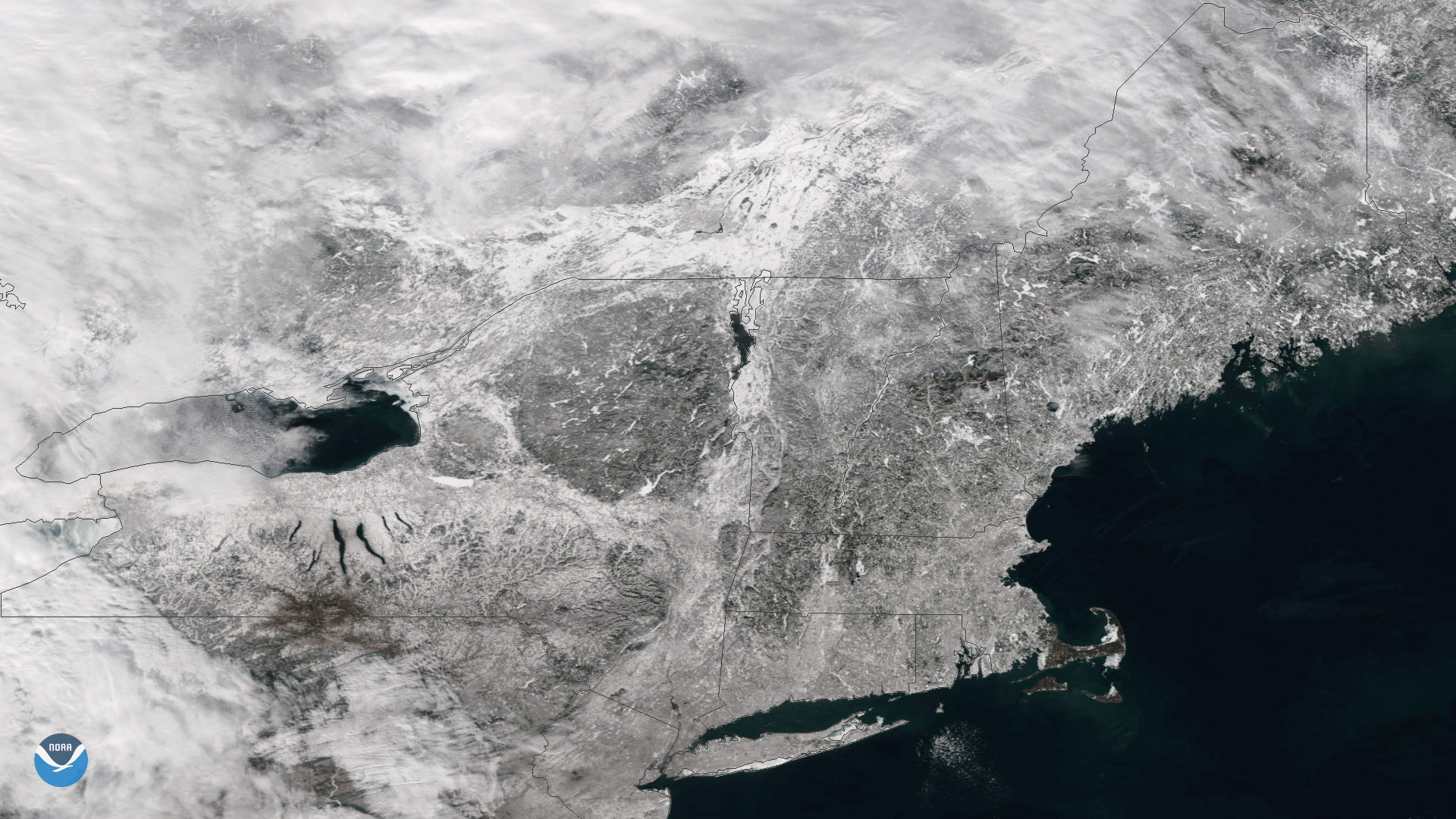
The Suomi NPP satellite flew over clear skies on January 10, 2018, capturing this image of snow on the ground in New England. Last…
Satellite Snapshots
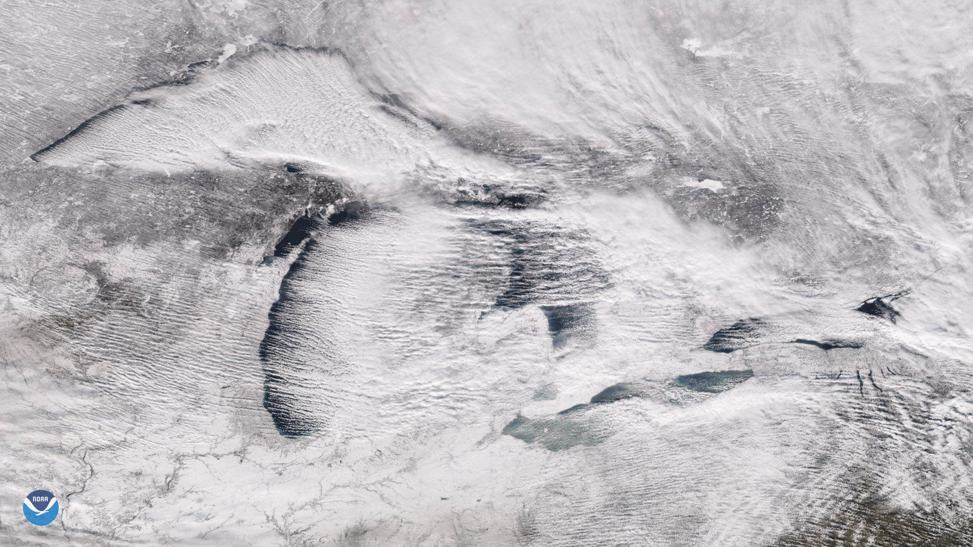
The Suomi NPP satellite's VIIRS instrument captured these parallel rows of clouds, known as "cloud streets" streaming over the Great Lakes.
Satellite Snapshots
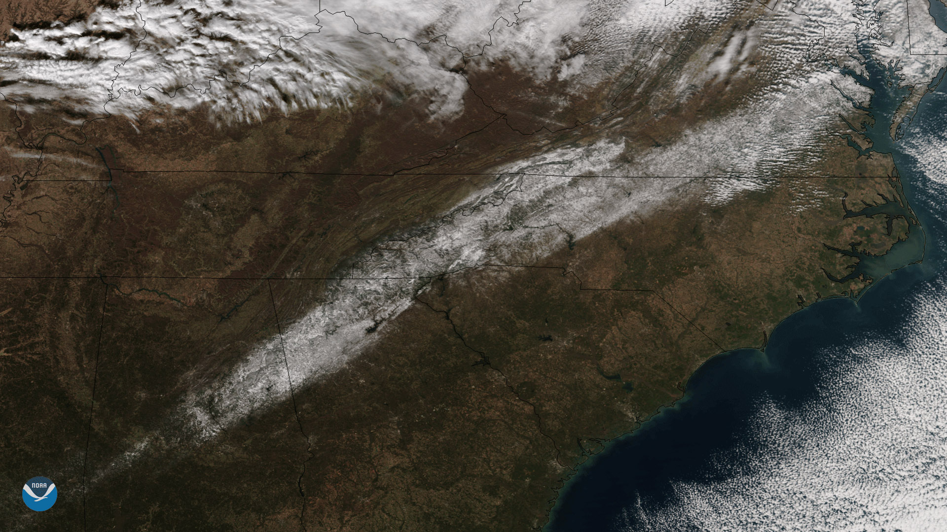
December 11, 2017 NOAA/NASA's Suomi NPP satellite captured this image of an unusual early-season snow that fell across the South on December 9, 2017…
Satellite Snapshots

n polar regions, areas of sea ice -- ice atop ocean waters -- not only supports entire ecosystems, it affects Earth’s climate by…
Feature Story
NOAA's fleet of Earth-observing satellites provide a steady stream of data on environmental conditions that scientists can use.