
Satellite Snapshots
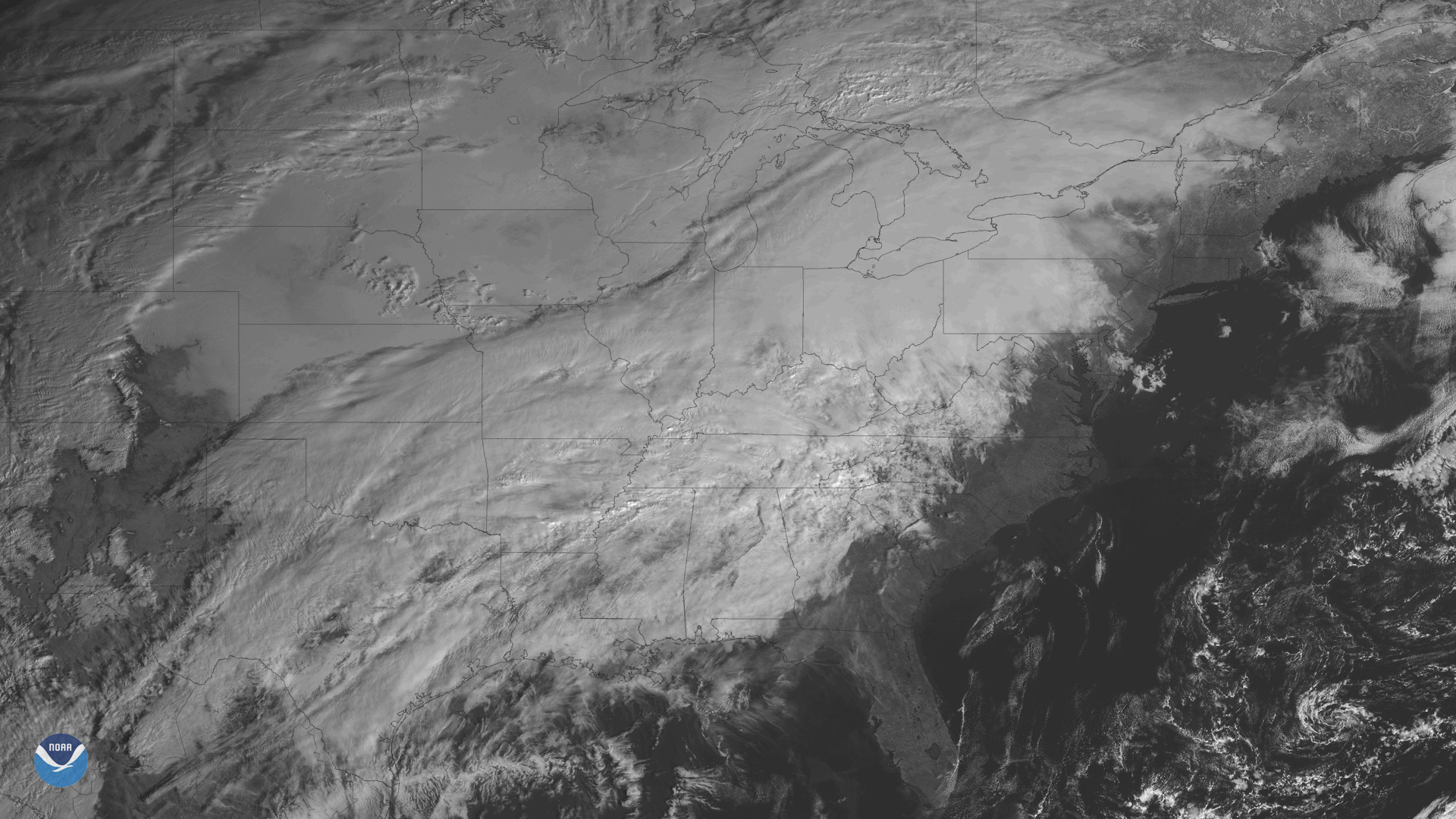
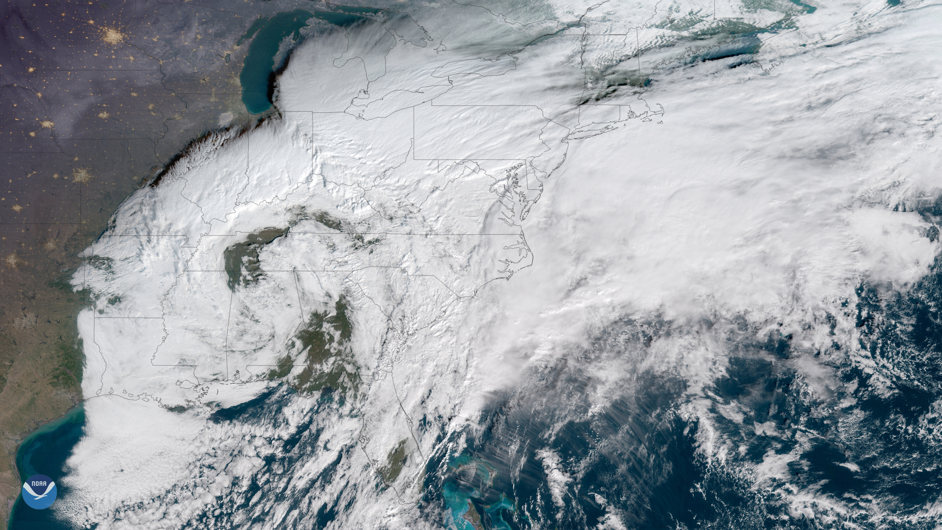
The GOES East satellite is watching a developing storm system bringing wintry weather to many states east of the Rockies.
Satellite Snapshots
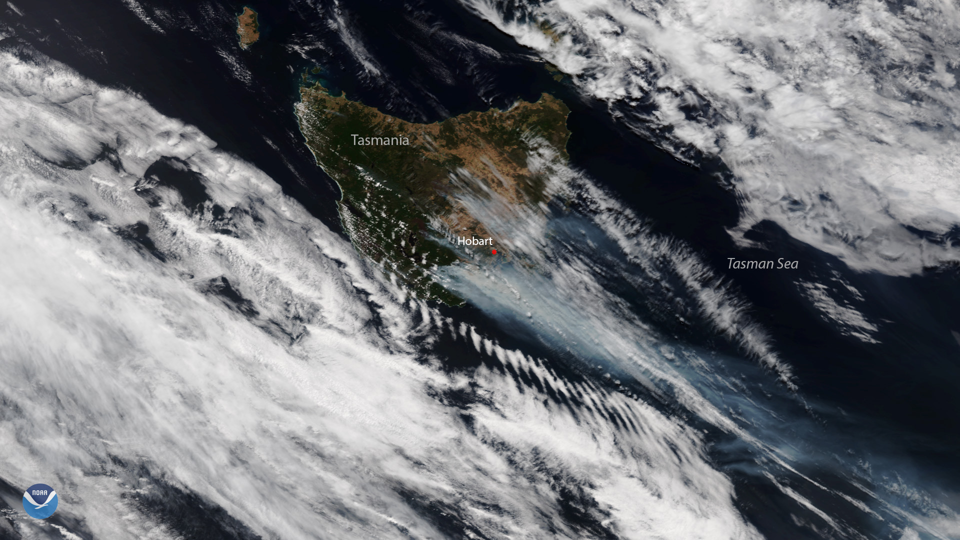
Plumes of smoke are seen over the bushfire-ravaged Australian island state of Tasmania in this Jan. 28, 2019 image from the NOAA-20…
Feature Story
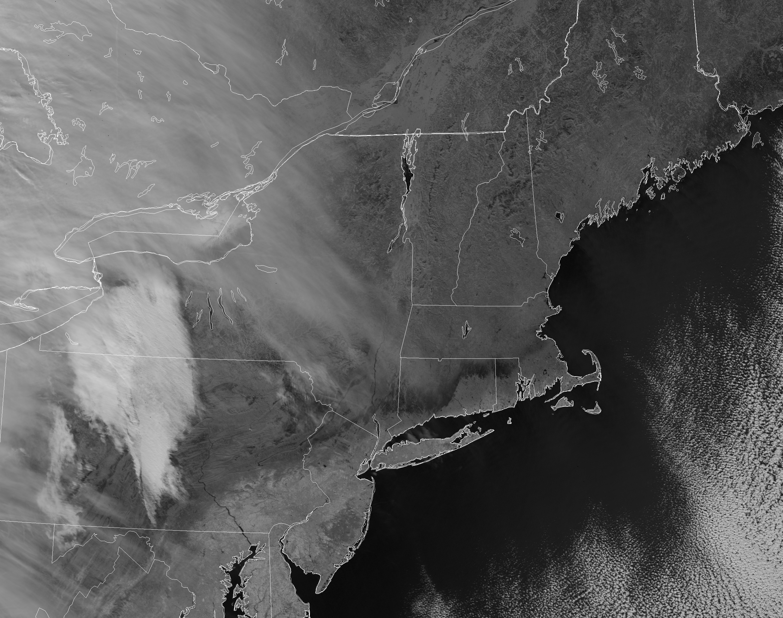
As a winter storm moved through the Northeast U.S. the weekend of Jan. 21-22, some 40 million residents watched the forecasts, wondering who would get
Satellite Snapshots
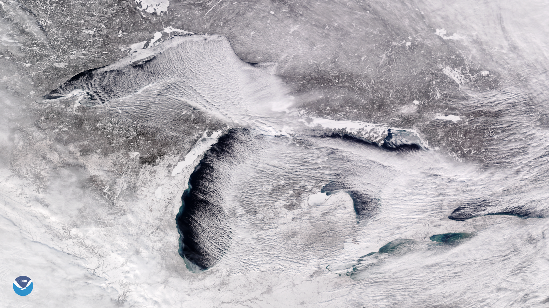
Bitter cold, arctic air is pouring into the Midwest and Great Lakes this week, and is expected to bring a prolonged period of…
Satellite Snapshots
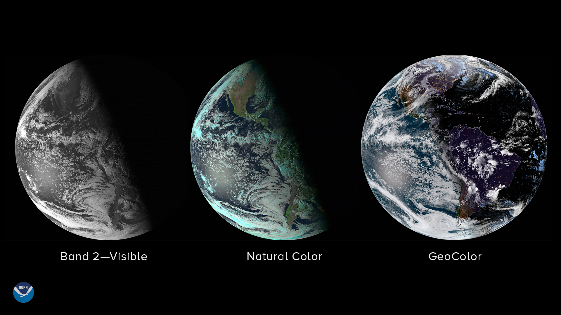
The winter solstice, the official start of astronomical winter, arrives at 5:23 p.m. Eastern Time on December 21. At this exact…
Feature Story
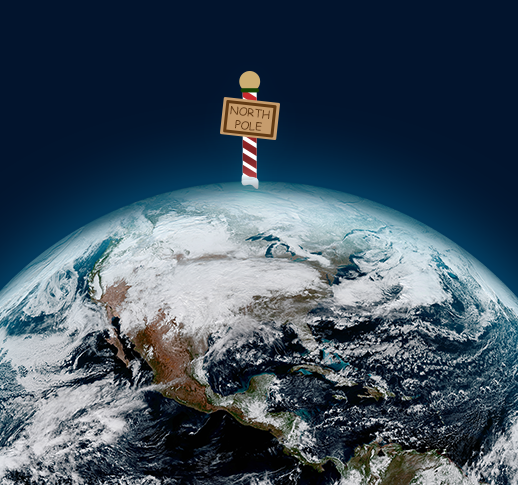
Around this time of year, we hear a lot about Santa and his elves working hard at the North Pole to make sure all the toys…
Satellite Snapshots
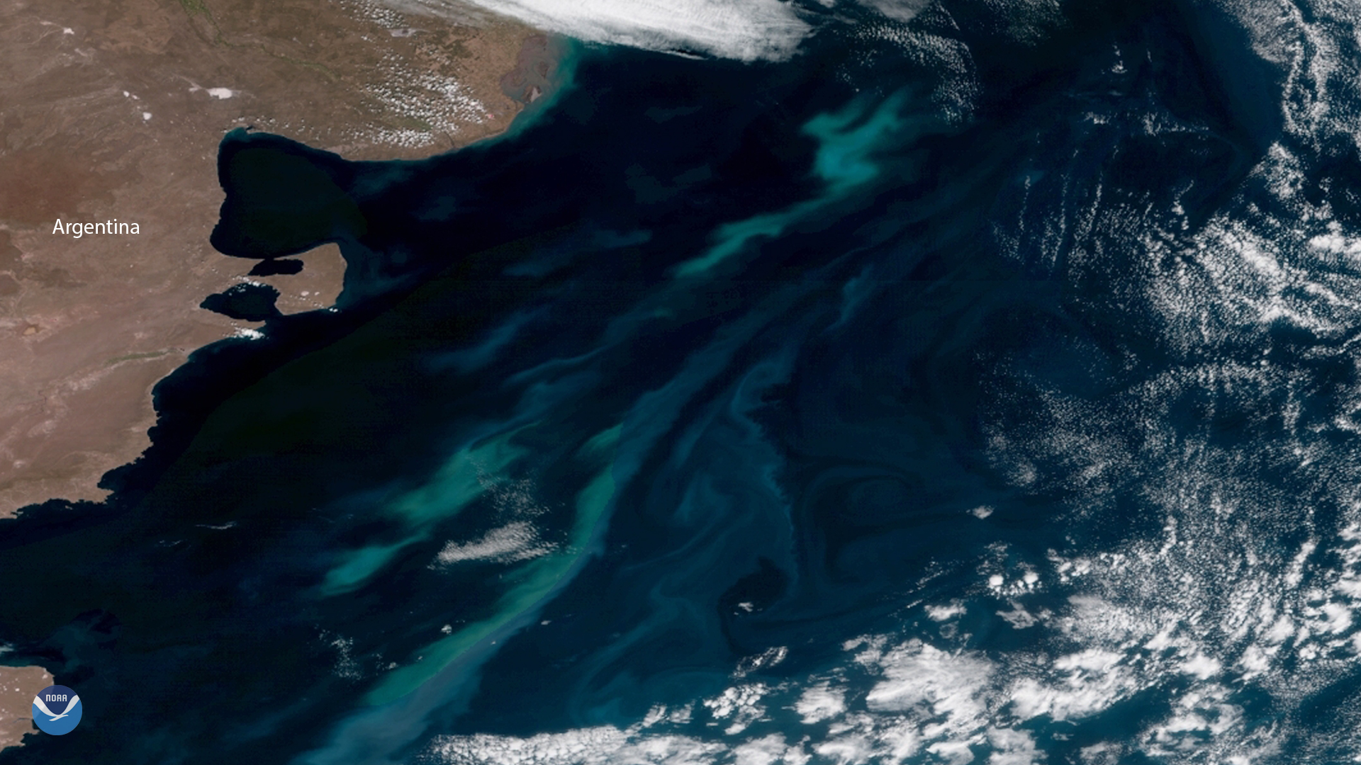
December is the beginning of summer in Earth's Southern Hemisphere. The long days and abundant sunlight help millions of tiny plant…
Satellite Snapshots
For much of 2018, satellite images have shown the Eastern U.S. covered in a thick blanket of clouds – and for good reason: Time and…