
Satellite Snapshots
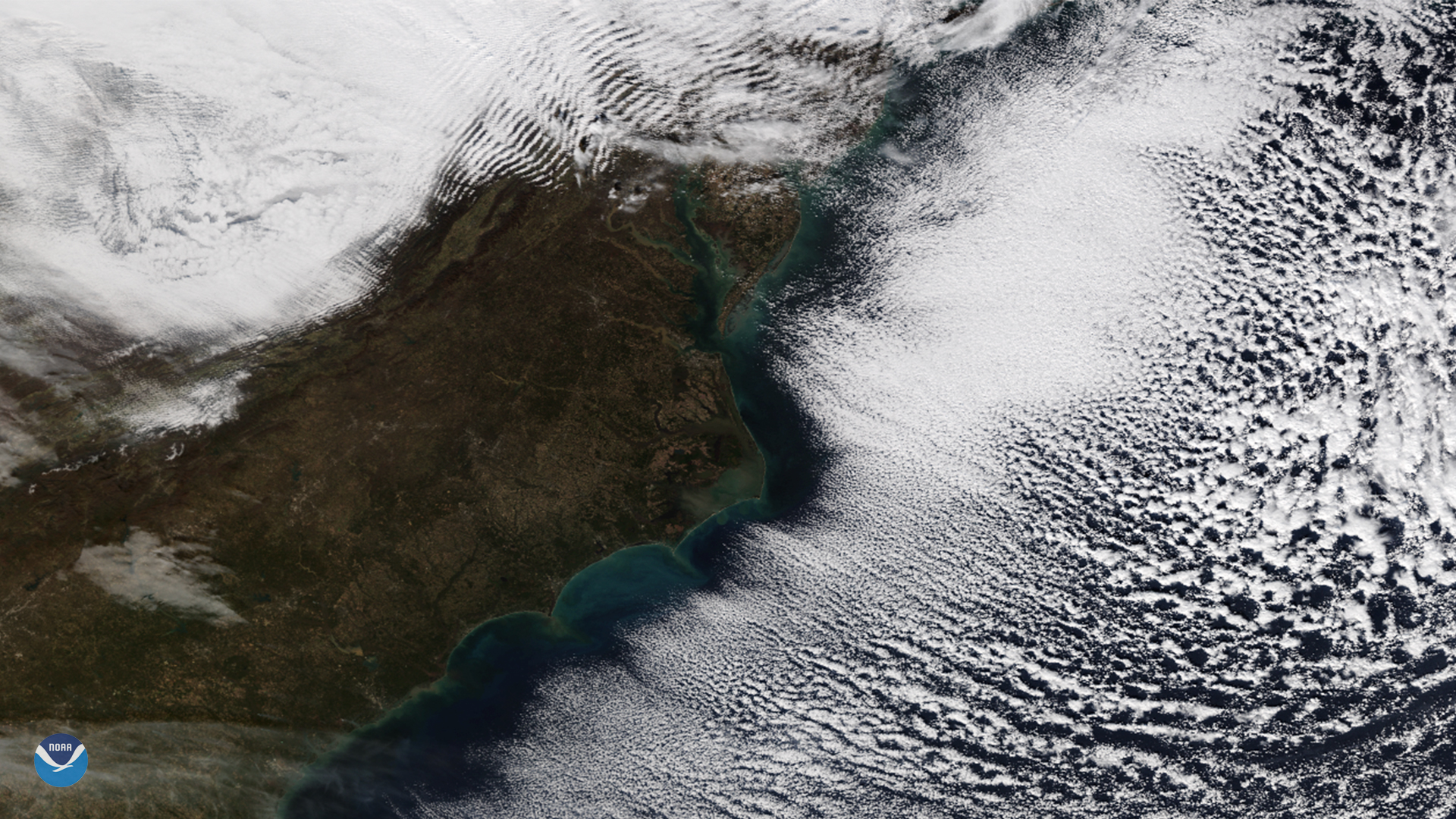
The NOAA-20 satellite spied cloud streets and gravity waves near the Mid-Atlantic region on Nov. 28, 2018.
Satellite Snapshots

By the second half of November, snow becomes more common across the Plains and Upper Midwest as arctic air masses from Canada dive…
Satellite Snapshots
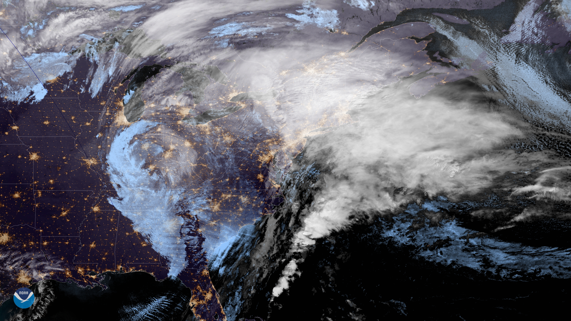
NOAA's GOES East satellite captured this geocolor enhanced image of an early season winter storm moving through the Northeast on…
Feature Story

The GOES-17 Advanced Baseline Imager (ABI) has sent its first images from the satellite's new vantage point over the Pacific Ocean.
Satellite Snapshots
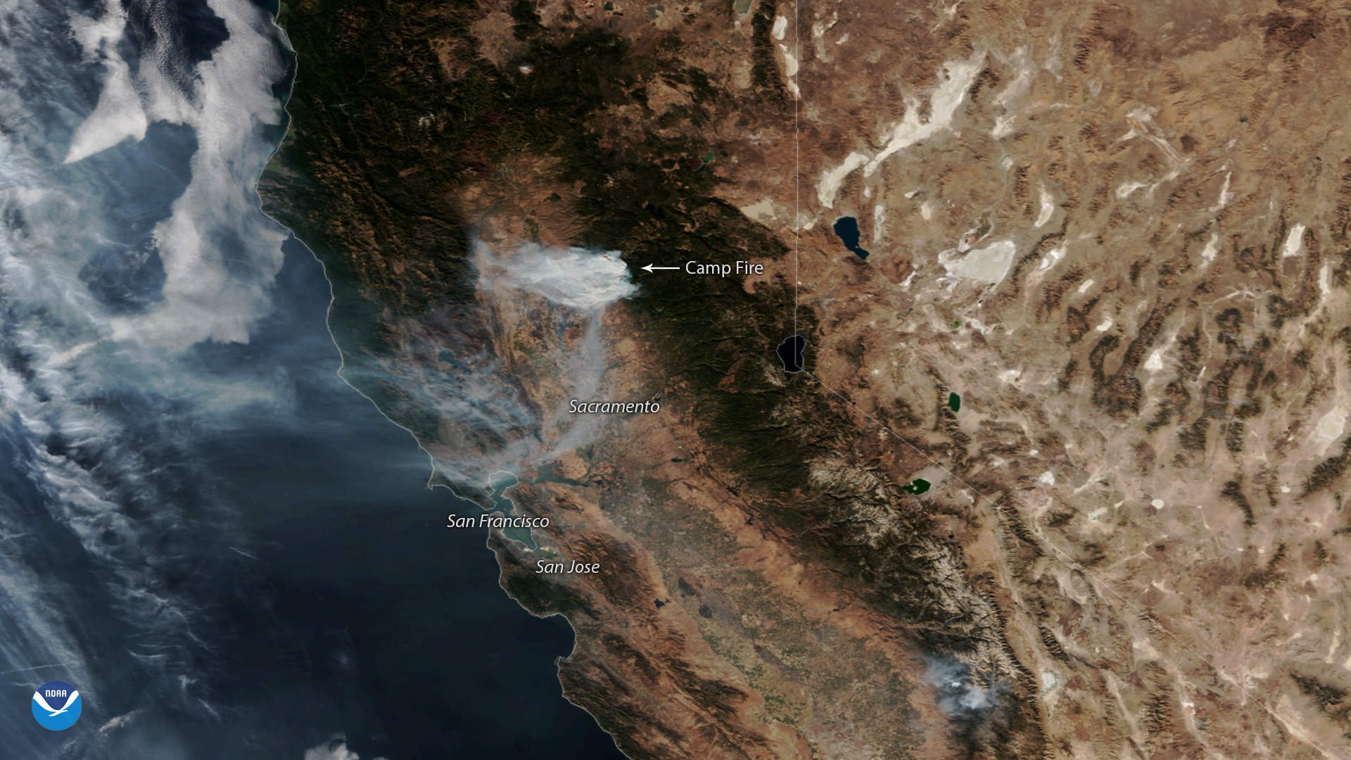
NOAA-20 captured this imagery of the fast-moving Camp Fire in Northern California on Nov. 12, 2018.
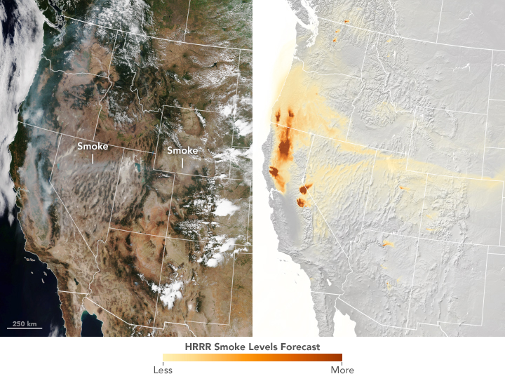
Satellite Snapshots

Plumes of smoke from California's Camp Fire are seen stretching across portions of the state in this NOAA-20 satellite image.
Satellite Snapshots
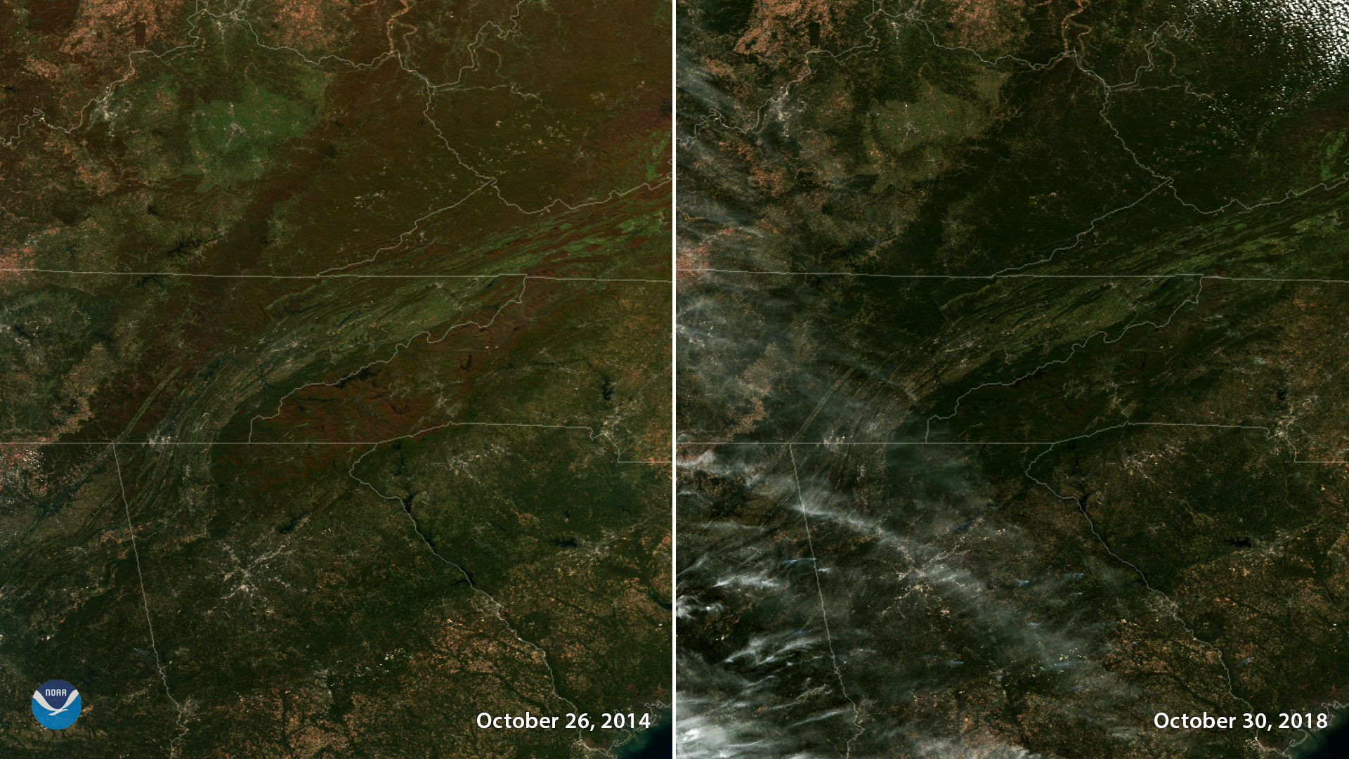
Each fall, when leaves turn vibrant colors, the changing of the seasons is not only visible on the ground – we can also see it from space.
Feature Story
By the time the U.S. Forest Service declared the Mendocino Complex Fire 100 percent contained on Sept.18, it had scorched more than 459,000 acres, des