
Feature Story
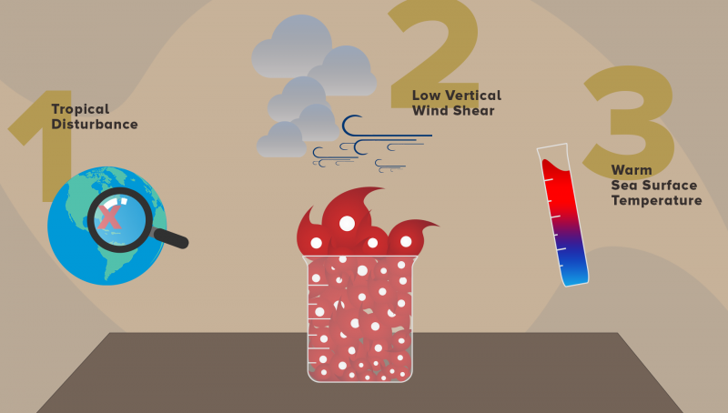
We’ve seen tropical cyclone activity in the Atlantic basin heat up quite a bit—most notably with the landfall of Hurricane Florence.
Feature Story
We’ve seen tropical cyclone activity in the Atlantic basin heat up quite a bit—most notably with the landfall of Hurricane Florence.
Feature Story
We’ve seen tropical cyclone activity in the Atlantic basin heat up quite a bit—most notably with the landfall of Hurricane Florence.
Feature Story

NASA and NOAA have appointed a board to investigate an instrument anomaly aboard the GOES-17 satellite.
Satellite Snapshots
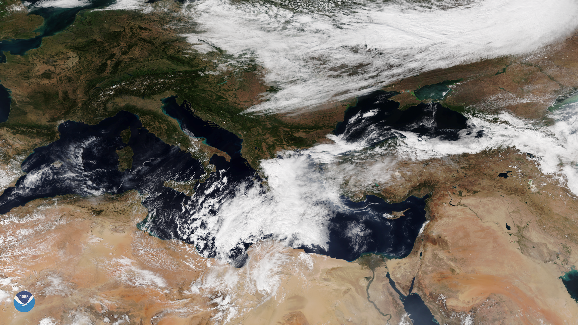
A tropical-like cyclone, known as a medicane, was seen by the NOAA-20 satellite over the Mediterranean Sea on Sept. 27, 2018.
Satellite Snapshots
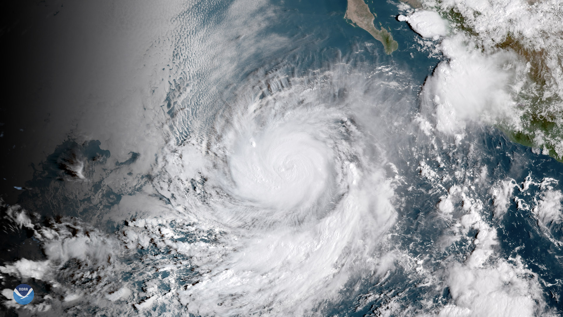
Hurricane Rosa south of the Baja Peninsula September 27, 2018
Satellite Snapshots

Less than ten days after Super Typhoon Mangkhut battered the Philippines and southern China, another powerful tropical cyclone is…
Satellite Snapshots
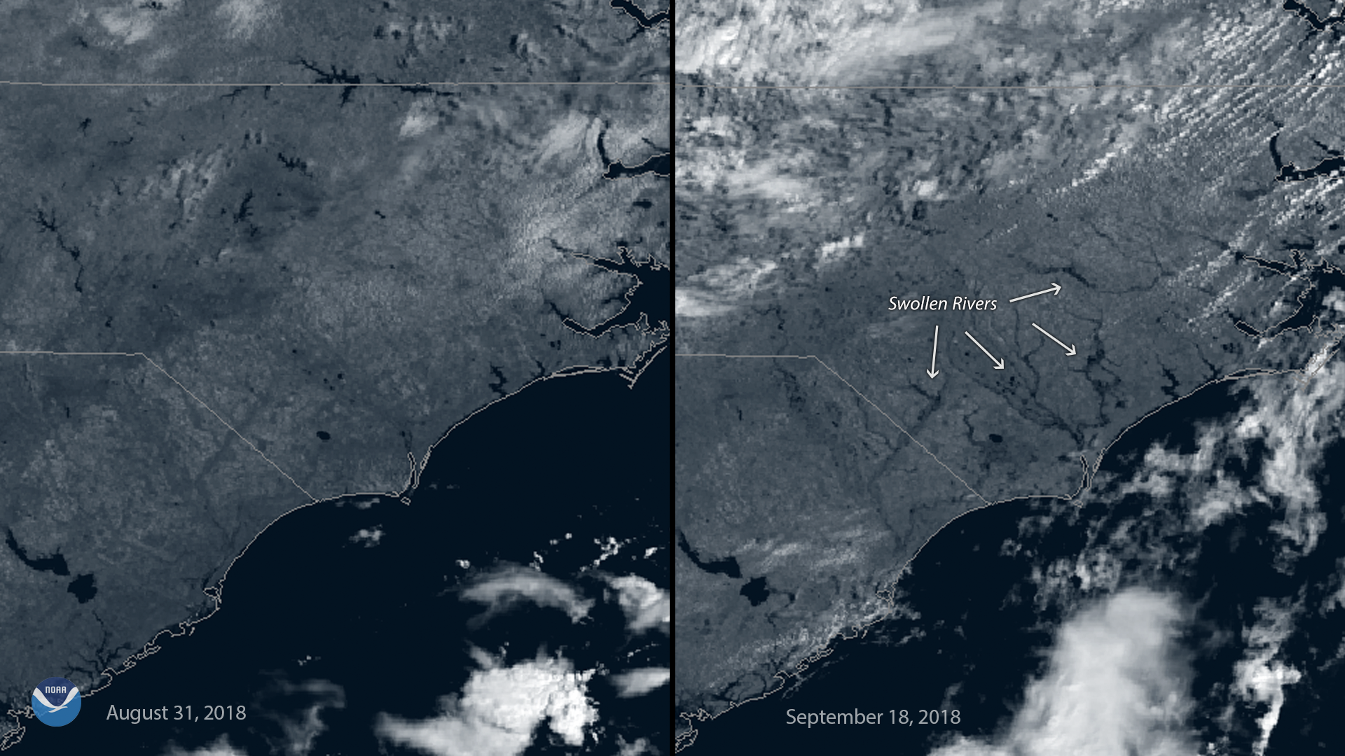
This before-and-after imagery from GOES East shows a changed landscape and flooding after Hurricane Florence affected southeastern North Carolina.