
Satellite Snapshots
Florence, now a tropical depression with maximum sustained winds of 35 mph, continues to threaten portions of the Carolinas with…
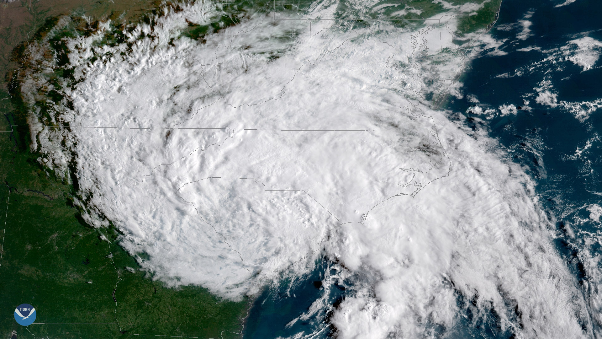
Satellite Snapshots
GOES East captured imagery of Tropical Storm Florence over the Carolinas on Sept. 15, 2018.
Satellite Snapshots
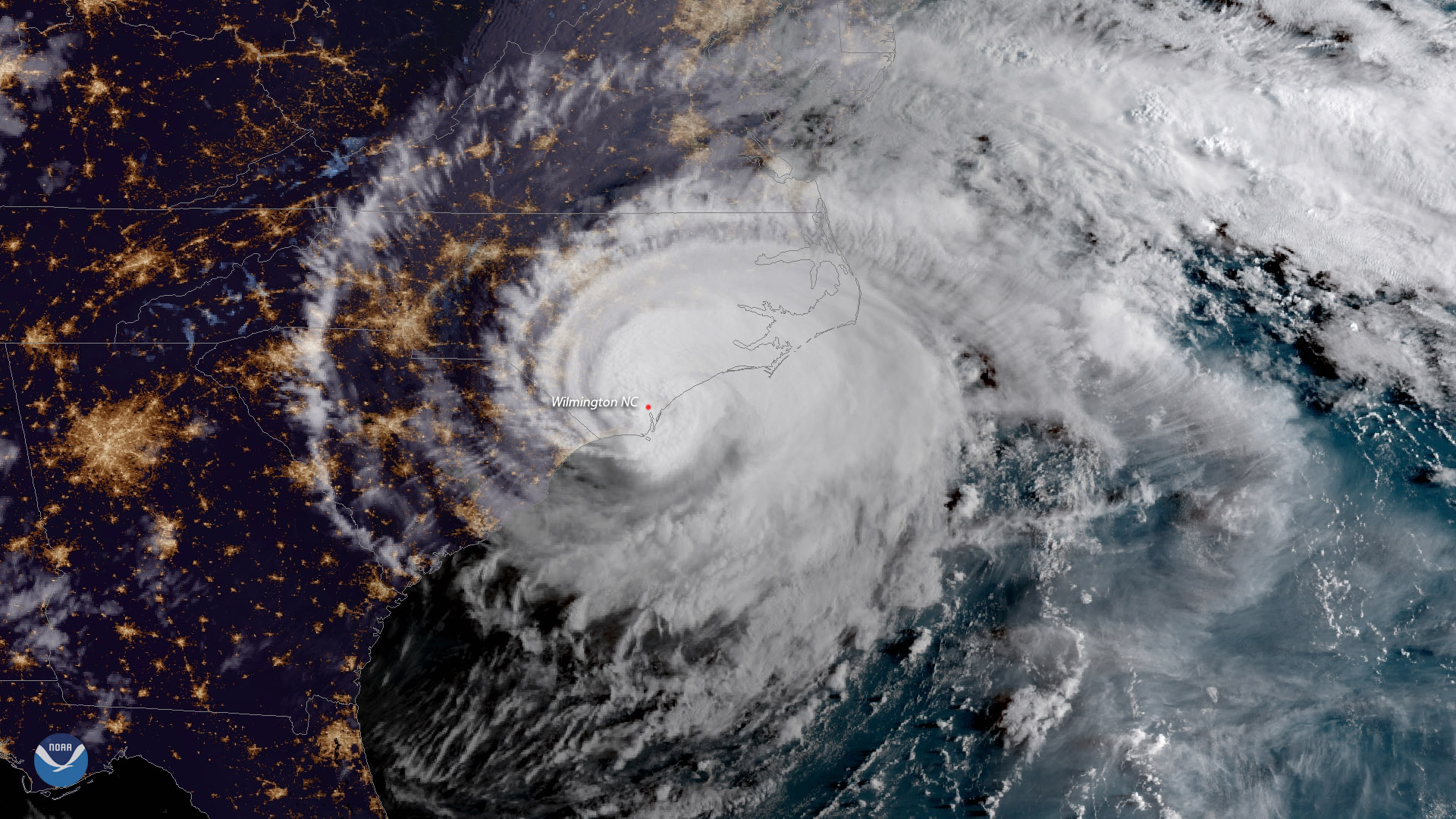
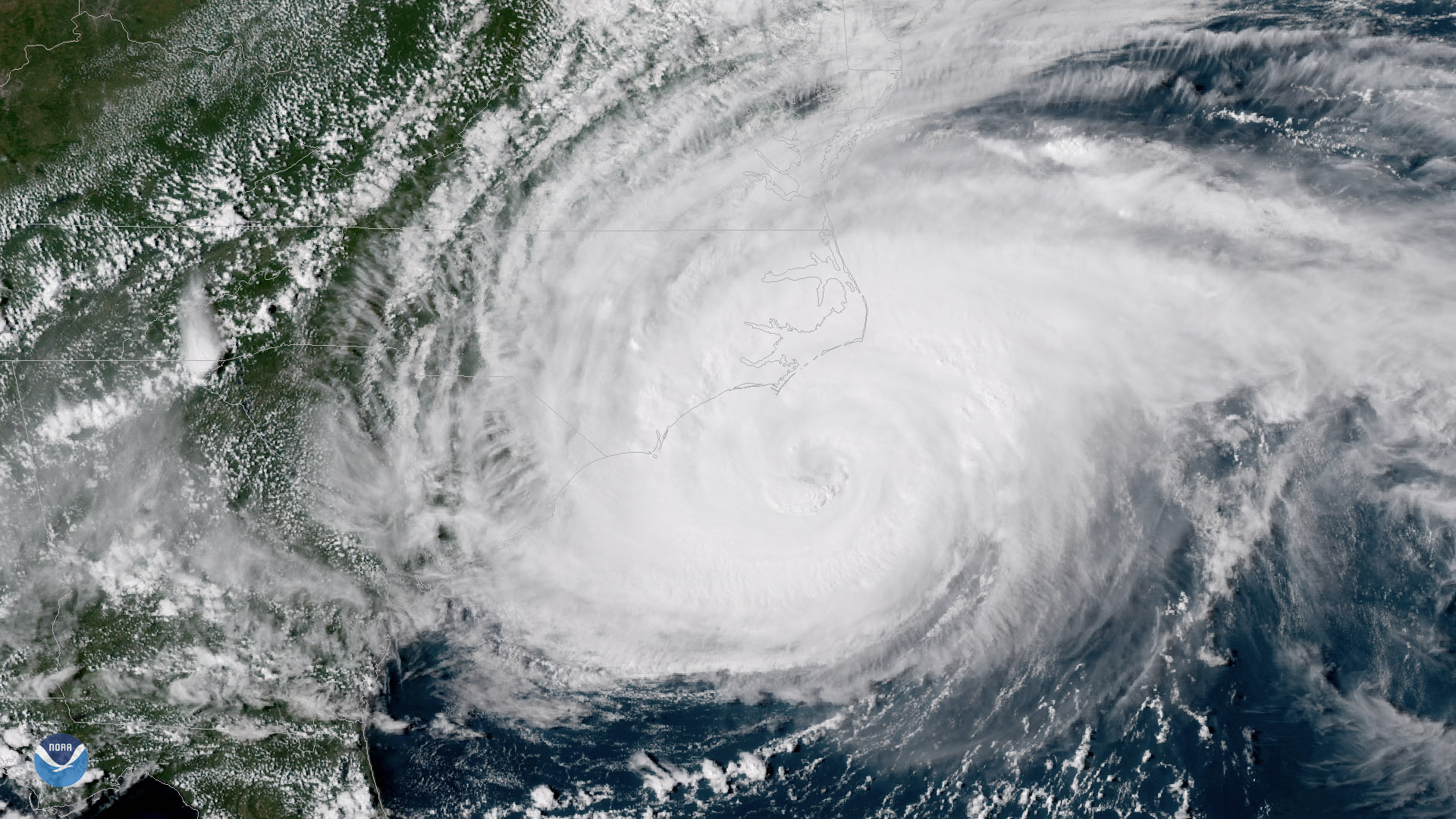
Hurricane Florence made landfall near Wrightsville Beach, North Carolina at 7:15 a.m. ET, September 14, 2018
Feature Story
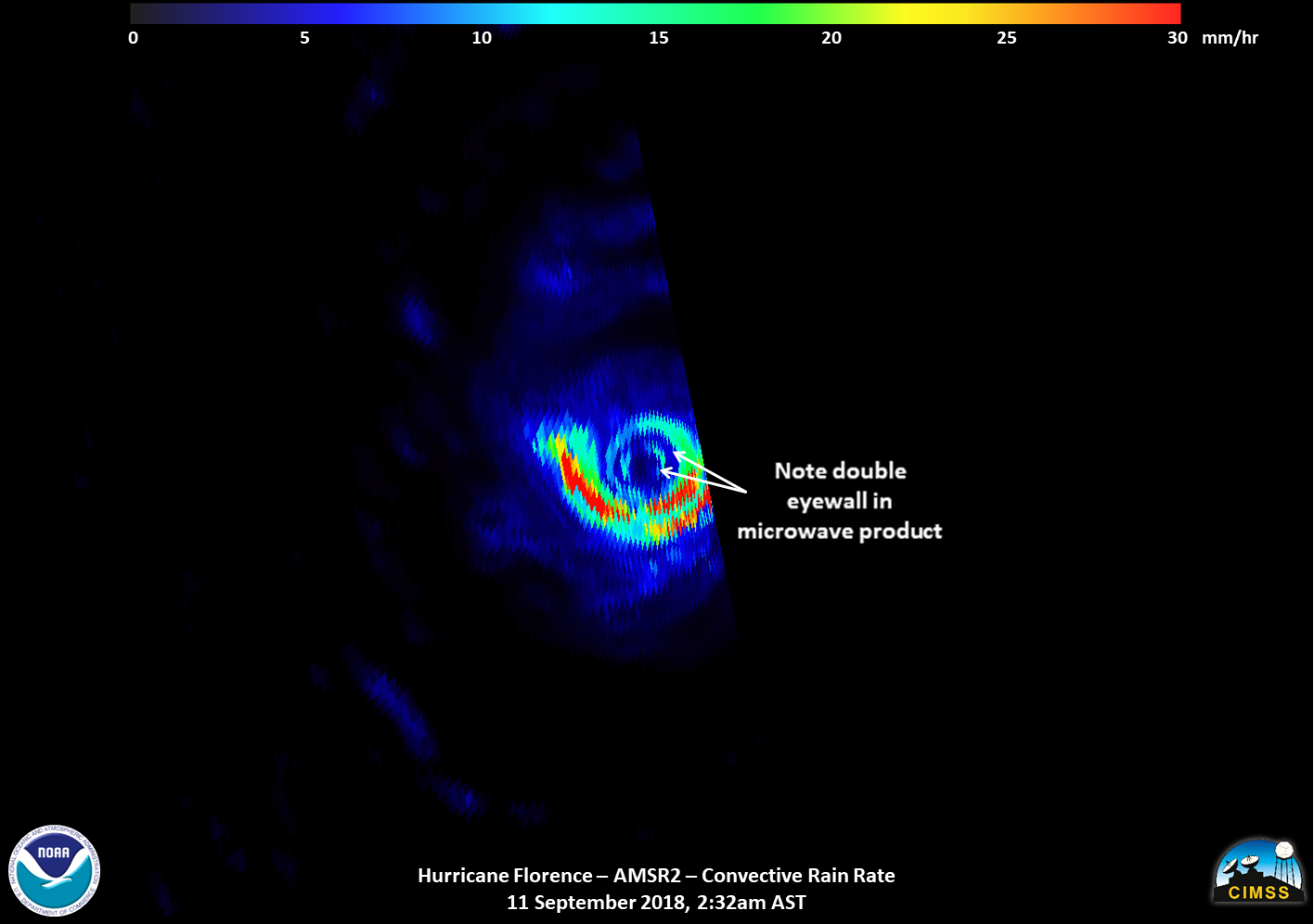
Satellite images of Hurricane Florence captured early Tuesday showed the storm developing a second, outer eyewall. By midday Tuesday, that outer eyewa
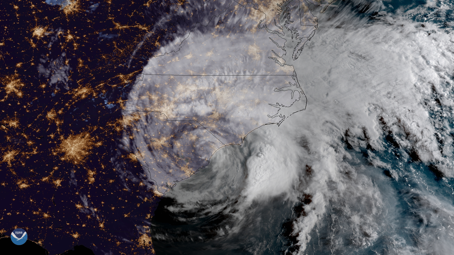
Satellite Snapshots
The outer bands of Hurricane Florence batter the North Carolina coast, September 13, 2018
Satellite Snapshots
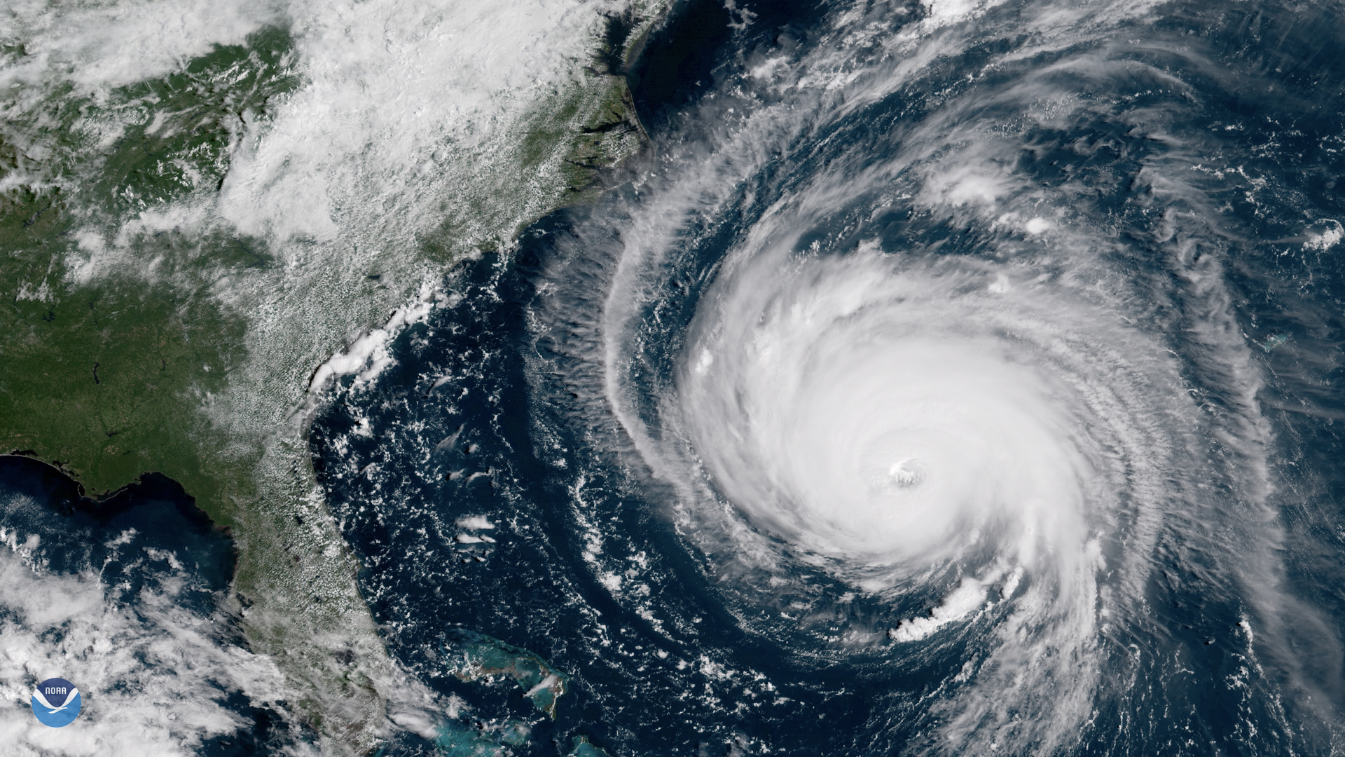
GOES East shows Florence's well-defined eye and outermost cloud bands beginning to approach the Outer Banks of North Carolina
Satellite Snapshots
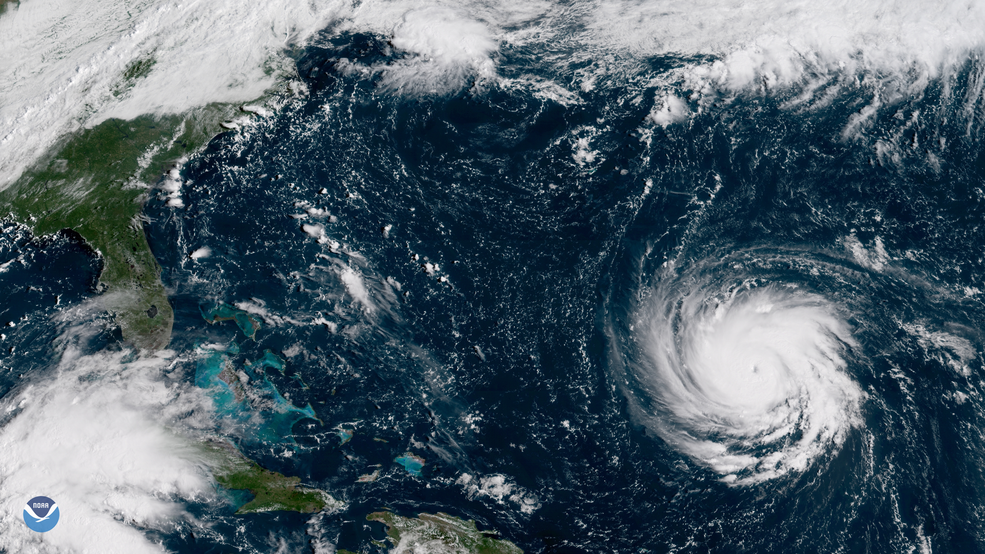
Hurricane Florence moved toward the U.S. East Coast as it intensified to a Category 4 storm, Monday September 12, 2018
Feature Story
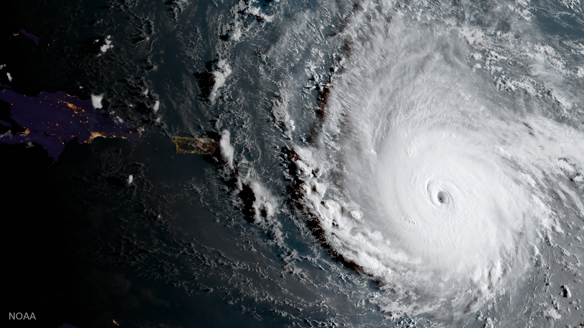
One of the strongest storms ever recorded in the Atlantic, Hurricane Irma left behind a trail of destruction from the Caribbean to the Florida Keys.