
Feature Story
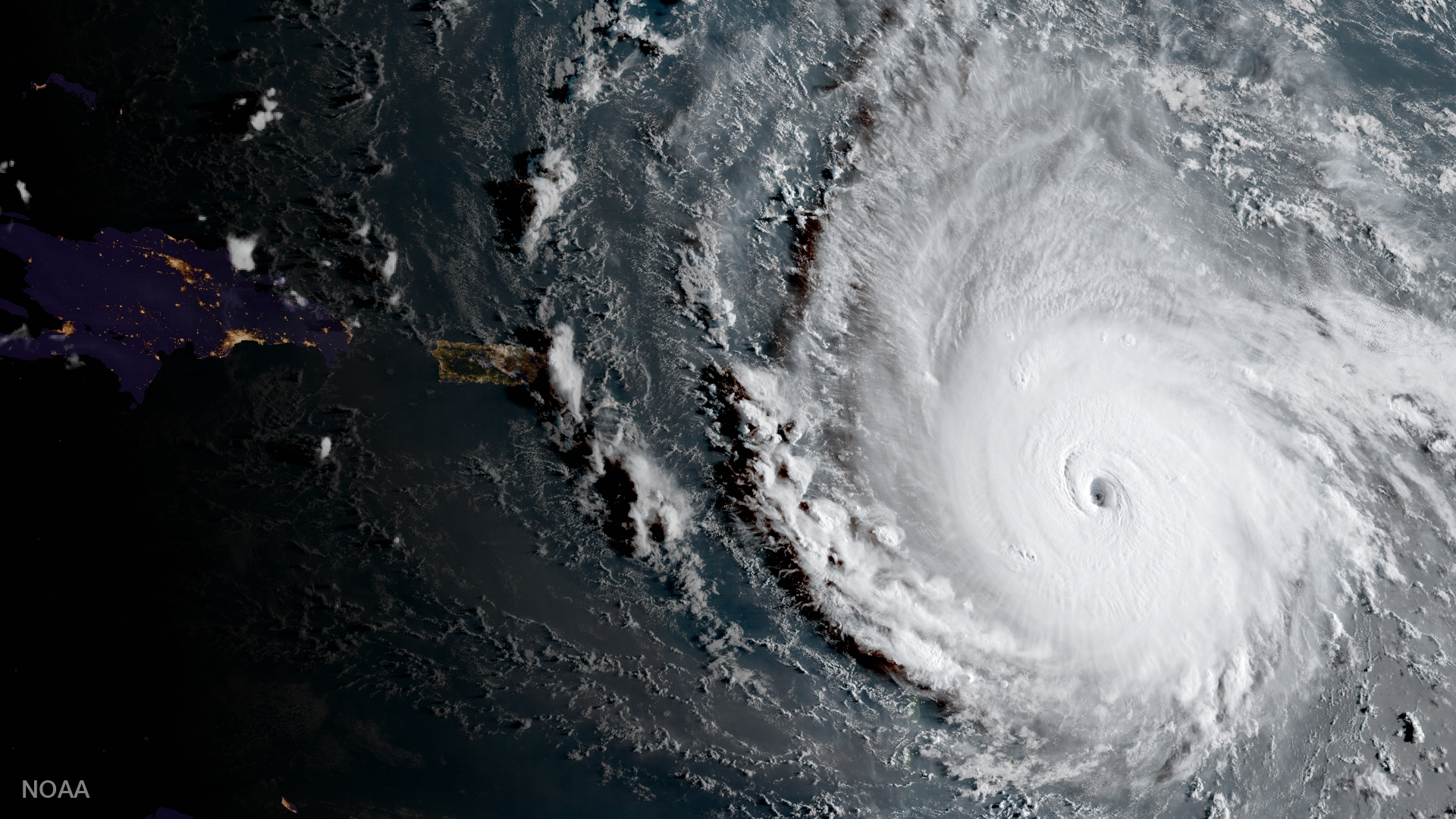
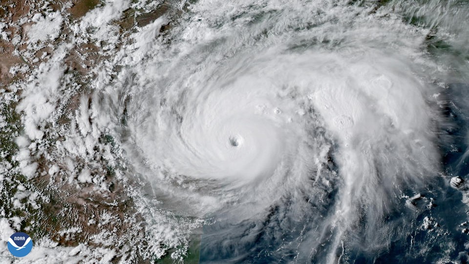
One of the strongest storms ever recorded in the Atlantic, Hurricane Irma left behind a trail of destruction from the Caribbean to the Florida Keys.
Satellite Snapshots
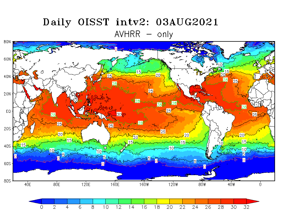
NOAA's polar-orbiting satellites are monitoring higher than average sea surface temperatures in the western North Atlantic.
Satellite Snapshots
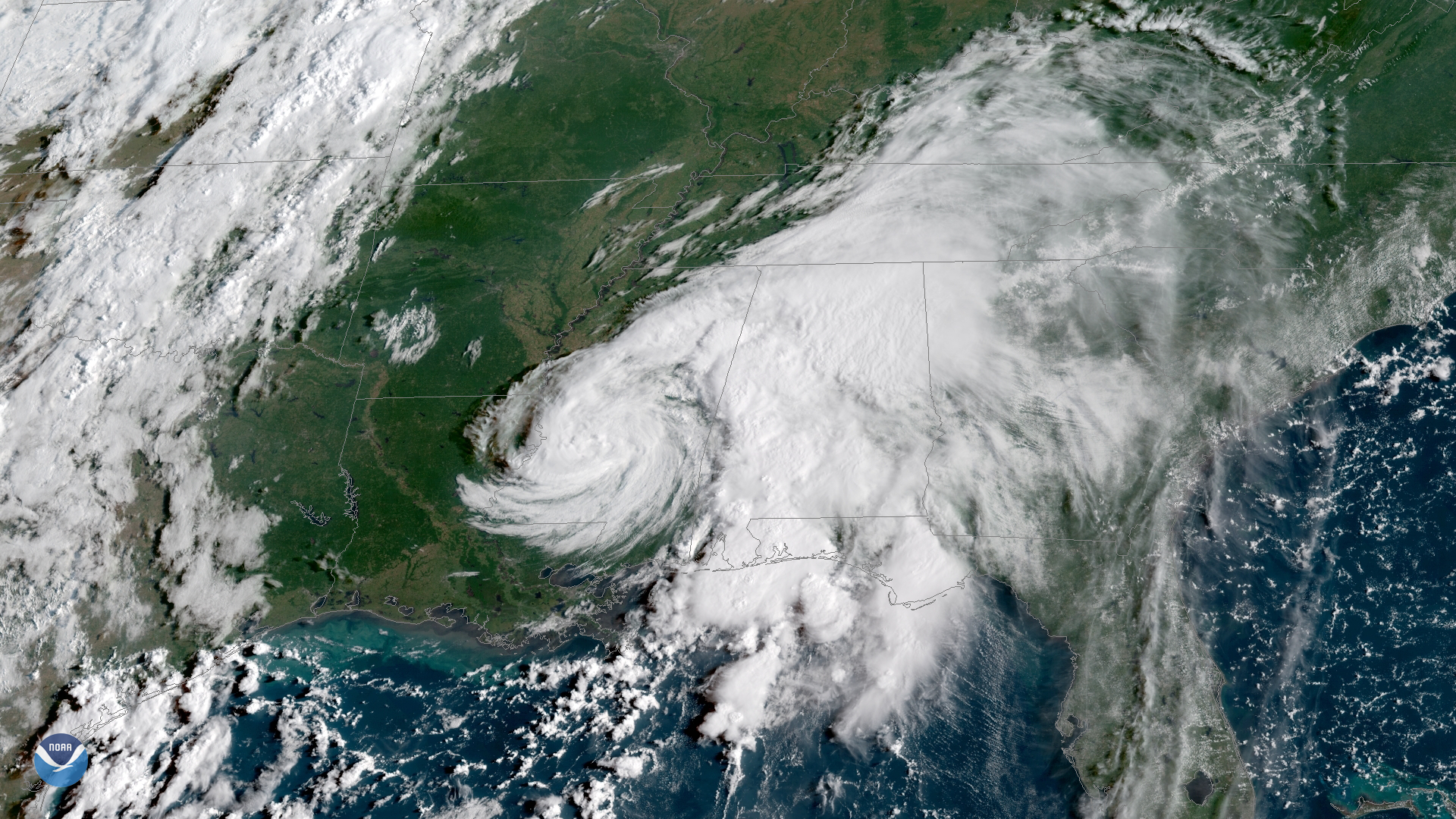
Tropical Storm Gordon, which made landfall near the Mississippi-Alabama border late on September 4, has weakened to a tropical…
Satellite Snapshots
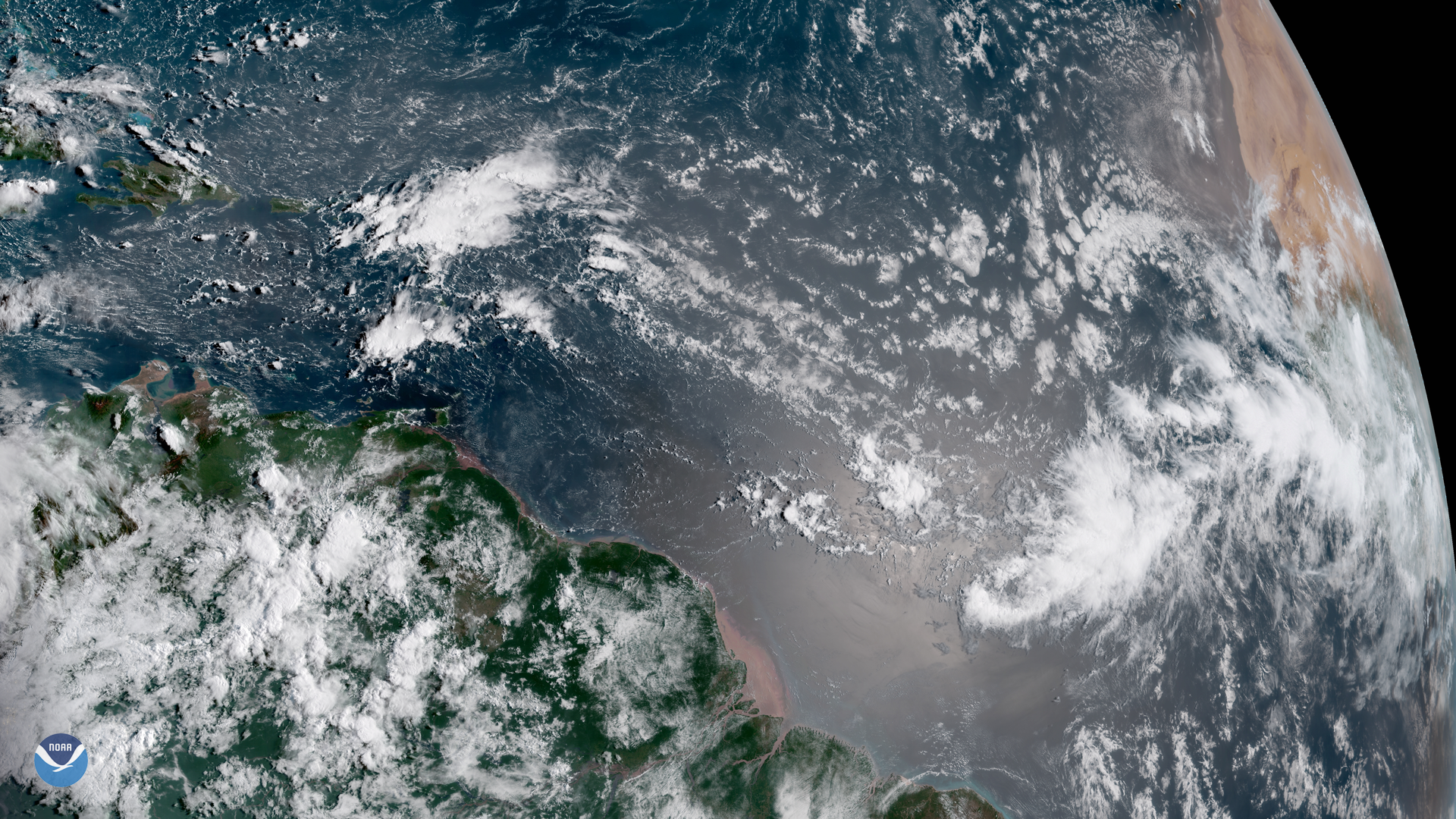
A cluster of clouds appears off the western coast of Africa in this GOES East satellite image, captured August 29, 2018, a sign that…
Feature Story
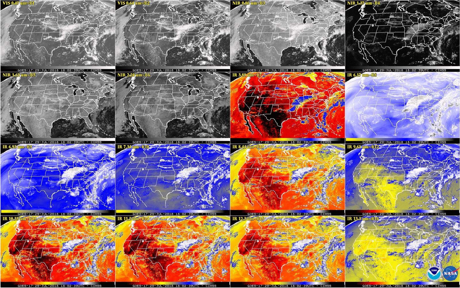
This week, NOAA will begin releasing GOES-17 Advanced Baseline Imager (ABI) “beta” level data and imagery.
Satellite Snapshots
Hurricane Harvey became the first Category-4 hurricane to make landfall along the coast of Texas since Carla in 1961.
Feature Story
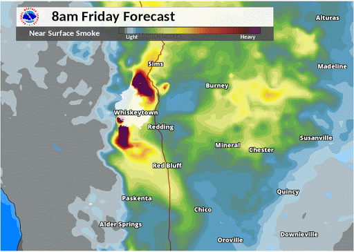
As California chokes on thick wildfire smoke, emergency responders look to a combination of powerful new NOAA satellite…
Satellite Snapshots
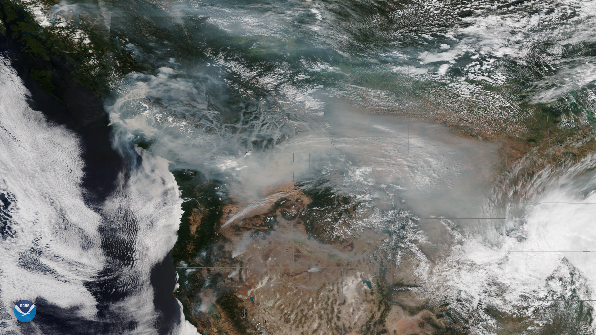
Wildfire smoke continues to cover large portions of the Western U.S. and Canada this week, as above-normal temperatures and dry…