
Satellite Snapshots
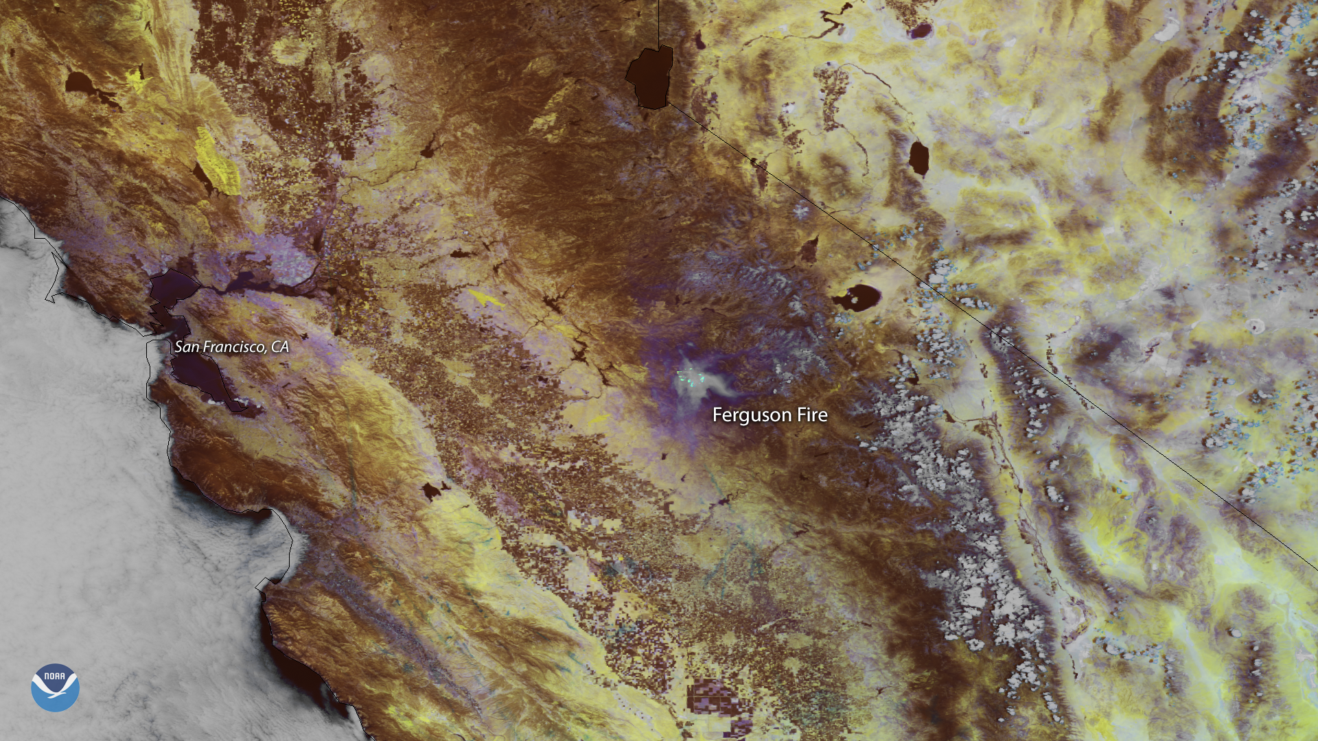
Smoke from the Ferguson Fire burning outside California's Yosemite National Park appears in this false color image captured by the NOAA…
Feature Story
Lightning strikes, giant sparks of electricity in Earth’s atmosphere that are hotter than the surface of the sun , are a major…
Satellite Snapshots
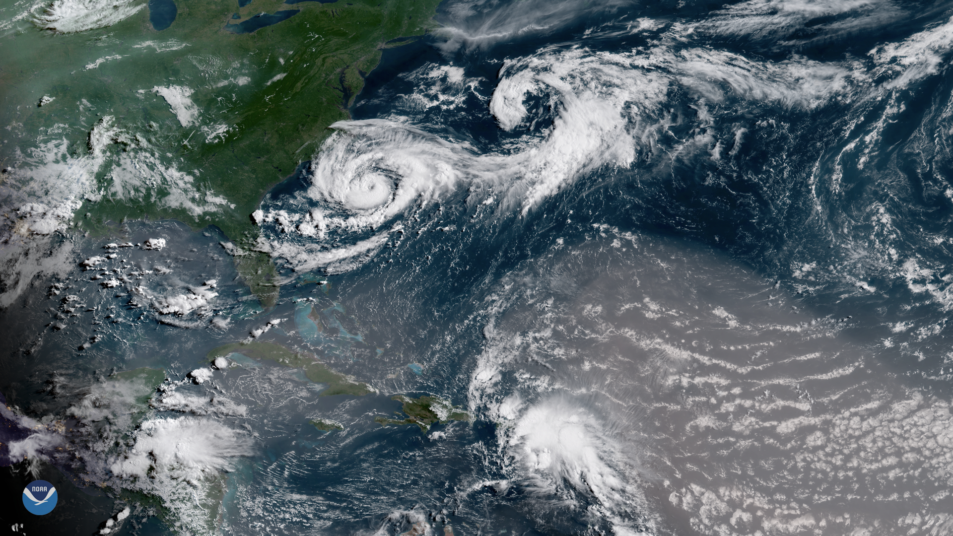
Several interesting atmospheric features appear in this GOES East satellite image of the western Atlantic Ocean, captured July 9, 2018…
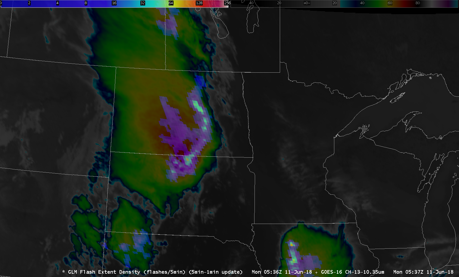
Satellite Snapshots

This multi-day infrared imagery from the NOAA-20 and Suomi NPP polar orbiting satellites shows the dangerous wildfires that continue to…
Feature Story

NOAA began monitoring sea level more than 20 years ago, with the TOPEX/Poseidon satellite in 1992. NOAA launched its newest in the series, Jason 3.
Feature Story
A year has passed since the Jason-3 satellite rocketed into space. NOAA's Laboratory of Satellite Altimetry provided us a report on those 365 days.
Feature Story
A year has passed since the Jason-3 satellite rocketed into space. NOAA's Laboratory of Satellite Altimetry provided us a report on those 365 days.
Satellite Snapshots
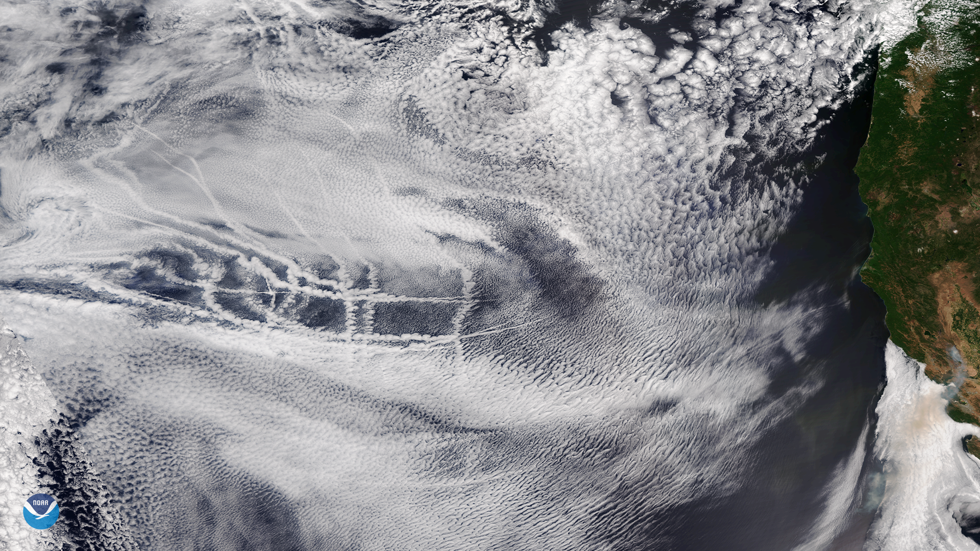
Ship tracks embedded in a layer of mid- and high-level clouds over the eastern Pacific Ocean on July 2, 2018