
Satellite Snapshots
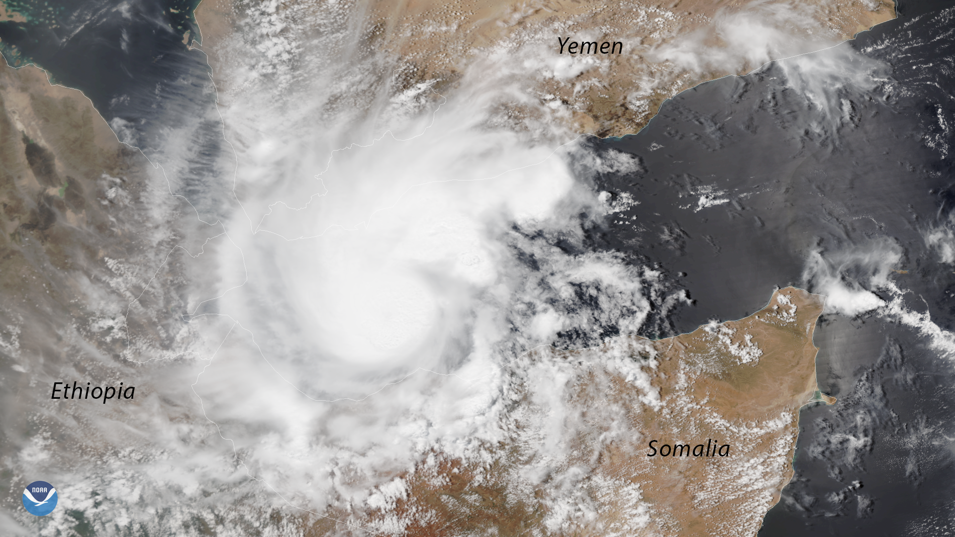
The NOAA-20 polar-orbiting satellite captured this image of a rare tropical cyclone in the Gulf of Aden, between Yemen and Somalia, on…
Satellite Snapshots
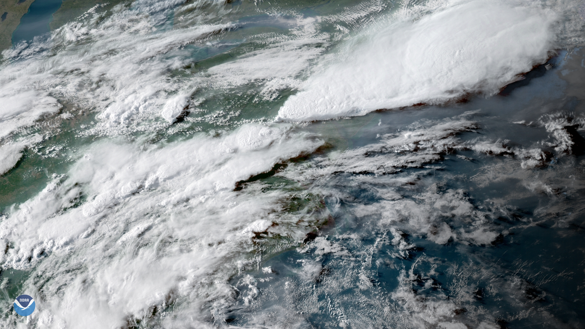
GOES East captured this image of the severe thunderstorms that struck the Northeastern U.S. on May 15, 2018. The storms produced strong…
Feature Story

The Space Environment In-Situ Suite (SEISS) instrument on board NOAA's recently launched GOES-17 satellite is successfully…
Satellite Snapshots
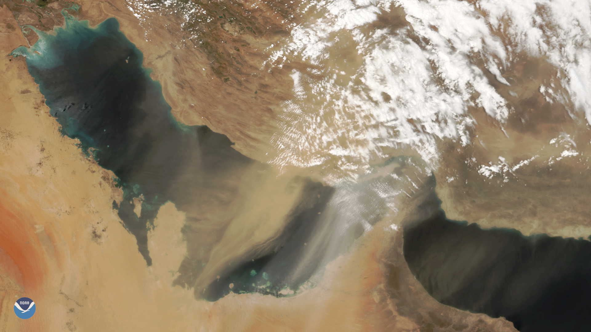
The NOAA-20 satellite captured this image of a large dust storm over the Persian Gulf and on May 13, 2018. Though beautiful from space,…
Satellite Snapshots
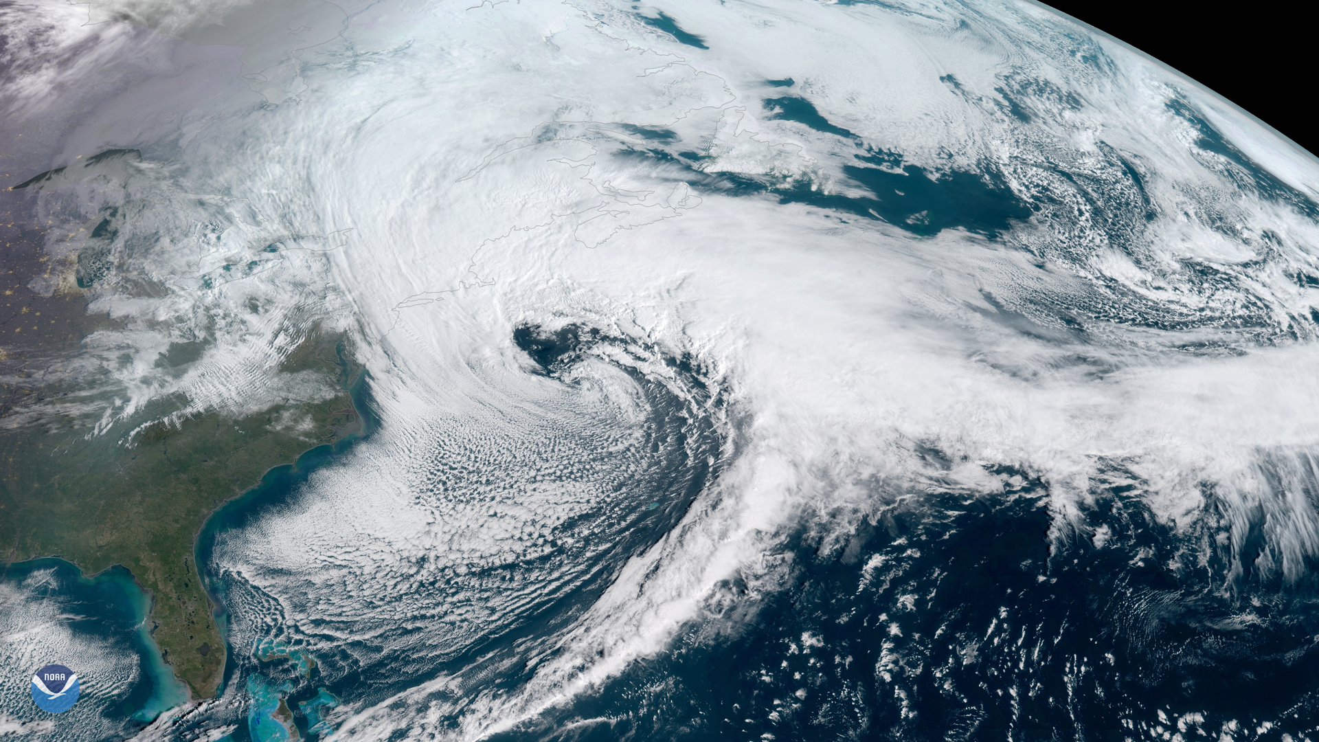
NOAA's GOES East satellite (GOES-16) captured the Nor'easter storm over the East Coast this morning (13:15 UTC). The National Weather…
Satellite Snapshots
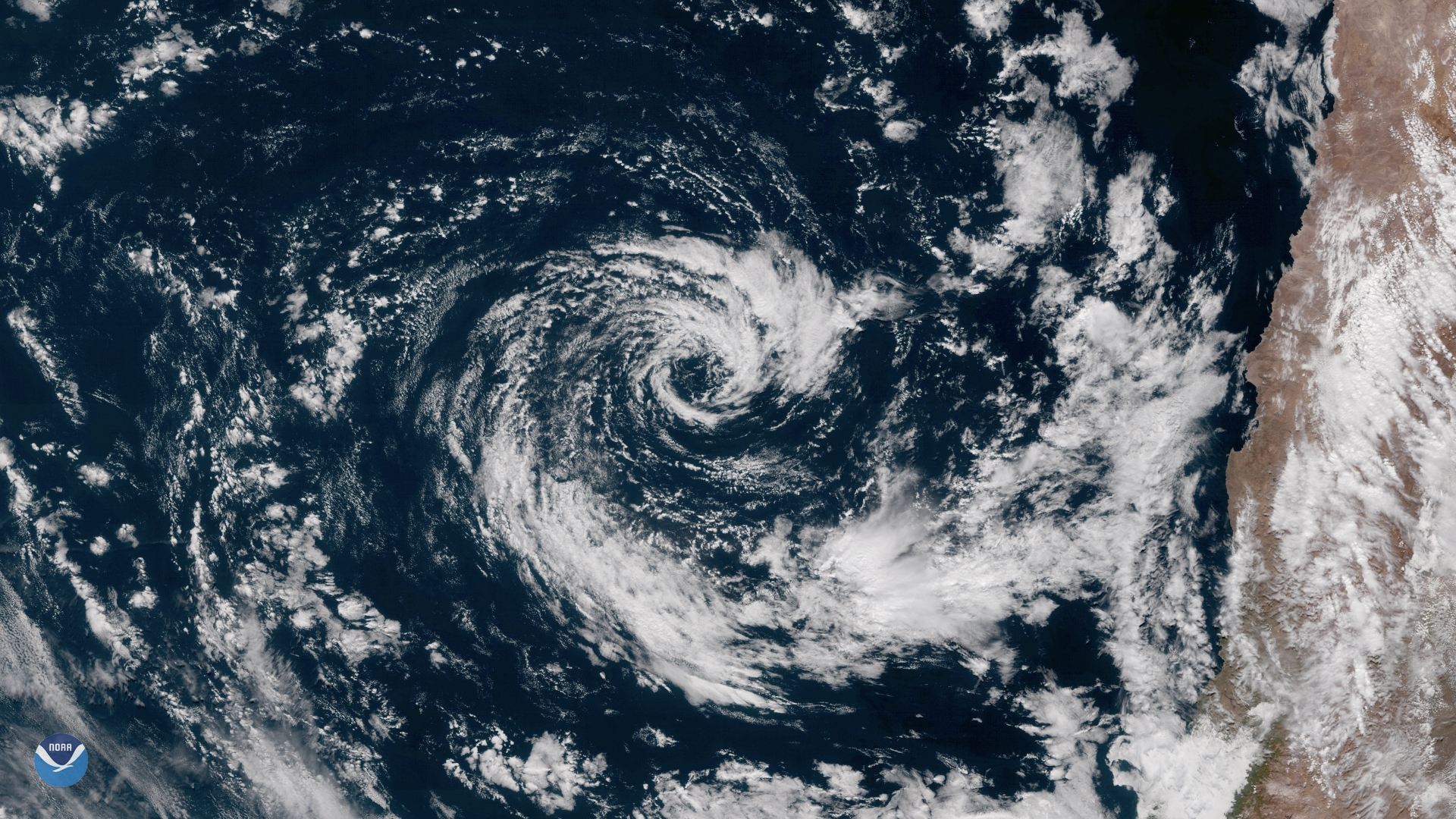
GOES East captured this image of an extremely rare subtropical cyclone in the southeastern Pacific Ocean on May 9, 2018. Located a few…
Satellite Snapshots
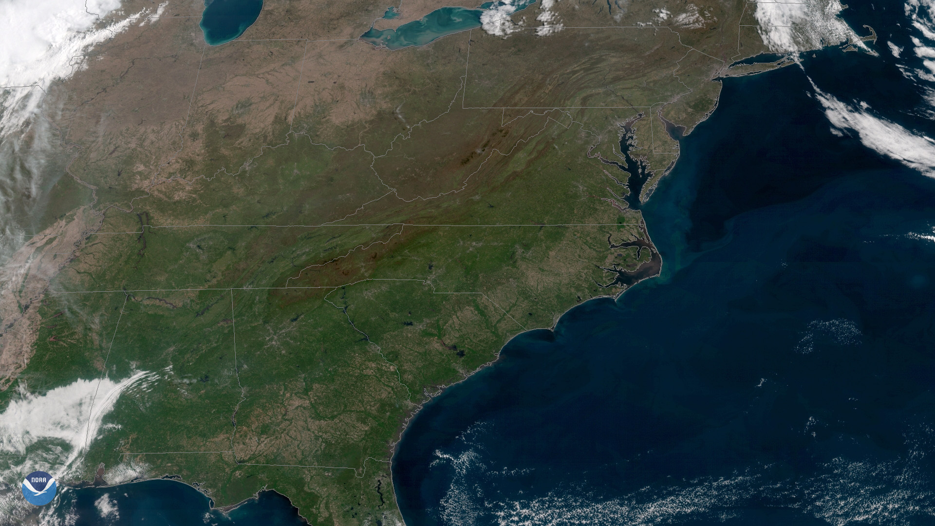
After a cooler than normal April in much of the Eastern U.S., May arrived with clear skies and warm temperatures east of the Mississippi…
Satellite Snapshots
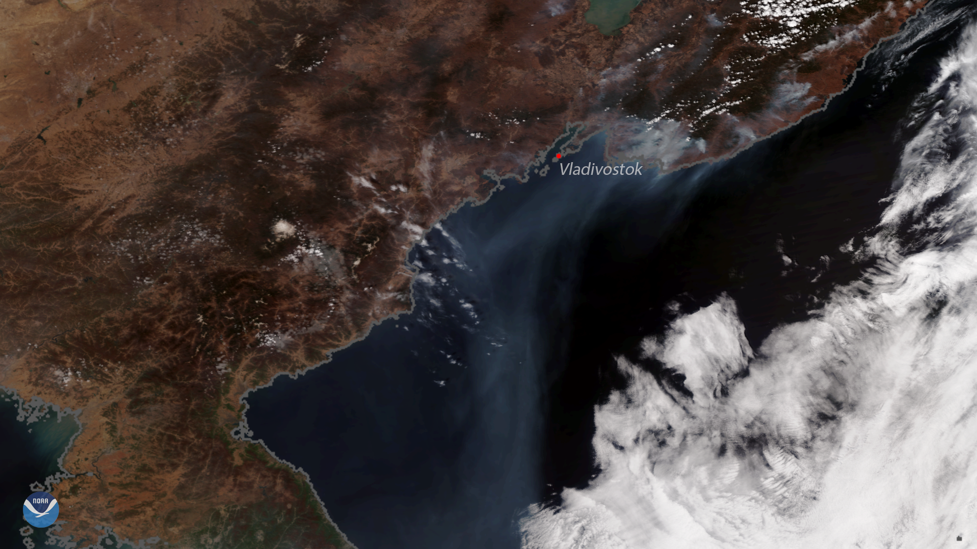
his image, captured by the NOAA-20 polar-orbiting satellite, shows several active fires burning along the coast of eastern Russia,…