
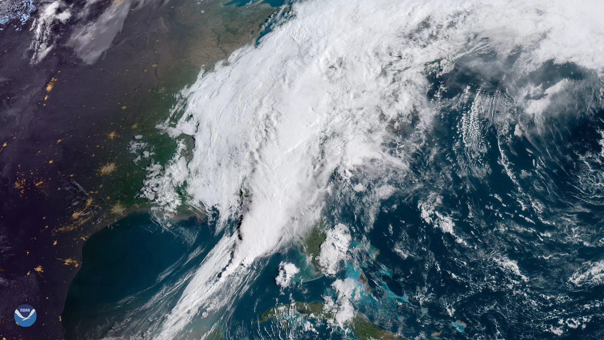
A sprawling storm system stretches from the Florida Panhandle into New England in this April 19, 2019, sunrise view from GOES East. For the first time in three years , the Carolinas and Virginia were placed under a moderate risk for severe weather, meaning widespread severe thunderstorms are likely.
“Heavy rainfall and a risk of flash flooding are also present as tropical moisture streams north along the East Coast,” the National Weather Service noted.
As of 2 p.m. ET, tornado watches were in effect for a swath of the East Coast, stretching from northern Florida to the Maryland-Pennsylvania border.
Friday’s storms are part of a larger severe weather outbreak that began on Wednesday. Thursday’s storms in Mississippi prompted at least 10 tornado reports.
This geocolor-enhanced imagery was created by NOAA's partners at the Cooperative Institute for Research in the Atmosphere. The GOES East geostationary satellite, also known as GOES-16, provides coverage of the Western Hemisphere, including the United States, the Atlantic Ocean and the eastern Pacific. The satellite's high-resolution imagery provides optimal viewing of severe weather events, including thunderstorms, tropical storms, and hurricanes.