
Feature Story

The ocean is a vast, interconnected system that covers about seventy percent of the Earth’s surface. Satellites are essential for observing this environment, supporting marine transportation, weather monitoring, and coastal safety.
Earth from Orbit

The 2025 Atlantic hurricane season, which officially ends on November 30, showcased near-normal activity, marked by periods of very strong storms.
Feature Story
To mark 50 years of GOES in orbit, NOAA is looking back at ten notable events captured by these groundbreaking satellites.
Feature Story

NOAA satellites have witnessed some pretty extreme events, from massive wildfires and explosive volcanic eruptions to a 515-mile-long lightning flash.
Feature Story

The Shift Begins Before Sunrise and Continues After Sunset: How NOAA Satellite Operators and Engineers Keep America Safe, Every Day of the Year
Earth from Orbit

Twenty years ago, Hurricane Katrina devastated New Orleans and the Mississippi coast.
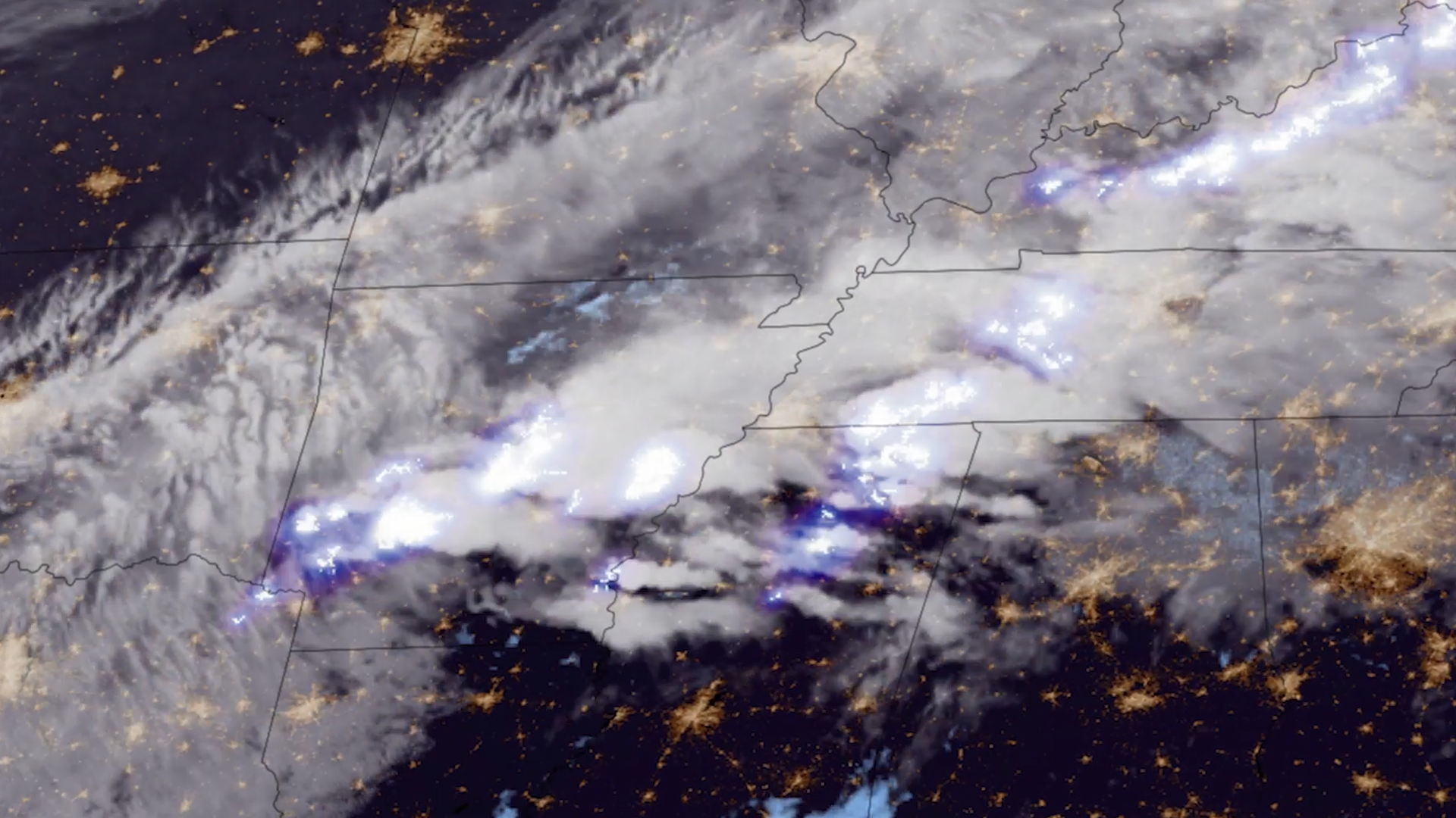
Feature Story

A reanalysis of GOES-16 satellite data revealed a record-breaking lightning megaflash that stretched 515 miles across the southern U.S. in 2017, now certified by the WMO as the longest ever recorded.
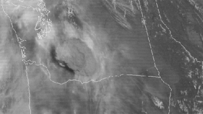
Earth from Orbit
Lightning is a dangerous weather hazard that poses a significant threat to life and property. It can strike at any time, but is most common in the summer months.