
Satellite Snapshots
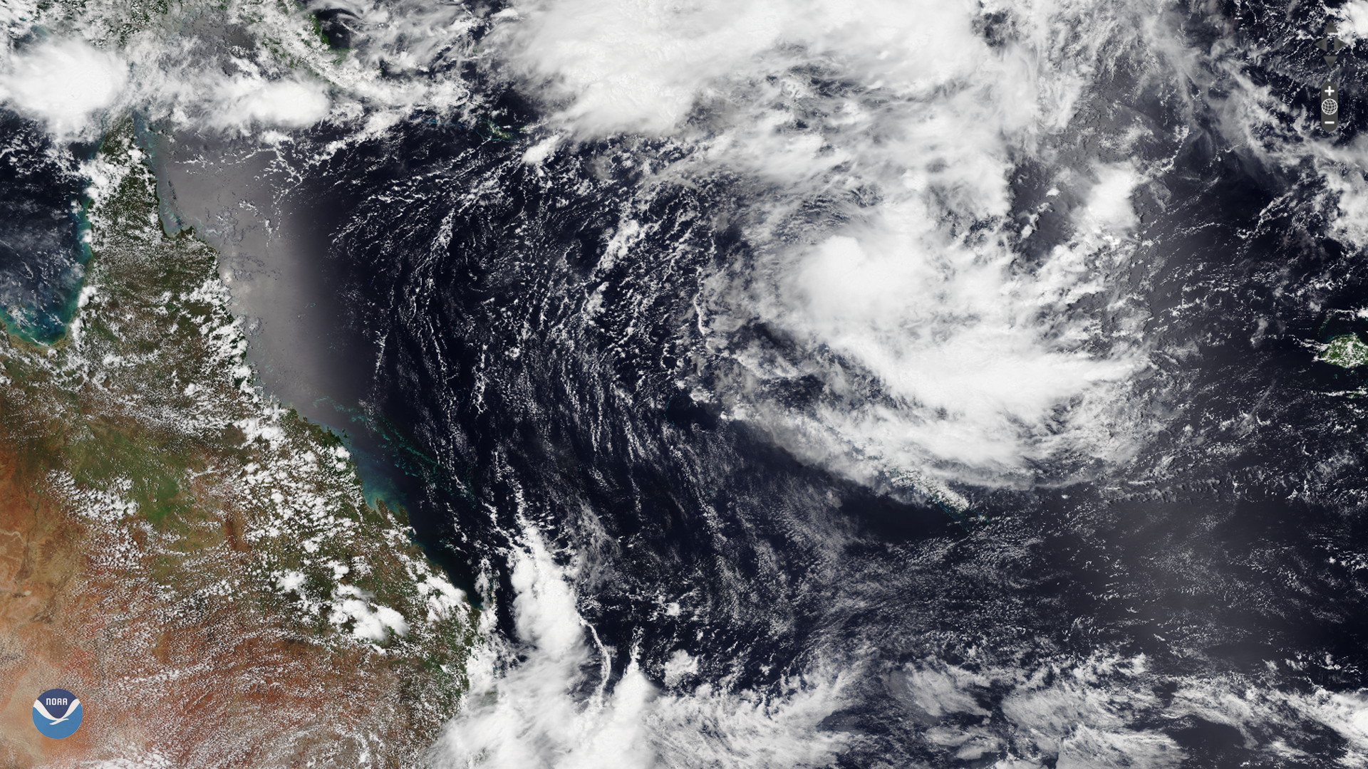
February 10, 2020 A relatively stationary tropical low south of the Solomon Islands has developed into a tropical cyclone after drifting slightly…
Satellite Snapshots
February 07, 2020 On Feb. 6, 2020, the NOAA-20 satellite viewed a strengthening low pressure system in the Mid-Atlantic region as it moved into the…
Feature Story
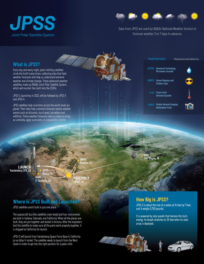
NOAA’s satellite imagery and data were the foundation of 2019’s life-saving forecasts throughout the 14 billion-dollar disasters.
Satellite Snapshots
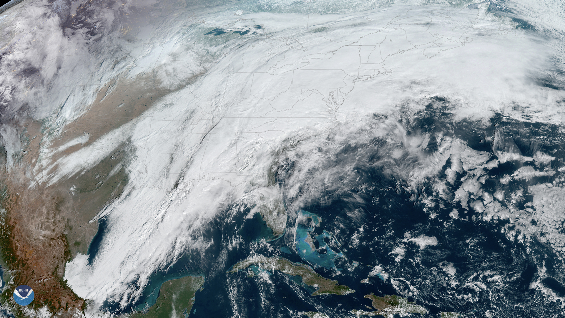
On Thursday, Feb. 6, 2020, the GOES-East satellite is watching a large winter storm stretching roughly 2,000 miles across the U.S.,…
Satellite Snapshots
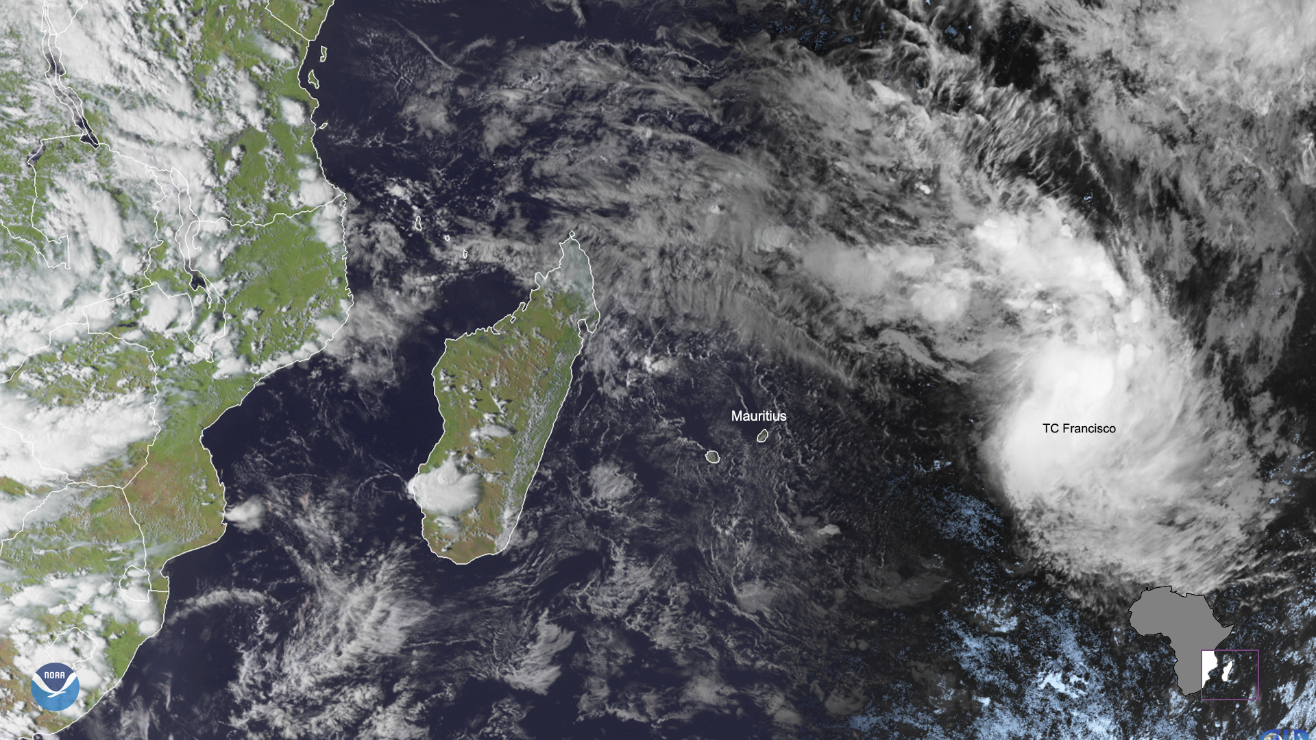
February 05, 2020 On Feb. 5, 2020, the Meteosat-8 satellite saw Tropical Cyclone Francisco make its way towards the island of Mauritius in the south…
Satellite Snapshots

February 04, 2020 On Feb. 4, 2020, GOES-East captured this imagery of low-level stratus clouds as they moved across Texas behind a cold front, while…
Feature Story
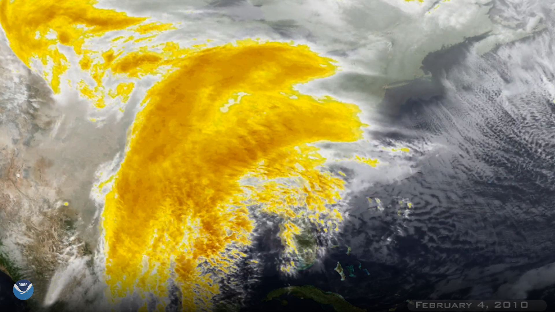
Ten years ago today, NOAA's satellites were watching a major winter storm unfolding. Nicknamed "Snowmageddon," the storm brought near-blizzard…
Feature Story

The Sentinel-6A/Jason CS satellite has been renamed the Sentinel-6 Michael Freilich, in honor of Earth scientist Michael Freilich.