
Satellite Snapshots
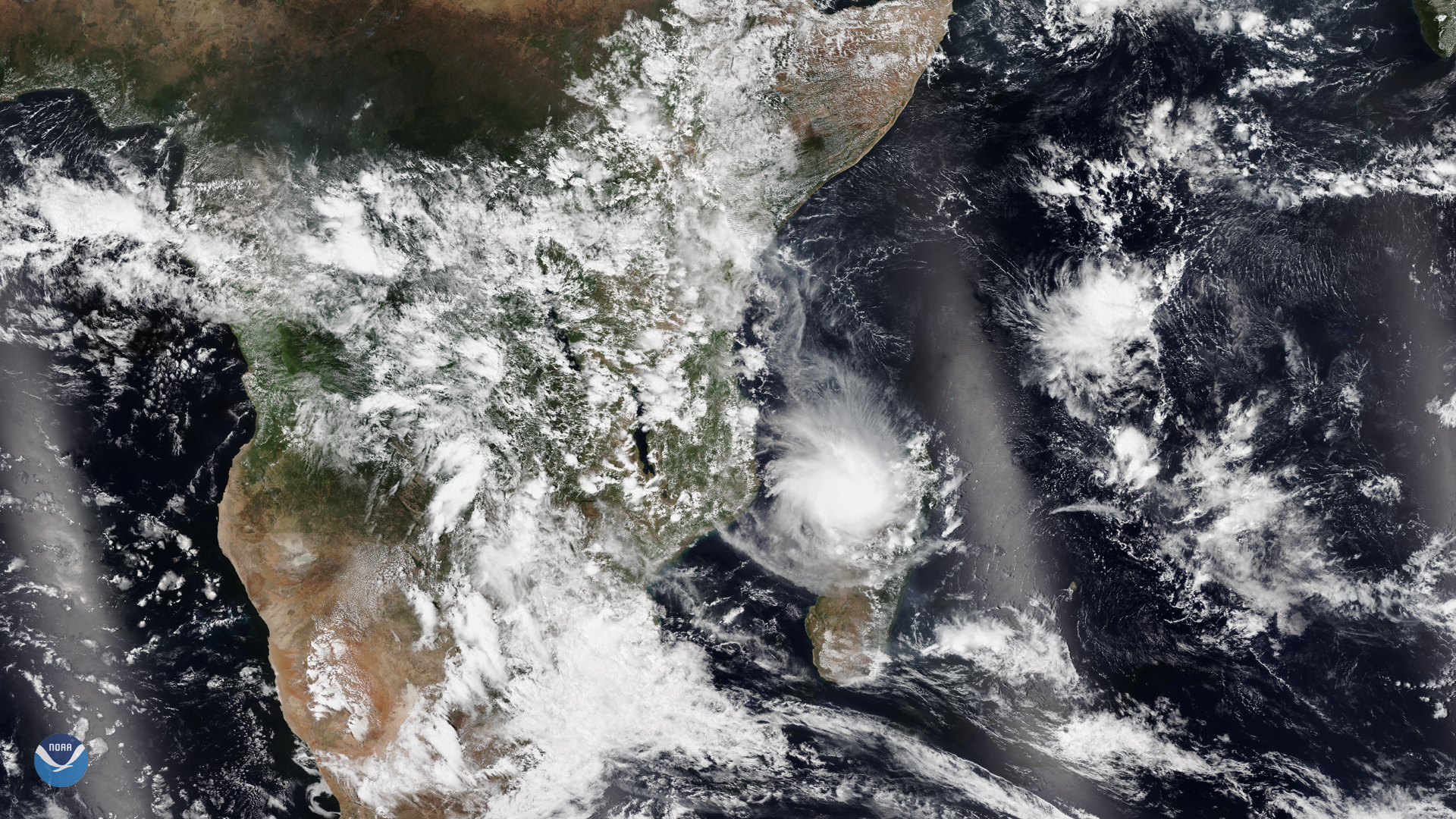
NOAA-20 captured Tropical Cyclone Belna as it made landfall at Boeny, a northwestern province on the island nation of Madagascar on…
Satellite Snapshots
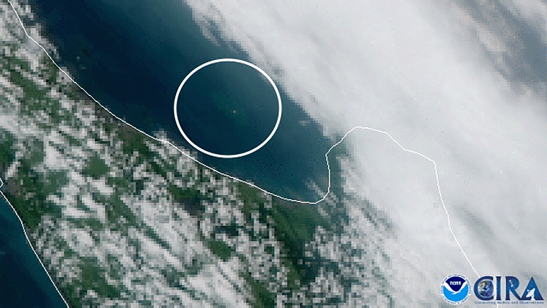
A powerful volcanic eruption occurred on White Island, a small uninhabited islet off the coast of New Zealand, on Dec. 9, 2019, at…
Satellite Snapshots
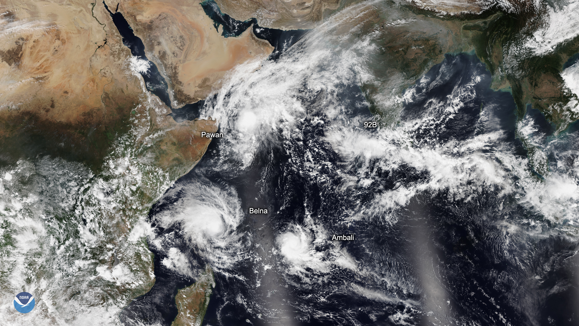
On Dec. 5, 2019, the NOAA-20 satellite captured this image of three tropical cyclones churning over the Indian Ocean, along with…
Satellite Snapshots
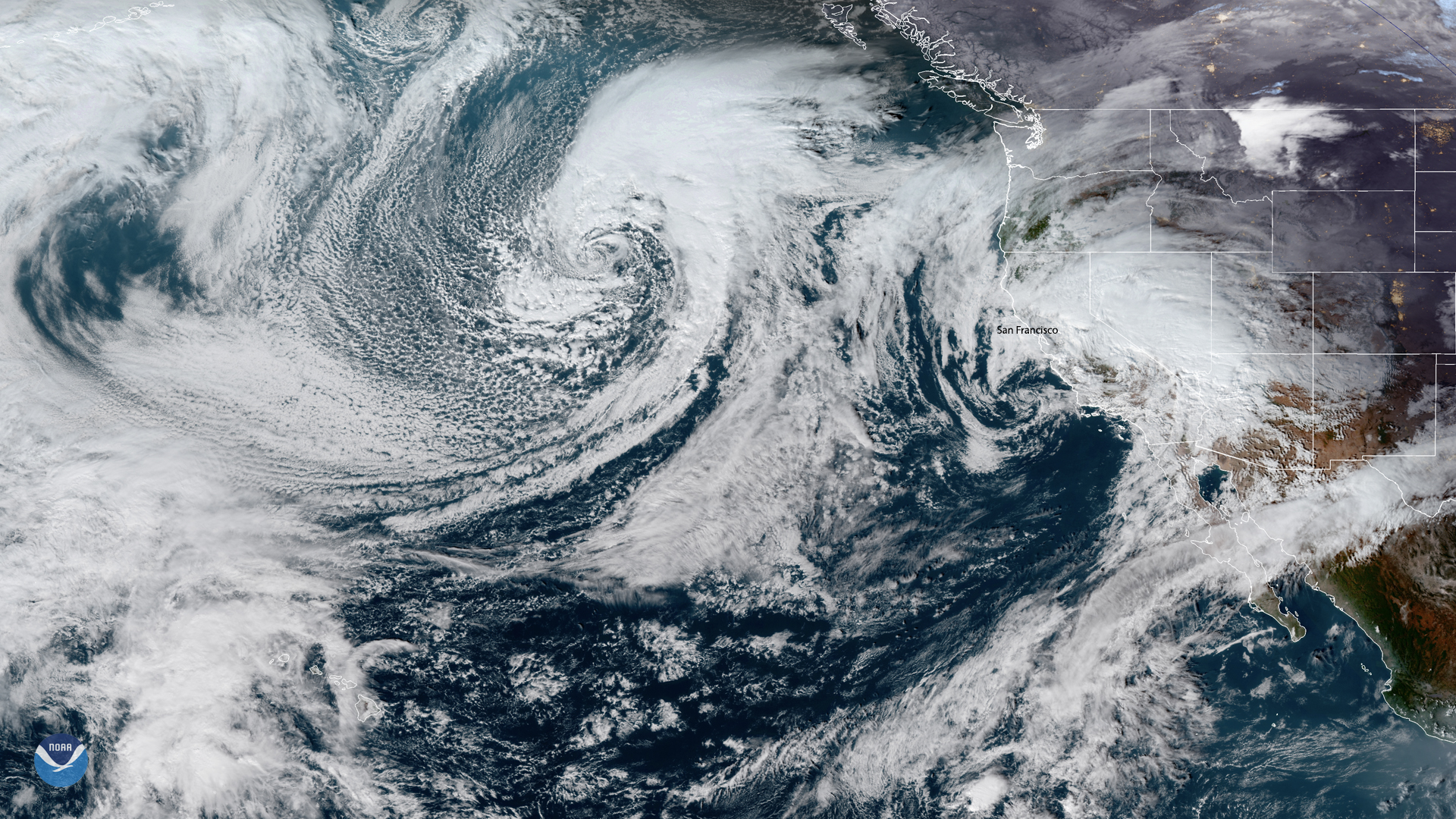
On Dec. 4, 2019 at 5:40 p.m. EST, the GOES satellites captured a large low-pressure system moving toward the continental US from…
Satellite Snapshots
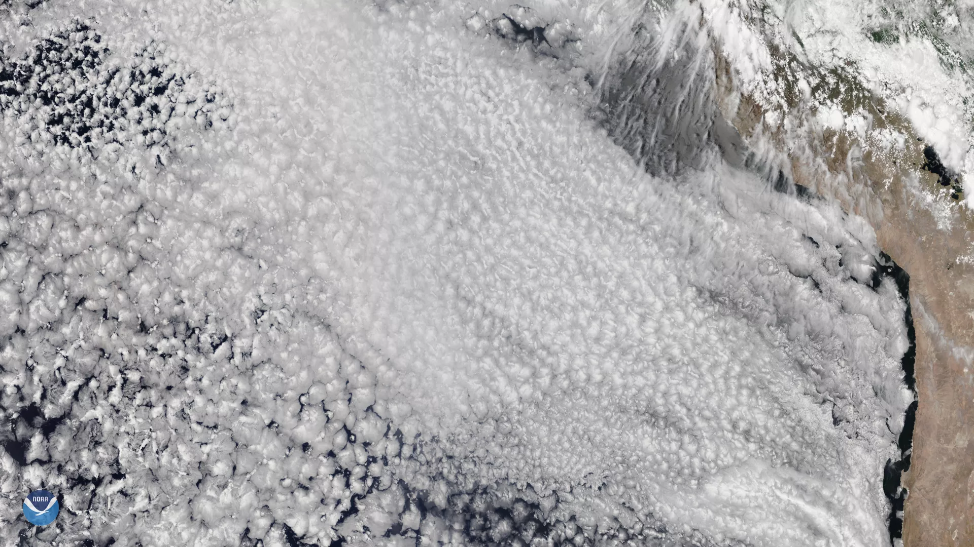
The NOAA-20 satellite snapped this beautiful photo of marine stratocumulus clouds (MSCs) off the western coast of South America on…
Satellite Snapshots
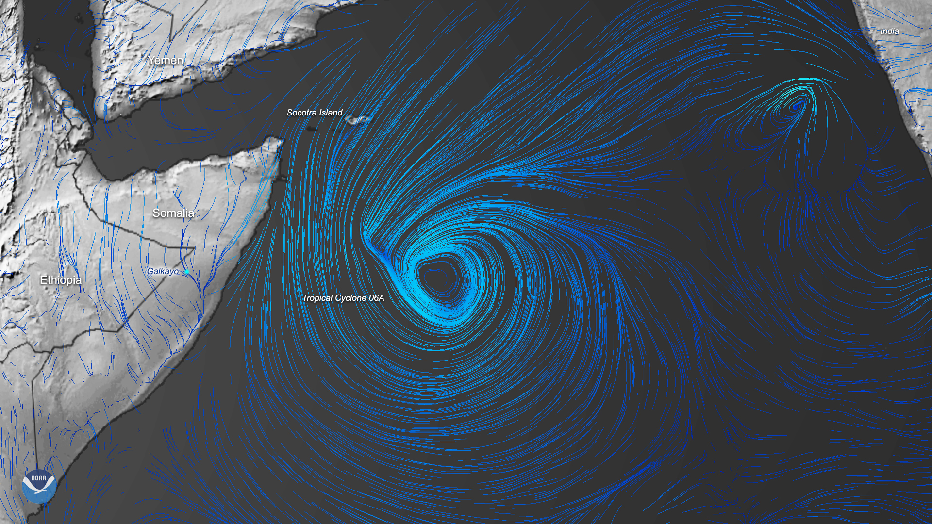
On Dec. 3, 2019, this image was created by using the Global Forecast System (GFS) data of Tropical Cyclone 06A off the coast of…
Satellite Snapshots
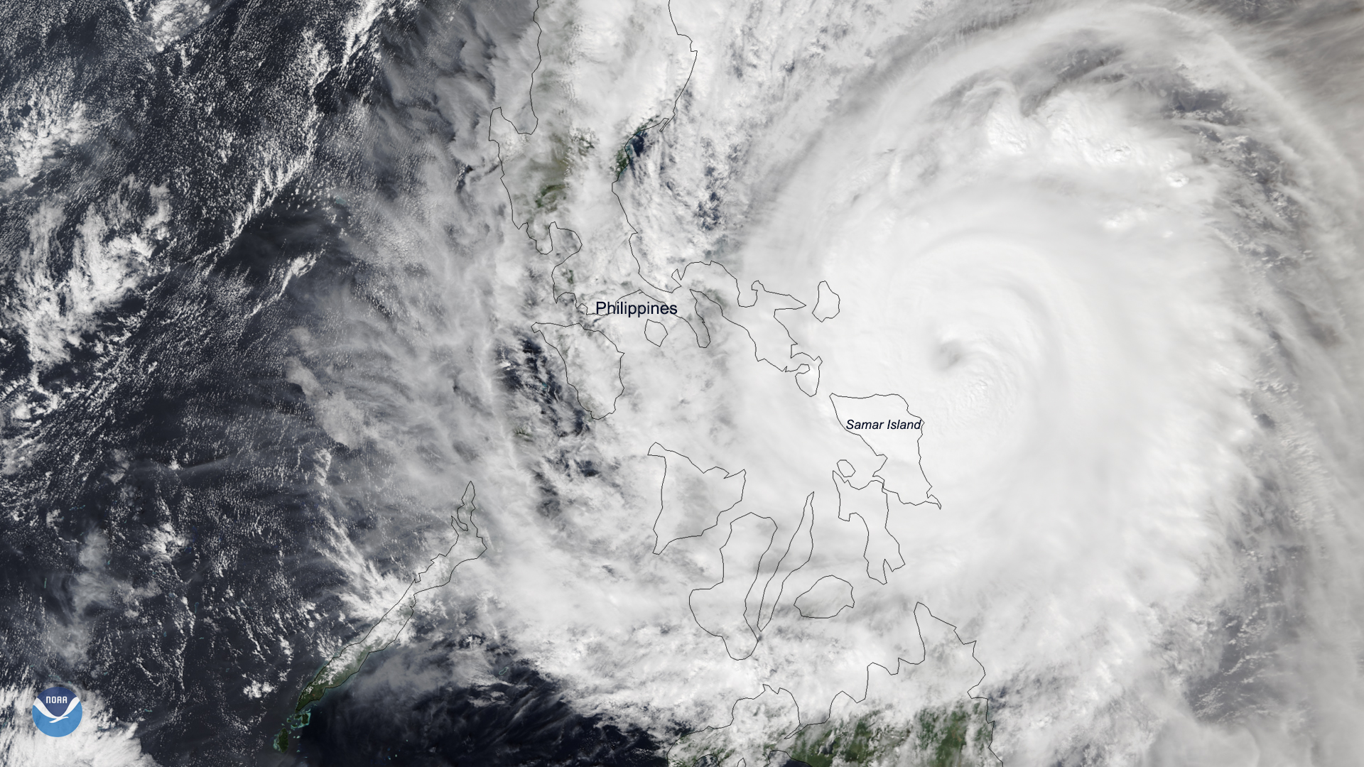
A rare late-season typhoon is bringing heavy rain and strong winds to the eastern islands of the Philippines. Typhoon Kammuri made…
Satellite Snapshots
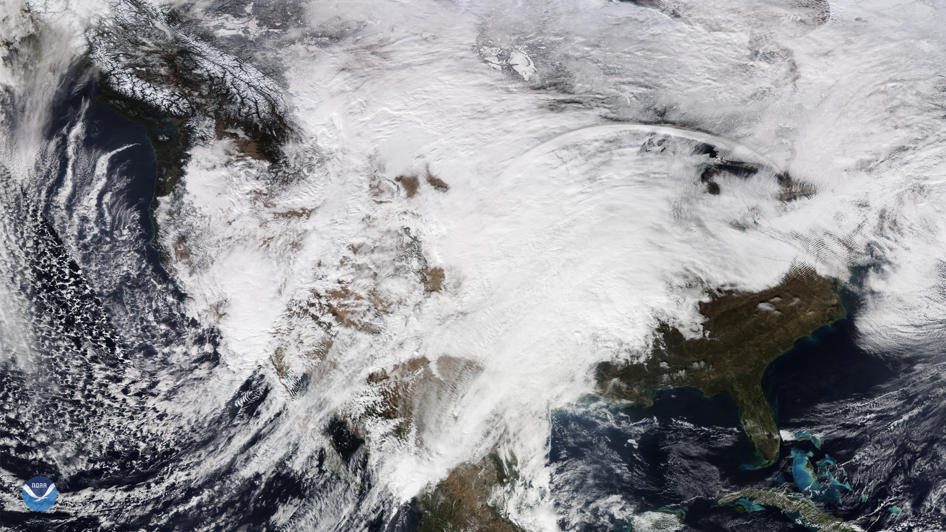
On Nov. 28, NOAA-20 captured this view of the continental United States as it was covered by a large low-pressure system and an…