
Feature Story
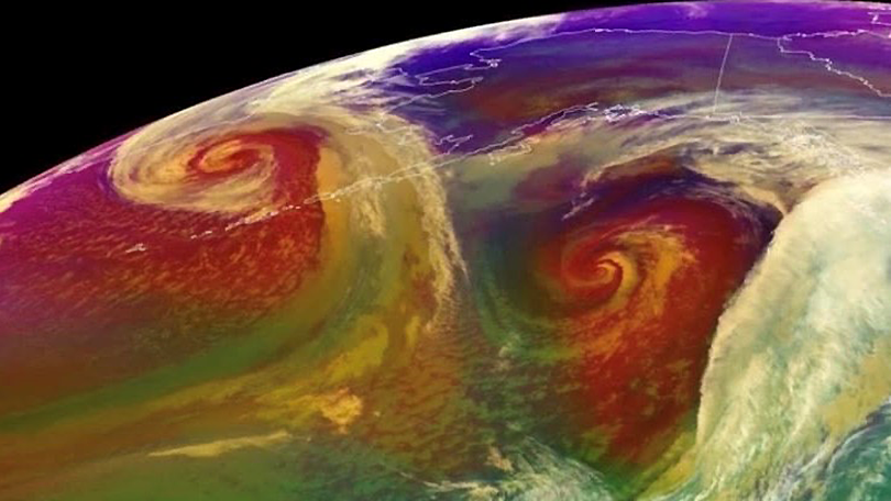
October 16, 2019 The #GOESWest satellite watched the remnants of #SuperTyphoonHagibis over the #BeringSea and a storm-force low over the Gulf of …
Satellite Snapshots
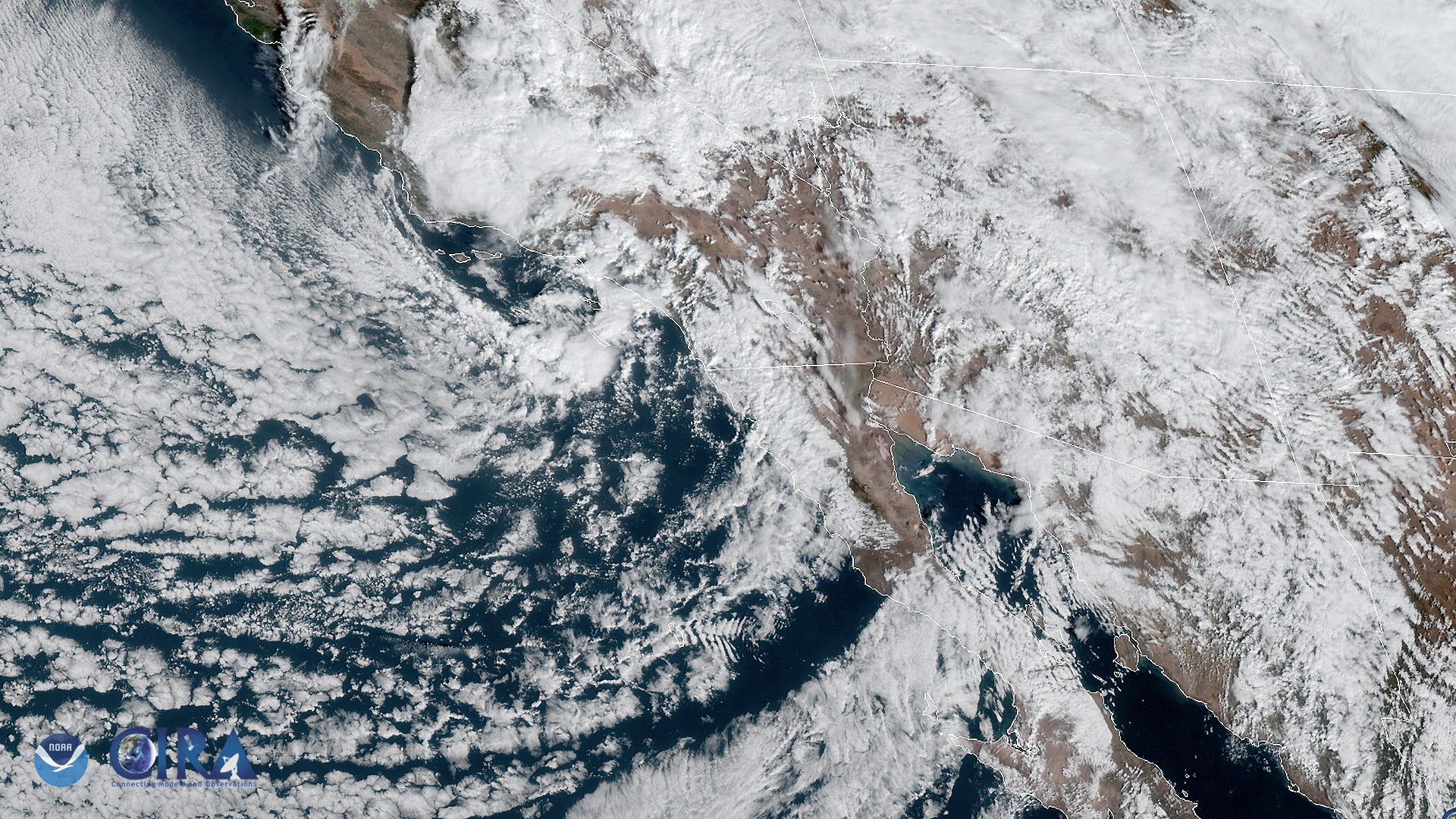
The GOES West satellite captured this image of the southwestern US and the Pacific Ocean on Nov. 20, as it was experiencing a storm…
Feature Story

Wind is a fundamental variable of weather. The heating of Earth’s surface and atmosphere by the sun drives winds that…
Satellite Snapshots
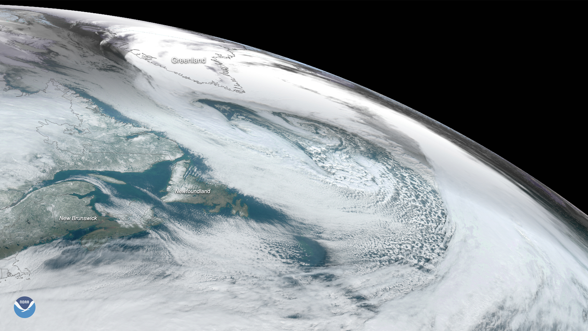
On Nov. 17, 2019, the GOES East satellite captured this image of a massive cyclone that formed over the Labrador Sea between…
Satellite Snapshots
The NOAA-20 satellite captured this imagery of a nor’easter off the mid-Atlantic coast and a low-pressure system off of Florida’s…
Satellite Snapshots
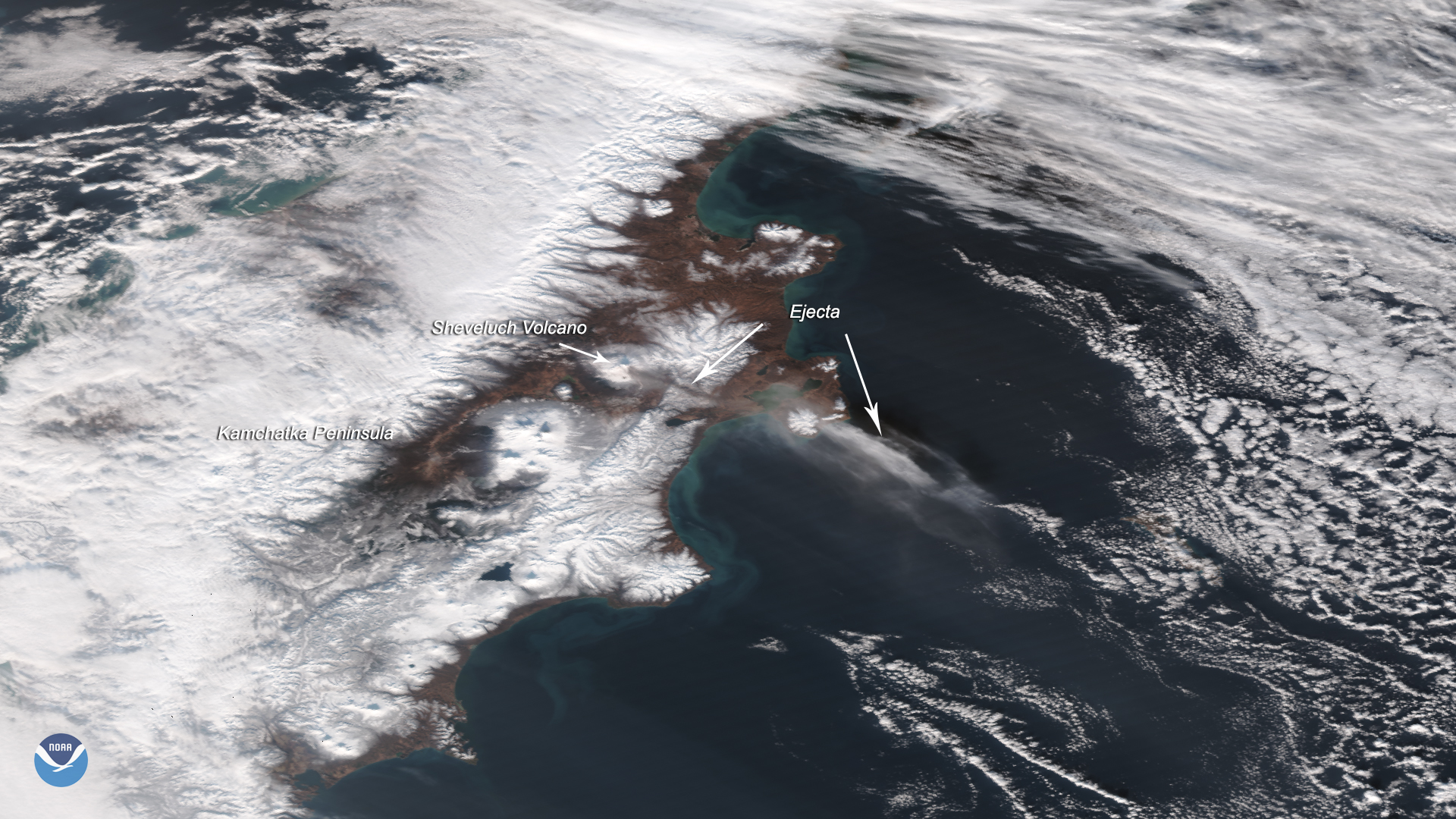
The Suomi-NPP satellite captured this image of the Sheveluch volcano erupting on Nov. 12, 2019, which affected flights over an area…
Satellite Snapshots
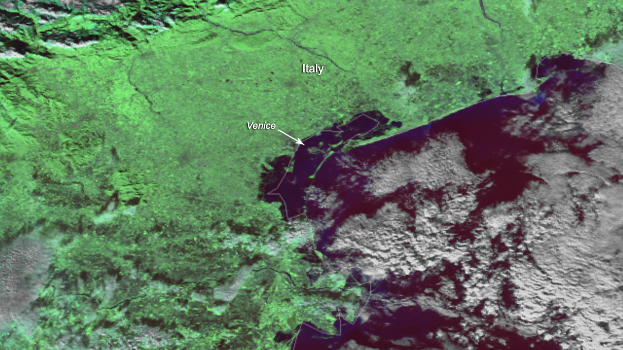
The NOAA-20 satellite captured imagery of Venice, Italy, on Nov. 14, 2019, after devastating floods disrupted essential services and tourism.
Satellite Snapshots
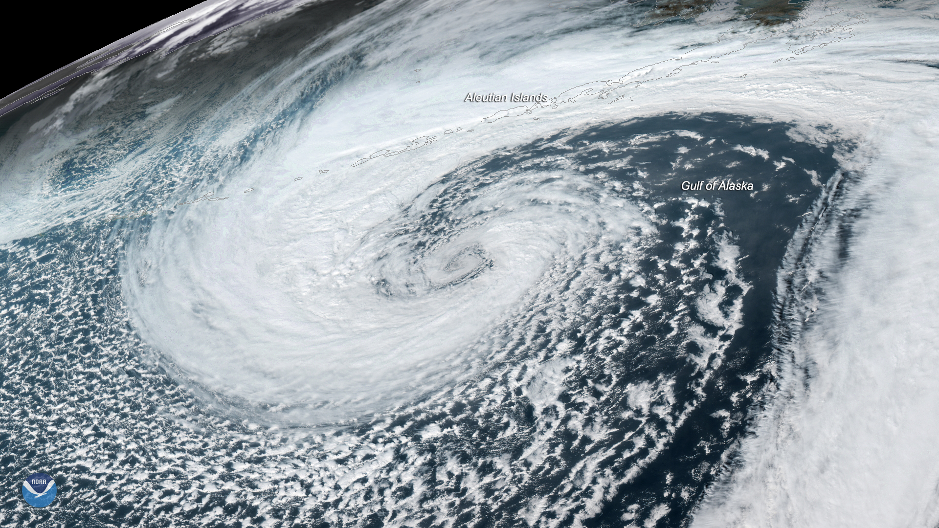
A mid-latitude cyclone was seen swirling in the Gulf of Alaska by the GOES West satellite on Nov. 12, 2019.