
Satellite Snapshots
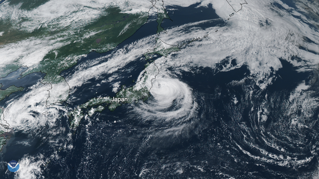
A powerful typhoon made landfall east of Tokyo, Japan, in the Chiba prefecture around 5 a.m. local time on Monday, September 9,…
Feature Story

Every day in America, millions of people wake up with the same question on their minds, “What’s the weather today?” The US…
Satellite Snapshots

Hurricane Dorian made landfall over Cape Hatteras, N.C., at 8:35 a.m. EDT Friday, Sept. 6, 2019, with maximum sustained winds near 90 mph. NOAA's GOES East captured this view of the strong Category 1 storm at 8:20 a.m. EDT, just 15 minutes…
Satellite Snapshots
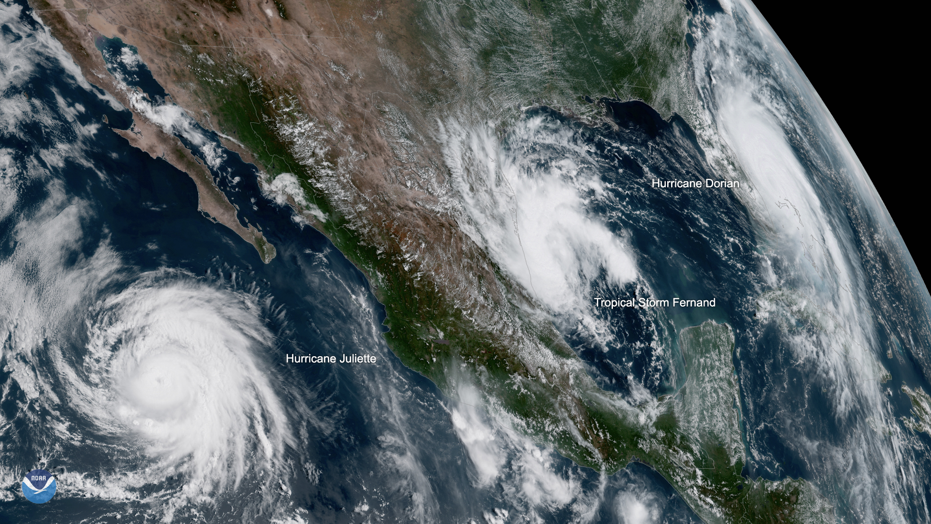
While Hurricane Dorian lashed the Bahamas throughout Labor Day weekend, two other storms were brewing.
Satellite Snapshots
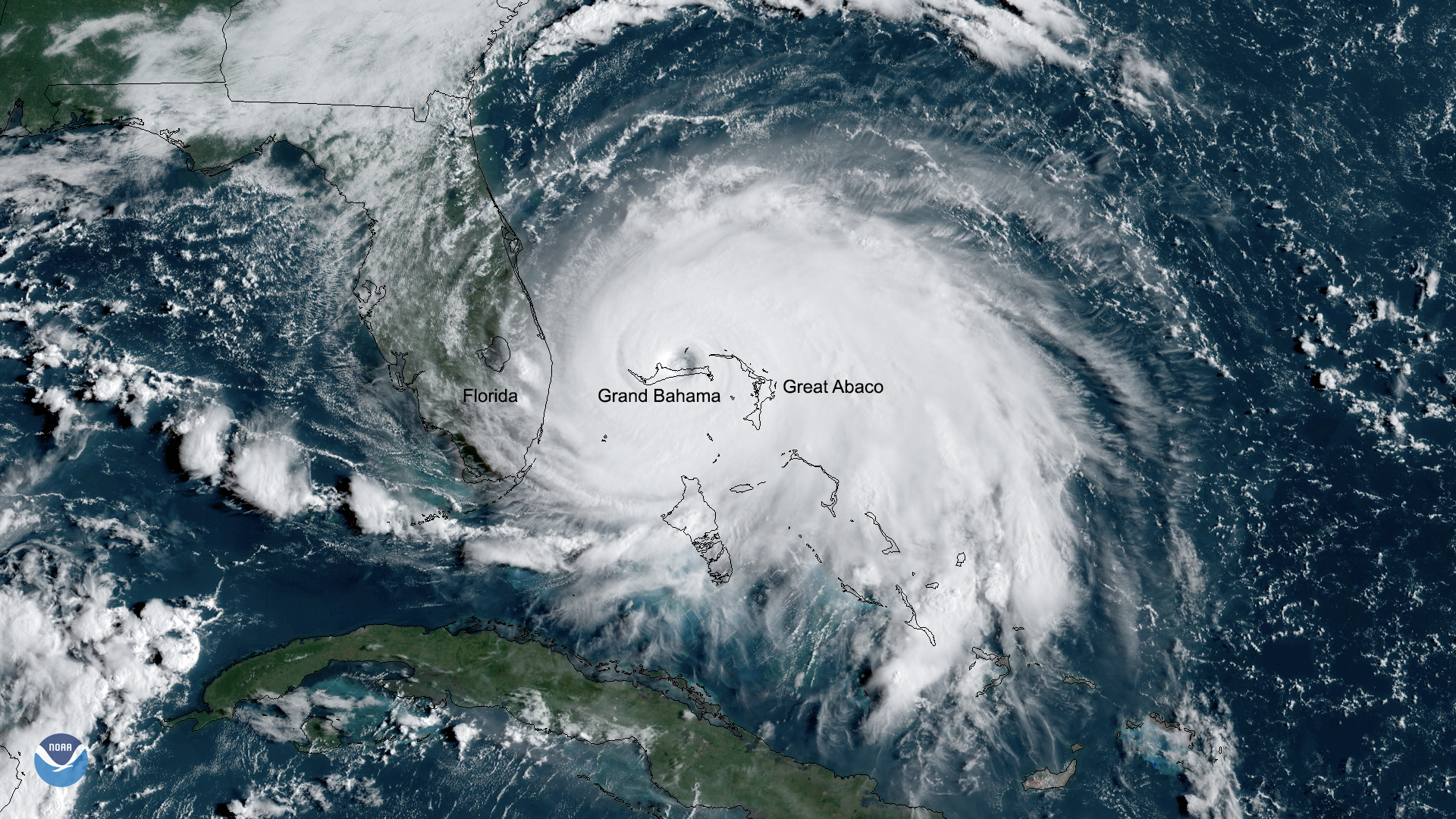
Catastrophic Hurricane Dorian slowed to a crawl over Grand Bahama Island overnight and into Labor Day, Monday September 2, 2019
Satellite Snapshots
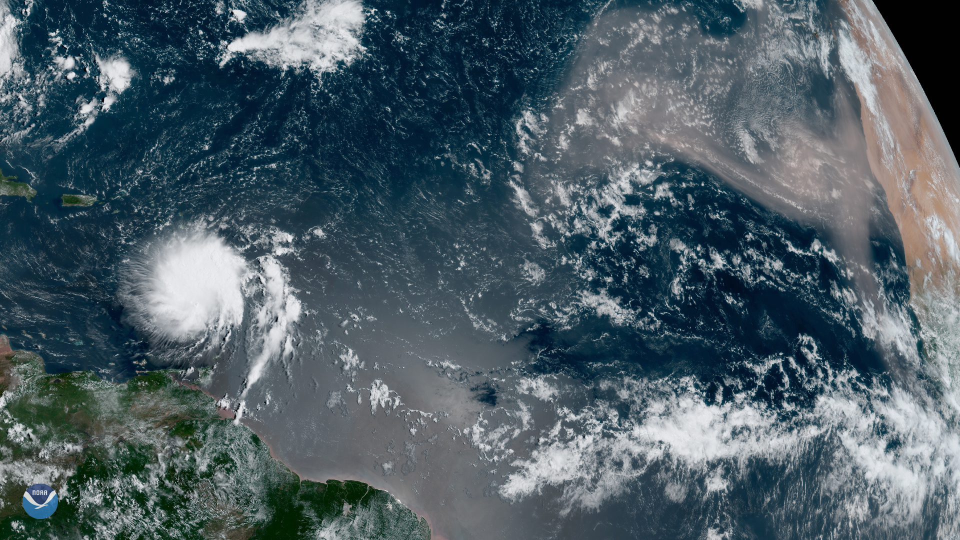
Although we’re inching closer to the peak of hurricane season — which typically occurs in early September — GOES East spotted one of…
Satellite Snapshots
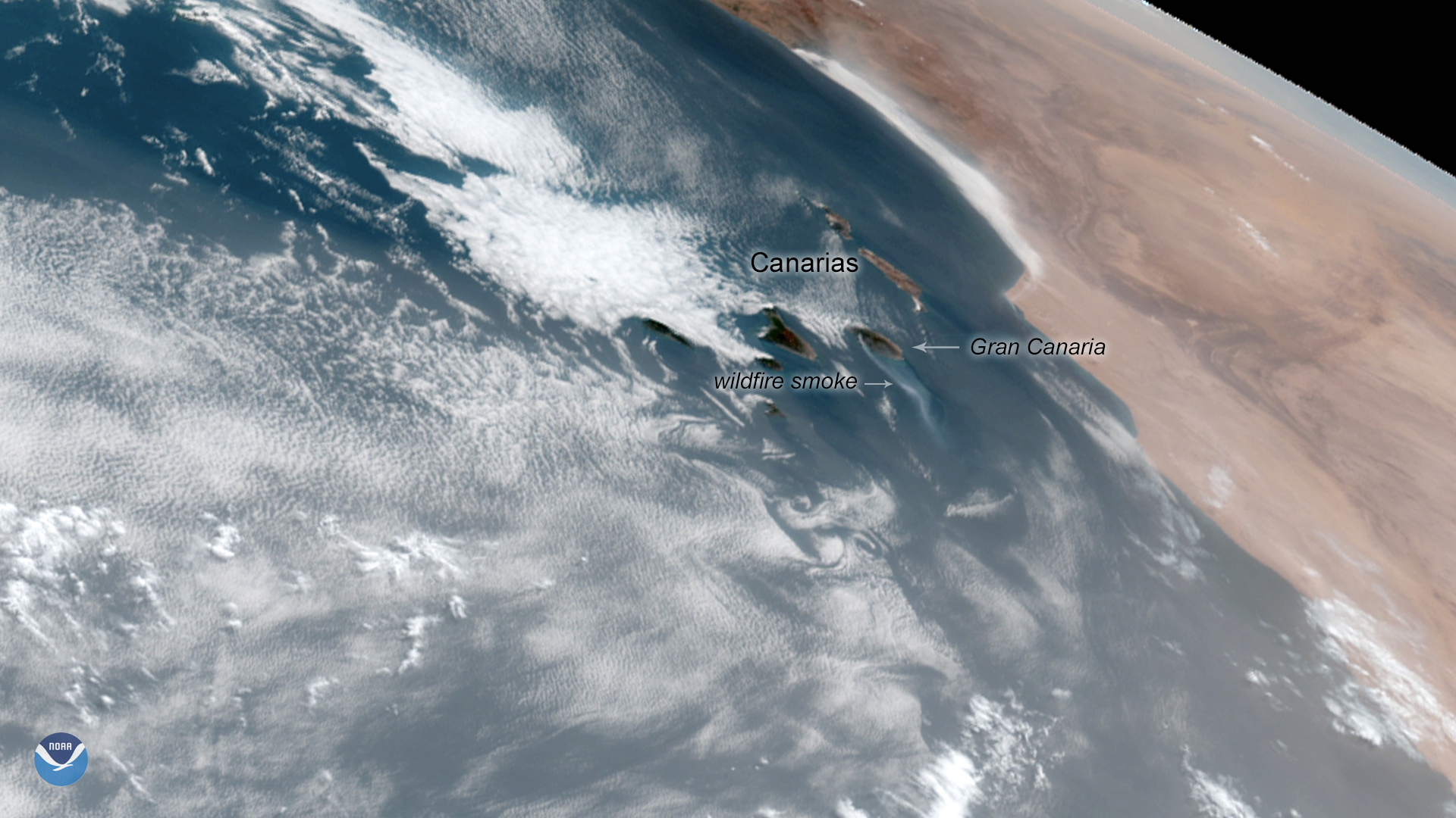
A wildfire burning on the Island of Gran Canaria in Spain’s Canary Islands is the worst in six years, authorities say. Originating…
Feature Story

On February 4, 1979, an iceberg slightly larger in area than the city of Indianapolis was first spotted in the Wilkesland Sea…