
Satellite Snapshots
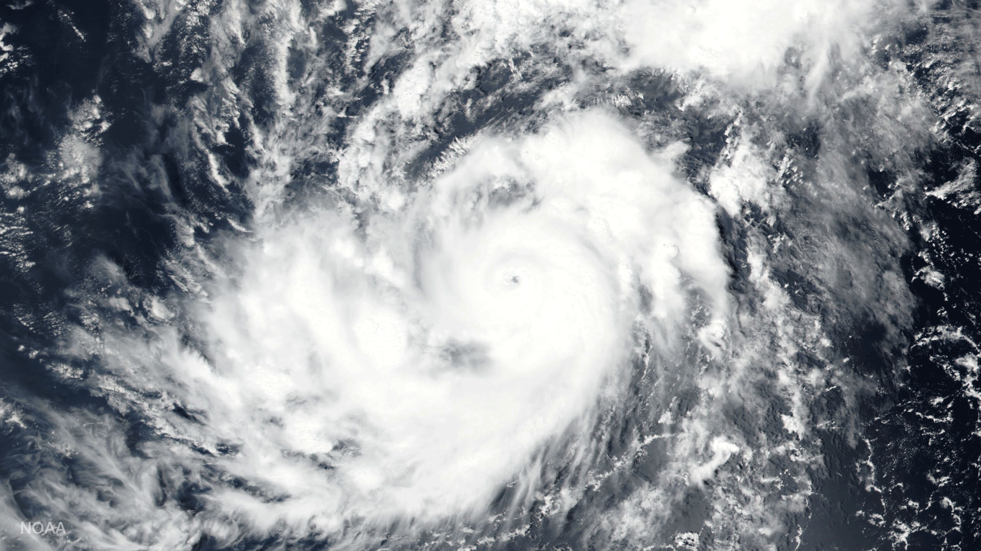
The Visible Infrared Imaging Radiometer Suite (VIIRS) instrument aboard the Suomi NPP satellite captured Hurricane Irma.
Feature Story
This is a collection of weather imagery from JPSS-1. NOAA’s Joint Polar Satellite System (JPSS) provides global observations that serve as the backbone of both short- and long-term forecasts, including those that help us predict and prepare for…
Satellite Snapshots
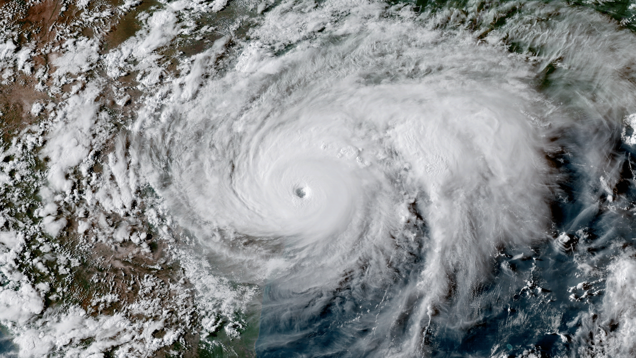
GOES-16 satellite GeoColor image of Hurricane Harvey at peak intensity on August 25, 2017 at 23:00 UTC.
Satellite Snapshots
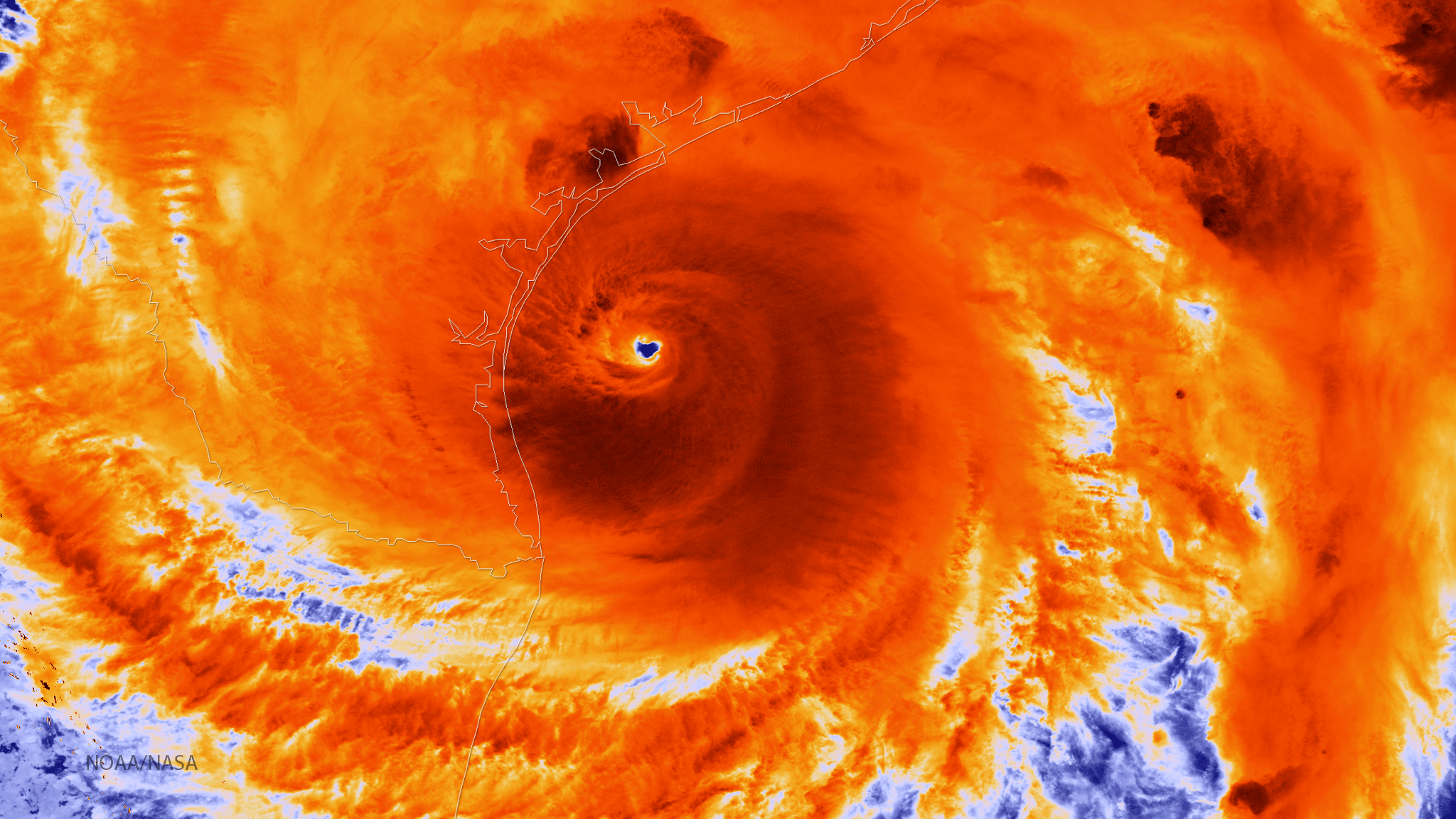
The NOAA/NASA Suomi NPP satellite captured this infrared image of Hurricane Harvey on August 25, 2017 at 18:55 UTC.
Satellite Snapshots
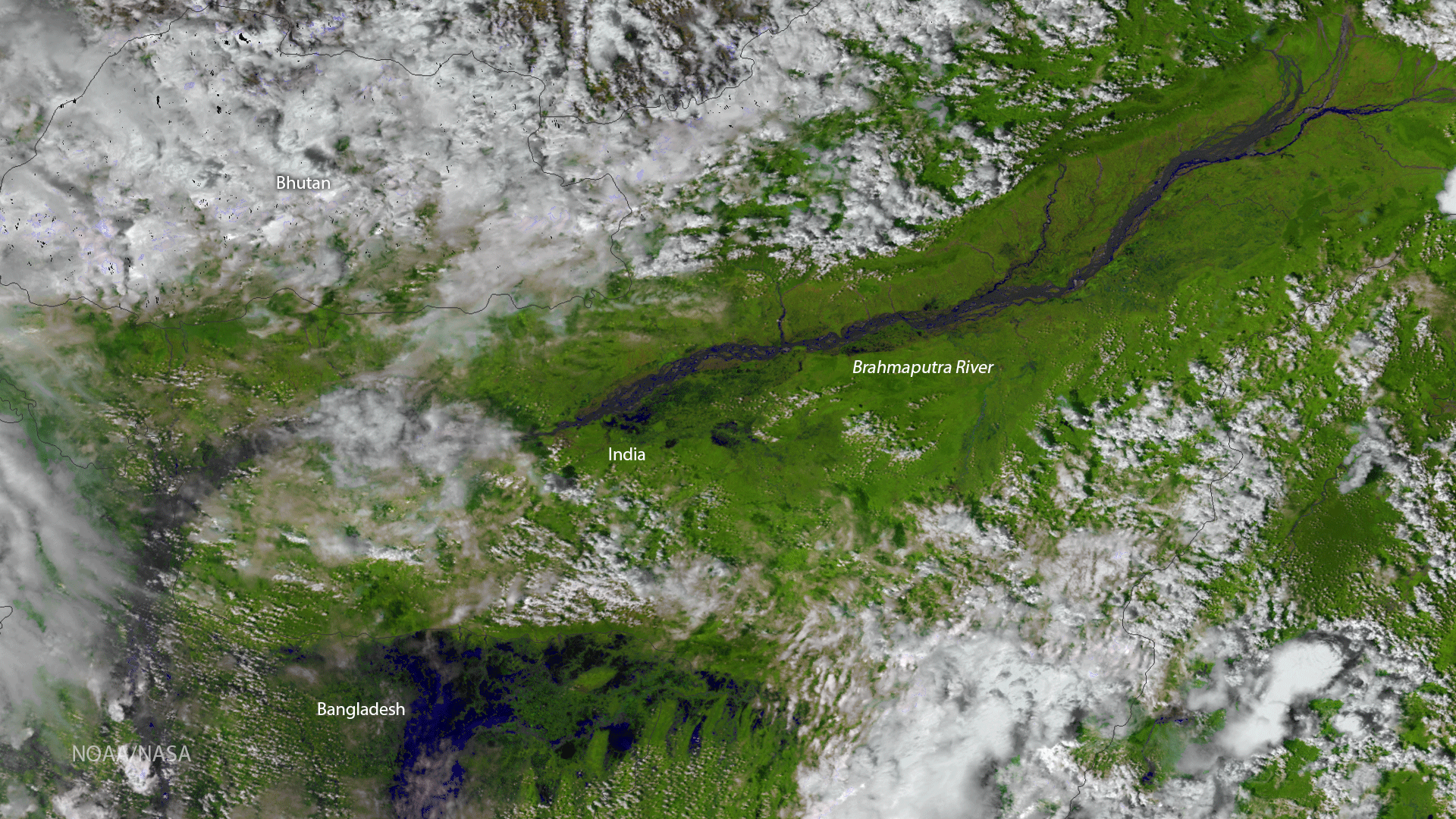
The Visible Infrared Imaging Radiometer Suite (VIIRS) instrument aboard the NOAA/NASA Suomi NPP satellite captured this color…
Satellite Snapshots
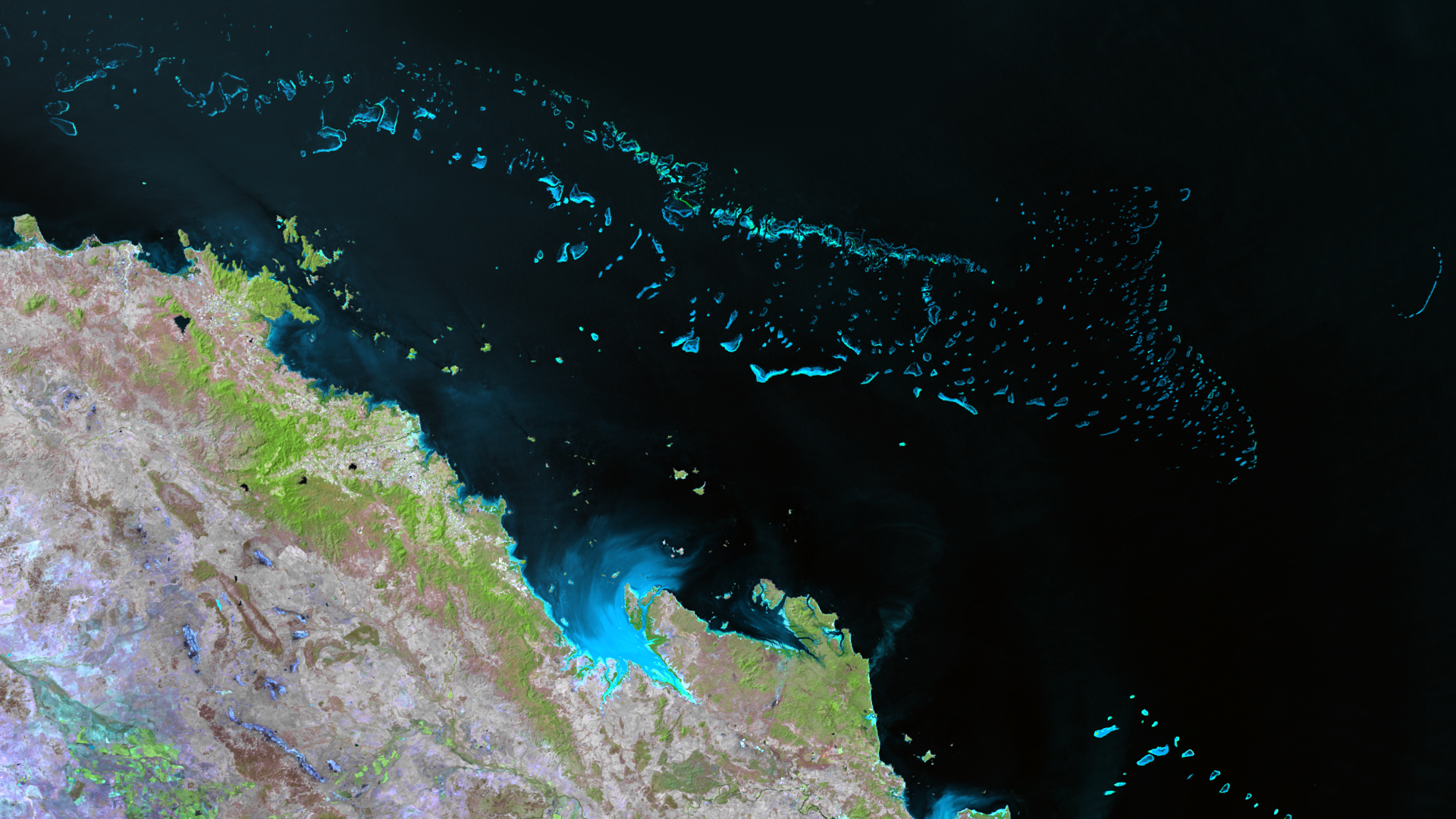
So extensive, it is visible from space, the Great Barrier Reef is the world's largest coral reef ecosystem. Stretching 2,300 km along…
Satellite Snapshots
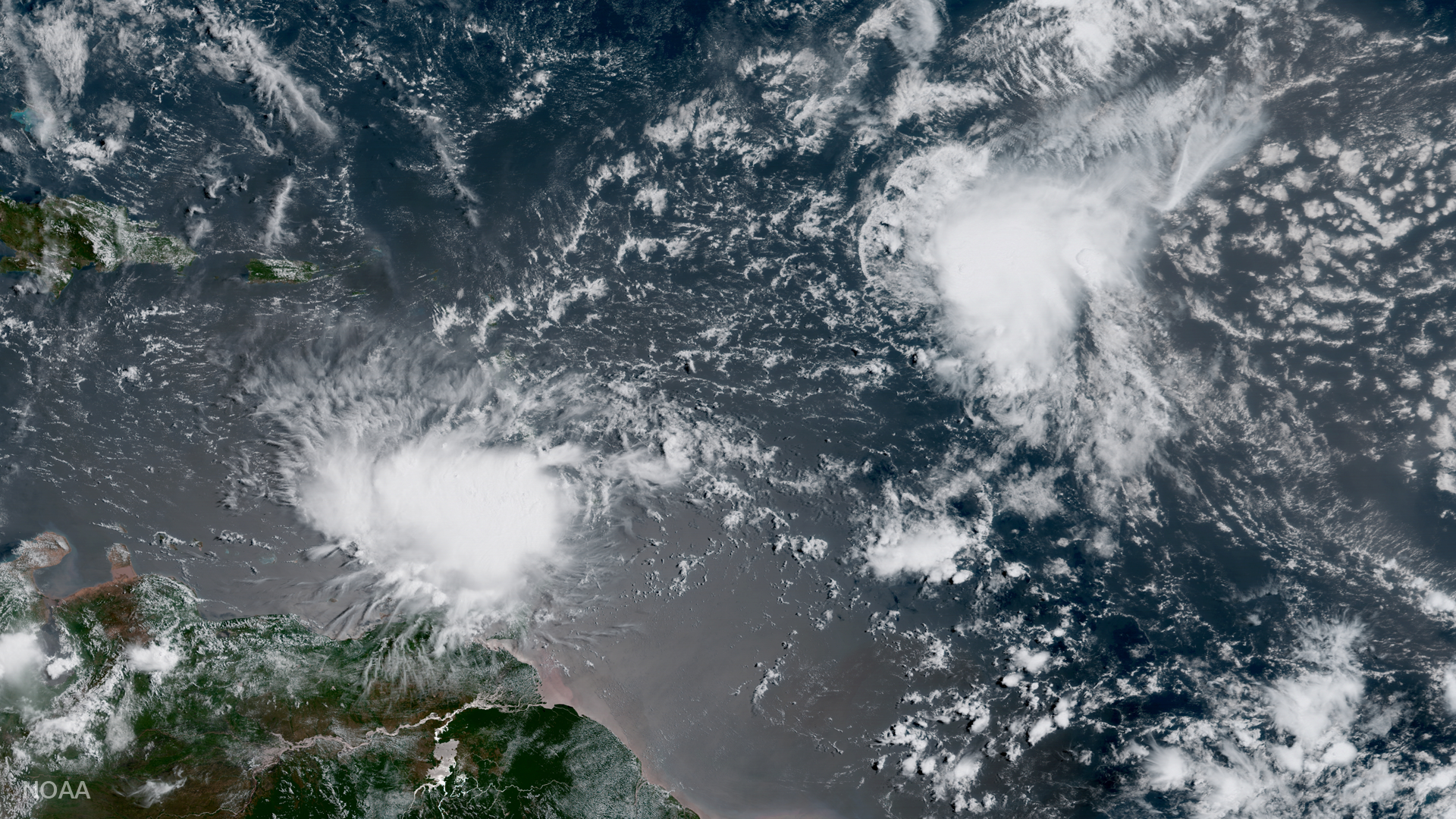
GOES-16 captured this image of Tropical Storm Harvey traversing the Windward Islands and entering the Caribbean Sea on August 18,…
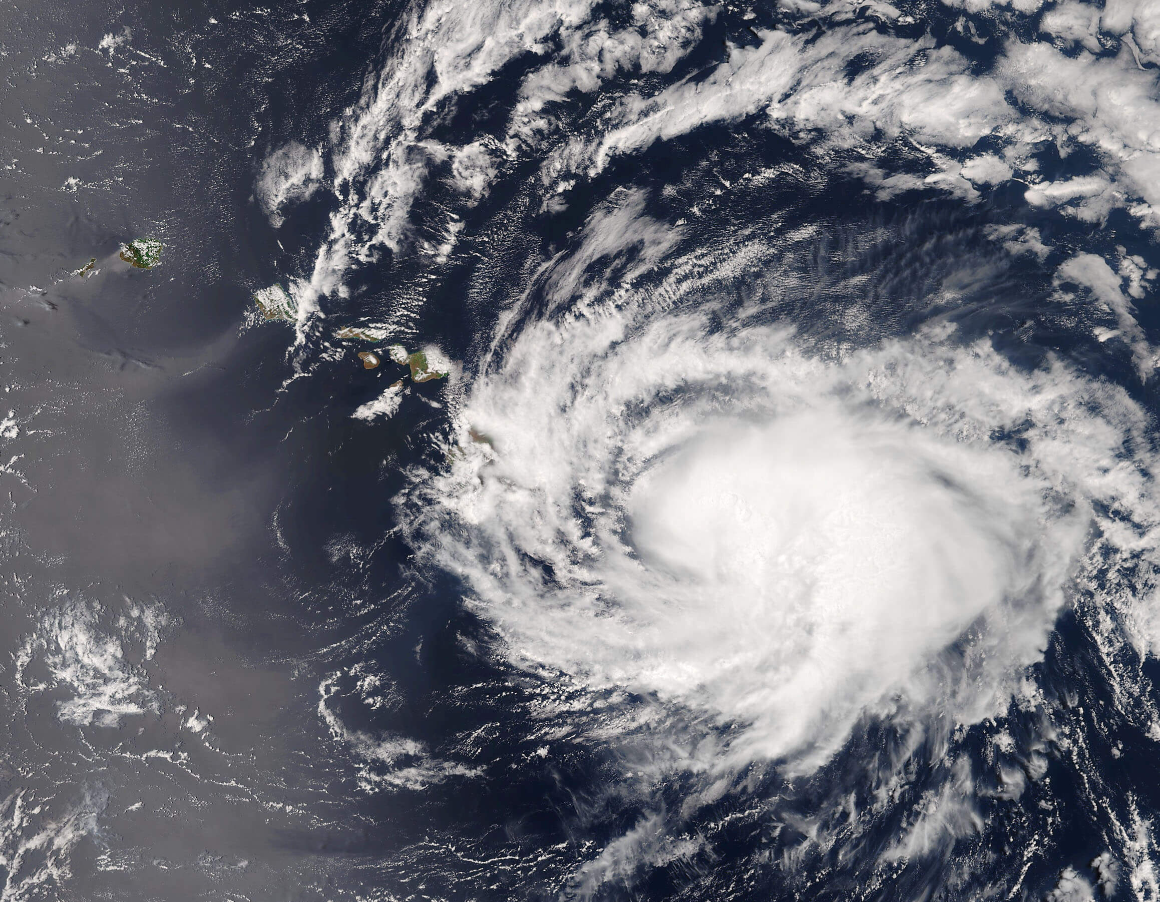
Satellite Snapshots
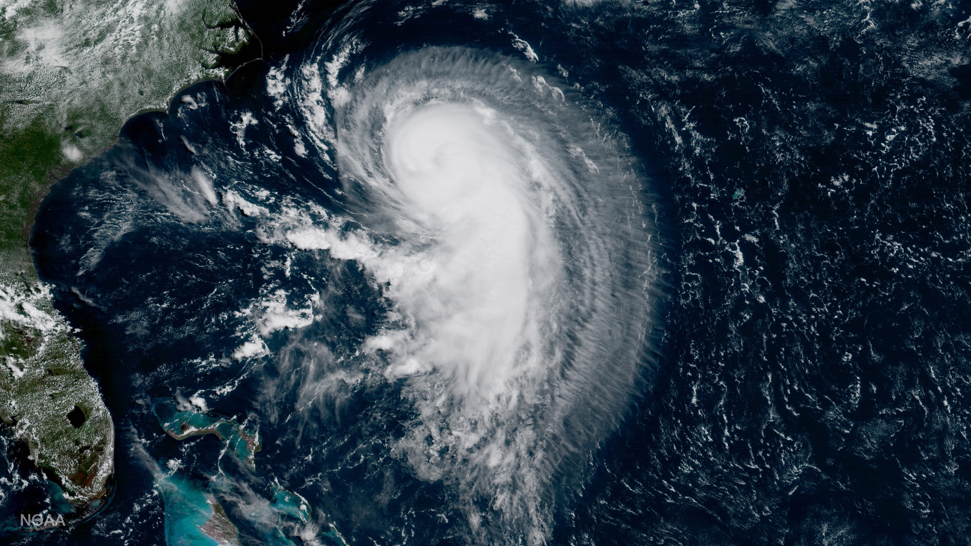
GOES-16 captured this image of Hurricane Gert in the Atlantic Ocean on August 15, 2017, 365 nautical miles west of Bermuda moving north-northeast