
Feature Story

The 8th satellite of the the Television and InfraRed Observation Satellite (or TIROS) program launched on December 21, 1963.
Satellite Snapshots
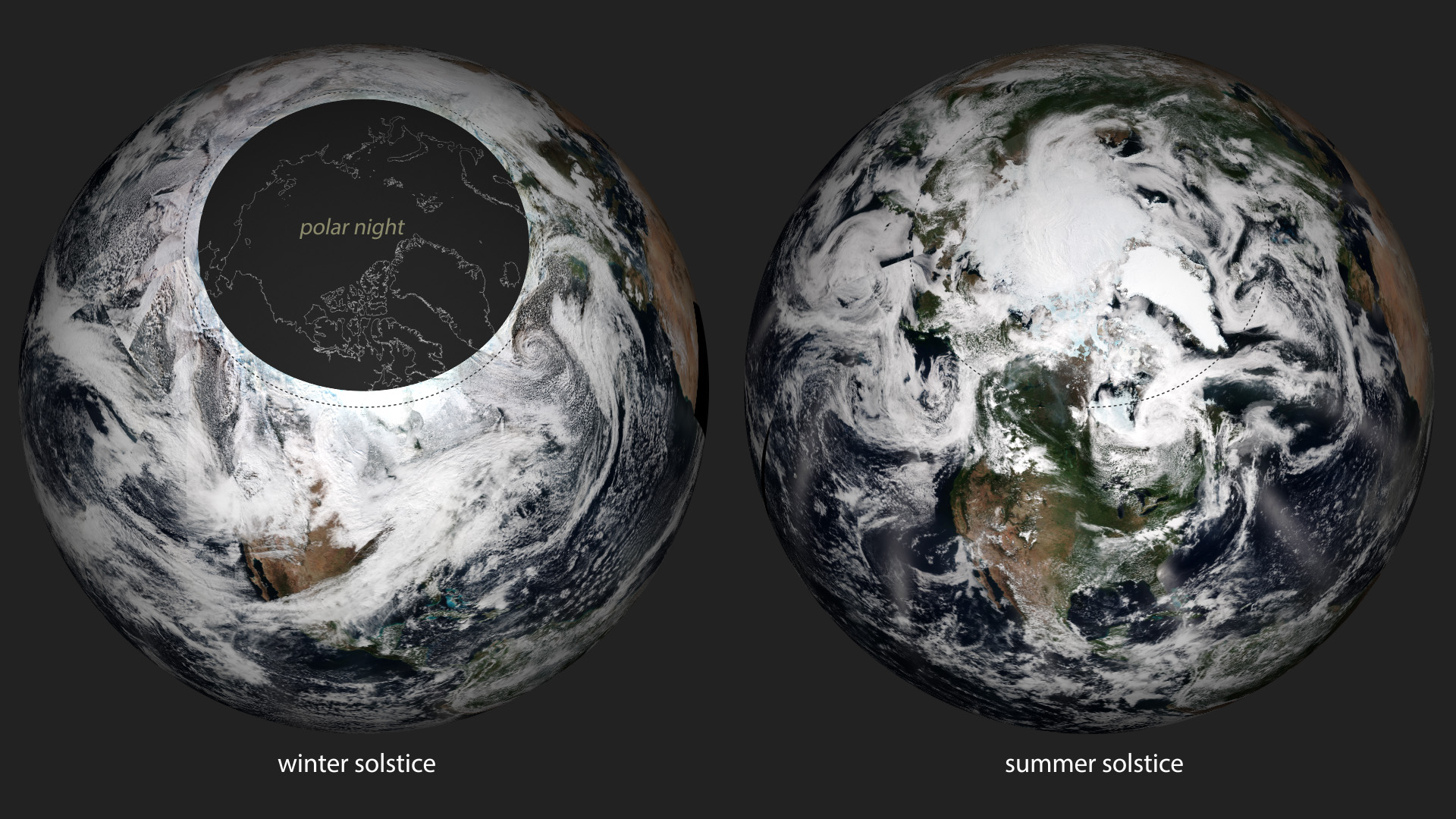
The official start of astronomical winter -- the winter solstice -- occurred at 5:44am this morning. The winter solstice is the…
Feature Story

GOES-S, the next spacecraft in the GOES-R satellite series, is undergoing environmental testing.
Feature Story

Did you know that NOAA's satellites monitor more than just weather on Earth? Our satellites also help forecasters at NOAA's SWPC.
Feature Story

The University of Colorado Laboratory for Atmospheric Physics always works an image of their mascot, Ralphie, everywhere - including on GOES-R!
Feature Story
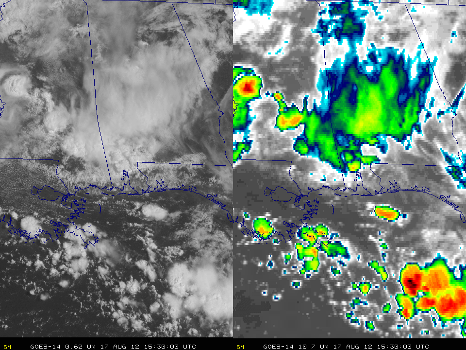
While collecting SRSO-R imagery in preparation for GOES-16's advanced capabilities, GOES-14 has seen some incredible things!…
Feature Story
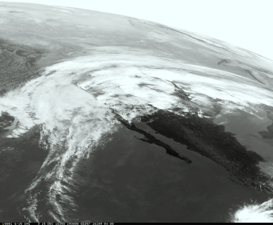
Atmospheric Rivers are a primary feature in the entire global water cycle, and are tied closely to both water supply and flood risks, particularly in
Satellite Snapshots
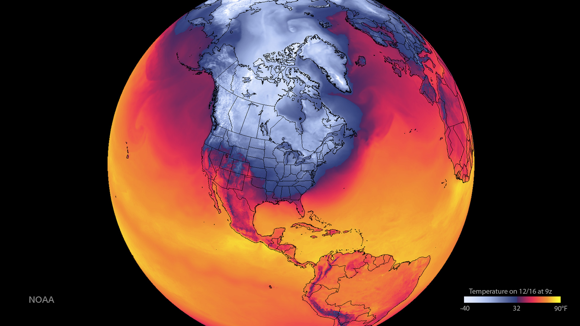
This data visualization shows the forecast minimum surface temperatures across the western hemisphere.