
Satellite Snapshots

The Jason-3 satellite, set to launch in 2016, will collect critical sea surface height data, adding to a satellite data record going back to 1992…
Satellite Snapshots

How will NOAA’s GOES-R satellite get from its current home in Colorado to Kennedy Space Center for launch in October 2016? Watch this fun video to…
Feature Story

The use of satellites to track harmful algal blooms goes back nearly 30 years, to the fall of 1987.
Satellite Snapshots
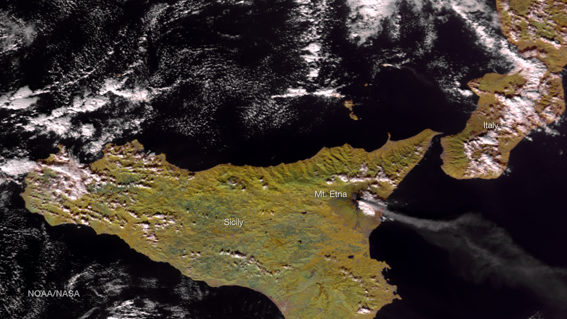
One of Mount Etna's largest eruptions in decades occurred on December 3, 2015. The Suomi NPP satellite passed over the region on…
Feature Story
How will NOAA’s GOES-R satellite get from its current home in Colorado to Kennedy Space Center for launch in October 2016? Watch this fun video.
Satellite Snapshots

Satellite science is fun for kids too! From weather and hazards on Earth to search and rescue and bursts of energy from the sun, the GOES-R satellite…
Feature Story

Did you know that the United States uses data from European polar-orbiting weather satellites, in addition to our own satellites, to help us produce o
Feature Story
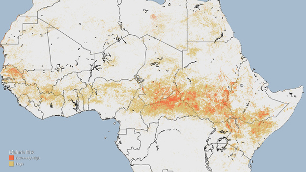
NOAA scientists are using data and imagery from polar-orbiting environmental satellites to predict malaria risk and save lives in Sub-Saharan Africa.