
Satellite Snapshots
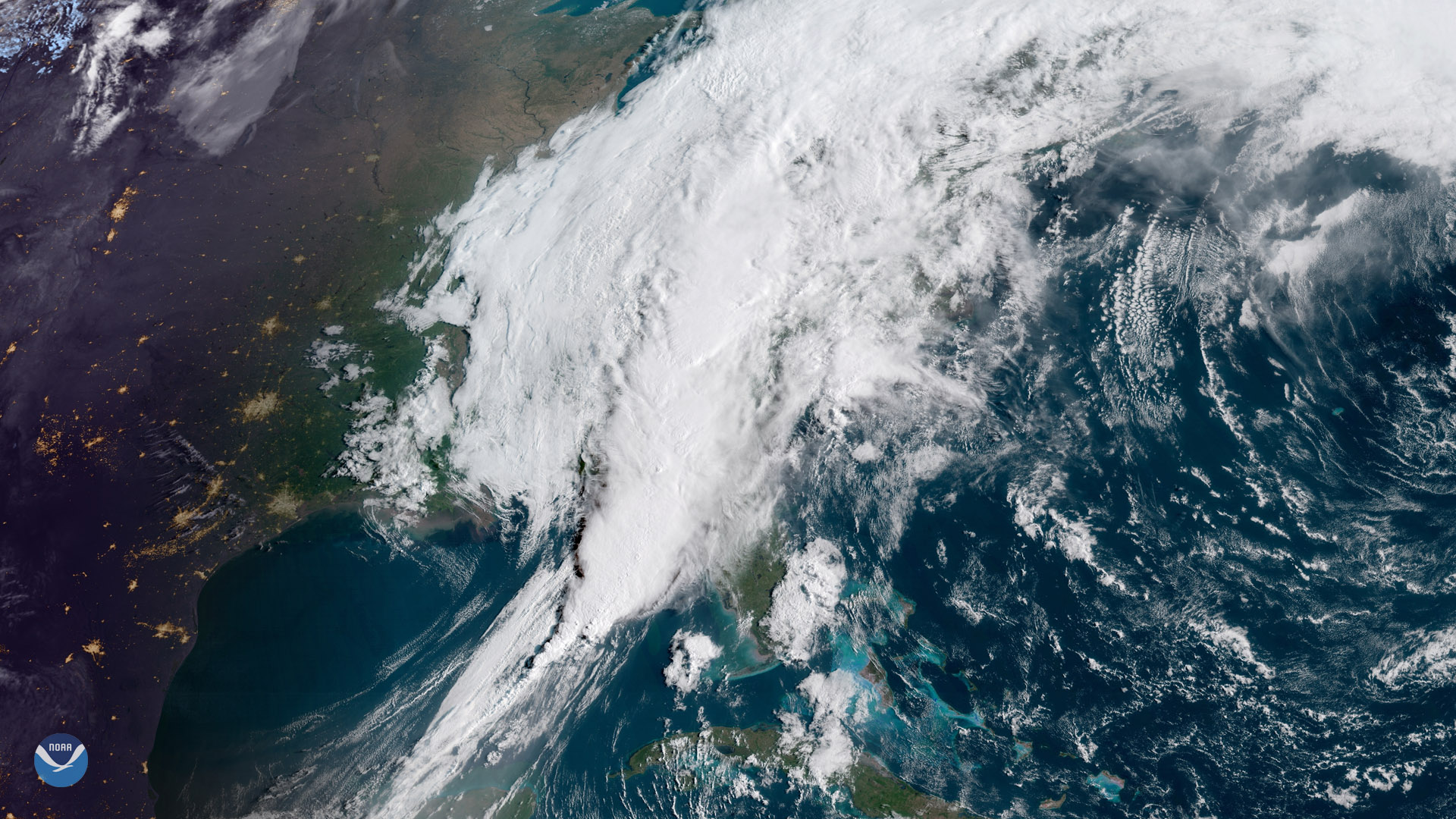
A sprawling storm system stretches from the Florida Panhandle into New England in this April 19, 2019, sunrise view from GOES East…
Satellite Snapshots
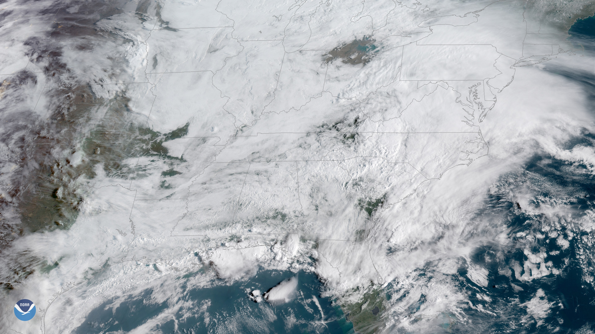
Gulf Coast thunderstorms bubble up above a blanket of clouds in this GOES East view from April 5, 2019.
Satellite Snapshots
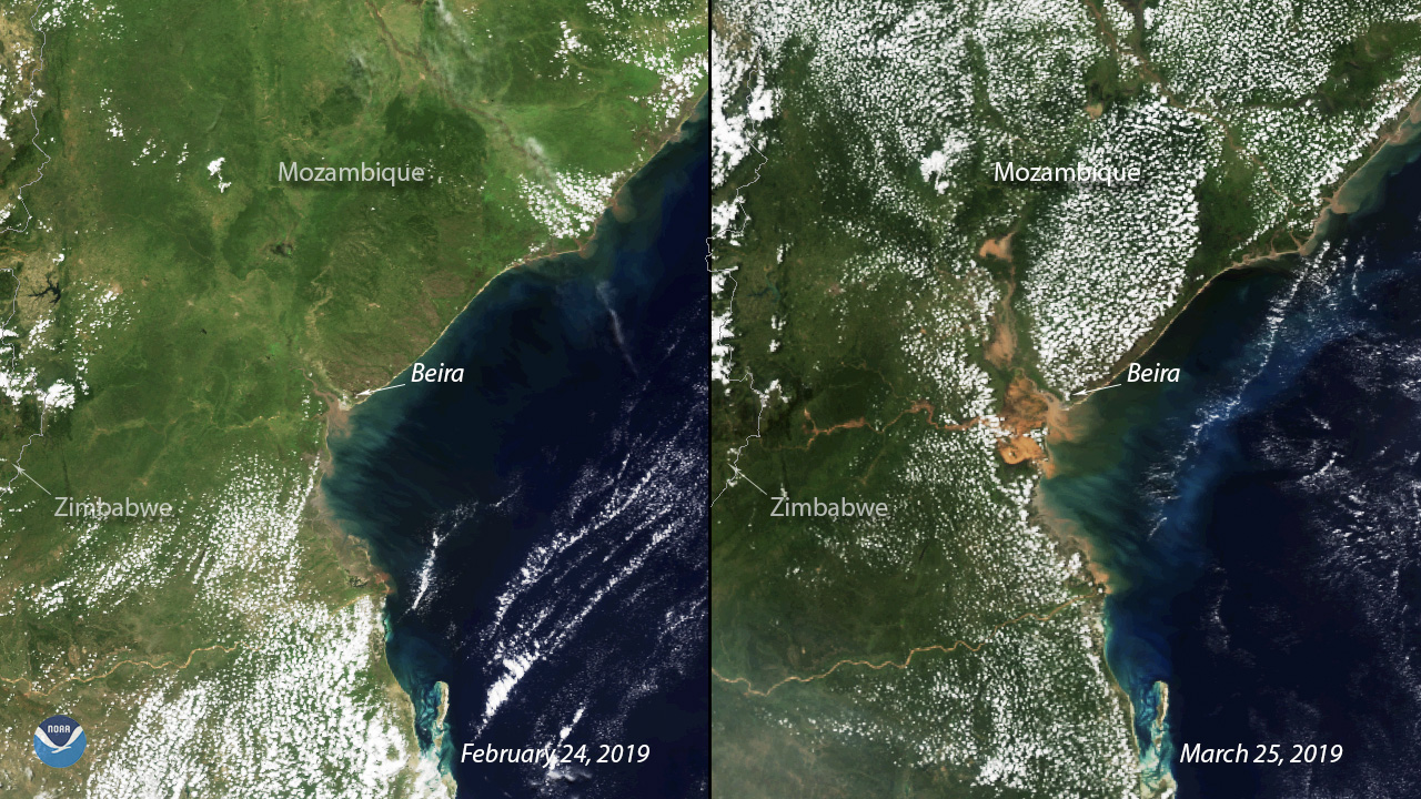
Exactly two weeks after Tropical Cyclone Idai barrelled through Mozambique’s coastal city of Beira, the devastation on the ground remains visible.
Satellite Snapshots
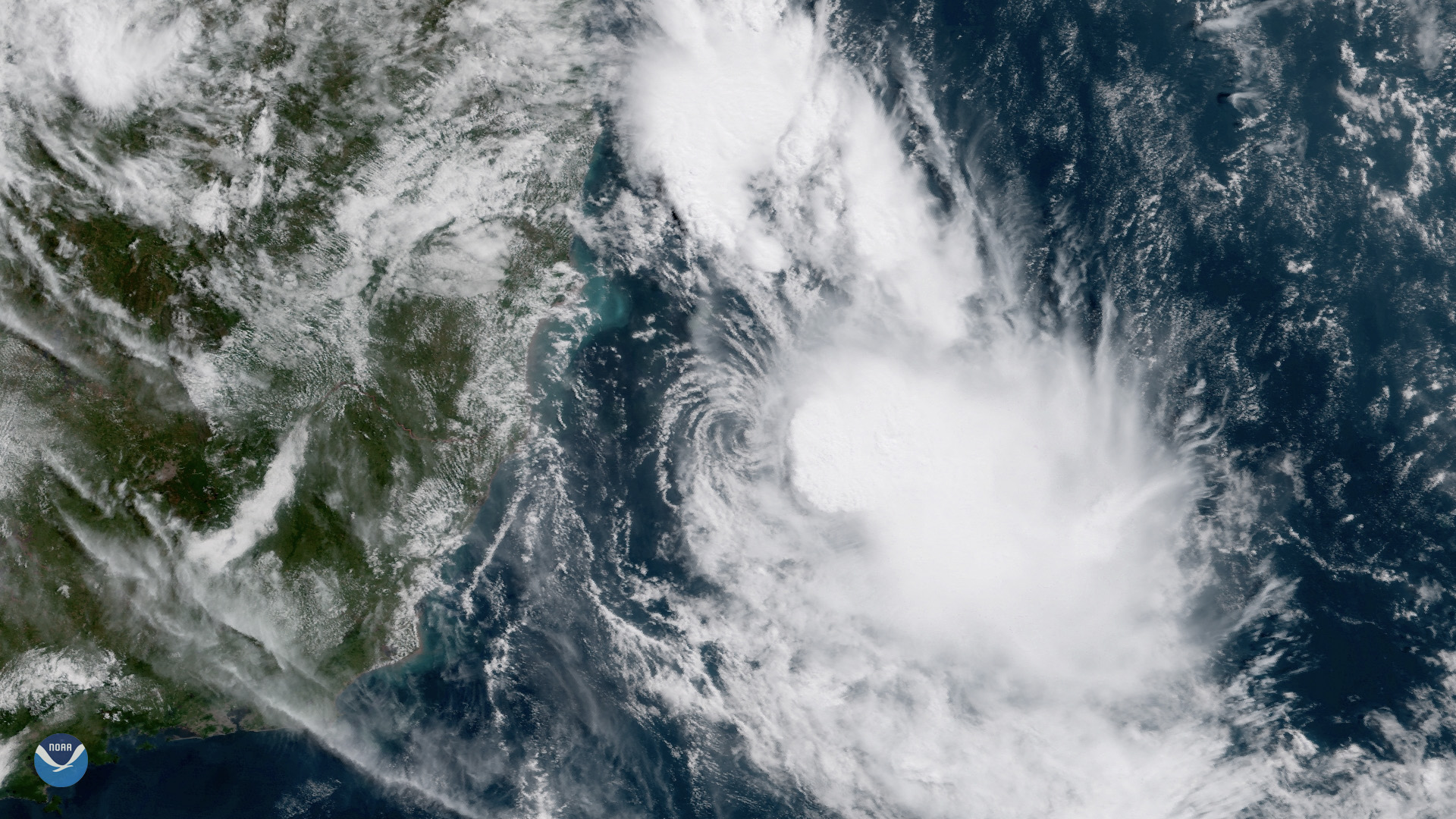
GOES East is watching Tropical Storm Iba, a rare storm that formed in the South Atlantic off the coast of Brazil on March 24, 2019.
Satellite Snapshots

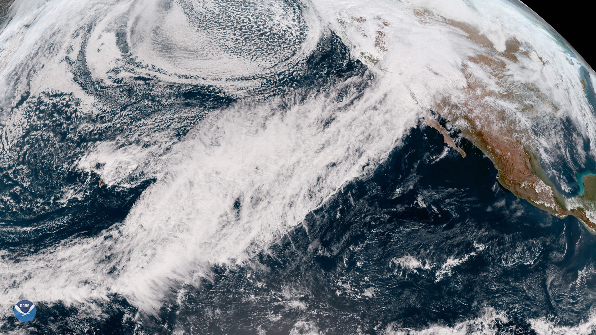
GOES West is watching an impressive low-pressure system of the coast of the Aleutian Islands that stretches to Hawaii.
Satellite Snapshots

GOES West captured this view of a powerful winter storm system on March 13, 2019 that is projected to sweep across much of the Central United States.
Feature Story
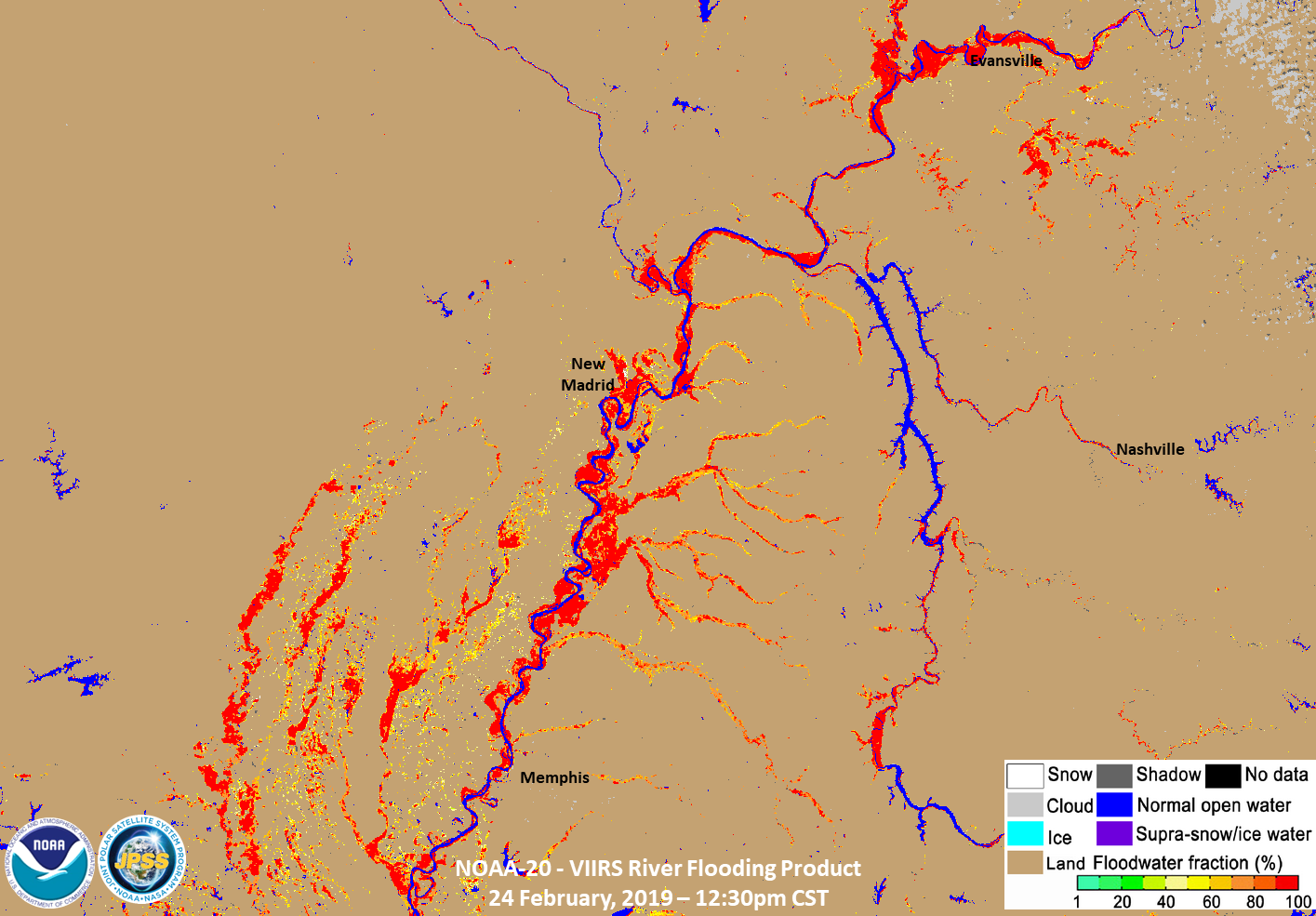
The severe storms that brought tornadoes, damaging winds, rain, and hail to the Southeast over the weekend, leaving tens…
Satellite Snapshots
Satellite imagery shows an atmospheric river that drenched California with heavy rain and mountain snow this week.