
Satellite Snapshots
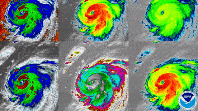
GOES-East satellite watched Hurricane Laura this week, this is how the storm looked via the different spectral bands...
Feature Story
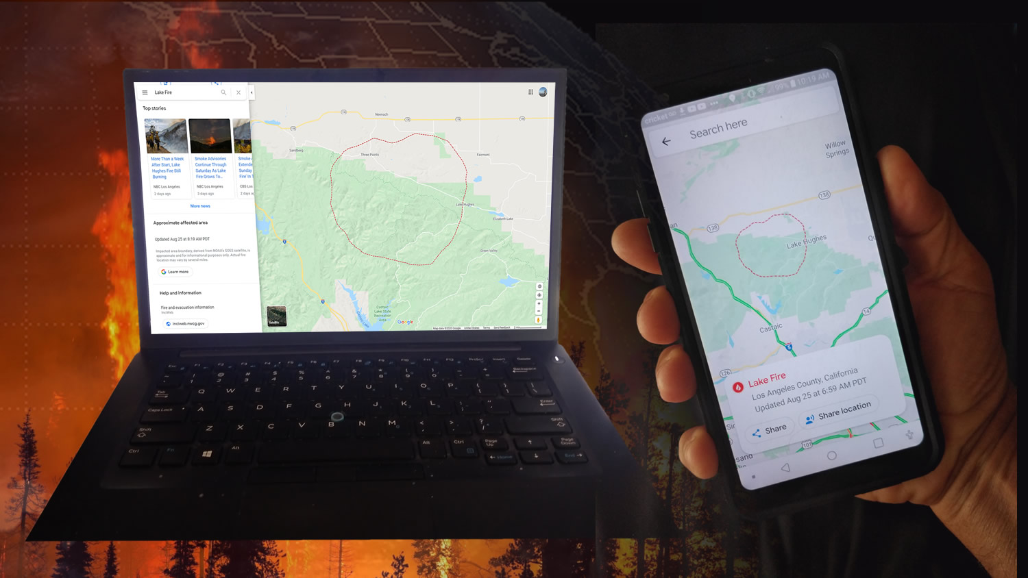
NOAA’s GOES-16 (GOES-East) and GOES-17 (GOES-West) satellites are helping the public see where active wildfires are and avoid dangerous situations.
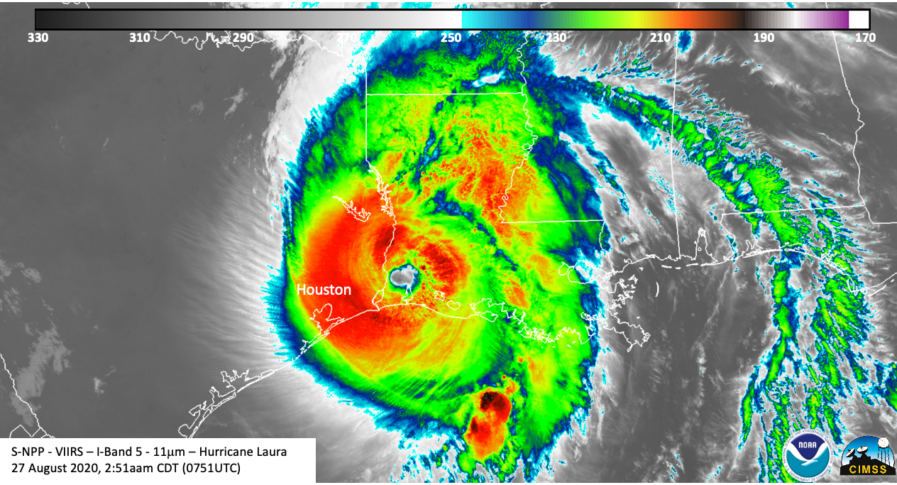
Satellite Snapshots
August 27, 2020 During the early morning hours of August 27, 2020, NOAA’s GOES-East saw Hurricane Laura make landfall at Cameron, Louisiana. While it…
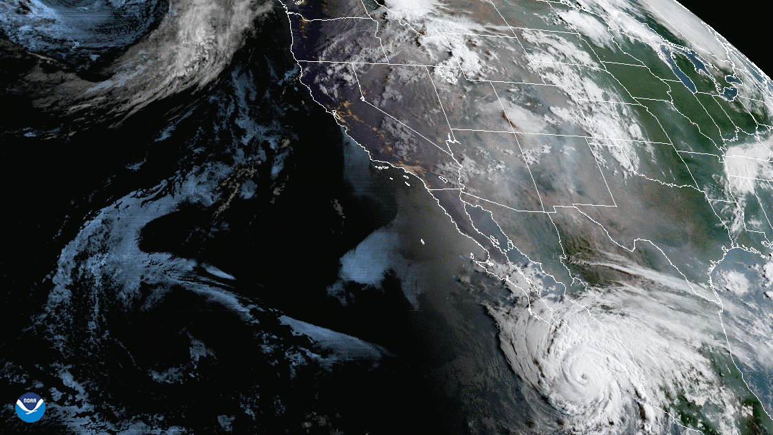
Satellite Snapshots
August 24, 2020 On August 24, 2020, NOAA’s GOES-East satellite was tracking two tropical systems, one in the Gulf of Mexico, the other in the…
Feature Story
Hurricane Laura made landfall Thursday morning, hammering the Louisiana and Texas coasts with 150 mile-per-hour winds
Satellite Snapshots
On Aug. 19, 2020, NOAA’s GOES-West satellite captured the above GeoColor image loop of massive wildfire smoke plumes billowing from…
Satellite Snapshots
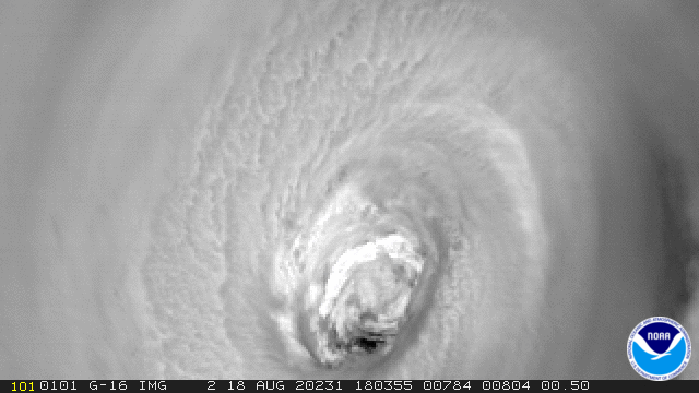
August 19, 2020 Hurricane Genevieve, as seen by NOAA’s GOES-East satellite on August 18, 2020, first appeared as Tropical Depression Twelve-E in the…
Feature Story

A new product that alerts pilots to clouds, icy conditions and dangerously cold temperatures is tapping into NOAA’s Joint…