
June 10, 2020 Talk about dust in the wind! This plume blowing west over the Atlantic from the Sahara desert was captured on June 7, 2020 by the NOAA…
Satellite Snapshots
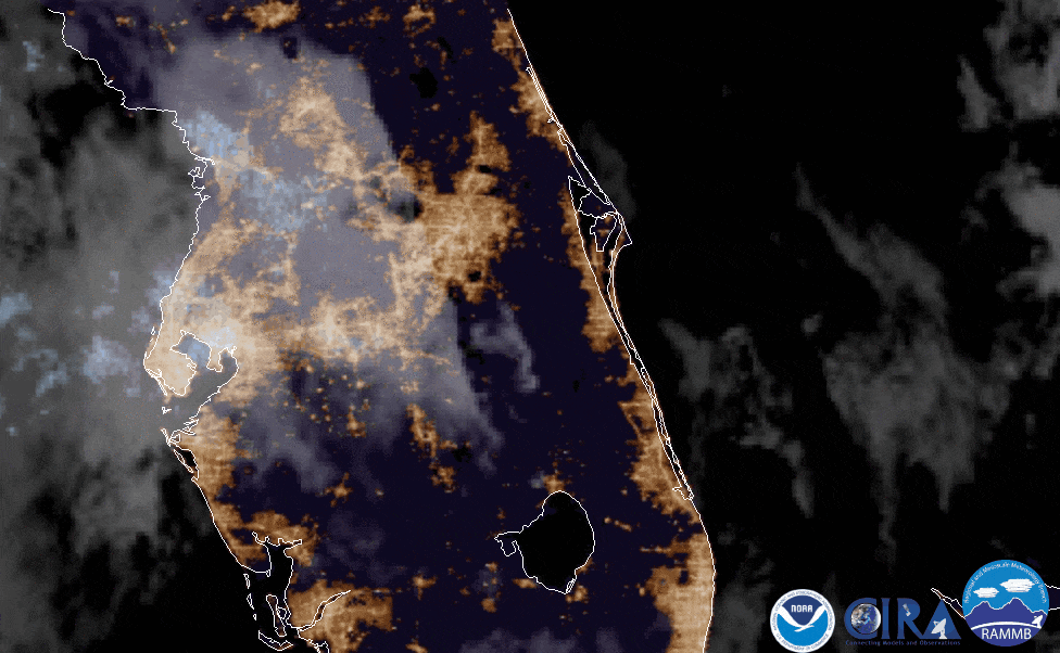
On June 9, 2020, the GOES East satellite captured imagery of fallstreak holes (AKA: hole punch clouds) over Florida.
Satellite Snapshots
June 09, 2020 From June 1–9, 2020, NOAA’s GOES-East satellite viewed the formation, development, and dissipation of two tropical cyclones, Amanda and…
Satellite Snapshots

The GOES-R series and NOAA-20 satellites help play a pivotal role in monitoring the health of coral reefs around the world.
Feature Story
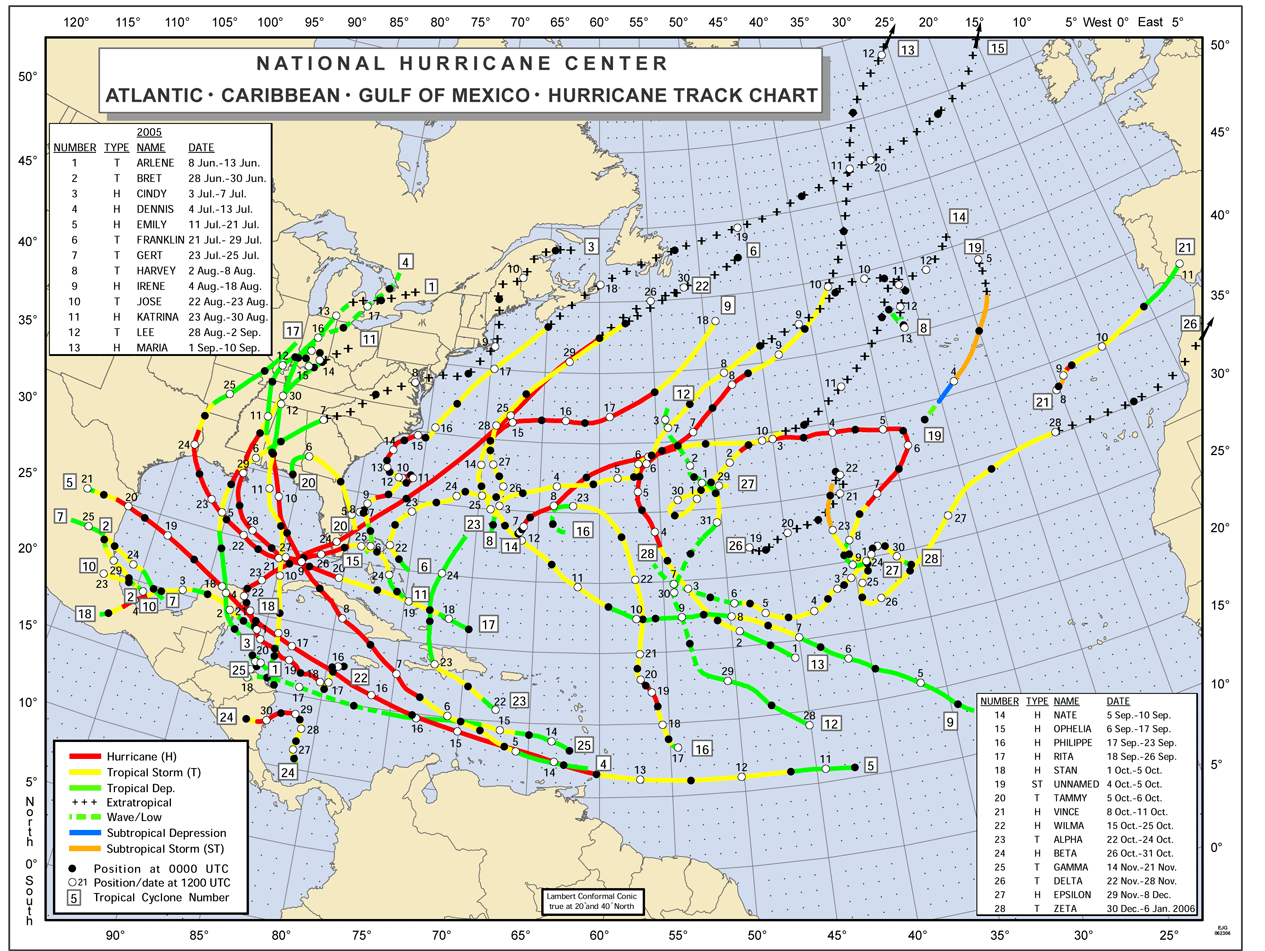
The incredible 2005 Atlantic hurricane season smashed many long-standing records. Some of the words used to describe it included,…
Satellite Snapshots
Himawari-8 watched a swirling low pressure storm system kick up dust and sand from the Gobi Desert into China.
Satellite Snapshots
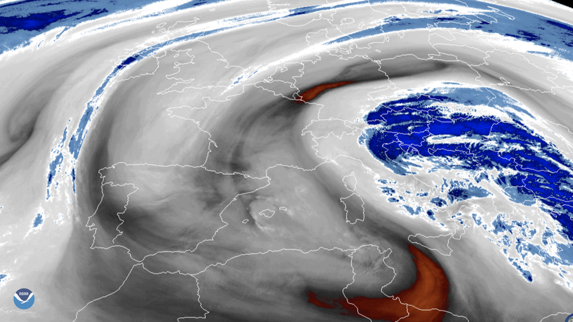
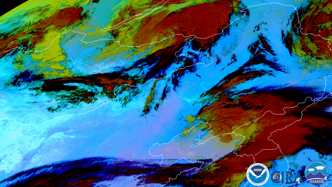
March 26, 2020 On March 26, 2020, the Meteosat-11 satellite viewed Italy and the surrounding Mediterranean Sea, where a low pressure system is making…
Satellite Snapshots
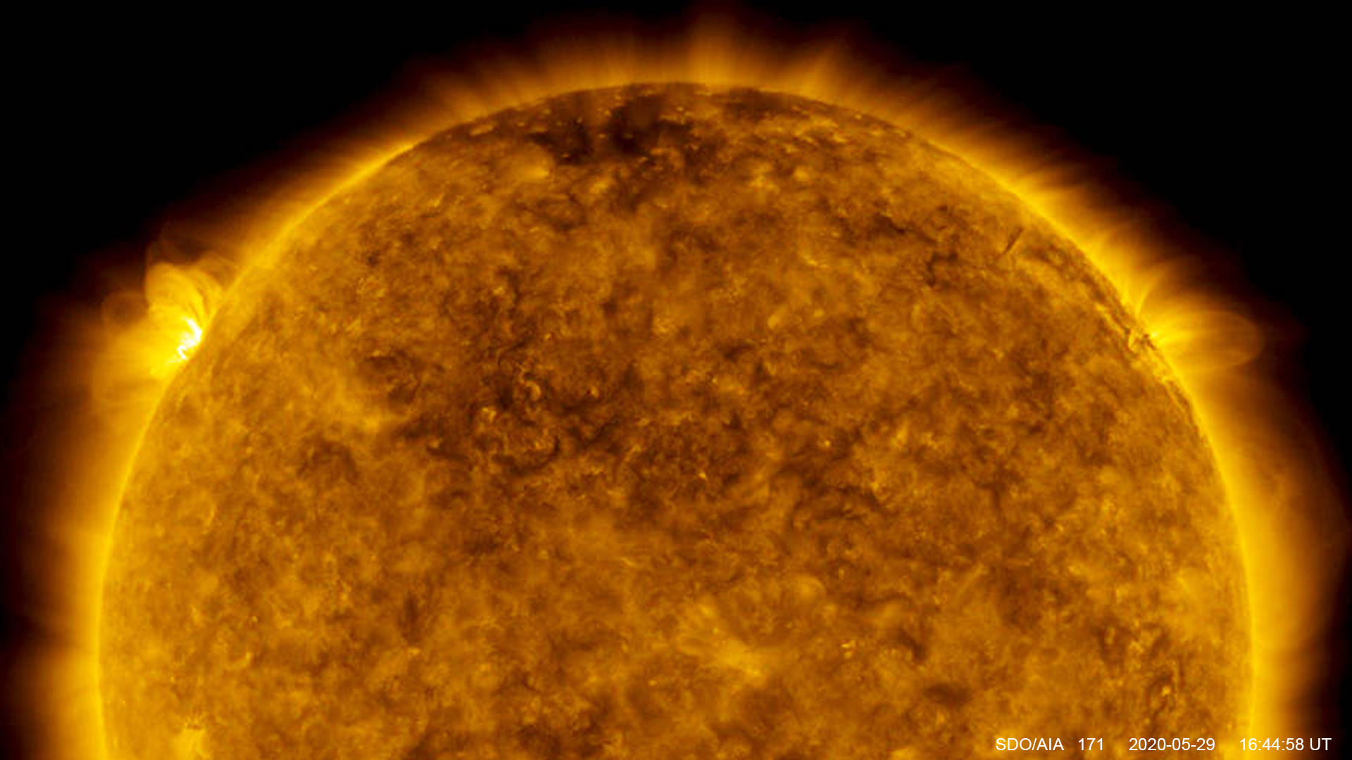
On May 29, 2020, NASA's Solar Dynamics Observatory captured the largest solar flare since October 2017.