

NESDIS education strives to provide educational material for teachers nationwide. Our goal is to help students understand the science behind satellite data and its impact on our world. Use the engaging educational resources, games, simulations, and videos below to help inspire the next generation of scientists.
Educational Resources Directory
Breathing clean air is important for your health but with wildfire smoke, air pollution and viruses it can sometimes feel difficult to “breathe easy.” This activity shows how to build a simple Corsi-Rosenthal box, a simple, inexpensive, but effective tool used to filter air indoors.

While the JPSS satellites observe the aurora in black and white, here's your students’ chance to add a splash of color! Let your students’ creativity shine as they capture the magic of an aurora using watercolors or tissue paper.

JPSS satellites piece together the Earth like a puzzle! This activity uses real JPSS imagery to create an easily printable puzzle of the Great Lakes region over the course of four seasons. Learn about the meteorological and astronomical seasons while completing this challenging puzzle.

Create Earth's changing greenery with paint dots, representing JPSS satellite observations of North America during each season.

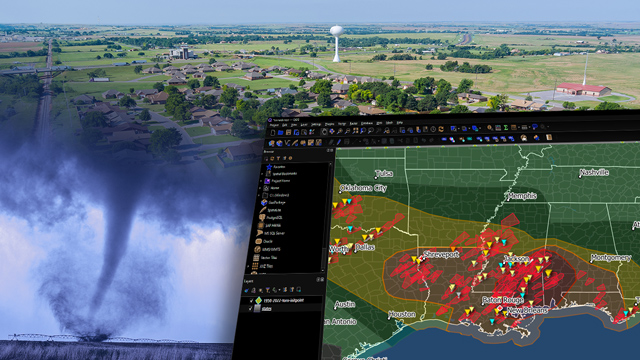
This activity guides students through the process of making a basic GIS map showing tornado touchdowns.
Learn about the satellites that monitor extreme weather and provide data for the daily forecast in this immersive AR app.

Data from NOAA’s JPSS satellites help us monitor extreme weather and plan for it in advance. This activity introduces children to the concept of creating a household emergency plan.

JPSS Loves Earth! Color the Earth and all of the things that JPSS data helps to protect.
