

NESDIS education strives to provide educational material for teachers nationwide. Our goal is to help students understand the science behind satellite data and its impact on our world. Use the engaging educational resources, games, simulations, and videos below to help inspire the next generation of scientists.
Educational Resources Directory
Earth has seasons because its axis is tilted. Earth’s axis is always pointed in the same direction, so different parts of Earth get the sun’s direct rays throughout the year. For example, in summer, the sun's rays hit that region more directly than at any other time of the year.

Our star–the sun–is made up of a bubbling, boiling substance called plasma. The sun constantly belches out great clouds of hot plasma.

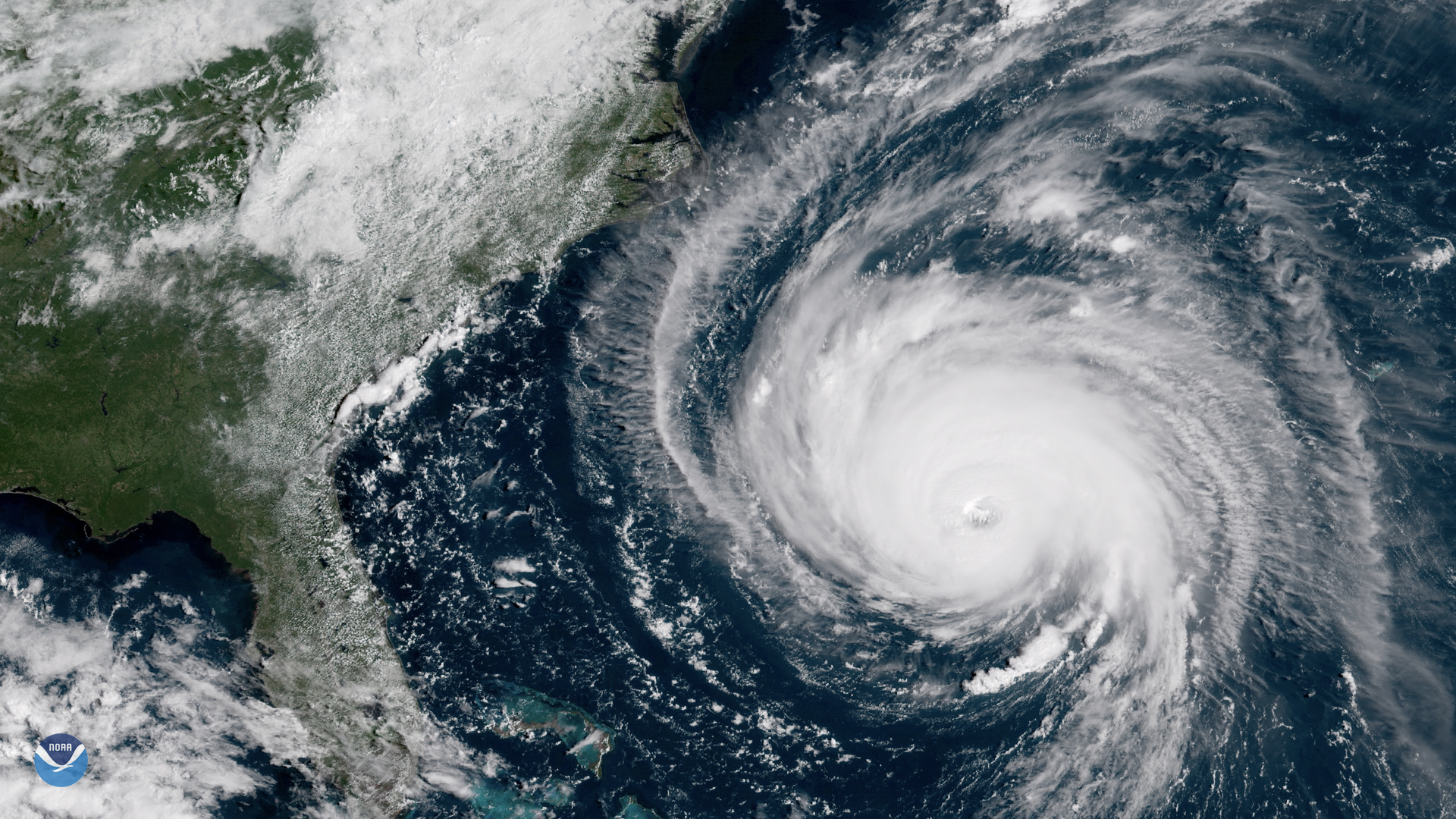
Hurricanes are the most violent storms on Earth. They form near the equator over warm ocean waters. Actually, the term hurricane is used only for the large storms that form over the Atlantic Ocean or eastern Pacific Ocean.
The polar vortex is a low pressure area—a wide expanse of swirling cold air—that is parked in polar regions. During winter, the polar vortex at the North Pole expands, sending cold air southward.

Introduce young learners to the concept of graphing in this "Battleship" game. Referencing weather factors from JPSS data to inform aviation safety.

This lesson will help students understand the never-ending scientific process of Earth’s Water Cycle through the development of a zine (self-published booklet) focusing on the topic.

This activity encourages students to use JPSS maps, data, and imagery to solve the mystery of a missing person using clues in an escape room style. Students will be exposed to actual satellite imagery of the ocean and test their graph reading skills.

JPSS studies the Earth's processes that cause the weather; temperature, air pressure, humidity, clouds and wind. In this activity you'll learn about wind and weather while crafting your own windsock!
