
Satellite Snapshots
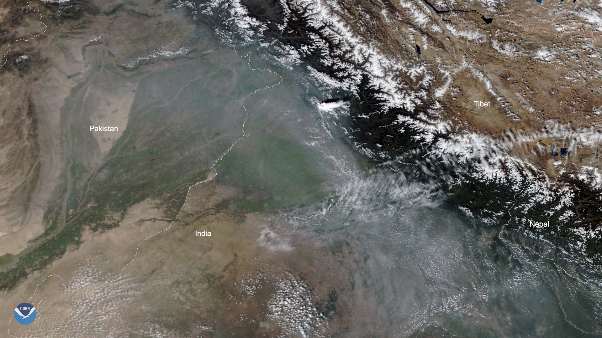
Smoke from fires in northeastern Pakistan and northwestern India can be clearly seen in this imagery captured by the NOAA-20…
Satellite Snapshots
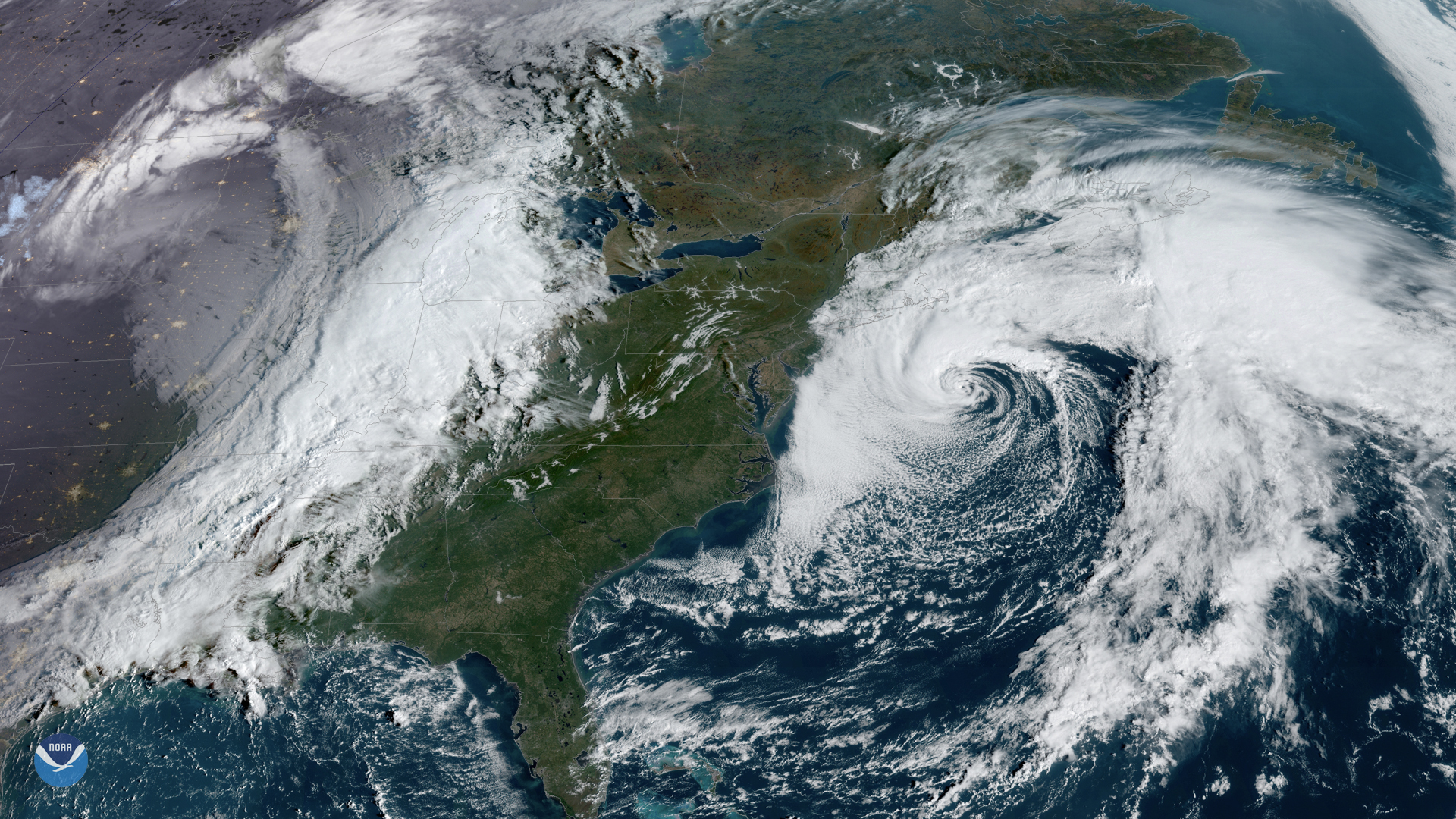
GOES East captured this awe-inspiring view of two large storm systems over North America on Friday, Oct. 11, 2019. To the west, a…
Feature Story
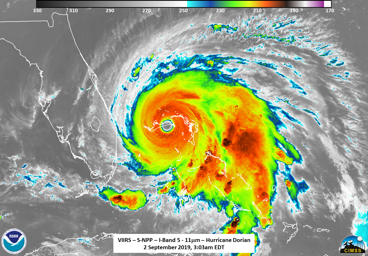
As Hurricane Dorian made landfall over two islands in the Bahamas, NOAA's Joint Polar Satellite System satellites captured these infrared images.
Satellite Snapshots
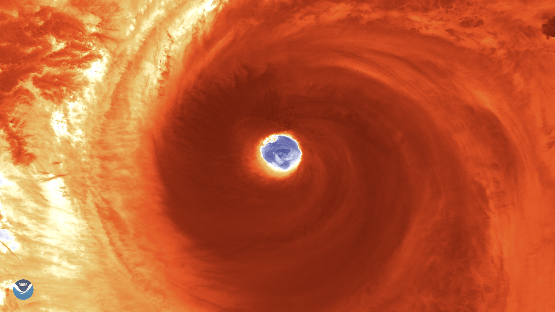
Japan is bracing for a possible hit from Super Typhoon Hagibis, as the monstrous storm located some 600 miles south of Yokosuka,…
Feature Story
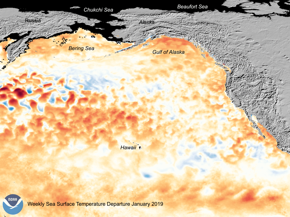
The new marine heat wave off the Pacific Coast is reminiscent of the early stages of the 2014–2016 “blob” that devastated…
Satellite Snapshots
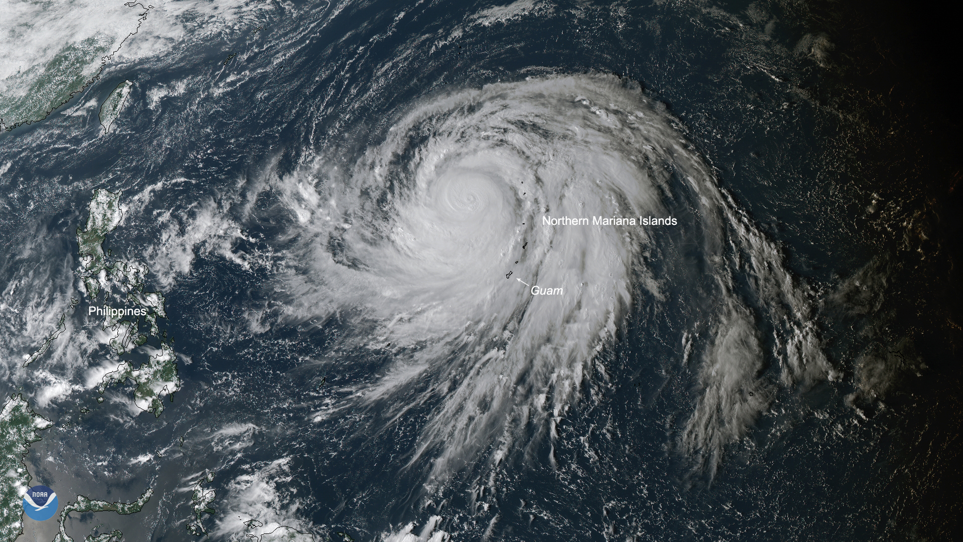
Super Typhoon Hagibis is currently the strongest storm on the planet, with the potential to become the strongest of the year.
Announcement

NOAA issued two Broad Agency Announcements, seeking fresh ideas for new instrument technologies and concepts for future use on its advancedgeostationa
Satellite Snapshots

GOES East watched a large low pressure system swirl over the Eastern United States and Canada on Sunday, Oct. 6, 2019, which brought…