
Satellite Snapshots

The Suomi NPP satellite zoomed in on the Decker Fire in Colorado on Oct. 2, 2019.
Satellite Snapshots
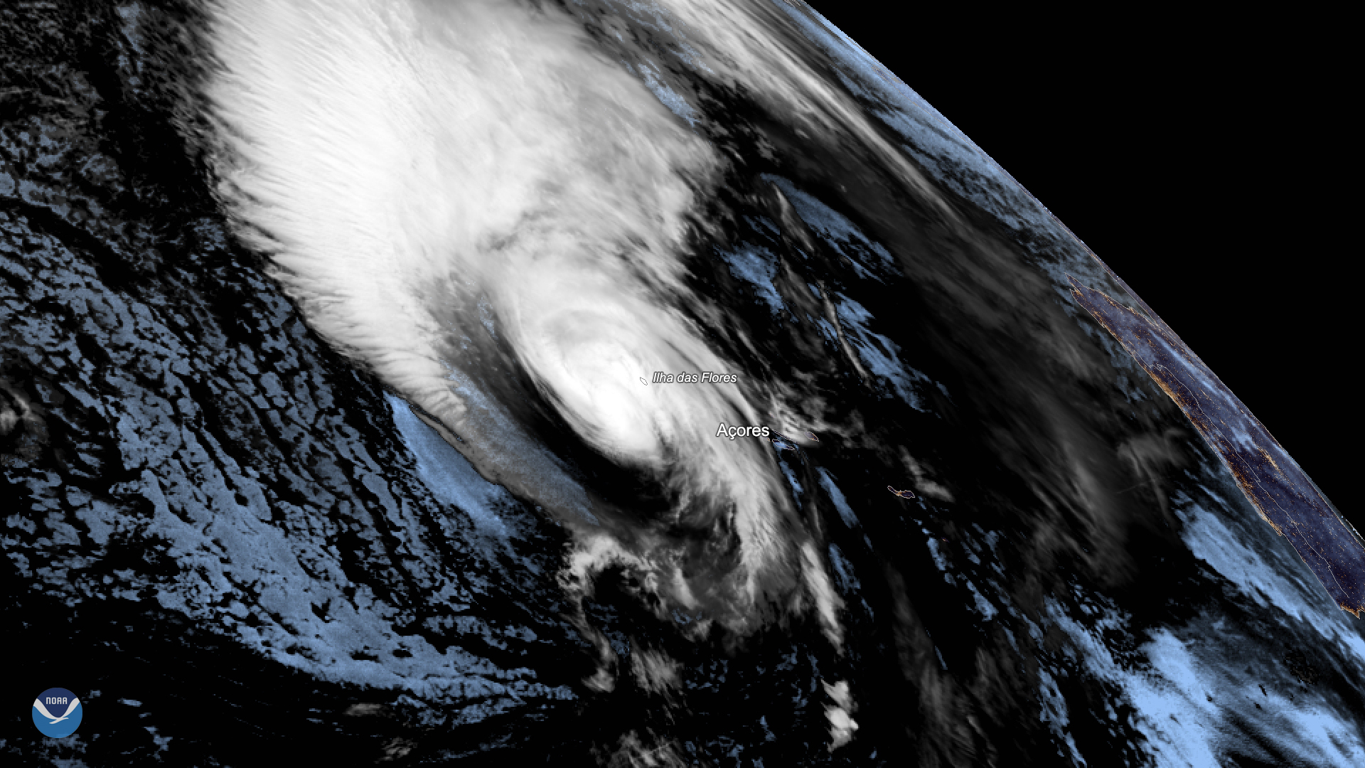
Hurricane Lorenzo lashed Portugal’s Azores Islands early Wednesday morning, toppling trees and downing power lines as the then…
Satellite Snapshots
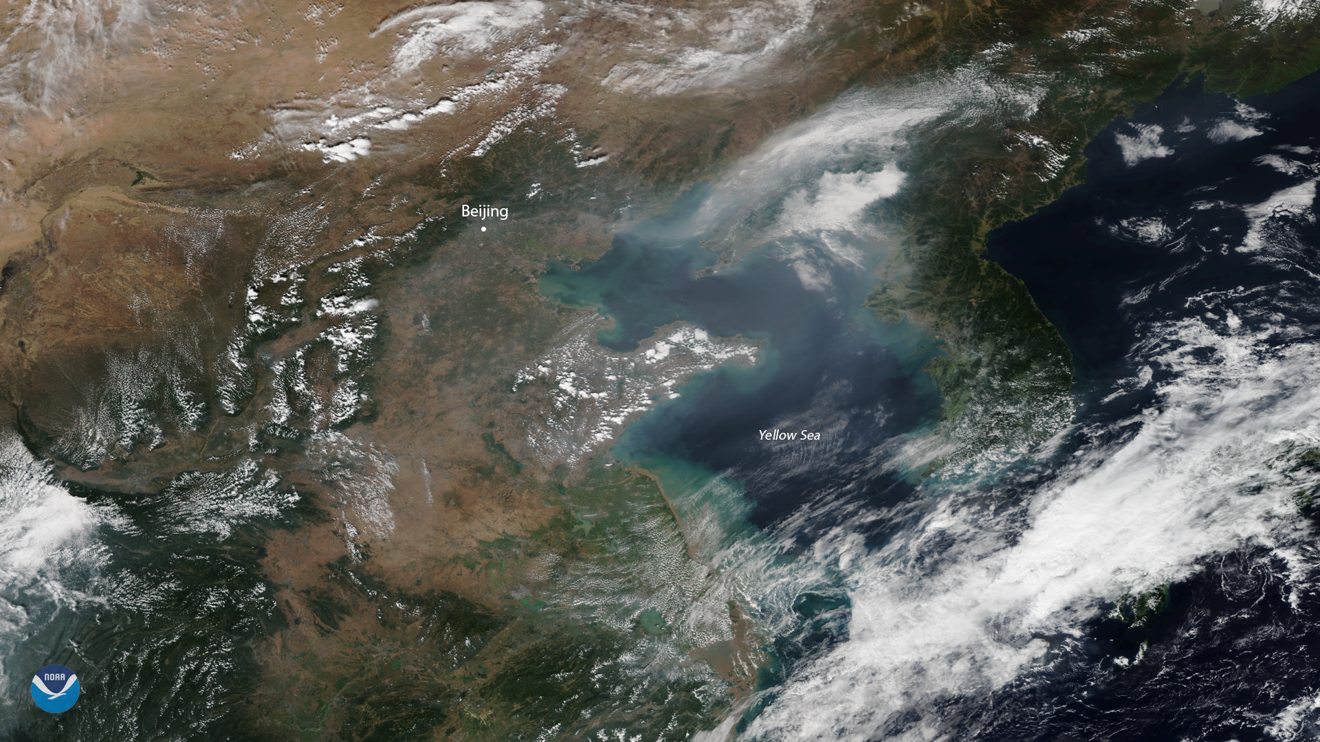
The NOAA-20 satellite spied heavy smog over China's capital city of Beijing on Sept. 29, 2019.
Satellite Snapshots
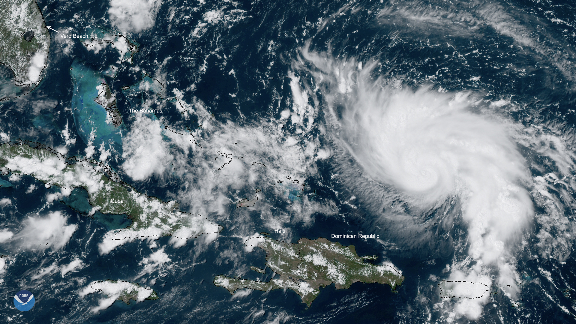
NOAA’s GOES East satellite zoomed in on Category 1 Hurricane Dorian on Thursday, Aug. 29, 2019 over the open waters of the Atlantic Ocean
Satellite Snapshots
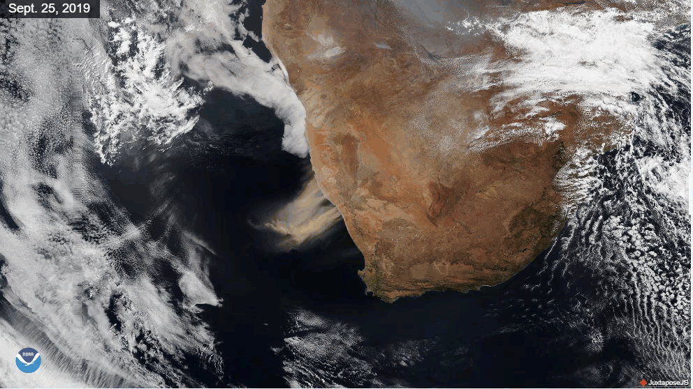
Very strong winds over southern Africa kicked up huge plumes of dust and sand, turning the skies an earthy red on Sept. 25, 2019.
Announcement

NOAA today announced Dr. Karen St. Germain, an accomplished remote sensing engineer and long-time leader in the development of federal space programs,
Satellite Snapshots
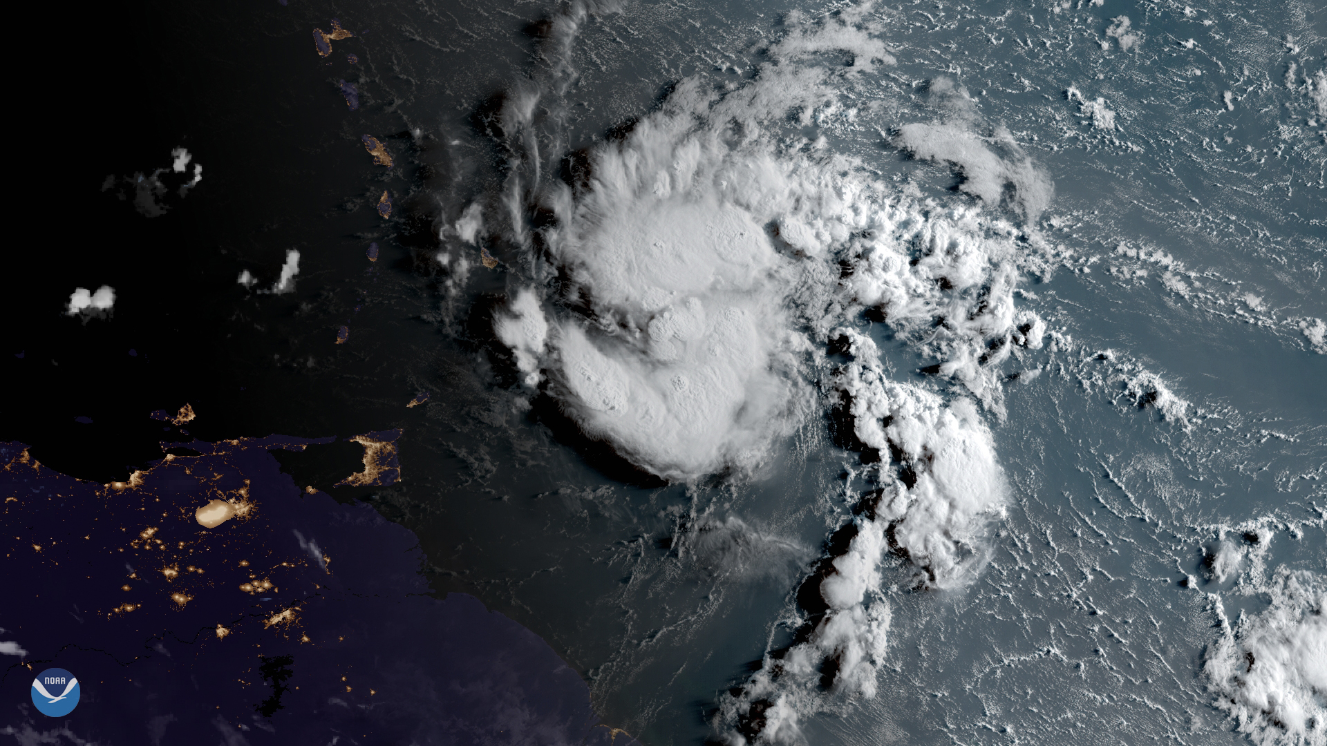
GOES East has been watching a tropical system just east of the Lesser Antilles, which became Tropical Storm Dorian
Satellite Snapshots
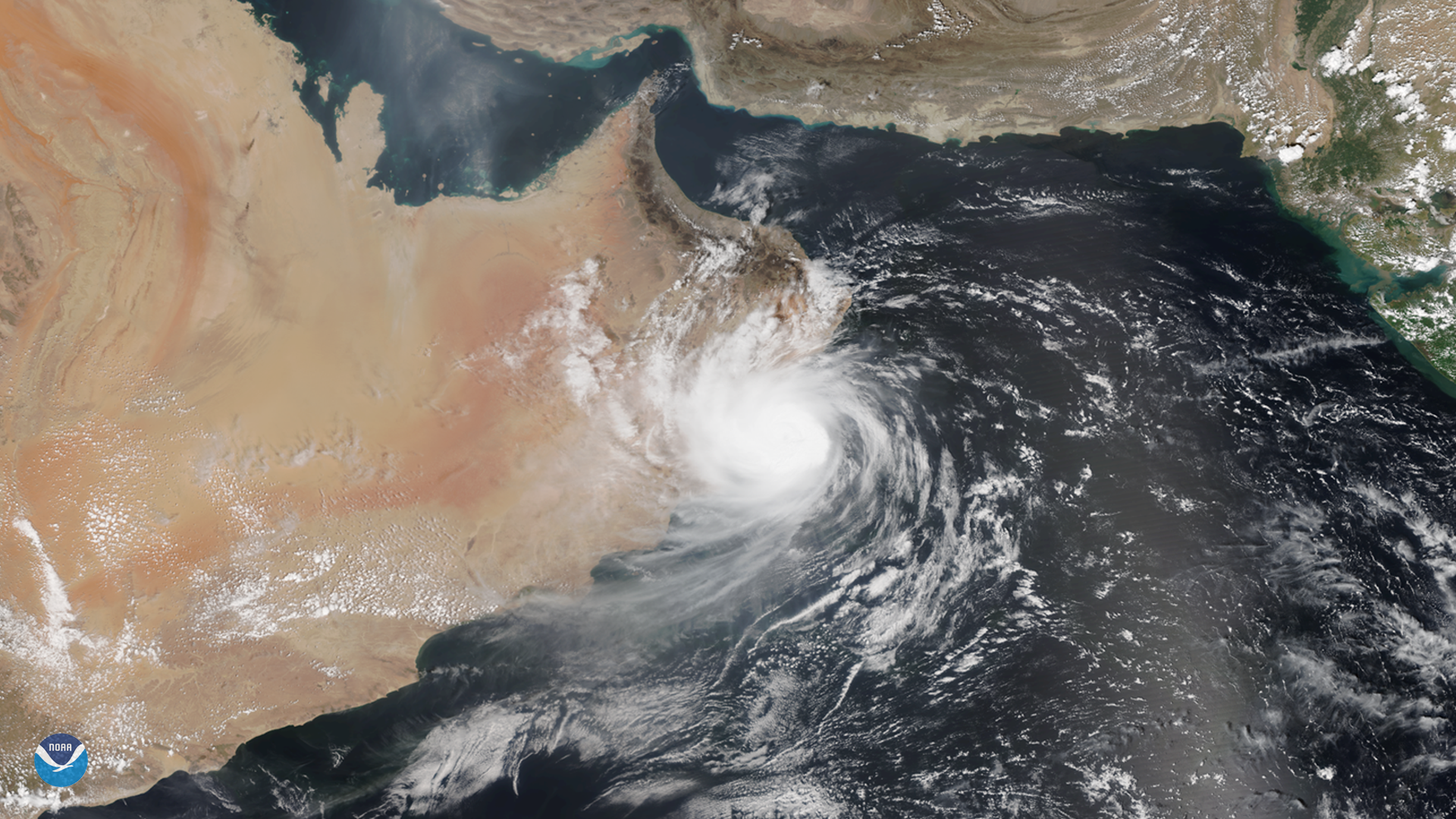
While we typically think of tropical cyclones as storms that form in the Atlantic and Pacific oceans, they do occasionally appear…