
Satellite Snapshots
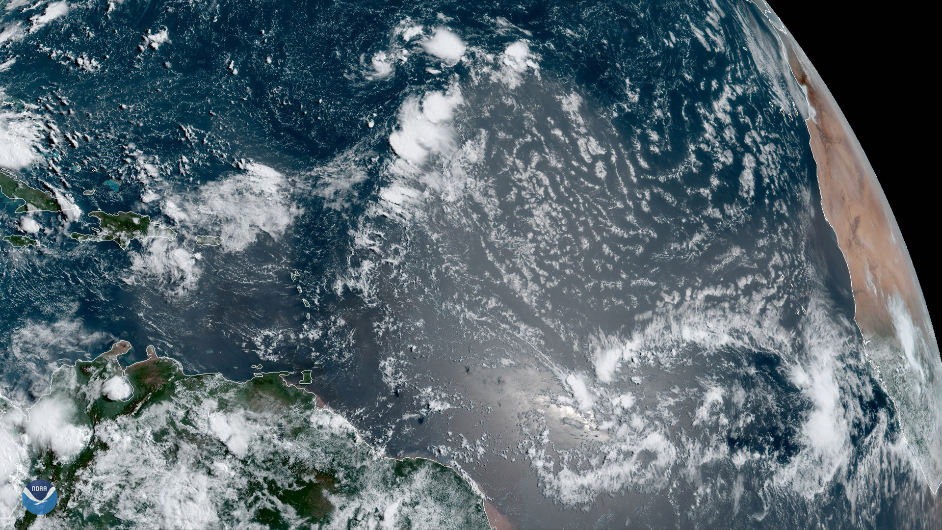
GOES East is ideally located to detect Saharan dust blowing across the Atlantic Ocean, as shown in this GeoColor image on August 1,…
Satellite Snapshots
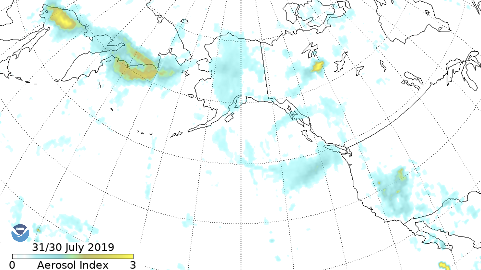
The Suomi-NPP Ozone Mapping and Profiler Suite (OMPS) aerosol index shows smoke moving across eastern Russia into Alaska, down the west…
Feature Story
From 10,000 feet above ground, pilots can spot the glow of a fire. Data from satellites and aircraft help make firefighting decisions.
Satellite Snapshots
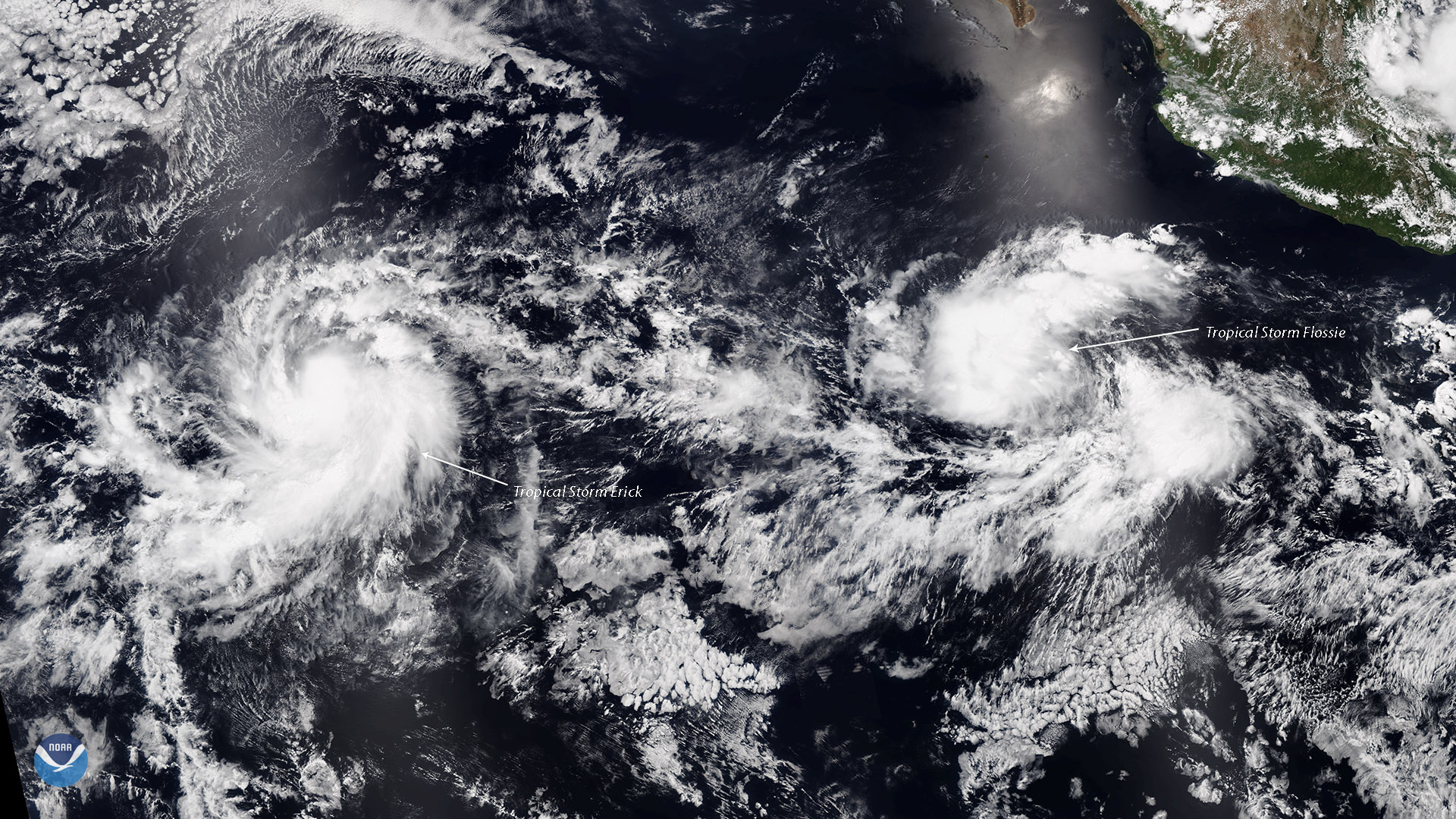
Tropical Storms Erick and Flossie, seen together in this July 28, 2019 view from the NOAA-20 satellite, are strengthening in the…
Satellite Snapshots
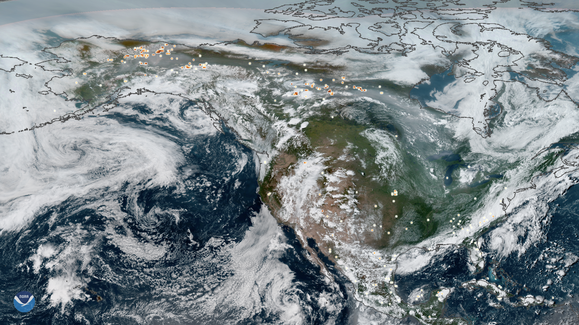
This true-color composite image of smoke from Arctic wildfires spreading across Alaska and Canada was captured by both GOES East and…
Satellite Snapshots
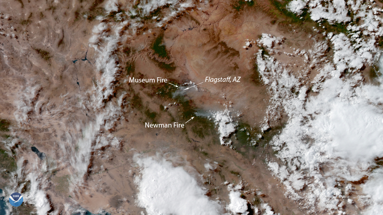
NOAA’s GOES West satellite zoomed in on two wildfires near Flagstaff, Ariz. on July 23, 2019. The Museum Fire , currently searing…
Satellite Snapshots
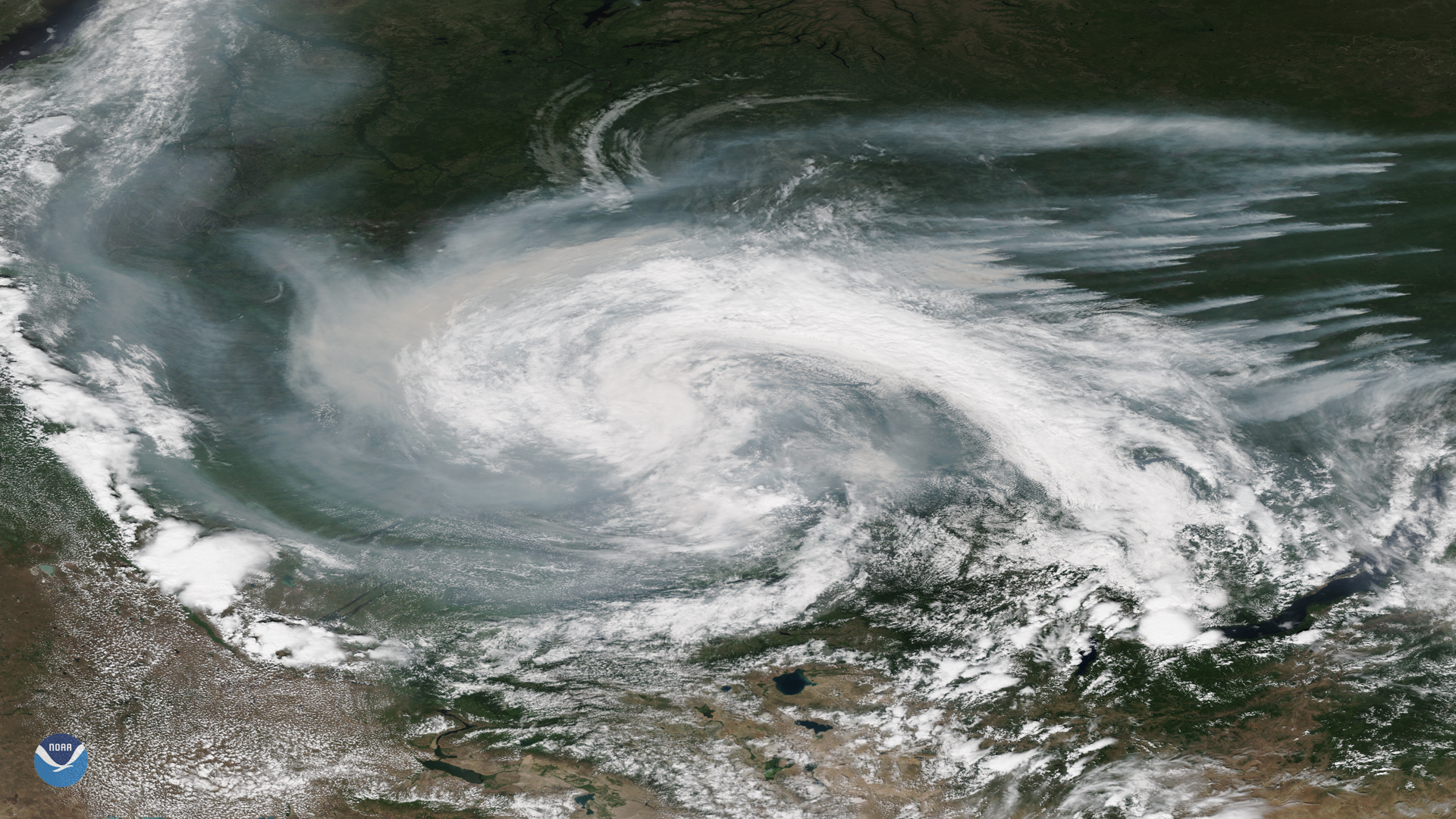
Smoke from active wildfires burning across northern Russia got caught in a low pressure system near the Verkhne-Tazovsky State Natural…
Satellite Snapshots
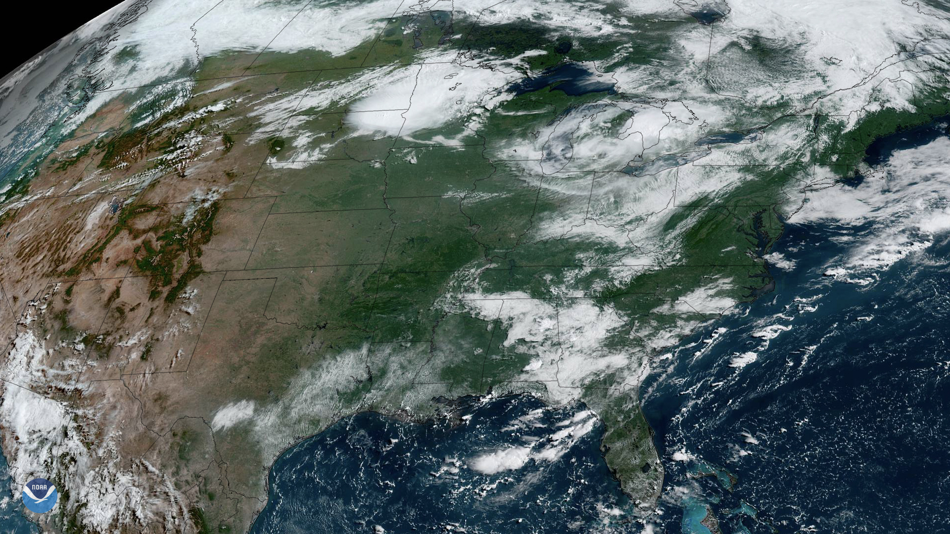
NOAA’s GOES East satellite watched as storms began firing up over the Upper Midwest on Friday, July 19, 2019. While there’s a cluster…