
Satellite Snapshots

Clear skies over Australia on July 16, 2019, gave the NOAA-20 polar-orbiting satellite an unobstructed view of smoke plumes from…
Feature Story

Researchers tracked a female fox in Krossfjorden, Svalbard over 2,700 miles to Canada using a satellite collar and the Argos network.
Satellite Snapshots
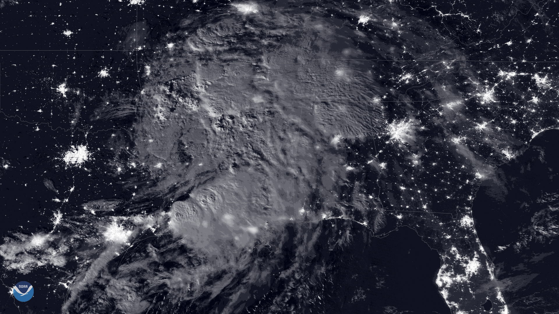
A nearly full moon made it possible for the day-night band of NOAA-20 's Visible Infrared Imaging Radiometer Suite (VIIRS) to capture…
Satellite Snapshots
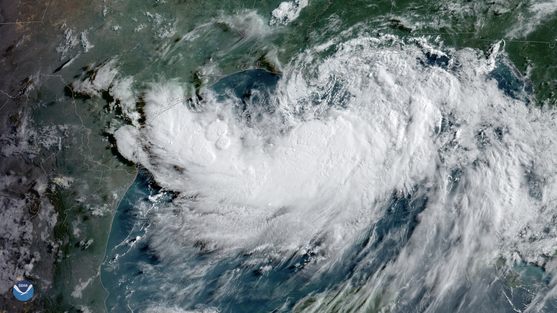
Tropical Storm Barry, seen here by GOES East on July 12, 2019, at 9 a.m. ET is strengthening over the warm waters of the northern Gulf…
Satellite Snapshots
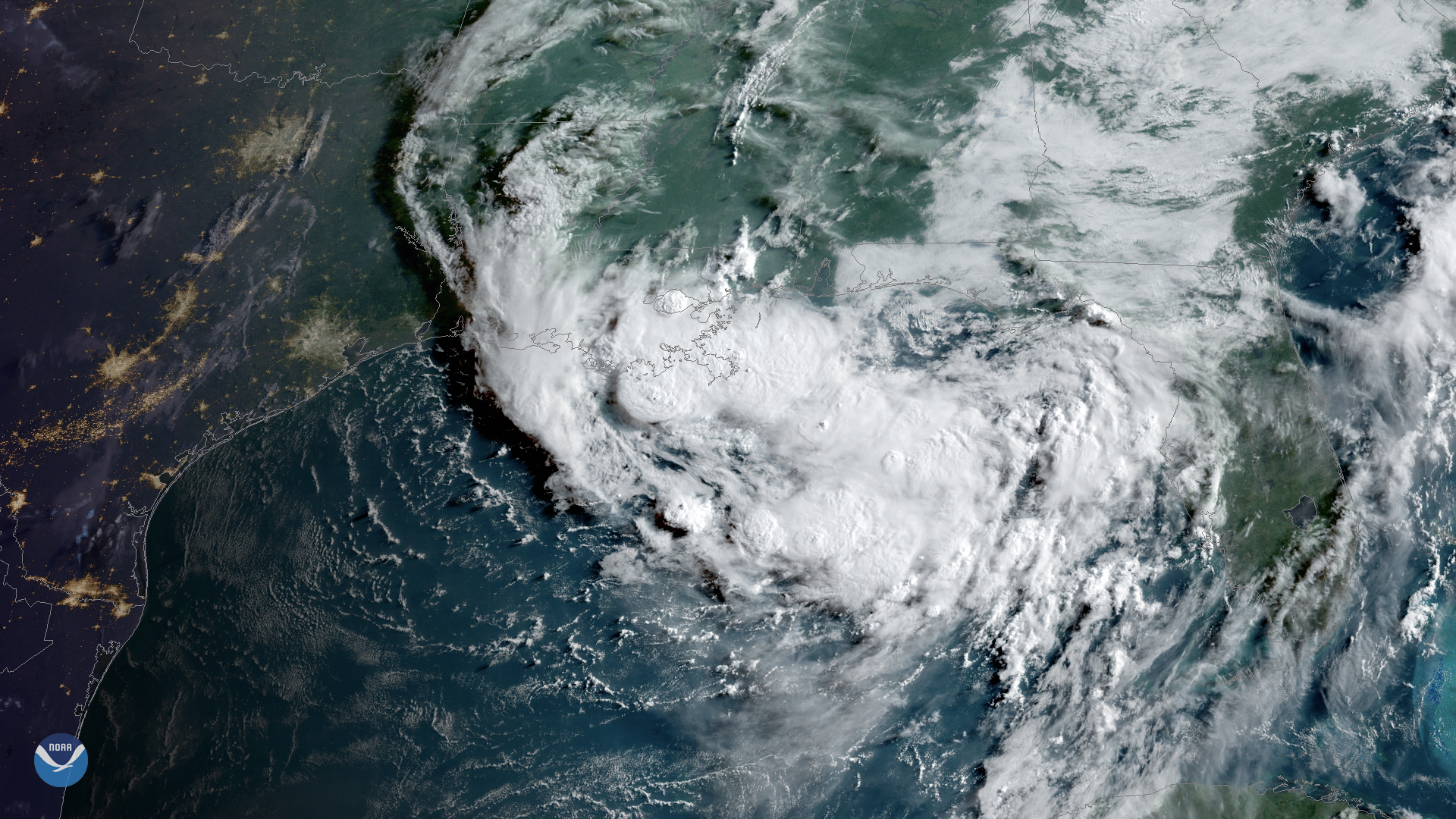
Clouds associated with a tropical disturbance bubbled up over the Gulf Coast on Wednesday, July 10, 2019.
Satellite Snapshots
A storm is brewing in the northern Gulf of Mexico. A broad area of low pressure, located just south of the eastern Florida Panhandle,…
Satellite Snapshots
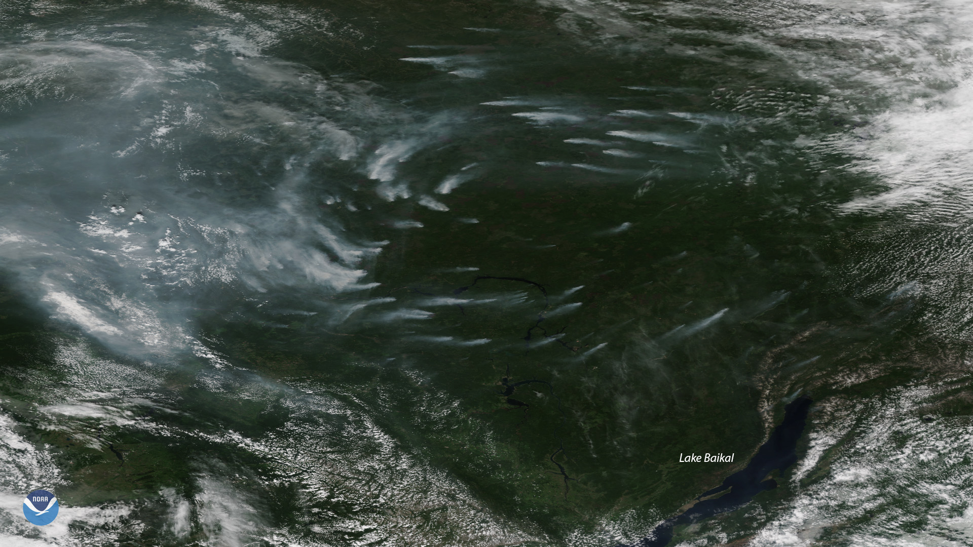
Plumes of smoke from more than a dozen large, active wildfires burning northwest of Russia’s Lake Baikal are seen in this NOAA-20…
Satellite Snapshots
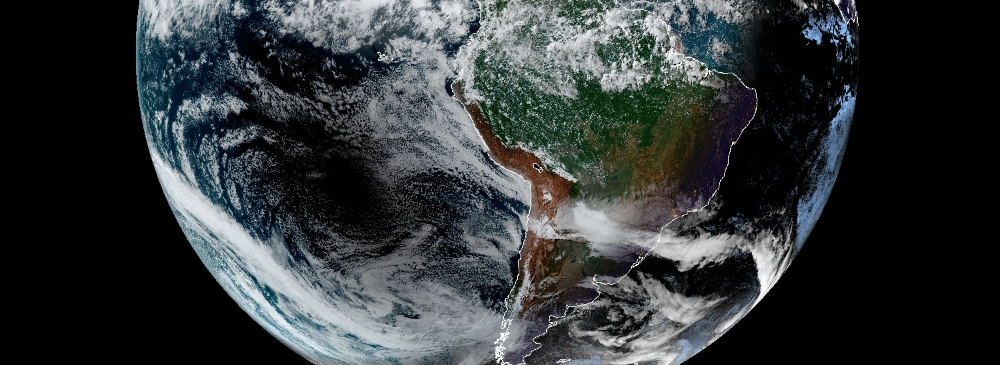
NOAA's GOES East saw the moon’s shadow as it moved west to east across South America on July 2, 2019. Parts of Chile and Argentina…