
Satellite Snapshots
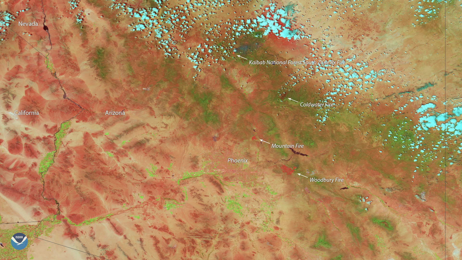
Heat from the Woodbury Fire, located east of Phoenix, is shown in red in this false-color imagery captured by the Suomi-NPP VIIRS instrument.
Satellite Snapshots
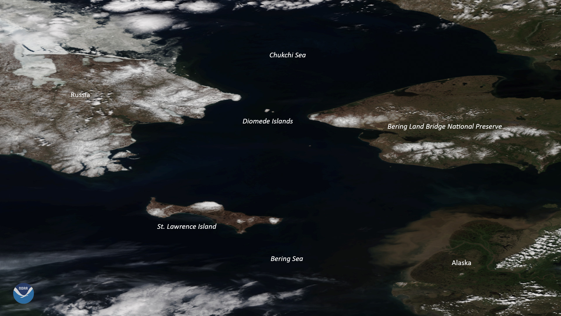
Clear skies over Alaska allowed NOAA-20 to capture this stunning view of the Bering Land Bridge National Preserve on June 13, 2019.
Satellite Snapshots
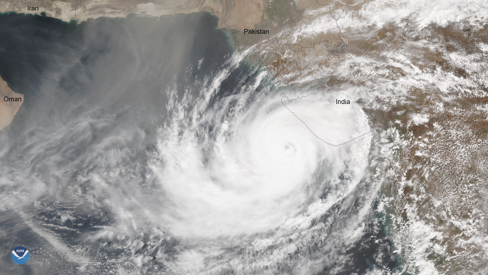
This Suomi-NPP imagery of Tropical Cyclone Vayu on June 13, 2019, shows the storm tracking toward India's northwestern coast.
Feature Story

Navigating the icy waters of Antarctica is no easy feat, but each year the U.S. military conducts a mission called Operation Deep Freeze.
Satellite Snapshots
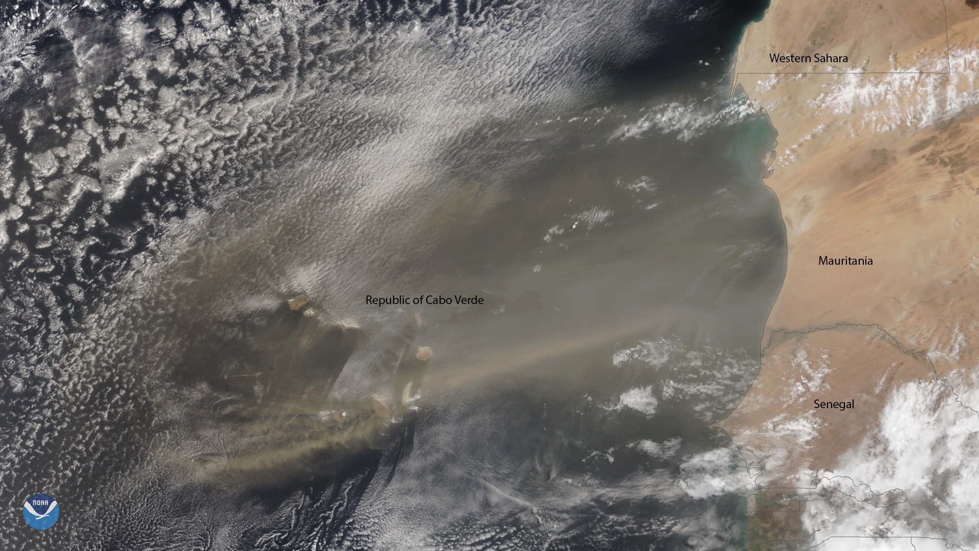
A plume of Saharan dust reaches beyond the Republic of Cabo Verde, which is located approximately 350 miles off the coast of northwest Africa.
Satellite Snapshots
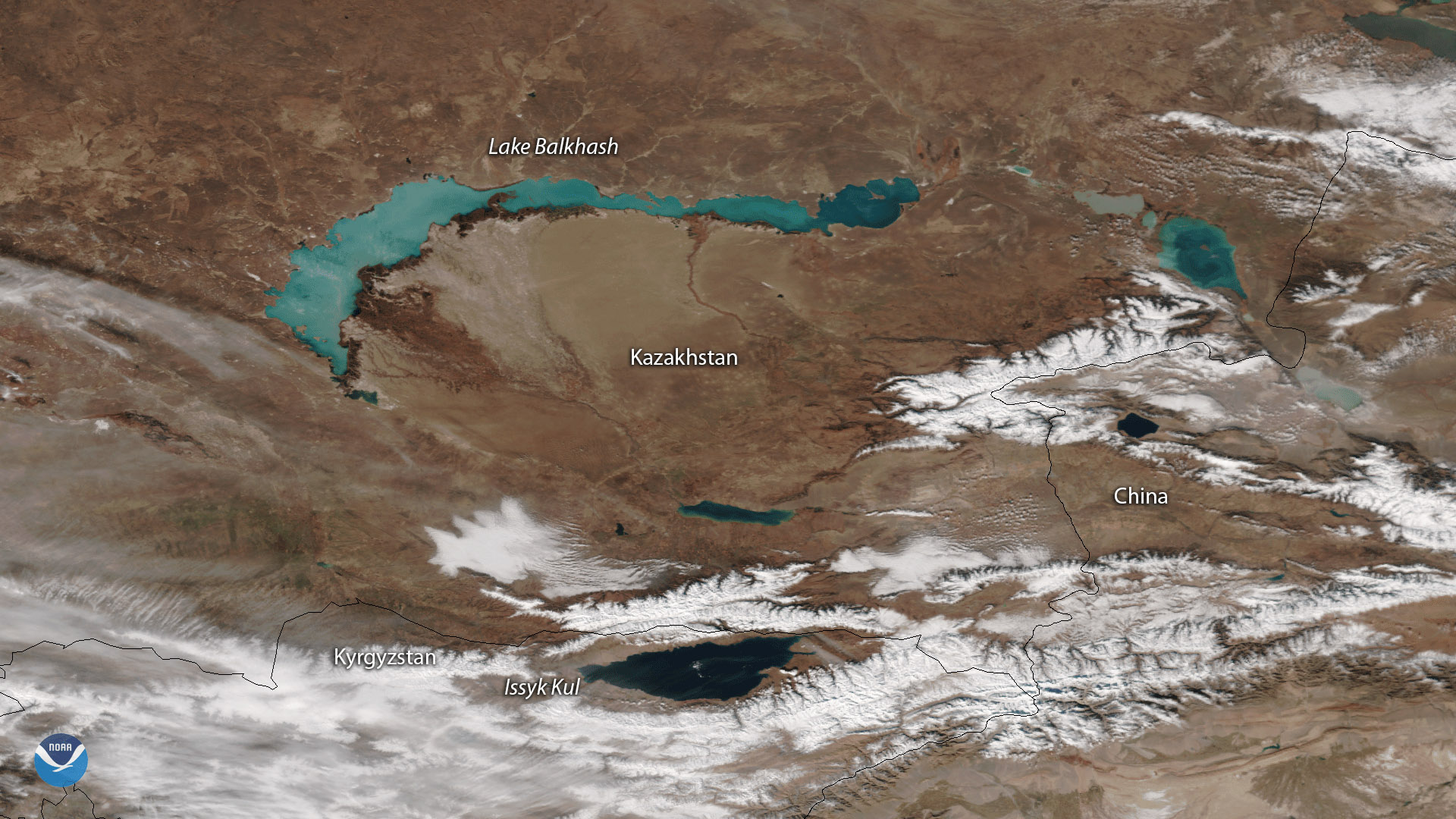
Spanning approximately 6,900 square miles, Lake Balkhash in Kazakhstan is one of the largest lakes in Asia and the 15th largest in the world.
Satellite Snapshots
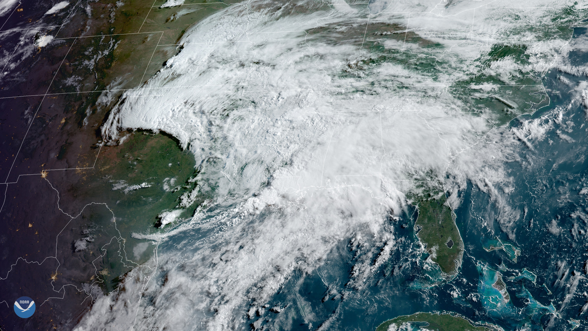
Tropical moisture is producing heavy rain across the Gulf Coast and lower Mississippi and Tennessee Valleys.
Announcement
NOAA announced it has selected the University of Maryland in College Park, to host its cooperative institute.