
Satellite Snapshots
As wildfires continue to rage across parts of Alberta, Canada, smoke from the blazes is reaching beyond North America.
Feature Story

The National Oceanic and Atmospheric Administration announced on May 24, 2019 that it has selected the University of Maryland in College Park, Marylan
Satellite Snapshots
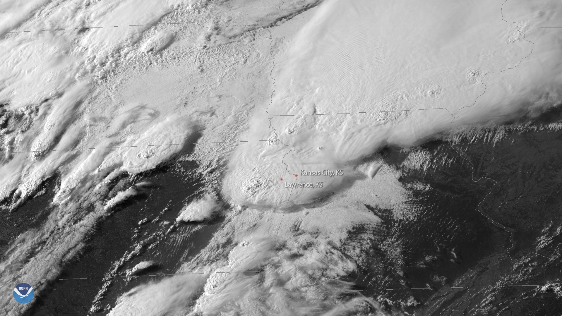
GOES East imagery shows thunderstorms bubbling up over northeastern Kansas on May 28, 2019.
Satellite Snapshots
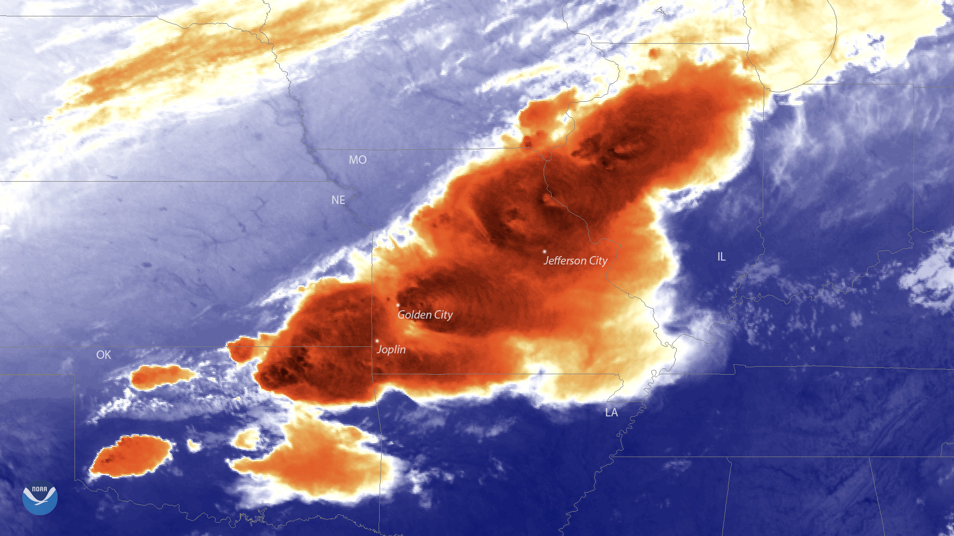
GOES East captured this view of the severe weather outbreak across parts of Missouri and Oklahoma as the storms were beginning to ramp up.
Satellite Snapshots
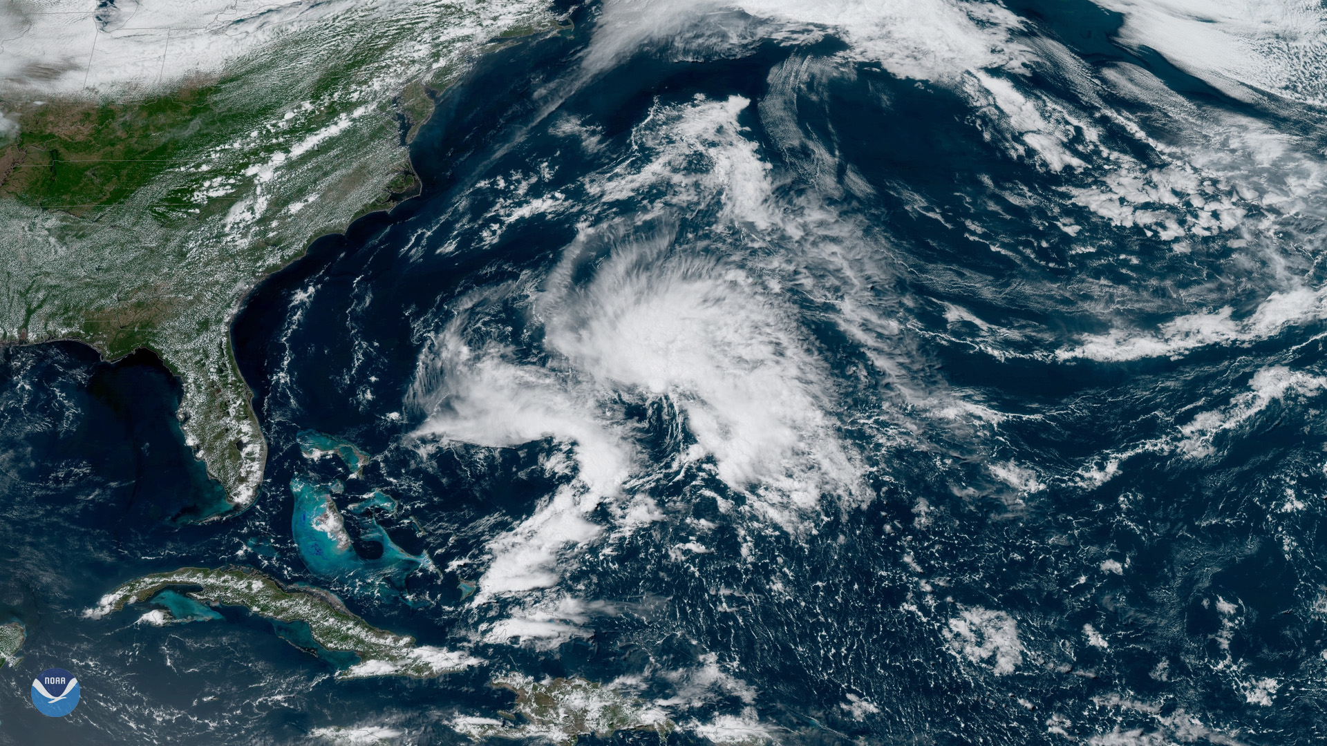
It’s official: Subtropical Storm Andrea is the first named storm of the 2019 Atlantic Hurricane Season.
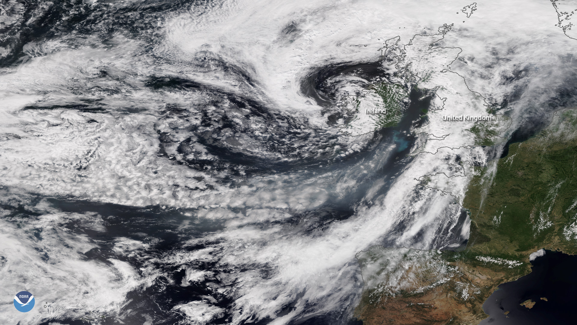
Satellite Snapshots
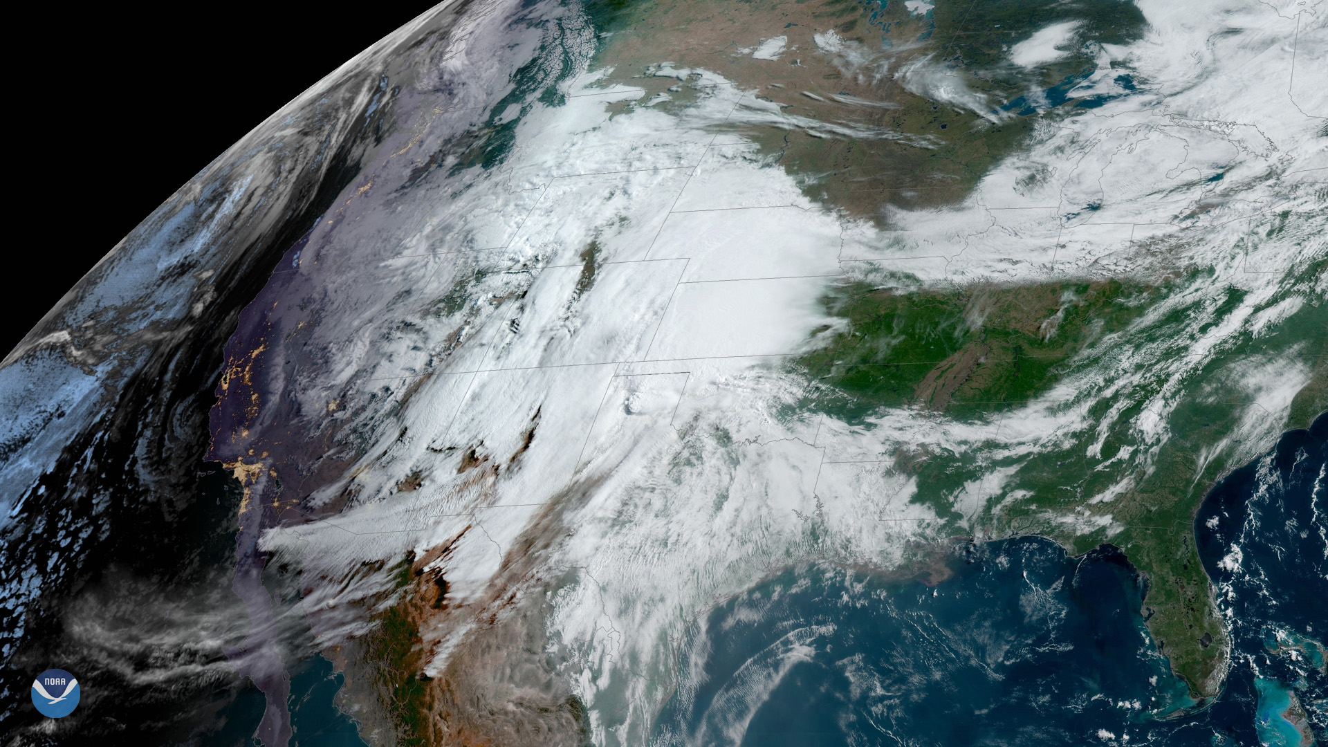
Residents across the central and southern Plains are bracing for more severe weather as a potent spring storm system bears down on the region.
Satellite Snapshots
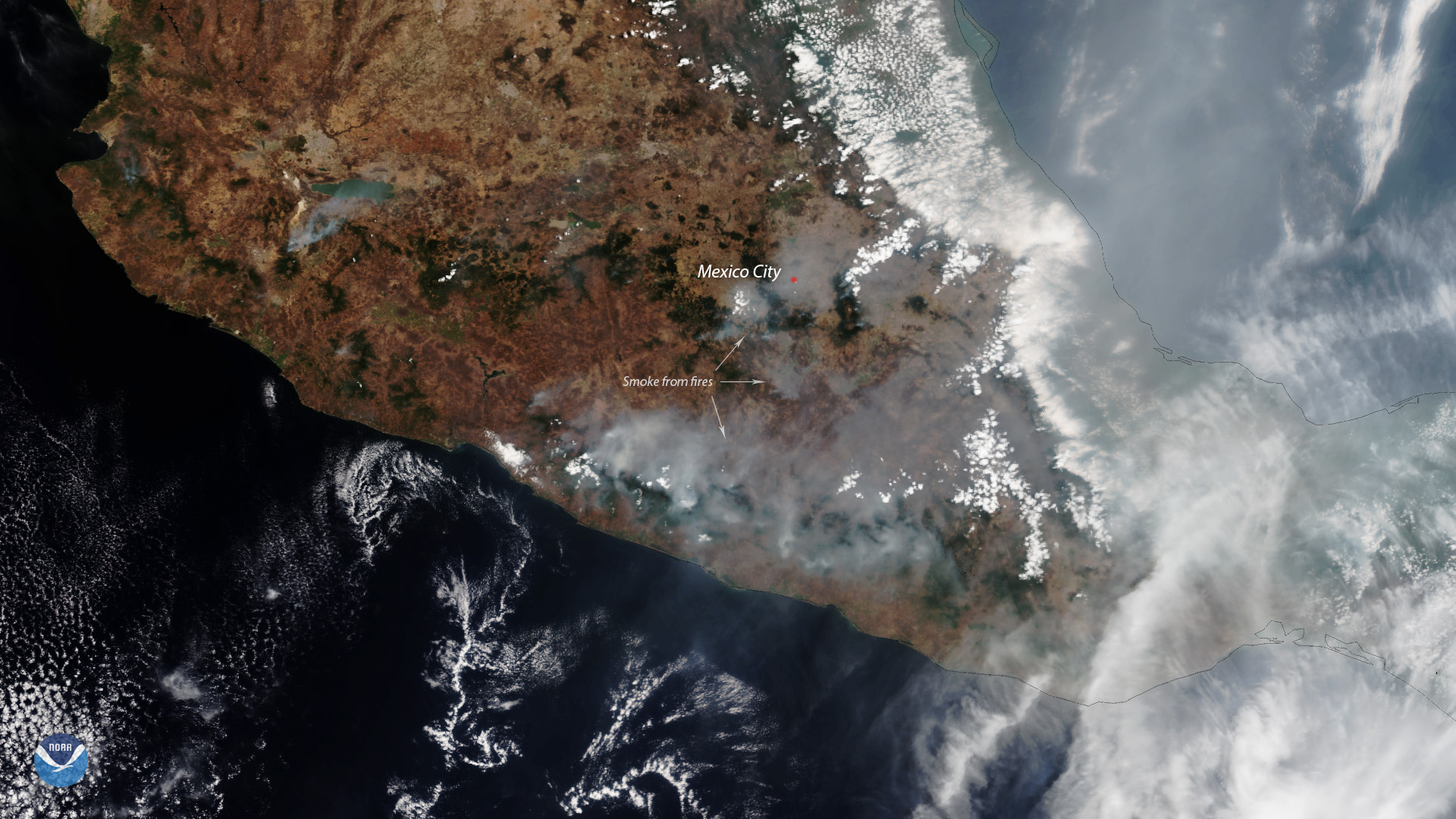
Mexico’s Megalópolis Environmental Commission urges residents to stay indoors as smoke inundates Mexico’s densely populated capital.
Satellite Snapshots
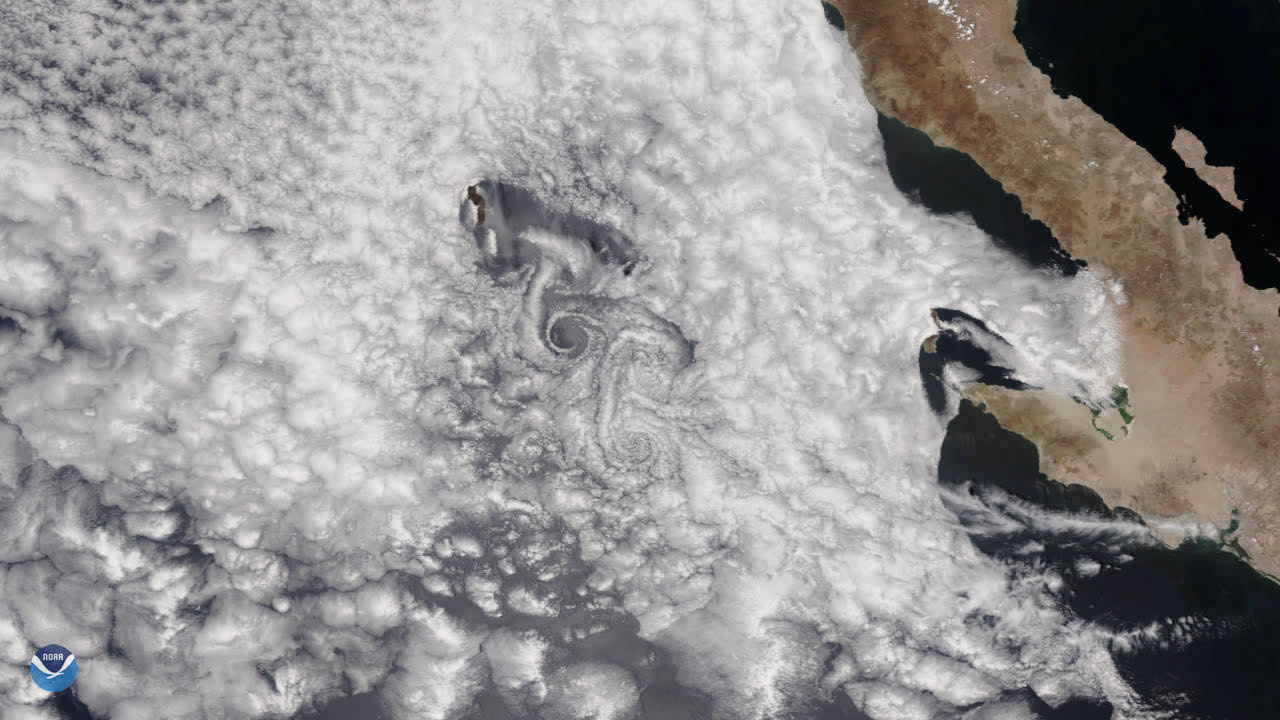
A spiraling cloud pattern, known as a von Kármán vortex, formed off the west coast of Mexico’s Baja California Peninsula on May 13, 2019.