
Satellite Snapshots
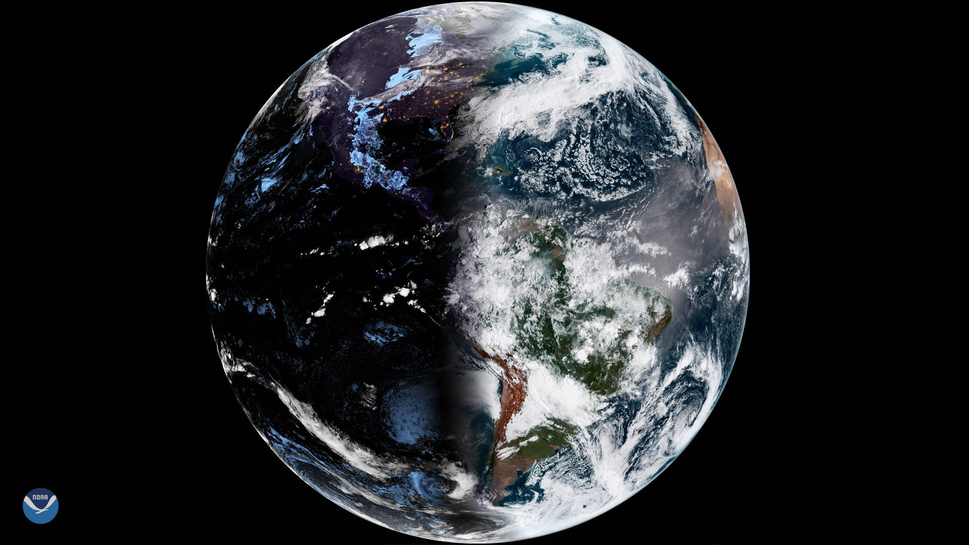
There are two times each year, in March and September, when the amount of daylight and darkness is “nearly” equal at all latitudes.
Satellite Snapshots
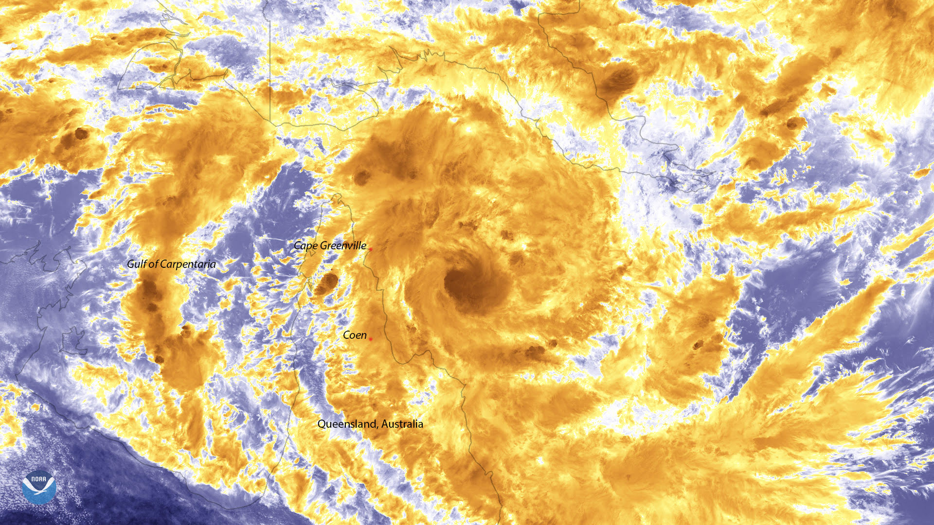
The Suomi NPP satellite watched Tropical Cyclone Trevor as it intensified over the Coral Sea on March 18, 2019.
Feature Story

Farmers and ranchers rely on the land to make a living, and while there are many ways to prepare for natural disasters, a newly…
Satellite Snapshots
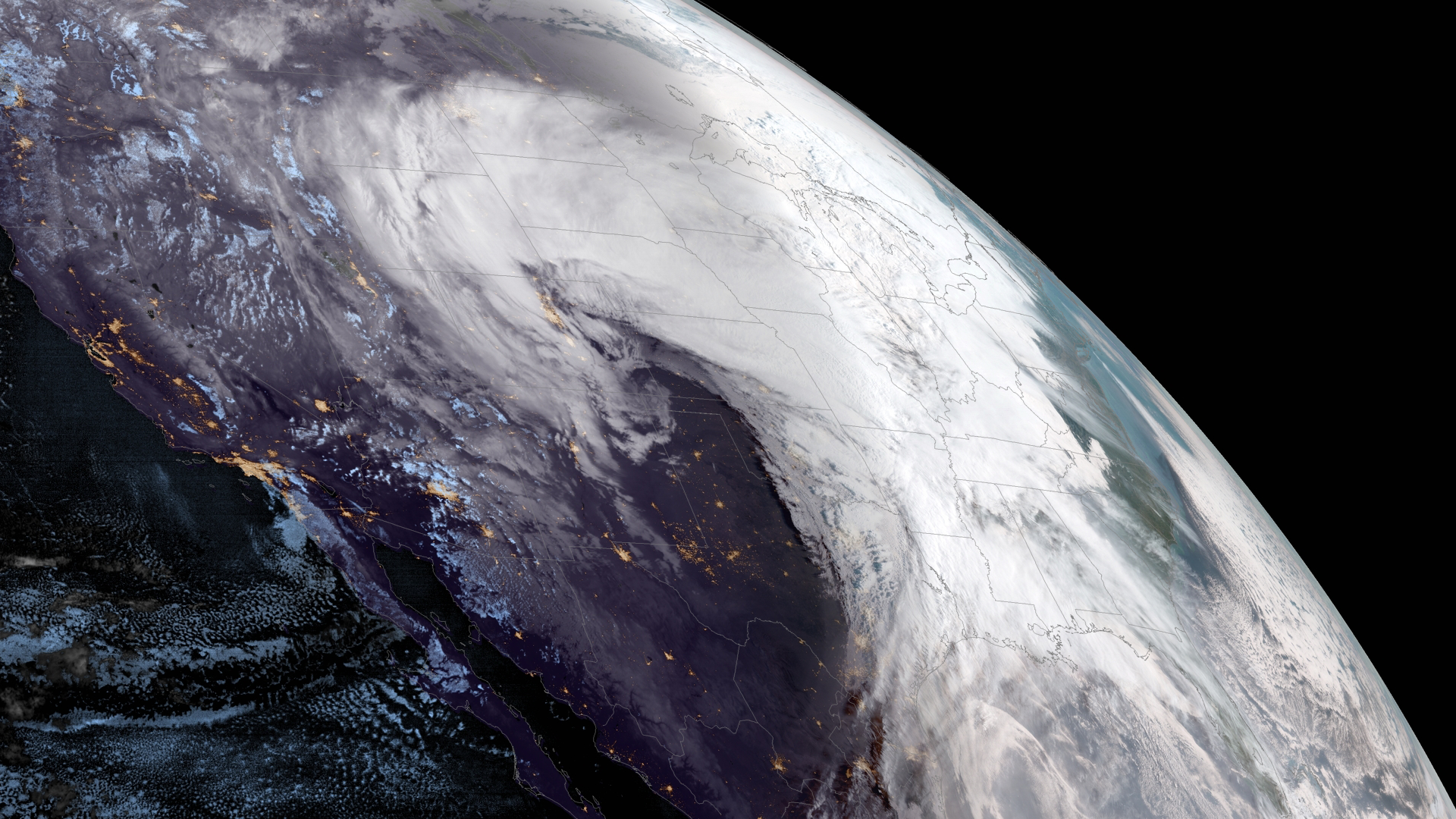
GOES West captured this view of a powerful winter storm system on March 13, 2019 that is projected to sweep across much of the Central United States.
Satellite Snapshots
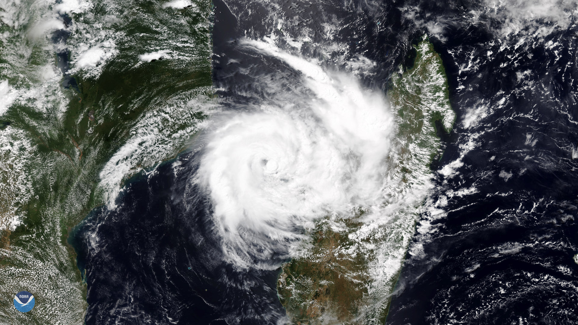
This NOAA-20 image of Tropical Cyclone Idai over the Mozambique Channel shows the storm brushing the island of Madagascar.
Feature Story
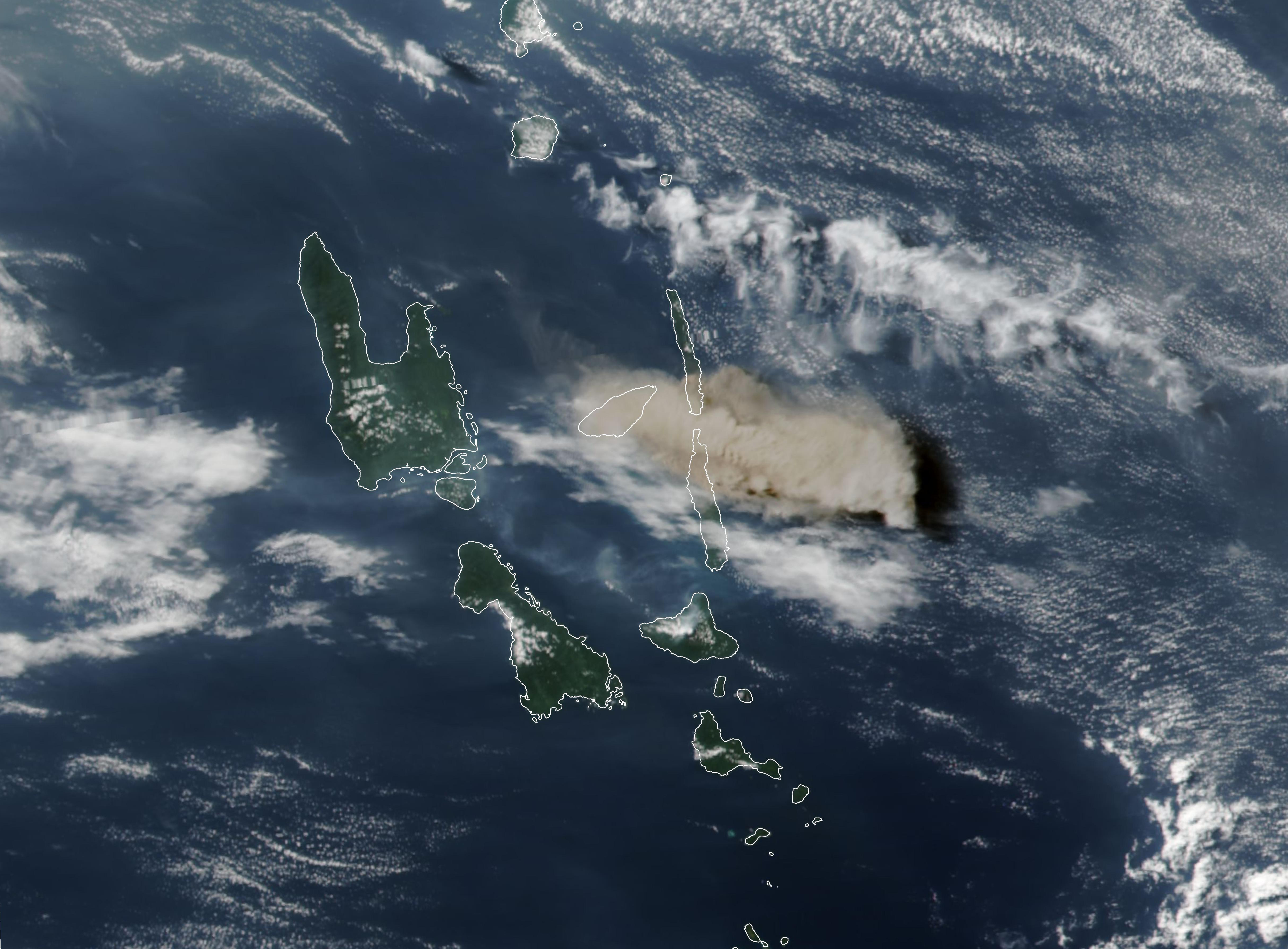
The Manaro Voui volcano on the island of Ambae in the nation of Vanuatu in the South Pacific Ocean made the 2018 record books. A NASA-NOAA satellite c
Satellite Snapshots
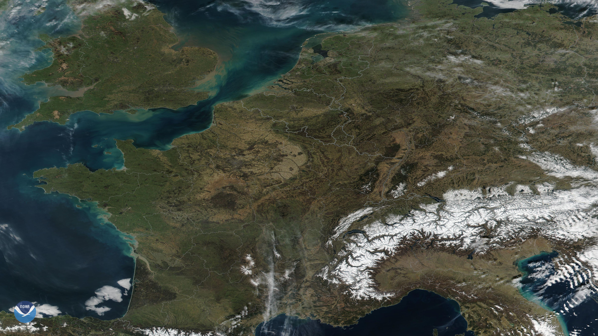
The Suomi NPP satellite captured mostly clear skies in western and central Europe as unusually warm weather sets winter temperature records.
Feature Story
The severe storms that brought tornadoes, damaging winds, rain, and hail to the Southeast over the weekend, leaving tens…