
Satellite Snapshots

The NOAA-20 satellite zoomed in on the jagged snowy peaks of several mountain ranges in Central Asia.
Satellite Snapshots
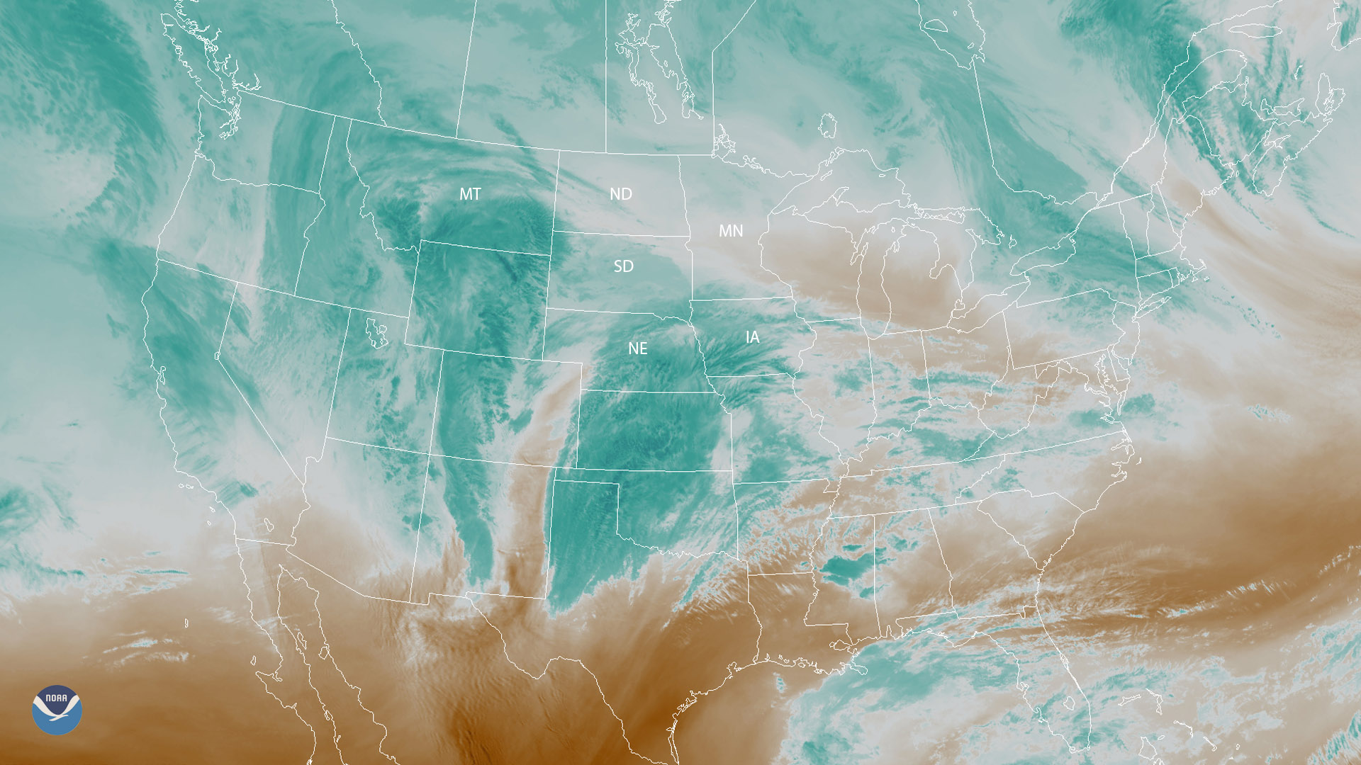
Water vapor imagery from GOES East shows wintry weather approaching parts of the Plains and upper Midwest on Nov. 30, 2018.
Satellite Snapshots
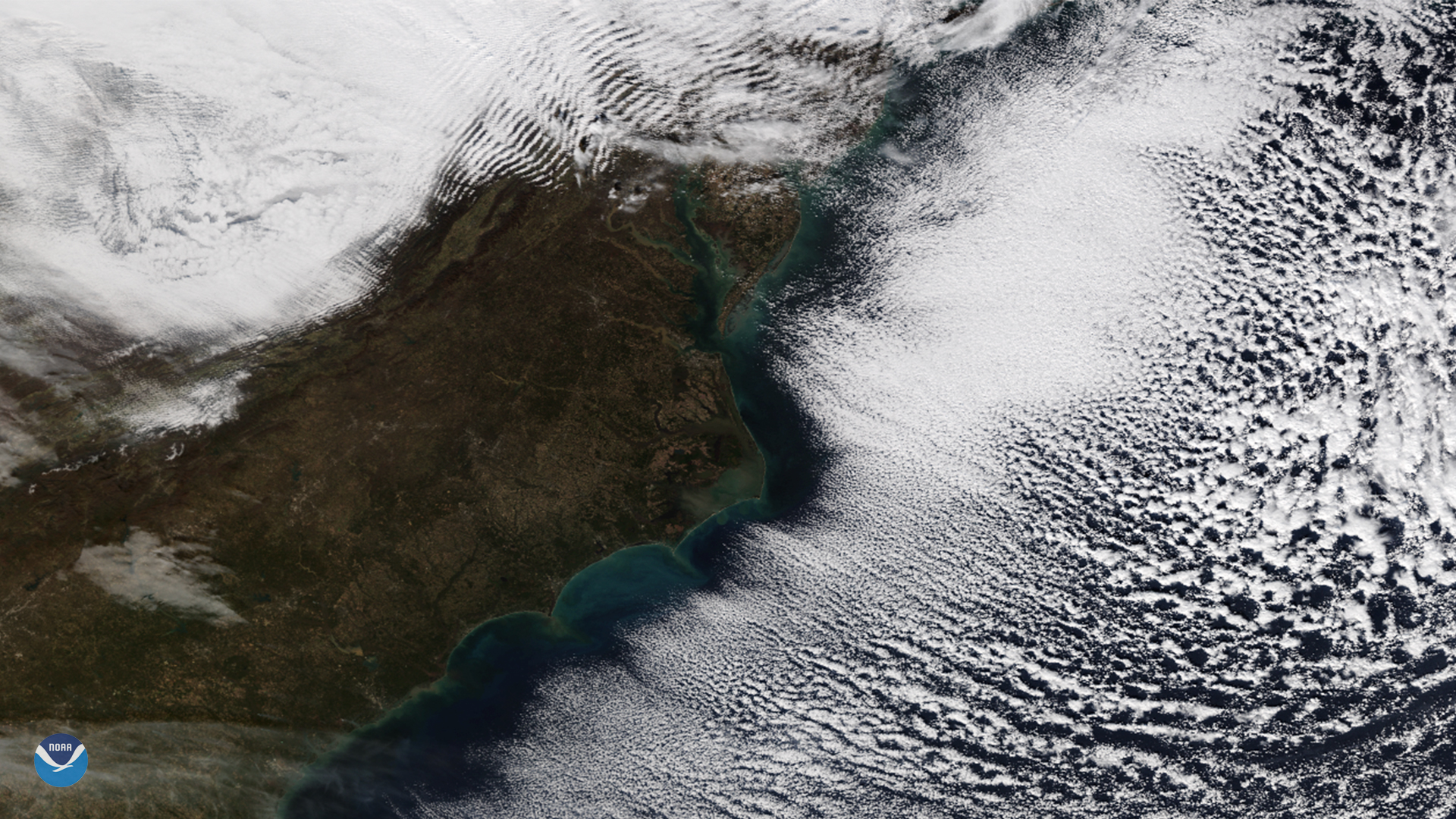
The NOAA-20 satellite spied cloud streets and gravity waves near the Mid-Atlantic region on Nov. 28, 2018.
Feature Story

While Arctic sea ice continues to shrink, human activity in the region is only growing. Ice extent, which is monitored by…
Satellite Snapshots

The polar-orbiting NOAA/NASA Suomi NPP satellite’s day-night band captured this stunning moonlit view of the Northeast on Friday,…
Satellite Snapshots

By the second half of November, snow becomes more common across the Plains and Upper Midwest as arctic air masses from Canada dive…
Satellite Snapshots
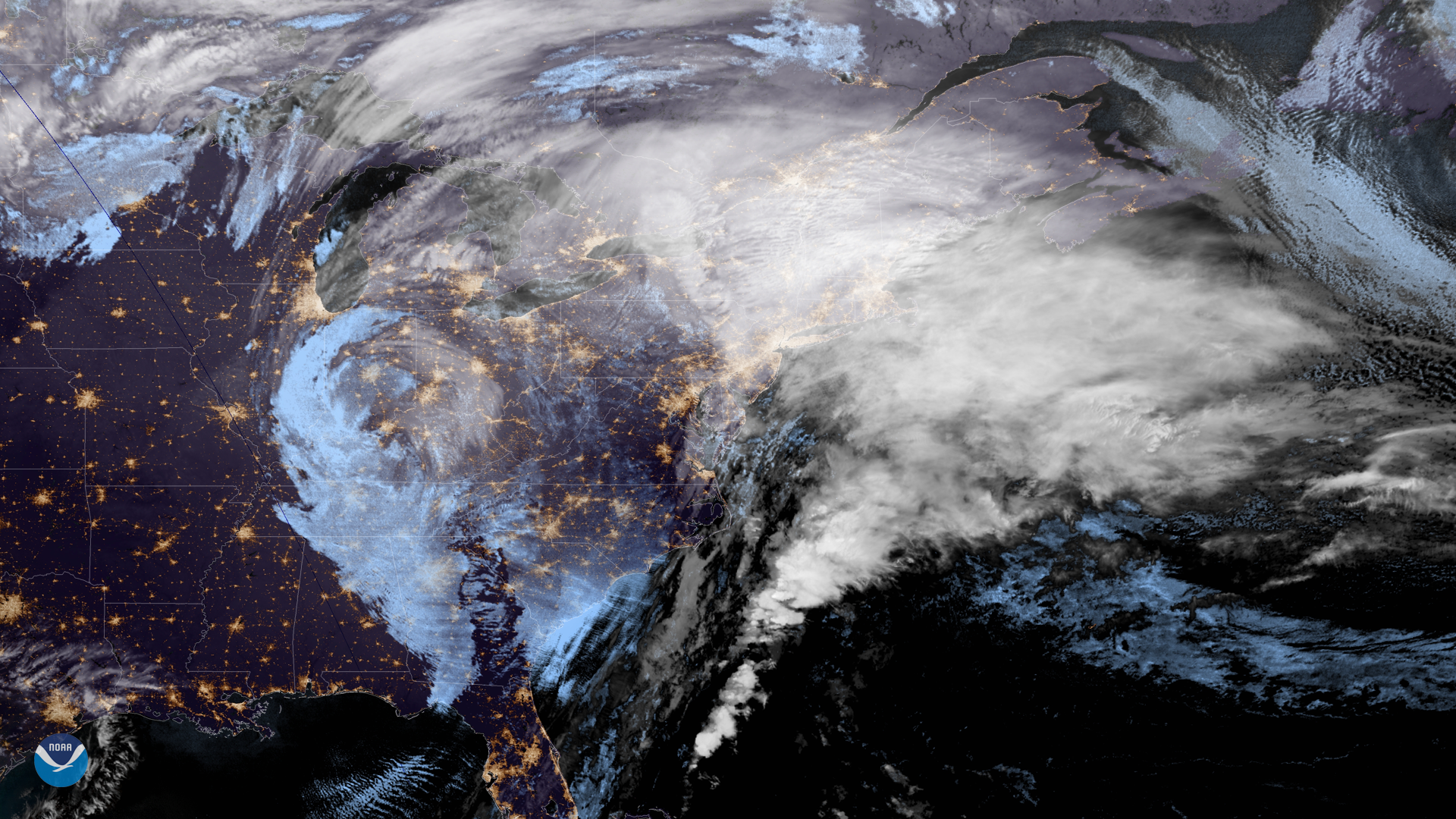
NOAA's GOES East satellite captured this geocolor enhanced image of an early season winter storm moving through the Northeast on…
Feature Story

The GOES-17 Advanced Baseline Imager (ABI) has sent its first images from the satellite's new vantage point over the Pacific Ocean.