
Satellite Snapshots
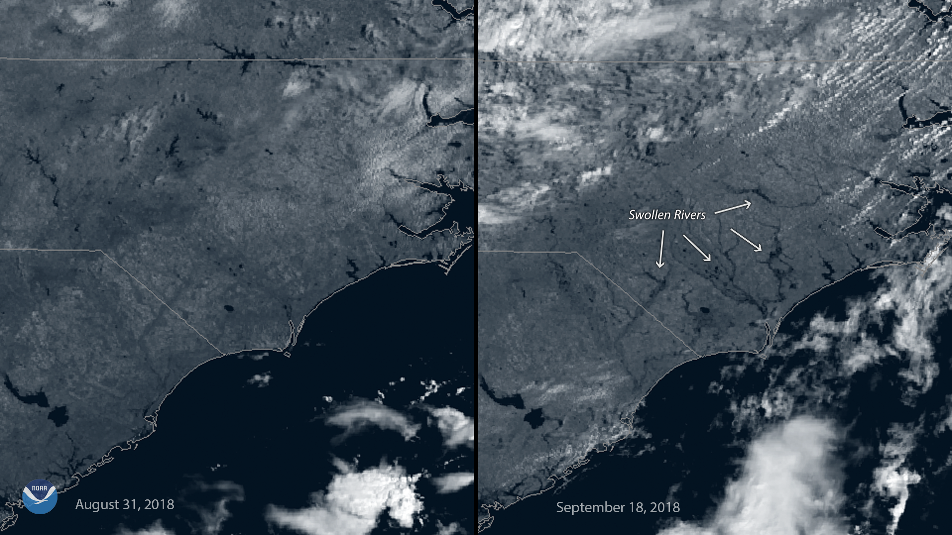
This before-and-after imagery from GOES East shows a changed landscape and flooding after Hurricane Florence affected southeastern North Carolina.
Announcement
On September 17, 2018, NOAA’s National Environmental Satellite, Data, and Information Service (NESDIS) awarded contracts to GeoOptics, Inc., Spire Global, Inc., and Space Sciences and Engineering LLC as part of the Commercial Weather Data Pilot…
Satellite Snapshots

Japan's Himawari-8 satellite captured the eye of Super Typhoon Mangkhut, which tore through the northern Philippines.
Feature Story

NESDIS has awarded contracts to three satellite companies as part of the Commercial Weather Data Pilot (CWDP) Round Two…
Satellite Snapshots
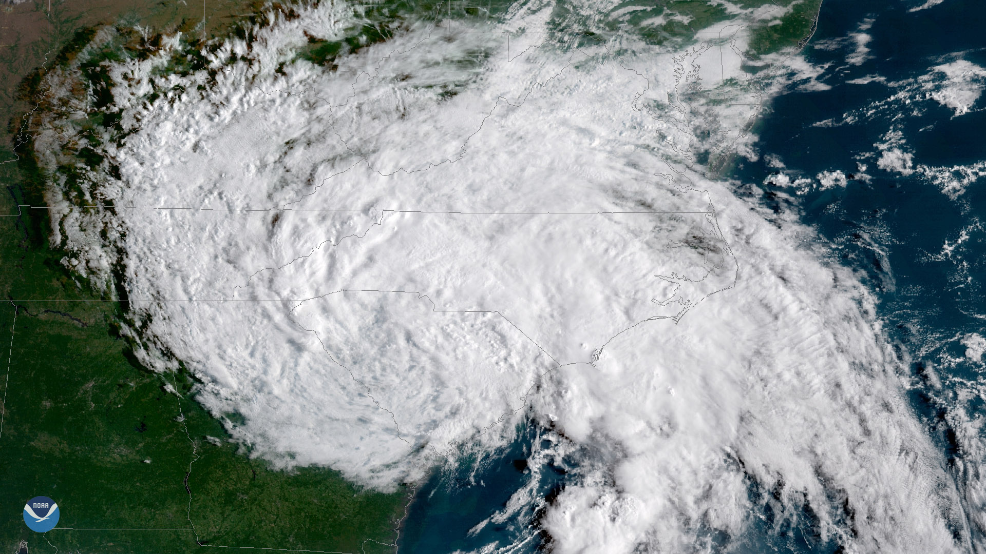
Florence, now a tropical depression with maximum sustained winds of 35 mph, continues to threaten portions of the Carolinas with…
Satellite Snapshots
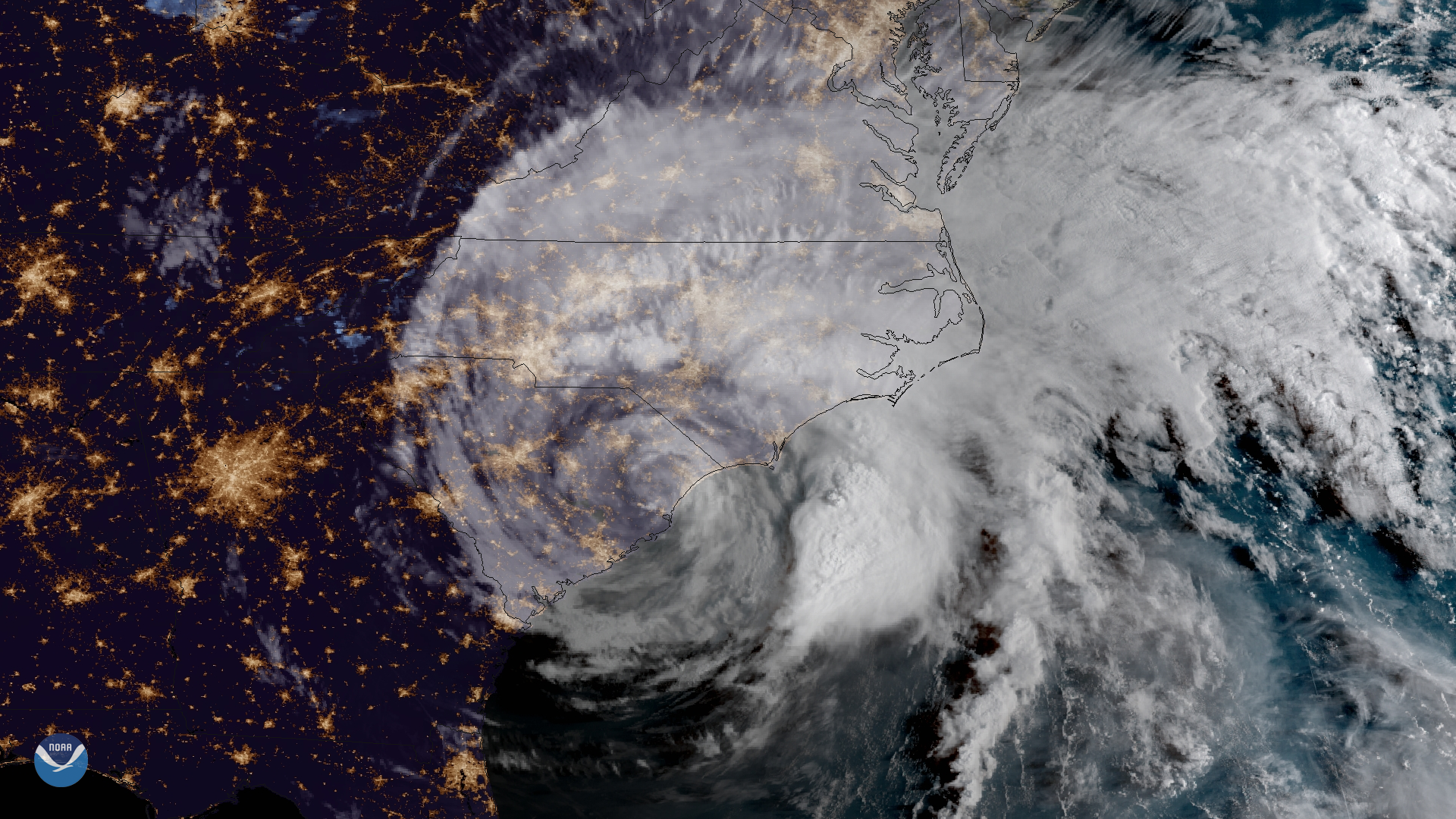
GOES East captured imagery of Tropical Storm Florence over the Carolinas on Sept. 15, 2018.
Satellite Snapshots
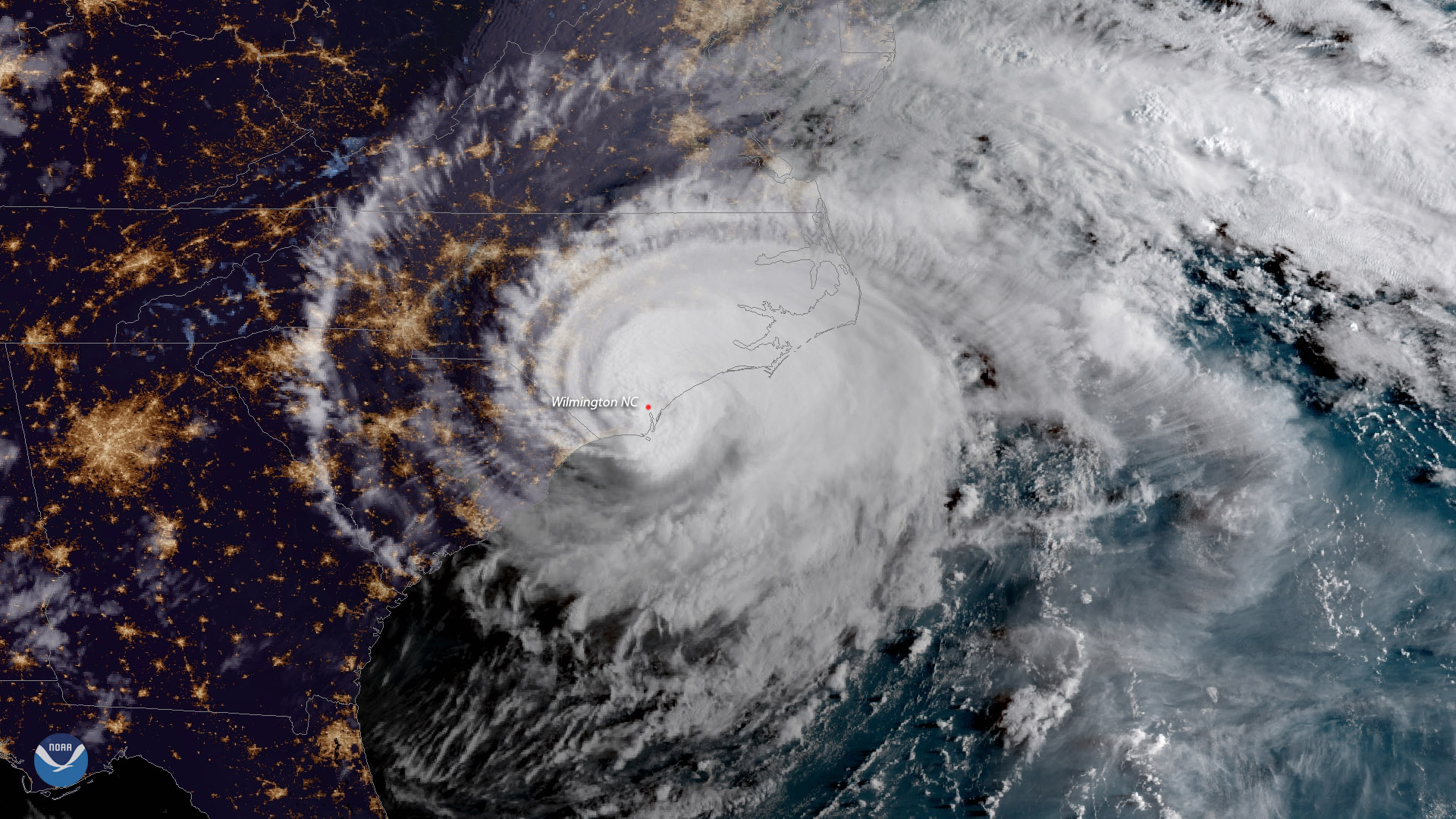
Hurricane Florence made landfall near Wrightsville Beach, North Carolina at 7:15 a.m. ET, September 14, 2018
Feature Story
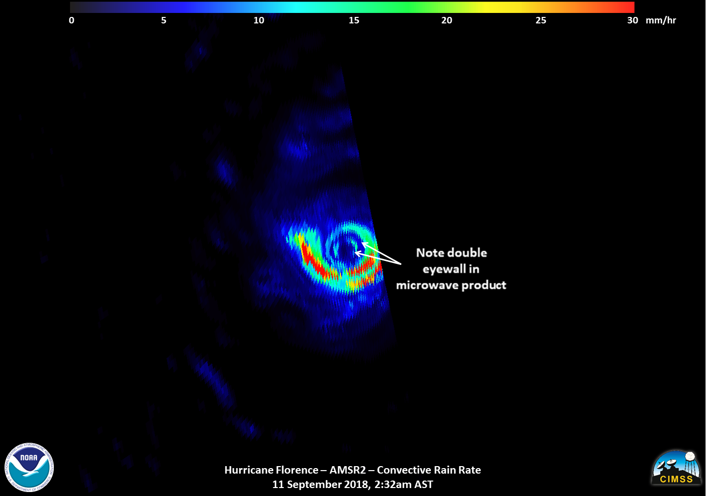
Satellite images of Hurricane Florence captured early Tuesday showed the storm developing a second, outer eyewall. By midday Tuesday, that outer eyewa