
Satellite Snapshots
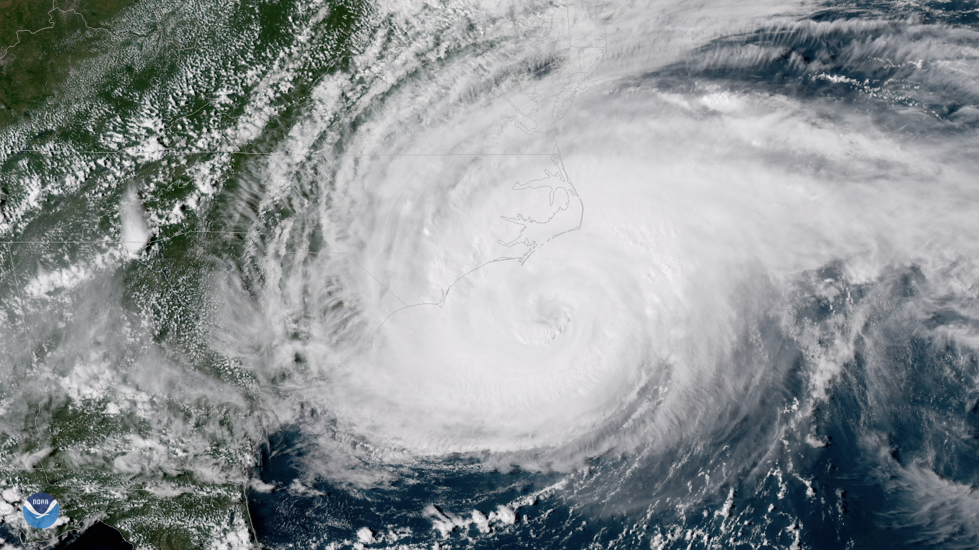
The outer bands of Hurricane Florence batter the North Carolina coast, September 13, 2018
Satellite Snapshots
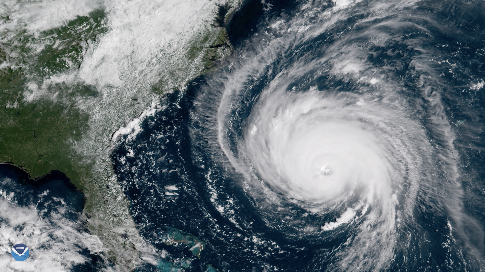
GOES East shows Florence's well-defined eye and outermost cloud bands beginning to approach the Outer Banks of North Carolina
Satellite Snapshots
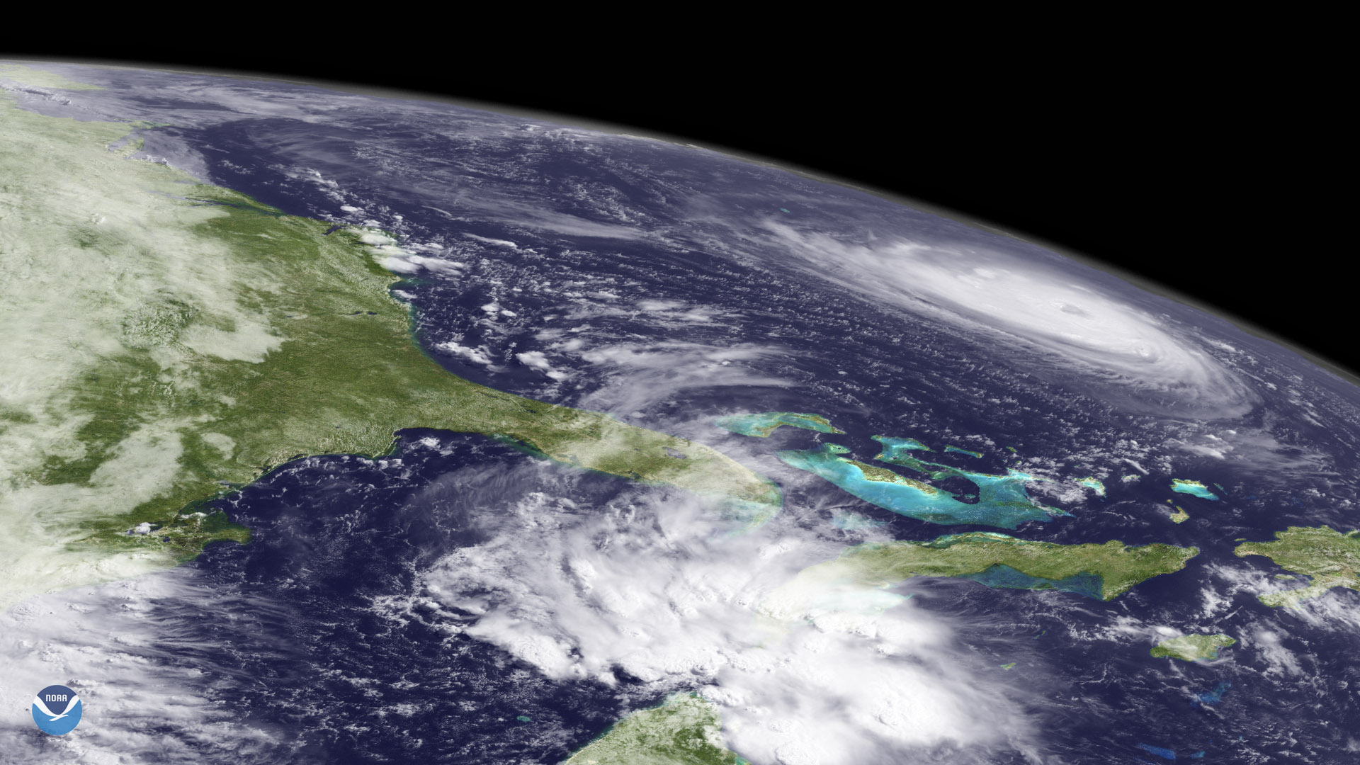
Florence appears at the northeast edge of GOES West's coverage area, over the western Atlantic Ocean
Satellite Snapshots
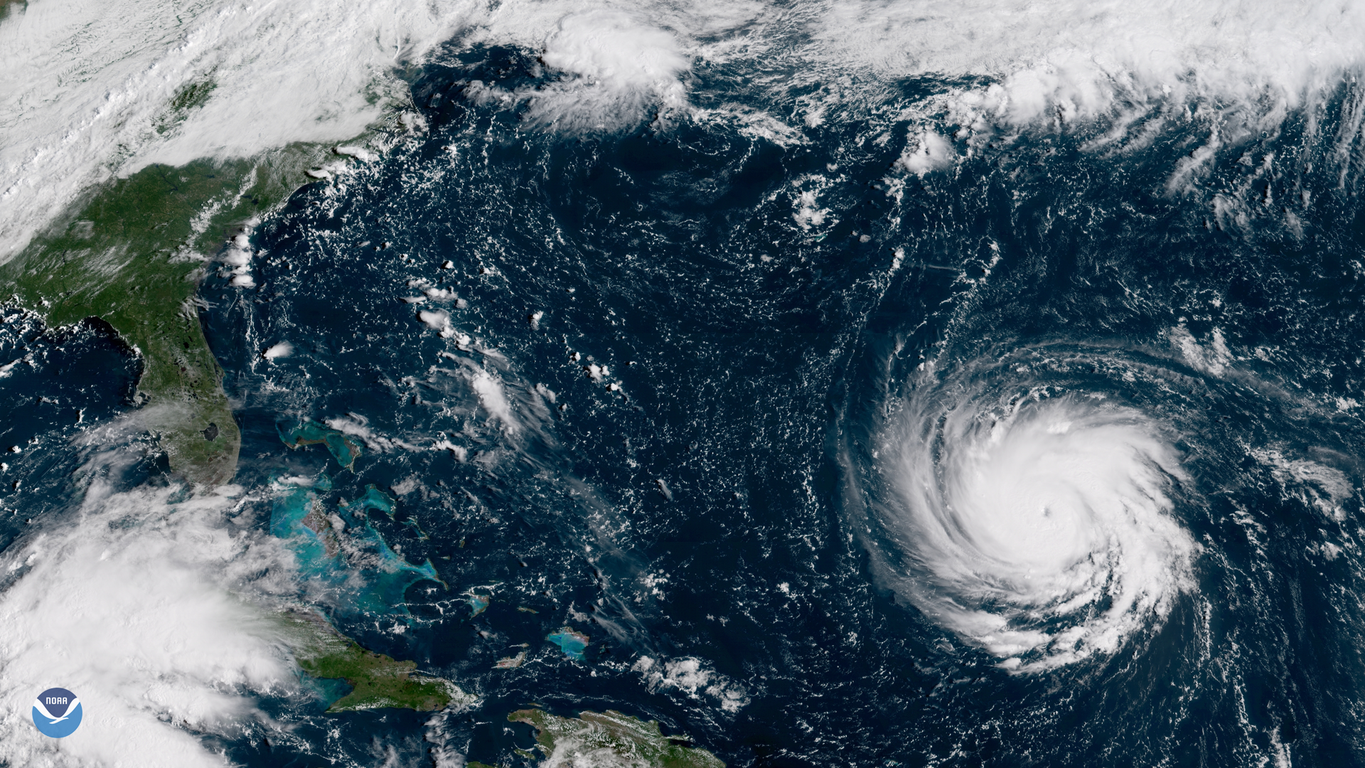
Hurricane Florence moved toward the U.S. East Coast as it intensified to a Category 4 storm, Monday September 12, 2018
Feature Story
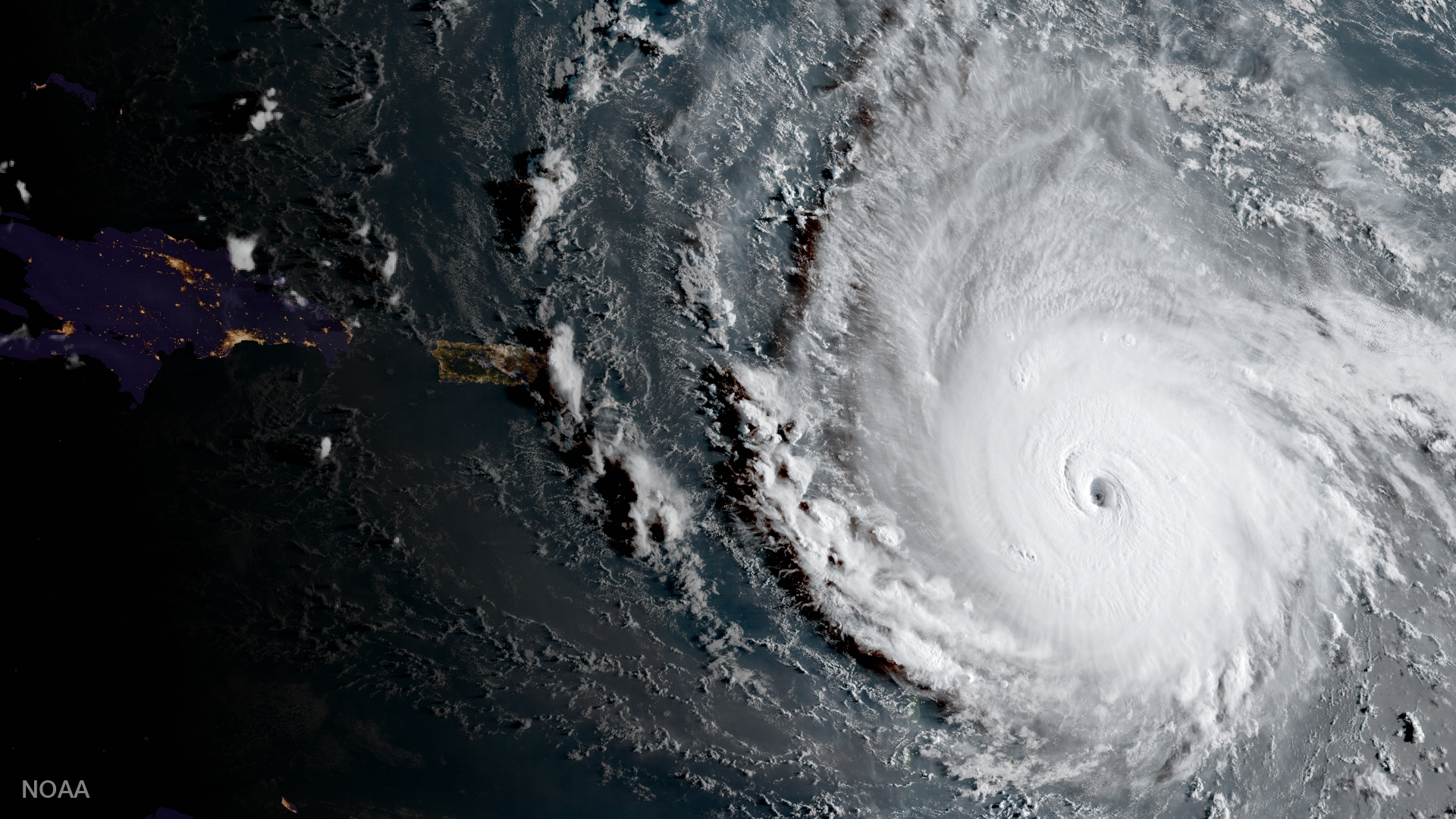
One of the strongest storms ever recorded in the Atlantic, Hurricane Irma left behind a trail of destruction from the Caribbean to the Florida Keys.
Satellite Snapshots
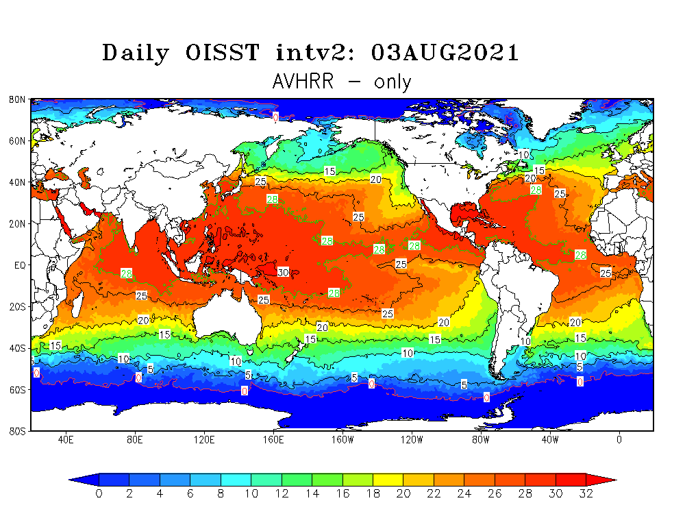
NOAA's polar-orbiting satellites are monitoring higher than average sea surface temperatures in the western North Atlantic.
Satellite Snapshots
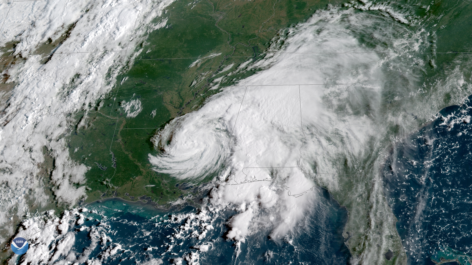
Tropical Storm Gordon, which made landfall near the Mississippi-Alabama border late on September 4, has weakened to a tropical…
Satellite Snapshots
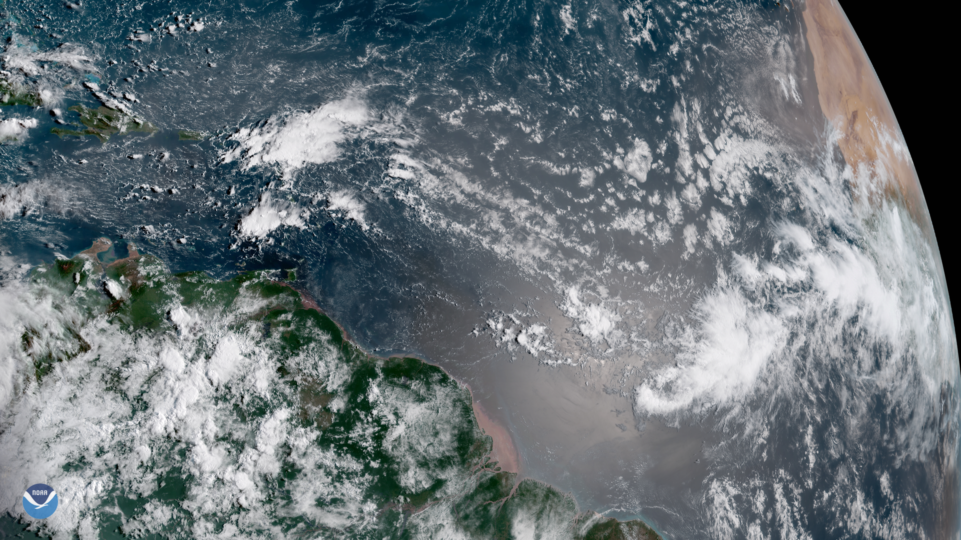
A cluster of clouds appears off the western coast of Africa in this GOES East satellite image, captured August 29, 2018, a sign that…